
Stafford Castle is an ancient Grade II listed castle situated two miles west of the town of Stafford in Staffordshire, England. From the time of the Norman Conquest and as recorded in the Domesday Book of 1086 it was the seat of the powerful Anglo-Norman Stafford family, feudal barons of Stafford, later Barons Stafford (1299) by writ, Earls of Stafford (1351) and Dukes of Buckingham (1444). The 14th-century stone keep was demolished in 1643, during the Civil War, having been held for the Royalists by Lady Isabel Stafford. The castle was remodeled in the early 19th century by the Jerningham family in the Gothic Revival style, on the foundations of the medieval structure, and incorporates much of the original stonework. Today the A518 Stafford-to-Newport Road passes next to it and it is a prominent local landmark visible from the M6 motorway and from the West Coast inter-city mainline.
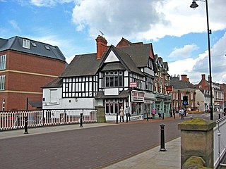
The Borough of Stafford is a local government district with borough status in Staffordshire, England. It is named after Stafford, its largest town, which is where the council is based. The borough also includes the towns of Stone and Eccleshall, as well as numerous villages and surrounding rural areas.

Spencer Compton, 2nd Earl of Northampton, styled Lord Compton from 1618 to 1630, was an English soldier and politician who sat in the House of Commons from 1621 to 1622. He became a peer by writ of acceleration in 1626 and by inheritance in 1630. He fought in the Royalist army and was killed in action at the Battle of Hopton Heath.

Sir John Gell, 1st Baronet was an English landowner from Derbyshire, who acted as local Parliamentarian commander for most of the First English Civil War before resigning in May 1646. He was notorious for parading the body of his Royalist opponent through Derby after the Battle of Hopton Heath in March 1643.

Gnosall is a village and civil parish in the Borough of Stafford, Staffordshire, England, with a population of 4,736 across 2,048 households. It lies on the A518, approximately halfway between the towns of Newport and the county town of Staffordshire, Stafford. Gnosall Heath lies immediately south-west of the main village, joined by Station Road and separated by Doley Brook. Other nearby villages include Woodseaves, Knightley, Cowley, Ranton, Church Eaton, Bromstead Heath, Moreton, and Haughton.

The battle of Hopton Heath was a part of the First English Civil War, fought on Sunday 19 March 1643 between Parliamentarian forces led by Sir John Gell and Sir William Brereton and a Royalist force under Spencer Compton, 2nd Earl of Northampton.

Staffordshire is a landlocked county in the West Midlands of England. It adjoins Cheshire to the north west, Derbyshire and Leicestershire to the east, Warwickshire to the south east, West Midlands and Worcestershire to the south, and Shropshire to the west. The historic county of Staffordshire includes Wolverhampton, Walsall, and West Bromwich, these three being removed for administrative purposes in 1974 to the new West Midlands authority. The resulting administrative area of Staffordshire has a narrow southwards protrusion that runs west of West Midlands to the border of Worcestershire. The city of Stoke-on-Trent was removed from the admin area in the 1990s to form a unitary authority, but is still part of Staffordshire for ceremonial and traditional purposes.
Adbaston is a village and a civil parish in the English county of Staffordshire.

Modbury is a large village, ecclesiastical parish, civil parish and former manor situated in the South Hams district of the county of Devon in England. Today due to its large size it is generally referred to as a "town" although the parish council has not elected to give itself the status of a town as it could do under s.245(6) of the Local Government Act 1972, so it does not have a town council and cannot have a town mayor. It is also known informally as a "market town", as from at least 1199 the lord of the manor has held the right to hold a regular market. The village is situated on the A379 road, which links it to Plymouth and Kingsbridge. The current parish population is approximately 1,500.

Braddock is a village and civil parish in Cornwall, England, United Kingdom. The village is about seven miles west of Liskeard, and five miles south-east of Bodmin. The parish was called Broadoak until 1 April 2021.

Tixall is a small village and civil parish in the Stafford district, in the English county of Staffordshire lying on the western side of the Trent valley between Rugeley and Stone, Staffordshire and roughly 4 miles east of Stafford. The population of the civil parish taken at the 2011 census was 239.

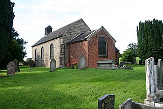
Gayton is a small rural village and civil parish in Staffordshire, located approximately 1 mile from the A51 between Stone and Stafford. In 2001 it had 167 residents, with 1 letter box, one bus stop, and new village hall. The post box is owned now by the village as is the telephone booth. The post code for Gayton properties normally start with ST18.
Events from the year 1643 in England. This is the second year of the First English Civil War, fought between Roundheads (Parliamentarians) and Cavaliers.

Cornwall played a significant role in the English Civil War, being a Royalist enclave in the generally Parliamentarian south-west.
Salt is a village in the Borough of Stafford in Staffordshire, England. It is in the civil parish of Salt and Enson, along with the hamlet of Enson. It is three miles northeast of Stafford situated half a mile southwest of the A51 trunk road and lying on elevated ground above the western side of the Trent valley. Population details as taken under the 2011 census are found under Seighford. The village has an ancient public house with a thatched roof, The Hollybush Inn, dating from the 17th century, reputedly much older, and a village hall.

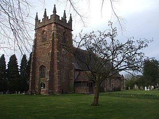
Weston is a village and civil parish. within the English county of Staffordshire. The parish is in the local authority of Stafford.

Ripple is a village and civil parish in the county of Worcestershire, England. Ripple is one of the most southerly parishes in the county and is situated on the A38 road with the River Severn as its western boundary. Besides Ripple, the parish contains the settlements of Holly Green, The Grove, Naunton, Ryall, Saxon's Lode, and Uckinghall. It had a combined population of 1,799 at the 2011 census.

The Battle of Burton Bridge was fought between Royalist and Parliamentarian forces at Burton upon Trent on 4 July 1643 during the First English Civil War. By the time of the battle, the town, which had at various times been held by both sides, was garrisoned by a Parliamentarian unit under the command of Captain Thomas Sanders and the town's military governor, Colonel Richard Houghton. The key river crossing at Burton was desired by Queen Henrietta Maria, who was proceeding southwards from Yorkshire with a convoy of supplies destined for King Charles I at Oxford. The Royalists, led by Colonel Thomas Tyldesley, launched a cavalry charge across the bridge which succeeded in defeating the Parliamentarians and capturing most of their officers, including Sanders and Houghton. The Queen's convoy proceeded on its way south to Oxford, with Tyldesley receiving a knighthood and a promotion in recognition of his victory. Burton changed hands several more times during the course of the war, before finally coming under Parliamentarian control in 1646.

Milwich is a village and a civil parish in the English county of Staffordshire.
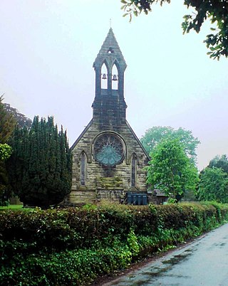
Marston is a village and civil parish 12 miles (19 km) south of Stoke-on-Trent, in the Stafford district, in the county of Staffordshire, England. In 2011 the parish had a population of 158. The parish touches Creswell, Hopton and Coton, Salt and Enson, Sandon and Burston, Stone Rural and Whitgreave.

