Hurricane Isabel was the strongest Atlantic hurricane since Mitch, and the deadliest, costliest, and most intense hurricane in the 2003 Atlantic hurricane season. Hurricane Isabel was also the strongest hurricane in the open waters of the Atlantic, both by wind speed and central pressure, before being surpassed by hurricanes Irma and Dorian in 2017 and 2019, respectively. The ninth named storm, fifth hurricane, and second major hurricane of the season, Isabel formed near the Cape Verde Islands from a tropical wave on September 6, in the tropical Atlantic Ocean. It moved northwestward, and within an environment of light wind shear and warm waters, it steadily strengthened to reach peak winds of 165 mph (266 km/h) on September 11. After fluctuating in intensity for four days, during which it displayed annular characteristics, Isabel gradually weakened and made landfall on the Outer Banks of North Carolina, with winds of 105 mph (169 km/h) on September 18. Isabel quickly weakened over land and became extratropical over western Pennsylvania on the next day. On September 20, the extratropical remnants of Isabel were absorbed into another system over Eastern Canada.

The 2004 Atlantic hurricane season was a very deadly, destructive, and active Atlantic hurricane season, with over 3,200 deaths and more than $61 billion in damage. More than half of the 16 tropical cyclones brushed or struck the United States. Due to the development of a Modoki El Niño – a rare type of El Niño in which unfavorable conditions are produced over the eastern Pacific instead of the Atlantic basin due to warmer sea surface temperatures farther west along the equatorial Pacific – activity was above average. The season officially began on June 1 and ended on November 30, though the season's last storm, Otto, dissipated on December 3, extending the season beyond its traditional boundaries. The first storm, Alex, developed offshore of the Southeastern United States on July 31, one of the latest dates on record to see the formation of the first system in an Atlantic hurricane season. It brushed the Carolinas and the Mid-Atlantic, causing one death and $7.5 million (2004 USD) in damage. Several storms caused only minor damage, including tropical storms Bonnie, Earl, Hermine, and Matthew. In addition, hurricanes Danielle, Karl, and Lisa, Tropical Depression Ten, Subtropical Storm Nicole and Tropical Storm Otto had no effect on land while tropical cyclones. The season was the first to exceed 200 units in accumulated cyclone energy (ACE) since 1995, mostly from Hurricane Ivan, the storm produced the highest ACE. Ivan generated the second-highest ACE in the Atlantic, only behind 1899 San Ciriaco Hurricane.

The 1962 Atlantic hurricane season featured Hurricanes Daisy and Ella – two tropical cyclones that showed the latest dates for the fourth and fifth named storms on record since tropical cyclones were first named in the North Atlantic ocean, starting in 1950, when they both formed on September 29 and October 14. On the same hand, it was the least active since 1939, with only five named storms. Although the season officially began on June 15, the first named storm did not form until August 26, the third-latest date. Hurricane Alma brushed the Outer Banks before becoming extratropical southeast of New England, destroying hundreds of boats and producing beneficial rainfall. In late August, Tropical Storm Becky developed unusually far east in the Atlantic Ocean, becoming the easternmost storm on record to recurve to the northeast. Celia followed in the September, forming east of the Lesser Antilles and executing a loop near Bermuda before dissipating. Hurricane Daisy, the latest fourth named storm, was the costliest of the season, leaving about $1.1 million in damage in New England (1962 USD). The storm dropped the highest rainfall total on record in Maine, and its precipitation caused 22 traffic fatalities. The final hurricane – Ella – the latest fifth named storm – was also the strongest, remaining offshore of the eastern United States but causing two deaths.

Hurricane Dennis caused flooding in North Carolina and the Mid-Atlantic states in early September 1999, which would later be compounded by Hurricane Floyd. The fifth tropical cyclone of the season, Dennis developed from a tropical wave to the north of Puerto Rico on August 24. Originally a tropical depression, the system moved west-northwestward and strengthened into a tropical storm despite unfavorable wind shear. The storm became a hurricane by August 26. After striking the Abaco Islands, conditions improved, allowing for Dennis to strengthen into a Category 2 on the Saffir–Simpson scale by August 28. Around this time, Dennis began to move parallel to the Southeastern United States. Early on August 30, the storm peaked with winds of 105 mph (165 km/h). By the following day, steering currents collapsed and the storm interacted with a cold front, causing Dennis to move erratically offshore North Carolina. Wind shear and cold air associated with the front weakened Dennis to a tropical storm on September 1 and removed some of its tropical characteristics. Eventually, warmer ocean temperatures caused some re-strengthening. By September 4, Dennis turned northwestward and made landfall in Cape Lookout, North Carolina, as a strong tropical storm. The storm slowly weakened inland, before transitioning into an extratropical cyclone over western New York on September 7.

Hurricane Emily in 1993 caused record flooding in the Outer Banks of North Carolina while remaining just offshore. The fifth named storm and the first yet strongest hurricane of the year's hurricane season, Emily developed from a tropical wave northeast of the Lesser Antilles on August 22, 1993. It moved northwestward and strengthened into a tropical storm on August 25, after becoming nearly stationary southeast of Bermuda. Emily then curved to the southwest but quickly resumed its northwest trajectory while strengthening into a hurricane. Late on August 31, the hurricane reached peak winds of 115 mph (185 km/h) on its approach to North Carolina. Although part of the eye passed over Hatteras Island in the Outer Banks, its absolute center remained 23 mi (37 km)/h) offshore. Gradually weakening, the hurricane swerved away from the coast toward the northeast and later east. Emily stalled again, this time northeast of Bermuda, and dissipated on September 6 to the southeast of Newfoundland.

Hurricane Charley was the second hurricane to threaten the East Coast of the United States within a year's timeframe, after Hurricane Gloria of 1985. The third tropical storm and second hurricane of the season, Charley formed as a subtropical low on August 13 along the Florida panhandle. After moving off the coast of South Carolina, the system transitioned into a tropical cyclone and intensified into a tropical storm on August 15. Charley later attained hurricane status before moving across eastern North Carolina. It gradually weakened over the north Atlantic Ocean before transitioning into an extratropical cyclone on August 20. Charley's remnants remained identifiable for over a week, until after crossing Ireland and Great Britain they dissipated on August 30.

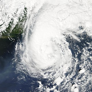
Hurricane Gustav was a Category 2 hurricane that paralleled the East Coast of the United States in September 2002 during the 2002 Atlantic hurricane season. It was the seventh named storm and first hurricane of the season. Initially a subtropical depression north of the Bahamas, Gustav passed just to the east of the Outer Banks, North Carolina as a tropical storm before traveling northeastward, making two landfalls in Atlantic Canada as a Category 1 hurricane. The storm was responsible for one death and $100,000 in damage, mostly in North Carolina. The interaction between Gustav and a non-tropical system produced strong winds that caused an additional $240,000 (2002 USD) in damage in New England, but this damage was not directly attributed to the hurricane.

Tropical Storm Danielle was a strong tropical storm that made landfall on Virginia in the 1992 Atlantic hurricane season. The fourth storm of the season, Danielle was one of two tropical cyclones in the year to make landfall in the United States, the other being Hurricane Andrew. It formed out of a stationary trough of low pressure on September 18 near the coast of North Carolina. The system quickly reached tropical storm status, and Danielle looped to the west due to a change in steering currents. Tropical Storm Danielle reached a peak of 65 mph (105 km/h) winds before weakening and hitting the Delmarva Peninsula. The storm quickly dissipated over land.

The effects of Hurricane Isabel in North Carolina were widespread, with the heaviest damage in Dare County. The hurricane made landfall in the Outer Banks of North Carolina on September 18. There, storm surge flooding and strong winds damaged thousands of houses. The storm surge produced a 2,000 feet (610 m) wide inlet on Hatteras Island, isolating Hatteras by road for two months. Several locations along North Carolina Highway 12 were partially washed out or covered with debris. Hurricane Isabel produced hurricane-force wind gusts across eastern North Carolina, knocking down trees and power lines. About 700,000 residents lost power due to the storm, although most outages were restored within a few days. The hurricane killed three people in the state – two due to falling trees, and the other a utility worker attempting to restore electricity. Damage in the state totaled $450 million.

Hurricane Gerda was a hurricane that formed during the 1969 Atlantic hurricane season. It was the seventh named storm, fifth hurricane and third major hurricane of the 1969 season. Gerda formed on September 6 and crossed Florida as a tropical depression. Gerda later became a tropical storm after making a hard right turn and moving northeast and reaching hurricane status on September 8. Gerda brushed past the Outer Banks of North Carolina before reaching maximum intensity of 120 mph (190 km/h) and a low barometric pressure of 980 millibars (29 inHg). On September 10, Gerda made landfall near Eastport, Maine, and became extratropical the following day.

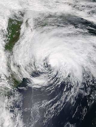
Tropical Storm Gabrielle was a short-lived tropical cyclone that passed over North Carolina before tracking out to sea. The seventh named storm of the 2007 Atlantic hurricane season, Gabrielle developed as a subtropical cyclone on September 8 about 385 miles (620 km) southeast of Cape Lookout, North Carolina. Unfavorable wind shear impacted the storm for much of its duration, although a temporary decrease in the shear allowed the cyclone to become a tropical storm. On September 9, Gabrielle made landfall at Cape Lookout National Seashore in the Outer Banks of North Carolina with winds of 60 mph (97 km/h). Turning to the northeast, the storm quickly weakened and dissipated on September 11.

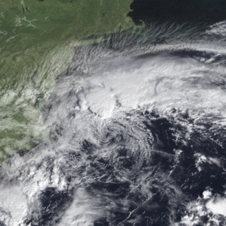
Tropical Storm Dean caused minor flooding along portions of the East Coast of the United States in September 1983. The seventh and final tropical cyclone of the very inactive 1983 Atlantic hurricane season, Dean developed from a frontal low to the northeast of the Bahamas on September 26. Initially subtropical, it gained characteristics of a tropical cyclone while tracking slowly north-northeastward. By September 27, the system was reclassified as Tropical Storm Dean. While tracking northward on September 28, Dean peaked with winds of 65 mph (100 km/h), shortly before curving west-northwestward and slowly leveling-off in intensity. Eventually, Dean made landfall in Virginia on the Delmarva Peninsula on September 29 as a weakening tropical storm. Dean rapidly weakened over land and was no longer classifiable as a tropical cyclone by early on October 1.

Hurricane Alma saw the latest development of the first storm since 1941. The first named storm of the 1962 Atlantic hurricane season, Alma formed from a tropical wave located offshore South Florida on August 26. Initially a tropical depression, it subsequently moved inland over South Florida. Impact in the state was minor, generally limited to light rainfall and rough seas. Early on August 27, the depression reemerged into the Atlantic Ocean and strengthened into Tropical Storm Alma later that day. Thereafter, it moved northeastward and remained offshore the East Coast of the United States. Alma strengthened into a hurricane on August 28, while located offshore the Outer Banks of North Carolina. In the eastern portion of the state, strong winds downed electrical poles, which caused power outages. Storm tides caused erosion in some areas. Damage in North Carolina reached $35,000 (1962 USD).

Hurricane Arthur was the earliest known hurricane to make landfall in the U.S. state of North Carolina during the calendar year. It was also the first hurricane to make landfall in the United States since Hurricane Isaac in 2012. The first named storm of the 2014 Atlantic hurricane season, Arthur developed from an initially non-tropical area of low-pressure over the Southeastern United States that emerged into the western Atlantic Ocean on June 28. After sufficiently organizing, developing a well-defined circulation and deep convection amid a favorable environment, it was classified as a tropical depression on July 1. The system continued to strengthen and was declared a tropical storm later that day. Drifting northward, the storm reached hurricane status early on July 3 and curved toward the north-northeast. Further structural organization resulted in additional intensification, and by 01:00 UTC on July 4, the system attained its peak winds of 100 mph (160 km/h) as a Category 2 hurricane on the Saffir–Simpson hurricane wind scale. Arthur made landfall at 03:15 UTC over North Carolina's Shackleford Banks, positioned between Cape Lookout and Beaufort, and intensified slightly further, with a minimum atmospheric pressure of 973 mbar. The storm then trekked swiftly northeast, weakening as it passed by Cape Cod and Nantucket, before transitioning into an extratropical cyclone and coming ashore at Weymouth, Nova Scotia, on July 5. The remnants continued generally northeastward through Atlantic Canada before ultimately dissipating on July 9 over the Labrador Sea.

Tropical Storm Arthur was a strong off-season tropical cyclone that impacted the East Coast of the United States in May 2020. The first of thirty-one depressions and thirty different named storms of the extremely active 2020 Atlantic hurricane season, Arthur marked the record sixth consecutive year in the Atlantic basin with a tropical cyclone forming before June. It was one of two off-season storms in the season, alongside short-lived Tropical Storm Bertha. Arthur originated from a front that stalled over the Straits of Florida on May 10, which slowly drifted south for two days. The system became a tropical depression on May 16 north of The Bahamas. A day later, the system intensified into a tropical storm and was named Arthur. Arthur gradually intensified while tracking towards the Outer Banks of North Carolina, attaining its peak intensity with maximum 1-minute sustained winds of 60 mph (97 km/h) and a minimum central pressure of 990 mbar (29 inHg) on May 19, before skirting the region and becoming an extratropical cyclone. The cyclone then accelerated towards Bermuda and dissipated on May 21.


