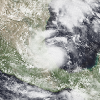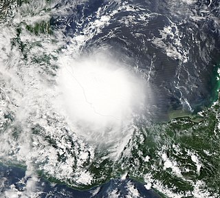
Hurricane Diana was a deadly tropical cyclone which made landfall in Mexico in August 1990. The fourth named storm and second hurricane of the season, Diana developed from a tropical wave in the southwestern Caribbean on August 4. Forming as a tropical depression, the system brushed Honduras before intensifying into a tropical storm the following day. Continuing to gradually strengthen, Diana made its first landfall in Mexico's Yucatán Peninsula as a strong tropical storm late on August 5. The cyclone weakened slightly due to land interaction, before emerging into the Bay of Campeche on August 6. Once over water, warm sea surface temperatures allowed Diana to quickly become a hurricane and later peak as a Category 2 on the Saffir–Simpson hurricane scale on August 7. Shortly thereafter, the storm made landfall near Tampico, Tamaulipas, with winds of 100 mph (160 km/h). Rapid weakening ensued once the storm moved over the high terrain of Mexico, with Diana diminishing to a tropical depression roughly 24 hours after moving onshore. The cyclone later emerged into the Gulf of California on August 9 shortly before dissipating. The remnant disturbance was monitored until losing its identity over Arizona on August 14.

Hurricane Stan was the deadliest tropical cyclone of the 2005 Atlantic hurricane season. A relatively weak system that affected areas of Central America and Mexico in early October 2005, Stan was the eighteenth named storm and eleventh hurricane of the 2005 season, having formed from a tropical wave on October 1 after it had moved into the western Caribbean. The depression slowly intensified, and reached tropical storm intensity the following day, before subsequently making its first landfall on the Yucatán Peninsula. While traversing the peninsula, the tropical storm weakened, but was able to re-intensify once it entered the Bay of Campeche. Under favorable conditions for tropical development, Stan attained hurricane strength on October 4, and later reached peak intensity with winds of 80 mph (130 km/h) and a minimum barometric pressure of 977 mbar (28.9 inHg). The hurricane maintained this intensity until landfall near Punta Roca Partida, Mexico later the same day. Once over the mountainous terrain of Mexico, however, Stan quickly weakened, and dissipated on October 5.

Hurricane Debby was the first hurricane to strike the Mexican state of Veracruz since Hurricane Anna in 1956. The eighth tropical cyclone, fourth named storm, and the first hurricane of the 1988 Atlantic hurricane season, Debby developed from a tropical wave off the west coast of the Yucatan Peninsula on August 31. The system slowly intensified as it tracked west-northwestward toward Mexico, eventually reaching tropical storm status on September 2. Thereafter, Debby began to rapidly strengthen, and the storm was upgraded to a hurricane later that day. After attaining peak winds of 75 mph (120 km/h), Debby made landfall near Tuxpan, Veracruz early on September 3. The hurricane quickly weakened inland, but managed to reach the eastern Pacific on September 5. Debby became Tropical Depression Seventeen-E, which moved northwest but remained poorly organized due to wind shear and dissipated on September 8.

Hurricane Lorenzo was a rapidly developing tropical cyclone that struck the Mexican state of Veracruz in late September 2007. The twelfth named storm and fifth hurricane of the 2007 Atlantic hurricane season, it formed in the southwestern Gulf of Mexico from a tropical wave. After meandering for two days without development, the storm began a steady westward track as its structure became better organized. In an 18‑hour period, Lorenzo's winds increased from 35 mph (55 km/h) to 80 mph (130 km/h), or from a tropical depression to a hurricane. On September 28 it struck near Tecolutla, Veracruz, a month after Hurricane Dean affected the same area, before it quickly dissipated over land.

The 2011 Atlantic hurricane season was the second in a group of three very active Atlantic hurricane seasons, each with 19 named storms, only behind 1887, 1995, 2010, and 2012. The above-average activity was mostly due to a La Niña that persisted during the previous year. Of the season's 19 tropical storms, only seven strengthened into hurricanes, and four of those became major hurricanes: Irene, Katia, Ophelia, and Rina. The season officially began on June 1 and ended on November 30, dates which conventionally delimit the period during each year in which most tropical cyclones develop in the Atlantic Ocean. However, the first tropical storm of the season, Arlene, did not develop until nearly a month later. The final system, Tropical Storm Sean, dissipated over the open Atlantic on November 11.

The 2013 Pacific hurricane season was an above average Pacific hurricane season with 21 tropical cyclones forming. Of these, 20 became named storms – 18 in the Eastern Pacific basin, and 2 in the Central Pacific basin. Of the 18 named storms in the east, 9 became hurricanes, with one, Raymond, becoming the season's only major hurricane. In the central, neither named storm became a hurricane. It was also a below-normal season in terms of Accumulated cyclone energy (ACE), as many of its systems were weak and short-lived. The season officially began on May 15 in the Eastern Pacific and started on June 1 in the Central Pacific; both ended on November 30. These dates conventionally delimit the period of each year when most tropical development occurs in these North Pacific basins. The first cyclone, Tropical Storm Alvin, formed on May 15, and the last, Tropical Storm Sonia, dissipated on November 4.

The 2016 Atlantic hurricane season was the deadliest Atlantic hurricane season since 2008, and the first above-average hurricane season since 2012, producing 15 named storms, 7 hurricanes and 4 major hurricanes. The season officially started on June 1 and ended on November 30, though the first storm, Hurricane Alex which formed in the Northeastern Atlantic, developed on January 12, being the first hurricane to develop in January since 1938. The final storm, Otto, crossed into the Eastern Pacific on November 25, a few days before the official end. Following Alex, Tropical Storm Bonnie brought flooding to South Carolina and portions of North Carolina. Tropical Storm Colin in early June brought minor flooding and wind damage to parts of the Southeastern United States, especially Florida. Hurricane Earl left 94 fatalities in the Dominican Republic and Mexico, 81 of which occurred in the latter. In early September, Hurricane Hermine, the first hurricane to make landfall in Florida since Hurricane Wilma in 2005, brought extensive coastal flooding damage especially to the Forgotten and Nature coasts of Florida. Hermine was responsible for five fatalities and about $550 million (2016 USD) in damage.

The 2017 Atlantic hurricane season was a devastating, extremely active Atlantic hurricane season and the costliest on record, with a damage total of at least $294.92 billion (USD). The season featured 17 named storms, 10 hurricanes, and 6 major hurricanes. Most of the season's damage was due to hurricanes Harvey, Irma, and Maria. Another notable hurricane, Nate, was the worst natural disaster in Costa Rican history. These four storm names were retired following the season due to the number of deaths and amount of damage they caused.

Hurricane Ingrid was one of two tropical cyclones, along with Hurricane Manuel, to strike Mexico within a 24-hour period, the first such occurrence since 1958. Ingrid was the ninth named storm and second hurricane of the 2013 Atlantic hurricane season. It formed on September 12 in the Gulf of Mexico from a broad disturbance that also spawned Manuel in the eastern Pacific. After initially moving westward toward Veracruz, Ingrid turned northeastward away from the coast. Favorable conditions allowed it to attain hurricane status on September 14, and the next day Ingrid attained peak winds of 140 km/h (85 mph). Subsequently, increased wind shear weakened the convection as the storm turned more to the northwest and west. On September 16, Ingrid made landfall just south of La Pesca, Tamaulipas in northeastern Mexico as a strong tropical storm, and dissipated the next day. The hurricane was also the last one to form in the Gulf of Mexico until Hurricane Hermine in 2016.

Tropical Storm Boris was a weak and short-lived tropical cyclone that brought rainfall to the Isthmus of Tehuantepec and surrounding areas in June 2014. The second named storm of the season, Boris developed from the interaction of a low-level trough and a Kelvin wave south of Mexico late on June 2. Initially a tropical depression, the system moved generally northward and strengthened into Tropical Storm Boris by midday on June 3. About six hours later, Boris peaked with maximum sustained winds of 45 mph (75 km/h) – indicative of a weak tropical storm. By early on June 4, interaction with land caused the storm to weaken, deteriorating to a tropical depression. Later that day, Boris degenerated into a remnant low pressure, before fully dissipating over the Gulf of Tehuantepec on June 5.

Tropical Storm Beatriz was a short-lived tropical storm that made landfall in the Mexican state of Oaxaca in June 2017. The second named storm of the 2017 Pacific hurricane season, Beatriz developed from a tropical wave which had exited the coast of West Africa on May 18 and crossed Central America, and was designated as Tropical Depression Two-E on May 31. Shortly after being upgraded to a tropical storm, Beatriz made landfall near Puerto Angel, Mexico on the evening of June 1. It subsequently weakened into a tropical depression as it moved ashore, dissipating quickly afterwards.

Hurricane Franklin was the first hurricane to make landfall in the Mexican state of Veracruz since Hurricane Karl in 2010. The sixth named storm, first hurricane and the first of ten consecutive hurricanes of the 2017 Atlantic hurricane season, Franklin formed on August 7 out of a tropical wave that was first tracked in the southeastern Caribbean Sea on August 3. The storm strengthened within a favorable environment and made landfall on the Yucatán Peninsula as a moderate tropical storm early on August 8 north of Belize. Weakening occurred as it crossed the peninsula, but Franklin re-emerged into the Bay of Campeche later that day, restrengthening quickly to become the season's first hurricane. It made landfall near Lechuguillas, Veracruz, on August 10 as a Category 1 hurricane, before rapidly weakening over the mountainous terrain of Mexico and dissipating shortly afterwards. On August 12, the storm's remnant mid-level circulation combined with a developing low in the Eastern Pacific to form Tropical Storm Jova.

Hurricane Max was a rapidly-forming tropical cyclone that made landfall in southwestern Mexico, causing minor damage. The sixteenth tropical cyclone, thirteenth named storm, and seventh hurricane of the 2017 Pacific hurricane season, Max developed from a trough of low pressure near the southwestern coast of Mexico on September 13. The storm tracked northeastward under the influence of a mid-level ridge and rapidly strengthened as a result of warm ocean temperatures in its path. Max strengthened into a hurricane on September 14 and peaked as a high-end Category 1 hurricane on the Saffir–Simpson scale shortly before making landfall in the Mexican state of Guerrero. Rapid weakening ensued as Max moved over the mountainous terrain of Mexico, and it weakened below hurricane strength early on September 15. At 12:00 UTC that day, Max dissipated over the mountains of southern Mexico.

The 2021 Pacific hurricane season was a moderately active Pacific hurricane season, with above-average activity in terms of number of named storms, but below-average activity in terms of major hurricanes, as 19 named storms, 8 hurricanes, and 2 major hurricanes formed in all. It also had a near-normal accumulated cyclone energy (ACE). The season officially began on May 15, 2021 in the Eastern Pacific Ocean, and on June 1, 2021, in the Central Pacific in the Northern Hemisphere. The season ended in both regions on November 30, 2021. These dates historically describe the period each year when most tropical cyclogenesis occurs in these regions of the Pacific and are adopted by convention. However, the formation of tropical cyclones is possible at any time of the year, as illustrated by the formation of Tropical Storm Andres on May 9, which was the earliest forming tropical storm on record in the Eastern Pacific. Conversely, 2021 was the second consecutive season in which no tropical cyclones formed in the Central Pacific.

Hurricane Nana was a small, short-lived tropical cyclone that caused relatively minor damage in Belize and Mexico in early September 2020. The sixteenth tropical cyclone, fourteenth named storm, and fifth hurricane of the record-breaking 2020 Atlantic hurricane season, Nana originated from a tropical wave that moved off the coast of West Africa on August 23. The system progressed westward with little development for the next week before crossing into the Caribbean Sea. The wave gradually developed organized convection and a defined surface low on September 1, signifying the formation of Tropical Storm Nana as it approached Jamaica. Persistent wind shear stifled development of the storm, though following repeated bursts of deep convection, it intensified into a minimal hurricane on September 3. Nana attained peak winds of 75 mph (121 km/h) and a minimum pressure of 994 mbar shortly before striking Belize. Once onshore, the hurricane rapidly degraded and its surface low dissipated over Guatemala on September 4. The mid-level remnants of Nana later reorganized over the Gulf of Tehuantepec and became Tropical Storm Julio.

Hurricane Gamma was a Category 1 hurricane that brought heavy rains, flooding, and landslides to the Yucatán Peninsula in early October 2020. The twenty-fifth depression, twenty-fourth named storm and ninth hurricane of the extremely active 2020 Atlantic hurricane season, Gamma developed from a vigorous tropical wave that had been monitored as it was entering the Eastern Caribbean on September 29. The wave moved westward and slowed down as it moved into the Western Caribbean, where it began to interact with a dissipating cold front. A low formed within the disturbance on October 1 and the next day, it organized into a tropical depression. It further organized into Tropical Storm Gamma early the next day. It continued to intensify and made landfall as a minimal hurricane near Tulum, Mexico, on October 3. It weakened over land before reemerging in the Gulf of Mexico. Gamma then briefly restrengthened some before being blasted by high amounts of wind shear, causing it to weaken again. It made a second landfall as a tropical depression in Nichili, Mexico on October 6 before dissipating as it was absorbed by the approaching Hurricane Delta.

Tropical Storm Helene was a moderate tropical storm which affected the southern Caribbean and Central America in mid-August 2012. The seventh tropical depression and eighth named storm of the 2012 Atlantic hurricane season, Helene was monitored as a tropical wave that exited the west coast of the African continent on August 5. It gradually moved westward and became a tropical depression east of the Lesser Antilles four days later. However, unfavorable conditions initially prevented it from developing, which led to its initial degeneration to a remnant low as it traversed the Caribbean Sea.

Hurricane Enrique was a Category 1 Pacific hurricane that brought heavy rainfall and flooding to much of western Mexico in late June 2021. The fifth named storm and first hurricane of the 2021 Pacific hurricane season, Enrique developed from a tropical wave the entered the Pacific Ocean off the coast of Nicaragua on June 22. In an environment conducive for intensification, the disturbance moved west-northwestward and developed into a tropical storm by 6:00 UTC on June 25, as it was already producing winds of 40 mph (65 km/h), and received the name Enrique. Enrique strengthened steadily within an environment of warm waters and low-to-moderate wind shear while continuing its northwestward motion. By 12:00 UTC on June 26, Enrique had intensified into a Category 1 hurricane as the storm turned more northwestward. Nearing the coast of Mexico, Enrique reached its peak intensity around 6:00 UTC the following day, with maximum sustained winds of 90 mph (150 km/h) and a minimum barometric pressure of 972 mbar (28.7 inHg). Enrique, passing closely offshore west-central Mexico, maintained its intensity for another 24 hours as it turned northward toward the Gulf of California. Turning back to the northwest on June 28, increasing wind shear and dry air caused the hurricane to weaken. Enrique dropped to tropical storm status at 18:00 UTC that day, and further weakened to a tropical depression on June 30 just to the northeast of Baja California. The depression was absorbed into a larger low pressure area to the southeast later that day.

Hurricane Grace was the strongest tropical cyclone to make landfall in the Mexican state of Veracruz. Grace impacted much of the Leeward Islands and Greater Antilles as a tropical storm, before causing more substantial impacts in the Yucatán Peninsula and Veracruz as a hurricane. It was the seventh named storm, second hurricane, and first major hurricane of the 2021 Atlantic hurricane season. Originating from a tropical wave in the Main Development Region, the primitive system tracked west-northwest across the Atlantic Ocean towards the Antilles, becoming a tropical depression on August 14. It strengthened into Tropical Storm Grace later the same day, but weakened back to a depression due to an unfavorable environment. After moving near Haiti as a tropical depression, it strengthened back to a tropical storm and became a hurricane on August 18, reaching an initial peak intensity with maximum sustained winds of 80 mph (130 km/h) and a pressure of 986 mbar (29.12 inHg). It weakened back to a tropical storm after its landfall in the Yucatán Peninsula and emerged into the Bay of Campeche, entering a very favorable environment for intensification hours later. Grace then rapidly intensified into a Category 3 hurricane with winds of 120 mph (190 km/h) in about 24 hours. The storm made its final landfall in the state of Veracruz at peak intensity and quickly degenerated into a remnant low over mainland Mexico on August 21; however, its remnants later regenerated into Tropical Storm Marty in the Eastern Pacific on August 23.

Hurricane Agatha was the strongest hurricane to make landfall along the Pacific coast of Mexico in the month of May since records began in 1949. The first named storm and the first hurricane of the 2022 Pacific hurricane season, Agatha originated from a surface trough south of the Gulf of Tehuantepec. It steadily organized into a tropical depression early on May 28 and within hours intensified into Tropical Storm Agatha. Amid favorable environmental conditions, the cyclone underwent rapid intensification on May 29, strengthening into a Category 2 hurricane and reaching peak winds of 110 mph (180 km/h). Though the storm moved west-northwest early on, it curved toward the northeast in response to weakening high pressure over Mexico. On the afternoon of May 30, the hurricane made landfall just west of Puerto Ángel, Oaxaca, with slightly weaker winds of 105 mph (169 km/h).


