Jefferson, West Virginia

Last updated
Jefferson, West Virginia
Kanawha County West Virginia incorporated and unincorporated areas Jefferson highlighted.svg
Location in Kanawha County and state of West Virginia.
Coordinates: 38°22′27″N81°46′43″W / 38.37417°N 81.77861°W / 38.37417; -81.77861 Coordinates: 38°22′27″N81°46′43″W / 38.37417°N 81.77861°W / 38.37417; -81.77861
Country United States
State West Virginia
County Kanawha
Area
  Total0.5 sq mi (1.4 km2)
  Land0.3 sq mi (0.9 km2)
  Water0.2 sq mi (0.5 km2)
Elevation
591 ft (180 m)
Population
 (2010)
  Total676
  Density1,768.6/sq mi (682.9/km2)
Time zone UTC-5 (Eastern (EST))
  Summer (DST) UTC-4 (EDT)
ZIP code
25177
Area code 304
FIPS code 54-41010 [1]
GNIS feature ID1802732 [2]

Jefferson is a census-designated place (CDP) in Kanawha County, West Virginia, United States, along the Kanawha River. The population was 676 at the 2010 census. [3] Jefferson was incorporated on March 22, 1997, but was disincorporated less than a decade later on February 21, 2007. [4]

Contents

In January 2001, Jefferson was profiled on The Daily Show with Jon Stewart by faux reporter Stephen Colbert.

Geography

Jefferson is located at 38°22′27″N81°46′43″W / 38.37417°N 81.77861°W / 38.37417; -81.77861 (38.374102, -81.778726). [5]

According to the United States Census Bureau, the CDP has a total area of 0.5 square miles (1.4 km2); 0.3 square miles (0.9 km2) of this is land, and 0.2 square miles (0.5 km2) is water.

Demographics

As of the census [1] of 2000, there were 567 people, 214 households, and 105 families residing in the former town. The population density was 1,768.6 inhabitants per square mile (684.1/km2). There were 257 housing units at an average density of 801.6 per square mile (310.1/km2). The racial makeup of the town was 81.48% White, 16.93% African American, 0.18% Native American, 0.18% from other races, and 1.23% from two or more races. Hispanic or Latino of any race were 0.53% of the population.

There were 214 households, out of which 23.8% had children under the age of 18 living with them, 28.0% were married couples living together, 17.3% had a female householder with no husband present, and 50.9% were non-families. 44.4% of all households were made up of individuals, and 11.2% had someone living alone who was 65 years of age or older. The average household size was 2.05 and the average family size was 2.81.

The age distribution was 16.4% under the age of 18, 10.1% from 18 to 24, 27.7% from 25 to 44, 22.6% from 45 to 64, and 23.3% who were 65 years of age or older. The median age was 42 years. For every 100 females, there were 97.6 males. For every 100 females age 18 and over, there were 91.9 males.

The median income for a household in the town was $16,384, and the median income for a family was $16,477. Males had a median income of $12,202 versus $16,042 for females. The per capita income for the town was $8,746. About 43.5% of families and 51.6% of the population were below the poverty line, including 74.7% of those under age 18 and 41.5% of those age 65 or over.

Related Research Articles

<span class="mw-page-title-main">Altoona, Florida</span> Census-designated place in Florida

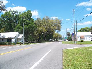
Altoona is an unincorporated community and census-designated place (CDP) in Lake County, Florida, United States. The population was 89 at the 2010 census. It is part of the Orlando–Kissimmee–Sanford Metropolitan Statistical Area.

<span class="mw-page-title-main">Buckner, Kentucky</span> CDP in Kentucky, United States

Buckner is a census-designated place (CDP) in Oldham County, Kentucky, United States. The population was 4,000 at the 2000 census.

Carlyss is a census-designated place (CDP) in Calcasieu Parish, Louisiana, United States. The population was 4,670 at the 2010 census. It is part of the Lake Charles Metropolitan Statistical Area.

<span class="mw-page-title-main">Cedar Hill, Missouri</span> Census-designated place in Missouri, United States

Cedar Hill is an unincorporated community and census-designated place (CDP) in northwest Jefferson County, Missouri, United States. The population was 1,721 at the 2010 census.

<span class="mw-page-title-main">Murphy, Missouri</span> Census-designated place in Missouri, United States

Murphy is a census-designated place (CDP) in Jefferson County, Missouri, United States. The population was 8,690 at the 2010 census, down from 9,048 in 2000.

Locustdale is a census-designated place (CDP) in Columbia and Schuylkill counties, Pennsylvania, United States. The population was 177 at the 2010 census. It is part of the Bloomsburg–Berwick Micropolitan Statistical Area.

<span class="mw-page-title-main">Idylwood, Virginia</span> Census-designated place in Virginia, United States

Idylwood is a census-designated place (CDP) in Fairfax County, Virginia, United States. The population was 17,954 as of the 2020 census. It originally developed as a suburban community along the route of the Washington and Old Dominion Railroad, and later along Virginia State Route 7. The construction of the Capital Beltway in the 1960s, and I-66 and the Orange Line of the Washington Metrorail system in the 1980s, as well as the concurrent development of nearby Tysons Corner into Washington's leading suburban business district, led to the development of several apartment, townhouse, and small-lot single-family housing complexes, as well as the high-rise Idylwood Towers condominium, in the portion of Idylwood lying to the north of I-66. The area to the south of I-66 remains primarily large-lot single-family.

<span class="mw-page-title-main">Gauley Bridge, West Virginia</span> Town in West Virginia, United States

Gauley Bridge is a town in Fayette County, West Virginia, United States. The population was 614 at the 2010 census. The Kanawha River is formed at Gauley Bridge by the confluence of the New and Gauley Rivers. Two miles to the southeast of Gauley Bridge, in Glen Ferris, is Kanawha Falls, a popular stopping point on Midland Trail Scenic Highway.

<span class="mw-page-title-main">Coal Fork, West Virginia</span> Census-designated place in West Virginia, United States

Coal Fork is an unincorporated census-designated place (CDP) in Kanawha County, West Virginia, United States. It is part of a larger unincorporated community known as Campbells Creek, approximately 10 minutes east of Charleston. The population was 1,233 at the 2010 census.

<span class="mw-page-title-main">Cross Lanes, West Virginia</span> Census-designated place in West Virginia, United States

Cross Lanes is a census-designated place (CDP) and suburb of Charleston in Kanawha County, West Virginia, United States. As of the 2010 census, its population was 9,995.

<span class="mw-page-title-main">Elkview, West Virginia</span> Census-designated place in West Virginia, United States

Elkview is a census-designated place (CDP) in Kanawha County, West Virginia, United States. The population was 1,222 at the 2010 census. It is named after the Elk River, which flows into the Kanawha River.

<span class="mw-page-title-main">Pinch, West Virginia</span> Census-designated place in West Virginia, United States

Pinch is a census-designated place (CDP) in Kanawha County, West Virginia, United States. The population was 3,262 at the 2010 census.

<span class="mw-page-title-main">Pratt, West Virginia</span> Town in West Virginia, United States

Pratt is a town in Kanawha County, West Virginia, United States, along the Kanawha River. The population was 482 at the 2020 census.

<span class="mw-page-title-main">Alum Creek, West Virginia</span> Census-designated place in West Virginia, United States

Alum Creek is a census-designated place (CDP) in Kanawha and Lincoln counties along the Coal River in the U.S. state of West Virginia. It includes the unincorporated communities of Alum Creek, Forks of Coal, and Priestley. The CDP had a population of 1,749 at the 2010 census, down from 1,839 at the 2000 census.

<span class="mw-page-title-main">Leon, West Virginia</span> Town in West Virginia, United States

Leon is a town in Mason County, West Virginia, United States, situated along the Kanawha River. The population was 137 at the 2020 census. It is part of the Point Pleasant, WV–OH Micropolitan Statistical Area.

Teays Valley is a census-designated place (CDP) in Putnam County, West Virginia, United States. The place is divided into the two districts of Teays Valley and Scott Depot. The population was 13,175 at the 2010 census. Teays Valley is part of the Huntington-Ashland, WV-KY-OH, Metropolitan Statistical Area (MSA). As of the 2010 census, the MSA had a population of 287,702. New definitions from February 28, 2013 placed the population at 363,000. This CDP place was named after trapper/hunter Thomas Teays, who spend a considerable amount of time staying here.

<span class="mw-page-title-main">Mineralwells, West Virginia</span> CDP in West Virginia, United States

Mineralwells, also known as Mineral Wells, is a census-designated place (CDP) in Wood County, West Virginia, United States. It is part of the Parkersburg-Marietta-Vienna, WV-OH Metropolitan Statistical Area. The population was 1,950 at the 2010 census.

<span class="mw-page-title-main">Garland, Wyoming</span> CDP in Wyoming, United States

Garland is a census-designated place in Park County, Wyoming, United States. The population was 115 at the 2010 census.

<span class="mw-page-title-main">Smithers, West Virginia</span> Place in West Virginia, United States

Smithers is a city in Fayette and Kanawha counties in the U.S. state of West Virginia. Located along the Kanawha River, it lies almost entirely in Fayette County. The population was 751 at the 2020 census. The city most likely takes its name from Smithers Creek. The small river city is noted for having a rich cultural history related to both its coal mining and Italian-American heritages.

<span class="mw-page-title-main">Jefferson Valley, New York</span> Census-designated place in New York, United States

Jefferson Valley-Yorktown, commonly known as Jefferson Valley, is a census-designated place (CDP) located in the town of Yorktown in Westchester County, New York, United States. The population was 14,142 at the 2010 census. It is a hot spot for local shoppers, due to its Jefferson Valley Mall.

References

  1. 1 2 "U.S. Census website". United States Census Bureau . Retrieved 2008-01-31.
  2. "US Board on Geographic Names". United States Geological Survey. 2007-10-25. Retrieved 2008-01-31.
  3. "U.S. Census website". United States Census Bureau . Retrieved 2011-05-14.
  4. "Boundary Changes". Geographic Change Notes: West Virginia. Population Division, United States Census Bureau. 2009-03-18. Archived from the original on 2006-02-06. Retrieved 2009-05-18.
  5. "US Gazetteer files: 2010, 2000, and 1990". United States Census Bureau. 2011-02-12. Retrieved 2011-04-23.