
Roma is a rural town and locality in the Maranoa Region, Queensland, Australia. It is the administrative centre of the Maranoa Region. The town was incorporated in 1867 and is named after Lady Diamantina Bowen, the wife of Sir George Bowen, the Governor of Queensland at the time. In the 2016 census, the locality of Roma had a population of 6,848 people.

Rockhampton is a city in the Rockhampton Region of Central Queensland, Australia. In the 2021 census, the population of Rockhampton was 79,293.

Townsville is a city on the north-eastern coast of Queensland, Australia. With a population of 179,011 as of the 2021 census, it is the largest settlement in North Queensland; it is unofficially considered its capital. Townsville hosts a significant number of governmental, community and major business administrative offices for the northern half of the state.

Brisbane Airport is the primary international airport serving Brisbane and South East Queensland. The airport services 31 airlines flying to 50 domestic and 29 international destinations, total amounting to more than 22.7 million passengers who travelled through the airport in 2016. In 2016, an OAG report named Brisbane airport as the fifth-best performing large-sized airport in the world for on-time performance with 86.71% of arrivals and departures occurring within 15 minutes of their scheduled times, slipping from 88.31% the year before. BNE covers an area of 2,700 hectares, making the airport among the largest in land area in all of Australia.

Gold Coast Airport is an international Australian airport located at the southern end of the Gold Coast and approximately 90 km (56 mi) south of Brisbane, within the South East Queensland agglomeration. The entrance to the airport is situated in the suburb of Bilinga near Coolangatta. The main runway itself cuts through the state borders of Queensland and New South Wales. During summer, these states are in two different time zones. The Gold Coast Airport operates on Queensland Time.

Nambour is a rural town and locality in the Sunshine Coast Region, Queensland, Australia. In the 2016 census, the locality of Nambour had a population of 11,187 people.

Central railway station is located on the North Coast line in Queensland, Australia. It is the principal station on the City network and is located in the north of the Brisbane central business district. Central station is one of four inner city stations that form a core corridor through the centre of Brisbane.

Archerfield Airport is a leased federal airport located in Archerfield, 11–12 km (6.8–7.5 mi) to the south of Brisbane, Queensland, Australia. For some time, it was the primary airport in Brisbane, but it is now the secondary airport. During World War II, it was used as a Royal Australian Air Force station. Airport traffic peaked in the 1980s. In December 2010, a development plan was released for public comment and included a new parallel runway.

The Pacific Motorway is a motorway in Australia between Brisbane, Queensland, and Brunswick Heads, New South Wales, through the New South Wales–Queensland border at Tweed Heads.
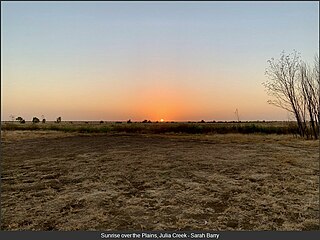
Julia Creek is an outback town and locality in the Shire of Mckinlay, Queensland, Australia. In the 2016 census, the locality of Julia Creek had a population of 511 people.

Sunshine Coast Airport is an Australian international airport located in Marcoola, 10 km (6.2 mi) north of Maroochydore, at the northern end of the Sunshine Coast. It is approximately 90 km (56 mi) north of centre of Brisbane, within the South East Queensland agglomeration. The airport is owned by Sunshine Coast Regional Council and is the principal and only jet-capable airport serving an urban area of nearly 400,000 residents.

Mitchell is a rural town and locality in the Maranoa Region, Queensland, Australia. The town services the local area, a cattle and sheep farming district. In the 2016 census, the locality of Mitchell had a population of 1,031 people.

Eagle Farm is an eastern industrial suburb of the City of Brisbane, Queensland, Australia. In the 2016 census, Eagle Farm had a population of 0 people.
Mount Isa Airport is an airport serving the western Queensland city of Mount Isa, Australia. It is served by a variety of scheduled regional airlines, with flights to Brisbane, Townsville and Cairns as well as several other regional centres.

Hervey Bay Airport is the main airport for the city of Hervey Bay, Queensland, Australia and the Fraser Coast region which incorporates the nearby city of Maryborough.

Adelaide Street is a major street in Brisbane, Queensland, Australia. It runs between and parallel to Queen Street and Ann Street.

Birdsville Airport is an airport serving Birdsville, Queensland, Australia. During the Birdsville Races weekend each September, as many as 200 light aircraft visit the airport, with aviators permitted to camp under the wings of their planes. The Channel Mail Run, the world's longest mail run operates between Port Augusta, South Australia and Birdsville, stopping in the town to collect mail for the remote Queensland cattle stations of Glengyle and Durrie.
Normanton Airport is an airport in Normanton, Queensland, Australia. A new terminal was opened in February 2006. The airport received $132,100 for security upgrades in 2006.

During the Australian gold rushes, starting in 1851, significant numbers of workers moved from elsewhere in Australia and overseas to where gold had been discovered. Gold had been found several times before, but the colonial government of New South Wales had suppressed the news out of the fear that it would reduce the workforce and destabilise the economy.

Bonogin is a rural hinterland locality in the City of Gold Coast, Queensland, Australia. In the 2016 census, Bonogin had a population of 4,573 people.
