
There are many forms of transport in Australia. Australia is highly dependent on road transport. There are more than 300 airports with paved runways. Passenger rail transport includes widespread commuter networks in the major capital cities with more limited intercity and interstate networks. The Australian mining sector is reliant upon rail to transport its product to Australia's ports for export.

Cairns Airport is an international airport in Cairns, Queensland, Australia. Formerly operated by the Cairns Port Authority, the airport was sold by the Queensland Government in December 2008 to a private consortium. It is the seventh busiest airport in Australia. The airport is located 2.3 nautical miles north northwest of Cairns or 7 kilometres (4.3 mi) north of the Cairns central business district, in the suburb of Aeroglen. The airport lies between Mount Whitfield to the west and Trinity Bay to the east.

Windorah is a town and a locality in the Shire of Barcoo, Queensland, Australia. It is one of only three towns in the Shire of Barcoo in Central West Queensland. In the 2016 census, Windorah had a population of 115 people.

Gold Coast Airport is an international Australian airport located at the southern end of the Gold Coast and approximately 90 km (56 mi) south of Brisbane, within the South East Queensland agglomeration. The entrance to the airport is situated in the suburb of Bilinga near Coolangatta. The runway itself cuts through the state borders of Queensland and New South Wales. During summer, these states are in two different time zones. The Gold Coast Airport operates on Queensland Time.

Hobart Airport is an international airport located in Cambridge, 17 km (11 mi) north-east of Hobart. It is the major and fastest growing passenger airport in Tasmania.

Sunshine Coast Airport is an Australian international airport located in Marcoola, 10 km (6.2 mi) north of Maroochydore, at the northern end of the Sunshine Coast. It is approximately 90 km (56 mi) north of centre of Brisbane, within the South East Queensland agglomeration. The airport is owned by Sunshine Coast Regional Council and is the principal and only jet-capable airport serving an urban area of nearly 400,000 residents.

Newcastle Airport is an international airport in Williamtown, New South Wales. It is located 15 kilometres; 9.2 miles (8 NM) north of Newcastle in Port Stephens. It is the 13th busiest airport in Australia, handling over 1.25 million passengers in the year ended 30 June 2017, an increase of 6.6% on the previous year. The airport occupies a 28 ha (69-acre) site on the southern border of RAAF Base Williamtown.

Hervey Bay Airport is the main airport for the city of Hervey Bay, Queensland, Australia and the Fraser Coast region which incorporates the nearby city of Maryborough.
Gladstone Airport is an airport serving Gladstone, a city in the Australian state of Queensland. It is located in the suburb of Clinton, about 10 km (6.2 mi) from the town's centre, off Aerodrome Road.
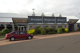
Armidale Airport is an airport serving Armidale, a city in the Australian state of New South Wales. It is located 2 nautical miles southwest of the town centre, on the New England Highway. The airport is operated by the Armidale Regional Council.

Birdsville Airport is an airport serving Birdsville, Queensland, Australia. During the Birdsville Races weekend each September, as many as 200 light aircraft visit the airport, with aviators permitted to camp under the wings of their planes. The Channel Mail Run, the world's longest mail run operates between Port Augusta, South Australia and Birdsville, stopping in the town to collect mail for the remote Queensland cattle stations of Glengyle and Durrie.
Emerald Airport is an airport serving Emerald, a town located in the Central Highlands district of Queensland, Australia. It is located 6 km (4 mi) south of the Emerald town centre, on the Gregory Highway. The airport is operated by the Central Highlands Regional Council.
Kowanyama Airport is an airport located 1 nautical mile southeast of Kowanyama, Queensland, Australia. In 2005 the airport received $107,448 for security upgrades.
Merimbula Airport is an airport serving Merimbula, New South Wales, Australia. It is located 1 nautical mile south of Merimbula and is owned and operated by Bega Valley Shire Council.
Moranbah Airport is an airport serving Moranbah, Queensland, Australia. It is located 3.25 nautical miles south of Moranbah and operated by BHP Mitsubishi Alliance, a coal mining company.
Quilpie Airport is an airport serving Quilpie, Queensland, Australia. It is located 1 nautical mile west of Quilpie and operated by the Quilpie Shire Council. The airport received $242,666 for security upgrades from the Australian Government in 2006.

Toowoomba City Aerodrome is an airport located 2.2 nautical miles northwest from the CBD of Toowoomba, Queensland, Australia. Toowoomba City Aerodrome is both licensed and certified. The aerodrome is owned and operated by Toowoomba Regional Council. Being certified means the airfield is able to have airlines and larger charter aircraft operate from the aerodrome. Being licensed means that the aerodrome is regulated by federal transport security regulations. Toowoomba City Aerodrome does not have a control tower; however the airfield is regulated and operated under Civil Aviation Safety Authority (CASA) regulations of aviation operations at non-tower controlled aerodromes.

The Windorah Solar Farm is Ergon Energy's first solar farm trial near the town of Windorah in Queensland. The plant uses five concentrated solar dishes or reflectors which were manufactured and installed by Solar Systems. This is expected to save up to 100,000 litres of diesel fuel per year. The integration of solar farm and diesel power is a first for Ergon Energy.

Central West Queensland is a remote region in the Australian state of Queensland which covers 396,650.2 km2. The region lies to the north of South West Queensland and south of the Gulf Country. It has a population of approximately 12,387 people.
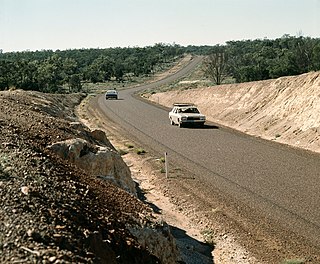
The Diamantina Developmental Road is a gazetted road in Queensland, Australia, that runs from Charleville in the south-central part of the state to Mount Isa in the north-west.
