Kalamunda, Western Australia

Last updated

Kalamunda
Perth,  Western Australia
Kalamunda Road, Kalamunda.jpg
Kalamunda Road, Kalamunda
Kalamunda, Western Australia
Coordinates 31°58′26″S116°03′29″E / 31.974°S 116.058°E / -31.974; 116.058
Population7,163 (SAL 2021) [1]
Established1901
Postcode(s) 6076
Area10.6 km2 (4.1 sq mi) [2]
Location25 km (16 mi) from Perth
LGA(s) City of Kalamunda
State electorate(s) Kalamunda
Federal division(s) Hasluck
Suburbs around Kalamunda:
Maida Vale Gooseberry Hill Piesse Brook
Forrestfield Kalamunda Piesse Brook
Forrestfield Lesmurdie Walliston

Kalamunda (Nyungar : Karlamarda) is a town and eastern suburb of Perth, Western Australia, located in the Darling Scarp at the eastern limits of the Perth metropolitan area.

Contents

History

Indigenous Noongar people were the first inhabitants of the area. The first permanent European settlers were the family of Frederick and Elizabeth Stirk, who arrived in 1881 and established a property called Headingly Hill at what is now Stirk Park; their house, Stirk Cottage, is now a museum. More settlers moved in during the 1890s, aided by the advent of the Kalamunda Zig Zag railway. At this time the Kalamunda area was known as "Gooseberry Hill". [3] [4] [5] The name Kalamunda was declared on 13 December 1901 after a request from thirty-two residents to form a townsite. They requested the name "Calamunnda", derived from two words in the indigenous Noongar language, as recorded in a book by Bishop Rosendo Salvado: cala meaning "fire", "home", "district", or "settlement" and mun-da meaning "forest" or "bush". Surveyor-General Harry Johnston respelt the name as "Kalamunnda" and it was changed to "Kalamunda" by 1901. [6] The local government area's unofficial motto is "A home in the forest". [7]

Environment

Geography

At 300 metres (980 ft) above sea level, Kalamunda and the surrounding areas experience colder night temperatures than the bulk of the Perth Metropolitan area to the west. Deep clay soils in the valleys in this area provide ideal growing conditions for stone fruits, apples and pears, wine production and for a small commercial rose growing industry.

The suburb of Gooseberry Hill is located to the north of Kalamunda where the terrain drops away sharply to the Helena Valley effectively isolating Kalamunda from other Darling Scarp population centres to the north. To the south and east the urban area transitions into the semi-rural and orchard growing areas of Bickley, Carmel and Pickering Brook, which in turn give way to extensive jarrah and marri forests.

Located nearby is the Kalamunda National Park and the northern terminus of the Bibbulmun Track, a 963 km recreational walking trail.

Important Bird Area

The town lies within the Mundaring-Kalamunda Important Bird Area, so identified by BirdLife International because of its importance as a non-breeding season roost site and foraging base for Long-billed Black Cockatoos. [8]

Climate

Kalamunda has a Mediterranean climate with hot dry summers and cool wet winters. Due to the suburb's high elevation of around 250–300 metres (820–980 ft) above mean sea level and location on the Darling Scarp, it is a few degrees cooler in winter than Perth; however, this difference is less pronounced in summer as Kalamunda is less affected than Perth by the regular afternoon sea breeze, the Fremantle Doctor, due to its inland location. Kalamunda is far wetter than the city with over 1,000 millimetres (39 in) of annual rainfall, due to its location in the Darling Scarp.

Climate data for Kalamunda
MonthJanFebMarAprMayJunJulAugSepOctNovDecYear
Mean daily maximum °C (°F)30.4
(86.7)
30.3
(86.5)
27.7
(81.9)
23.8
(74.8)
19.0
(66.2)
16.4
(61.5)
15.4
(59.7)
16.3
(61.3)
18.3
(64.9)
20.6
(69.1)
24.5
(76.1)
28.0
(82.4)
22.6
(72.7)
Mean daily minimum °C (°F)16.2
(61.2)
16.3
(61.3)
15.3
(59.5)
13.4
(56.1)
10.8
(51.4)
9.1
(48.4)
8.0
(46.4)
8.1
(46.6)
9.2
(48.6)
10.1
(50.2)
12.5
(54.5)
14.6
(58.3)
12.0
(53.6)
Average precipitation mm (inches)11.9
(0.47)
17.4
(0.69)
22.7
(0.89)
55.7
(2.19)
144.3
(5.68)
216.2
(8.51)
213.8
(8.42)
165.9
(6.53)
102.1
(4.02)
70.5
(2.78)
28.6
(1.13)
19.6
(0.77)
1,063.3
(41.86)
Average precipitation days2.52.63.97.013.316.618.516.513.110.96.23.7114.8
Source: [9]

Transport

Kalamunda bus station Transperth Kalamunda Bus Station.jpg
Kalamunda bus station

Kalamunda Road serves as a major access road for Perth Airport, and provides the foothills suburbs with access to the Perth central business district.

The suburb is serviced by the Kalamunda bus station, which provides bus services across the Perth metropolitan area.

Kalamunda was once part of a thriving logging region, with Kalamunda railway station the largest station on the Upper Darling Range Railway. The area has a number of features as a result of this railway including a museum at the site of the original station. Typical rail side road structures with a rail reserve between and the Zig Zag road on the old section where the railway climbed the Darling Scarp. It is at Gooseberry Hill that the railway used to descend from the hills to Midland Junction, dropping 300 metres in a series of 5 zig-zag shunts. The railway line has been replaced by a single lane, one-way scenic drive that follows the old track.

Bus

Bus Stations

  •    Kalamunda Bus Station

Bus Routes

Facilities

Kalamunda has extensive areas with orchards, primarily involved in apple and stone fruit production. The region largely serves as a dormitory suburb for Perth workers. It has a modest retail, government and education sector, and a small industrial base. While the town's retail centre is the largest in the Darling Scarp it primarily services Kalamunda and the contiguous urbanised areas of Lesmurdie and Walliston.

Kalamunda and the surrounding areas have an arts and crafts tradition, and are home to three major Perth residential colleges. Conservation groups are active within the community, and efforts have been made (largely successfully) to maintain native vegetation adjacent to the urban areas, and to some extent with the urban area.

Kalamunda is home to the television towers of all free-to-air Perth Television stations, and the approach control radar for Perth Airport.

Demographics

In the 2016 census, Kalamunda had a population of 6,970; 48.3% male and 51.7% female. The median age of Kalamunda residents was 47, and median weekly personal income was $676. Aboriginal and/or Torres Strait Islander people made up 0.7% of the population. [19]

The most popular religious affiliations in descending order in the 2016 census were No Religion 33.1%, Catholic 22.4%, Anglican 18.8%, Not Stated 9.0% and Christian, nfd 3.8%. Christianity was the largest religious group reported overall (61.4%) (this figure excludes not stated responses). [19]

The population profile of Kalamunda is slightly in advance of the Perth Metropolitan area with a media age of 47, compared with Perth Metropolitan areas median age of 36, [20] and it is likely that in time it will develop a large retirement population. The population of Kalamunda and the surrounding areas have a diverse ethnicity. Notably however, there are many Italian families who became involved in the orchard industry in the post-Second World War migration period.

Despite the steady encroach of the urban sprawl in recent times which has eroded the sense of a 'regional centre', Kalamunda remains a quiet town amongst the jarrah forests on the Darling Scarp.

Short stay accommodation in a forest setting close to Perth is a growth area, and Kalamunda is increasingly offering eco-tourism experiences for local and overseas visitors.

See also

Related Research Articles

<span class="mw-page-title-main">Forrestfield, Western Australia</span> Suburb of Perth, Western Australia

Forrestfield is a suburb of the City of Kalamunda in Western Australia. It lies 15 kilometres to the south-east of Perth at the base of the Darling Scarp and the southern border of Perth Airport.

<span class="mw-page-title-main">Bellevue, Western Australia</span> Suburb of Perth, Western Australia

Bellevue is an eastern suburb of Perth, Western Australia in the local government areas of the City of Swan and the Shire of Mundaring. It is at the foot of the slopes of Greenmount, a landmark on the Darling Scarp that is noted in the earliest of travel journals of the early Swan River Colony.

<span class="mw-page-title-main">Burswood, Western Australia</span> Suburb of Perth, Western Australia

Burswood is an inner southeastern suburb of Perth, Western Australia, located immediately across the Swan River from Perth's central business district (CBD). Its local government area is the Town of Victoria Park. Burswood is the location of the State Tennis Centre, Perth Stadium, Belmont Park Racecourse, and the Crown Perth casino and hotel complex.

<span class="mw-page-title-main">Welshpool, Western Australia</span> Suburb of Perth, Western Australia

Welshpool is an inner southeastern suburb of Perth, Western Australia, located mostly within the City of Canning and partially within the Town of Victoria Park.

<span class="mw-page-title-main">Bentley, Western Australia</span> Suburb of Perth, Western Australia

Bentley is a southern suburb of Perth, the capital city of Western Australia, 8 kilometres (5.0 mi) southeast of Perth's central business district. Its local government areas are the City of Canning and the Town of Victoria Park. Bentley is home to the main campus of Curtin University and Technology Park.

East Cannington is a southeastern suburb of Perth, Western Australia. Its local government area is the City of Canning.

<span class="mw-page-title-main">Queens Park, Western Australia</span> Suburb of Perth, Western Australia

Queens Park is a suburb of Perth, Western Australia, located within the City of Canning. Its postcode is 6107.

Maddington is a suburb 20 kilometres (12 mi) southeast of the central business district of Perth, the capital of Western Australia, within the City of Gosnells local government area. Maddington is a mixed-use suburb containing major residential, retail and industrial sections as well as some semi-rural areas.

<span class="mw-page-title-main">Swan View, Western Australia</span> Suburb of Perth, Western Australia

Swan View is an eastern suburb of Perth, Western Australia. Its local government areas are the City of Swan and the Shire of Mundaring. It is 25 kilometres (16 mi) from Perth in the Perth Hills on the edge of the Darling Scarp, just to the west of the John Forrest National Park, east of Roe Highway and north of the Great Eastern Highway.

High Wycombe is a suburb of Perth, Western Australia, within the City of Kalamunda. High Wycombe lies east of the Perth CBD at the base of the Darling Scarp. Formerly part of Maida Vale, the suburb was officially declared on 2 June 1978; its name, which was first used in 1958 by a subdivider, Western Agencies, refers to the town in Buckinghamshire where one of the partners in the firm was born.

<span class="mw-page-title-main">Gooseberry Hill, Western Australia</span> Suburb of Perth, Western Australia

Gooseberry Hill is a suburb of Perth, Western Australia, located within the City of Kalamunda. It is the site of Gooseberry Hill National Park.

<span class="mw-page-title-main">Lesmurdie, Western Australia</span> Suburb of Perth, Western Australia

Lesmurdie is a suburb of Perth, Western Australia, located within the City of Kalamunda. It was established in 1897 by Archibald Sanderson, a politician and journalist, who began buying properties in the area from the Canning Jarrah Timber Company to build up a rural retreat and fruit-growing property. He named it after Lesmurdie Cottage, a shooting box near Dufftown, Scotland that his father had rented. It was officially gazetted on 8 June 1959.

Maida Vale is a suburb of Perth, Western Australia, located within the City of Kalamunda. Kalamunda Road runs through the suburb. Its first European settler was William Henry Mead, who arrived in 1873, built a home in the Ridge Hill area and established the orchard Orangedale. It was named in 1910 after a property name of another settler, WH McCormack. The name is believed to be derived from the eponymous area of West London., which is itself named after the 1806 Battle of Maida.

<span class="mw-page-title-main">Helena Valley, Western Australia</span> Suburb of Perth, Western Australia

Helena Valley is the name of a river valley and a locality in the foothills of the Darling Scarp in Perth, Western Australia.
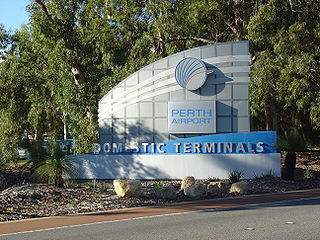
<span class="mw-page-title-main">Perth Airport (suburb)</span> Suburb of Perth, Western Australia

Perth Airport is an eastern suburb of Perth, the capital city of Western Australia. Its local government areas are the City of Belmont, the City of Swan (north) and the City of Kalamunda (east). It is located approximately 12 km east of the central business district. The suburb is the home of Perth Airport, the main international airport of Perth.

<span class="mw-page-title-main">Kalamunda Road</span> Road in Perth, Western Australia

Kalamunda Road is a minor arterial road linking the historic suburb of South Guildford with the Darling Scarp suburb of Kalamunda, in Perth, Western Australia.

<span class="mw-page-title-main">South Guildford, Western Australia</span> Suburb of Perth, Western Australia

South Guildford is a suburb of Perth, Western Australia, located in the City of Swan local government area.

Darling Downs is an outer south-eastern suburb of Perth, Western Australia, within the Shire of Serpentine-Jarrahdale. The name, referring to the suburb's proximity to the Darling Scarp, was first used as an estate name in 1977, and adopted as a suburb name in 1997.
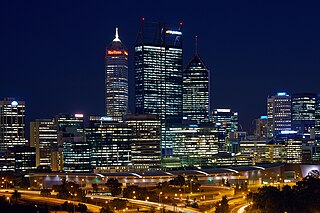
<span class="mw-page-title-main">Perth (suburb)</span> Suburb of Perth, Western Australia

Perth is a suburb in the Perth metropolitan region, Western Australia that includes both the central business district of the city, and a suburban area spreading north to the northern side of Hyde Park. It does not include the separate suburbs of Northbridge or Highgate. Perth is split between the City of Perth and the City of Vincent local authorities, and was named after the city of the same name in Scotland.

<span class="mw-page-title-main">Midland, Western Australia</span> Suburb of Perth, Western Australia

Midland is a suburb in the Perth metropolitan region, as well as the regional centre for the City of Swan local government area that covers the Swan Valley and parts of the Darling Scarp to the east. It is situated at the intersection of Great Eastern Highway and Great Northern Highway. Midland is almost always regarded as a suburb of Perth, being only 16 km (10 mi) away from the city centre.

References

  1. Australian Bureau of Statistics (28 June 2022). "Kalamunda (suburb and locality)". Australian Census 2021 QuickStats. Retrieved 28 June 2022.  OOjs UI icon edit-ltr-progressive.svg
  2. Australian Bureau of Statistics (27 June 2017). "2016 Community Profiles: Kalamunda (State Suburb)". 2016 Census of Population and Housing. Retrieved 14 October 2019. OOjs UI icon edit-ltr-progressive.svg
  3. "6.0 Thematic History". MUNICIPAL HERITAGE INVENTORY 2019 (PDF). City of Kalamunda. May 2019. Retrieved 14 October 2019.
  4. "Stirk Cottage". Kalamunda and Districts Historical Society. Retrieved 14 October 2019.
  5. Wynne, Emma (5 September 2016). "The story of Kalamunda's first house, Stirk Cottage". ABC Radio Perth . Retrieved 14 October 2019.
  6. "History of metropolitan suburb names – K". Western Australian Land Information Authority. Archived from the original on 16 March 2022. Retrieved 14 October 2019.
  7. "Local Planning Strategy" (PDF). City of Kalamunda. Retrieved 14 October 2019.
  8. "IBA: Mundaring-Kalamunda". Birdata. Birds Australia. Archived from the original on 6 July 2011. Retrieved 23 August 2011.
  9. "Climate statistics for Kalamunda". Bureau of Meteorology. Retrieved 21 June 2011.
  10. "Route 272". Bus Timetable 109 (PDF). Transperth. 25 August 2023 [effective from 20 November 2023].
  11. "Route 273". Bus Timetable 109 (PDF). Transperth. 25 August 2023 [effective from 20 November 2023].
  12. "Route 274". Bus Timetable 109 (PDF). Transperth. 25 August 2023 [effective from 20 November 2023].
  13. "Route 275". Bus Timetable 109 (PDF). Transperth. 25 August 2023 [effective from 20 November 2023].
  14. "Route 276". Bus Timetable 109 (PDF). Transperth. 25 August 2023 [effective from 20 November 2023].
  15. "Route 279". Bus Timetable 94 (PDF). Transperth. 10 October 2023 [effective from 20 November 2023].
  16. "Route 282". Bus Timetable 94 (PDF). Transperth. 10 October 2023 [effective from 20 November 2023].
  17. "Route 283". Bus Timetable 94 (PDF). Transperth. 10 October 2023 [effective from 20 November 2023].
  18. "Route 307". Bus Timetable 96 (PDF). Transperth. 16 January 2024 [effective from 4 February 2024].
  19. 1 2 Australian Bureau of Statistics (27 June 2017). "Kalamunda (State Suburb)". 2016 Census QuickStats. Retrieved 14 October 2019. OOjs UI icon edit-ltr-progressive.svg
  20. Australian Bureau of Statistics (27 June 2017). "2016 Community Profiles: Perth SUA". 2016 Census of Population and Housing. Retrieved 19 December 2019. OOjs UI icon edit-ltr-progressive.svg

Commons-logo.svg Media related to Kalamunda, Western Australia at Wikimedia Commons