
Kalamunda is a town and eastern suburb of Perth, Western Australia, located in the Darling Scarp at the eastern limits of the Perth metropolitan area.

Bull Creek is a suburb of Perth, Western Australia, located within the local government area of City of Melville. The suburb lies to the south of a creek of the same name, which flows into the Canning River.

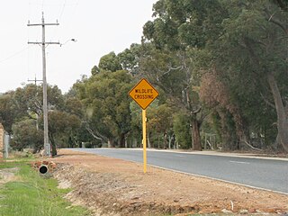
Forrestfield is a suburb of the City of Kalamunda in Western Australia. It lies 15 kilometres to the south-east of Perth at the base of the Darling Scarp and the southern border of Perth Airport.
Bateman is a suburb of Perth, Western Australia, located within the City of Melville.

Kardinya is a suburb of Perth, Western Australia, located within the City of Melville. The suburb is home to under 10,000 people, including many international students due to its proximity to Murdoch University.
Darch is a suburb of Perth, Western Australia, located within the City of Wanneroo approximately 17 kilometres (11 mi) north of the Perth CBD. Previously part of Landsdale, much of the suburb was rural in character until the late 1990s. It was named after an early settler family in the area, with the name being approved in 1997. The area was subsequently opened to residential development, especially from 2001 onwards, as part of Cell 6 of the East Wanneroo Development Area.
High Wycombe is a suburb of Perth, Western Australia, within the City of Kalamunda. High Wycombe lies east of the Perth CBD at the base of the Darling Scarp. Formerly part of Maida Vale, the suburb was officially declared on 2 June 1978; its name, which was first used in 1958 by a subdivider, Western Agencies, and refers to the town in Buckinghamshire where one of the partners in the firm was born.
Bickley is a suburb located within the City of Kalamunda, in Perth, Western Australia.
Carmel is a suburb of Perth, Western Australia, located within the City of Kalamunda.

Gooseberry Hill is a suburb of Perth, Western Australia, located within the City of Kalamunda. It is the site of Gooseberry Hill National Park.

Lesmurdie is a suburb of Perth, Western Australia, located within the City of Kalamunda. It was established in 1897 by Archibald Sanderson, a politician and journalist, who began buying properties in the area from the Canning Jarrah Timber Company to build up a rural retreat and fruit-growing property. He named it after Lesmurdie Cottage, a shooting box near Dufftown, Scotland that his father had rented. It was officially gazetted on 8 June 1959.
Maida Vale is a suburb of Perth, Western Australia, located within the City of Kalamunda. Kalamunda Road runs through the suburb. Its first European settler was William Henry Mead who arrived in 1873, building a home in the Ridge Hill area and establishing an orchard named Orangedale. It was named in 1910 after a property name of another settler, WH McCormack. The name is believed to be derived from the eponymous area of west London.

Pickering Brook is a suburb of Perth, Western Australia, located within the City of Kalamunda.
Wattle Grove is a suburb of Perth, Western Australia, located within the City of Kalamunda.

The City of Kalamunda is a local government area in the eastern metropolitan region of the Western Australian capital city of Perth about 25 kilometres (15.5 mi) east of Perth's central business district. The city covers an area of 324.2 square kilometres (125.2 sq mi), much of which is state forest rising into the Darling Scarp to the east. According to the 2016 Census, the city recorded a population of 57,449 people.

Bayswater is a suburb 6 kilometres (3.7 mi) north-east of the central business district of Perth, the capital of Western Australia. It is located north of the Swan River, within the City of Bayswater local government area. It predominantly a low density residential suburb with a small town centre lined with shops and a light industrial area to the east. Development in the suburb was first triggered by the construction of the Fremantle-Guildford railway line in 1881. In 1885, Bayswater estate was founded. Since then, the suburb has been almost fully developed, with a population of 14,432 as of 2016.

Kalamunda is an electoral district of the Legislative Assembly in the Australian state of Western Australia.
Lesmurdie Senior High School is a public co-educational high school in the Perth suburb of Lesmurdie, Western Australia.

Northbridge is an inner city suburb of Perth, Western Australia, historically separated from Perth's central business district by the Fremantle and Joondalup railway lines.

