Kei Road

Last updated
Kei Road

Keiweg
South Africa Eastern Cape location map.svg
Red pog.svg
Kei Road
South Africa adm location map.svg
Red pog.svg
Kei Road
Coordinates: 32°42′07″S27°33′32″E / 32.702°S 27.559°E / -32.702; 27.559 Coordinates: 32°42′07″S27°33′32″E / 32.702°S 27.559°E / -32.702; 27.559
Country South Africa
Province Eastern Cape
District Amathole
Municipality Amahlathi
Area
[1]
  Total4.57 km2 (1.76 sq mi)
Population
(2011) [1]
  Total1,179
  Density260/km2 (670/sq mi)
Racial makeup (2011)
[1]
   Black African 99.5%
   Coloured 0.2%
   Indian/Asian 0.2%
  Other0.2%
First languages (2011)
[1]
   Xhosa 96.9%
  Other3.1%
Time zone UTC+2 (SAST)
Postal code (street)
4920
PO box
4920
Area code 043

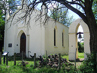
Kei Road is a town in Amathole District Municipality in the Eastern Cape province of South Africa.

Amathole District Municipality District municipality in Eastern Cape, South Africa

Amathole is one of the 7 districts of Eastern Cape province of South Africa. The seat of Amathole is East London. Over 90% of its 892,637 people speak Xhosa. The district code is DC12. "Amathole" means calves, the name of the mountain range and forest which forms the northern boundary of the district.

Eastern Cape Province of South Africa

The Eastern Cape is a province of South Africa. Its capital is Bhisho, but its two largest cities are Port Elizabeth and East London. It was formed in 1994 out of the Xhosa homelands or bantustans of Transkei and Ciskei, together with the eastern portion of the Cape Province. It is the landing place and home of the 1820 Settlers. The central and eastern part of the province is the traditional home of the Xhosa people.

South Africa Republic in the southernmost part of Africa

South Africa, officially the Republic of South Africa (RSA), is the southernmost country in Africa. It is bounded to the south by 2,798 kilometres (1,739 mi) of coastline of Southern Africa stretching along the South Atlantic and Indian Oceans; to the north by the neighbouring countries of Namibia, Botswana, and Zimbabwe; and to the east and northeast by Mozambique and Eswatini (Swaziland); and it surrounds the enclaved country of Lesotho. South Africa is the largest country in Southern Africa and the 25th-largest country in the world by land area and, with over 57 million people, is the world's 24th-most populous nation. It is the southernmost country on the mainland of the Old World or the Eastern Hemisphere. About 80 percent of South Africans are of Sub-Saharan African ancestry, divided among a variety of ethnic groups speaking different African languages, nine of which have official status. The remaining population consists of Africa's largest communities of European (White), Asian (Indian), and multiracial (Coloured) ancestry.

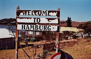
Village 27 km north-east of King William’s Town and 24 km south-east of Stutterheim. It was so named after its situation on the military road between King William’s Town and the Kei River. [2]

Stutterheim Place in Eastern Cape, South Africa

Stutterheim is a town with a population of 46,730 in South Africa, situated in the Border region of the Eastern Cape province.

Related Research Articles

East London, Eastern Cape Place in Eastern Cape, South Africa

East London is a city on the southeast coast of South Africa in the Buffalo City Metropolitan Municipality of the Eastern Cape province. The city lies on the Indian Ocean coast, largely between the Buffalo River and the Nahoon River, and hosts the country's only river port. As of 2011, East London had a population of over 267,000 with over 755,000 in the metropolitan area.

Bhisho Place in Eastern Cape, South Africa

Bhisho is the capital of the Eastern Cape Province in South Africa. The Office of the Premier, Provincial Legislature and many other government departments are headquartered in the town. The town situated 3 kilometres away from King Williams Town and 70 kilometres away from East London is part of the Buffalo City Metropolitan Municipality of the Eastern Cape.

Delmas, Mpumalanga Place in Mpumalanga, South Africa

Delmas is a small maize farming town situated east of Johannesburg in Mpumalanga, South Africa. The town is located some 19 km north-east of Springs and 73 km south-east of Pretoria.

Great Kei River river in South Africa

The Great Kei River is a river in the Eastern Cape province of South Africa. It is formed by the confluence of the Black Kei River and White Kei River, northeast of Cathcart. It flows for 320 km (199 mi) and ends in the Great Kei Estuary at the Indian Ocean with the small town Kei Mouth on the west bank. Historically the Great Kei River formed the southwestern border of the Transkei region.

King Williams Town Place in Eastern Cape, South Africa

King William's Town is a town in the Eastern Cape province of South Africa along the banks of the Buffalo River. The town is about 60 kilometres North West of the Indian Ocean port of East London. The town is part of the Buffalo City Metropolitan Municipality in the Eastern Cape.

British Kaffraria

British Kaffraria was a British colony/subordinate administrative entity in present-day South Africa, consisting of the districts now known as King Williams Town and East London.

Wild Coast Region, Eastern Cape region of South Africa

The Wild Coast is a section of the coast of the Eastern Cape, a province of South Africa. The region stretches from East London in the south to the border of KwaZulu-Natal in the north. It is the traditional home of the Xhosa people, and the birthplace of many prominent South Africans, including Nelson Mandela and Thabo Mbeki.

Cannon Rocks Place in Eastern Cape, South Africa

Cannon Rocks is a small seaside town on the Indian Ocean in the Eastern Cape Province, South Africa, between Boknes and the boundary of the Greater Addo Elephant Park. It is situated 135 km to the east of Port Elizabeth and 180 km west of East London approximately 15 minutes from the town of Kenton-on-Sea. Port Alfred is approximately 30 km to the East of Cannon Rocks. Cannon Rocks is part of the Ndlambe Local Municipality in the Sarah Baartman District of the Eastern Cape.

Porterville, Western Cape Place in Western Cape, South Africa

Porterville is a town in the Western Cape province in South Africa.

Kei Mouth Place in Eastern Cape, South Africa

Kei Mouth is a resort town on the southeast coast of South Africa, situated in the Wild Coast region of the Eastern Cape Province, situated 94 kilometres from the city of East London. The town is situated on the Indian Ocean coast, on the western bank of the Great Kei River, and has one of the country's three remaining car transporting pontoon river ferries.

Aggeneys Place in Northern Cape, South Africa

Aggeneys is a mining town established in 1976 on a farm of that name, situated between Pofadder and Springbok in the Northern Cape, South Africa.

Hamburg, Eastern Cape Place in Eastern Cape, South Africa

Hamburg is a small town with about 1000 inhabitants in the Eastern Cape province, in South Africa. It is located on the coast between the city of East London and the town of Port Alfred.

Hopefield, Western Cape Place in Western Cape, South Africa

Hopefield is a settlement in West Coast District Municipality in the Western Cape province of South Africa on the R45 between Malmesbury and Vredenburg.The town is east of Saldanha Bay and Langebaan, 40 km southeast of Vredenburg and 120 km north of Cape Town.

Peddie, Eastern Cape Place in Eastern Cape, South Africa

Peddie is a town in the Ngqushwa Local Municipality within the Amathole District Municipality in the Eastern Cape province of South Africa.

Middledrift, Eastern Cape Place in Eastern Cape, South Africa

Middledrift is a small town located 90 kilometres (60 mi) north-west of East London in the Eastern Cape province of South Africa. It is situated in Raymond Mhlaba Municipality in Amathole District in an area that was formerly part of the Ciskei.

Berlin, Eastern Cape Place in Eastern Cape, South Africa

Berlin is a small town in Buffalo City Metropolitan Municipality in the Eastern Cape province of South Africa.

Frankfort, Eastern Cape Place in Eastern Cape, South Africa

Frankfort is a town in Amathole District Municipality in the Eastern Cape province of South Africa.

St Marks, Eastern Cape Place in Eastern Cape, South Africa

St Mark’s, Eastern Cape is a town in Chris Hani District Municipality in the Eastern Cape province of South Africa.

Debe Nek Place in Eastern Cape, South Africa

Debe Nek is a town in Amahlathi Local Municipality in the Eastern Cape province of South Africa.

References

  1. 1 2 3 4 "Main Place Kei Road". Census 2011.
  2. "Dictionary of Southern African Place Names (Public Domain)". Human Science Research Council. p. 245.