The history of Botswana encompasses the region's ancient and tribal history, its colonisation as the Bechuanaland Protectorate, and the present-day Republic of Botswana. The first modern humans to inhabit Botswana were the San people, and agriculture first developed approximately 2,300 years ago. The first Bantu peoples arrived c. 200 CE, and the first Tswana people arrived about 200 years later. The Tswana people split into various tribes over the following thousand years as migrations within the region continued, culminating in the Difaqane in the late 18th century. European contact first occurred in 1816, which led to the Christianization of the region.
Botswana is a parliamentary republic in which the President of Botswana is both head of state and head of government. The nation's politics are based heavily on British parliamentary politics and on traditional Batswana chiefdom. The legislature is made up of the unicameral National Assembly and the advisory body of tribal chiefs, the Ntlo ya Dikgosi. The National Assembly chooses the president, but once in office the president has significant authority over the legislature with only limited separation of powers. The Botswana Democratic Party (BDP) rules as a dominant party; while elections are considered free and fair by observers, the BDP has controlled the National Assembly since independence. Political opposition often exists between factions in the BDP rather than through separate parties, though several opposition parties exist and regularly hold a small number of seats in the National Assembly.

Namibia, officially the Republic of Namibia, is a country in Southern Africa. Its western border is the Atlantic Ocean. It shares land borders with Angola and Zambia to the north, Botswana to the east and South Africa to the east and south. Although it does not border Zimbabwe, less than 200 metres of the Botswanan right bank of the Zambezi River separates the two countries. Its capital and largest city is Windhoek.
Rhodesia, officially from 1970 the Republic of Rhodesia, was an unrecognised state in Southern Africa from 1965 to 1979. During this fourteen-year period, Rhodesia served as the de facto successor state to the British colony of Southern Rhodesia, and in 1980 it became modern day Zimbabwe.

The economy of South Africa is a mixed economy, emerging market, and upper-middle-income economy, one of only eight such countries in Africa. The economy is the most industrialised, technologically advanced, and diversified in Africa. Following 1996, at the end of over twelve years of international sanctions, South Africa's nominal gross domestic product (GDP) almost tripled to a peak of US$416 billion in 2011. In the same period, foreign exchange reserves increased from US$3 billion to nearly US$50 billion, creating a diversified economy with a growing and sizable middle class, within three decades of ending apartheid.

Ivory Coast, also known as Côte d'Ivoire and officially the Republic of Côte d'Ivoire, is a country on the southern coast of West Africa. Its capital city of Yamoussoukro is located in the centre of the country, while its largest city and economic centre is the port city of Abidjan. It borders Guinea to the northwest, Liberia to the west, Mali to the northwest, Burkina Faso to the northeast, Ghana to the east, and the Atlantic Ocean's Gulf of Guinea to the south. With 30.9 million inhabitants in 2023, Ivory Coast is the third-most populous country in West Africa. Its official language is French, and indigenous languages are also widely used, including Bété, Baoulé, Dioula, Dan, Anyin, and Cebaara Senufo. In total, there are around 78 different languages spoken in Ivory Coast. The country has a religiously diverse population, including numerous followers of Islam, Christianity, and traditional faiths often entailing animism.

The Free State, formerly known as the Orange Free State, is a province of South Africa. Its capital is Bloemfontein, which is also South Africa's judicial capital. Its historical origins lie in the Boer republic called the Orange Free State and later the Orange Free State Province.
Dirigisme or dirigism is an economic doctrine in which the state plays a strong directive (policies) role, contrary to a merely regulatory or non-interventionist role, over a market economy. As an economic doctrine, dirigisme is the opposite of laissez-faire, stressing a positive role for state intervention in curbing productive inefficiencies and market failures. Dirigiste policies often include indicative planning, state-directed investment, and the use of market instruments to incentivize market entities to fulfill state economic objectives.
The earliest humans were hunter gatherers who were living in small, family groupings. Even then there was considerable trade that could cover long distances. Archaeologists have found that evidence of trade in luxury items like precious metals and shells across the entirety of the continent.
The amaMfengu were a group of Xhosa clans whose ancestors were refugees that fled from the Mfecane in the early-mid 19th century to seek land and protection from the Xhosa. These refugees were assimilated into the Xhosa nation and were officially recognized by the then king, Hintsa.

Apartheid was a system of institutionalised racial segregation that existed in South Africa and South West Africa from 1948 to the early 1990s. Apartheid was characterised by an authoritarian political culture based on baasskap, which ensured that South Africa was dominated politically, socially, and economically by the nation's minority white population. In this minoritarian system, there was social stratification and campaigns of marginalization such that white citizens had the highest status, with them being followed by Indians as well as Coloureds and then Black Africans. The economic legacy and social effects of apartheid continue to the present day, particularly inequality.
The Cape Colonial Forces (CCF) were the official defence organisation of the Cape Colony in South Africa. Established in 1855, they were taken over by the Union of South Africa in 1910, and disbanded when the Union Defence Forces were formed in 1912.

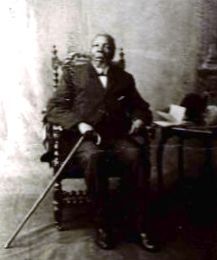
King Sarhili was the King of Xhosa nation from 1835 until his death in 1892 at Sholora, Bomvanaland. He was also known as "Kreli", and led the Xhosa armies in a series of frontier wars.

The Economic History of Zimbabwe began with the transition to majority rule in 1980 and Britain's ceremonial granting of independence. The new government under Prime Minister Robert Mugabe promoted socialism, partially relying on international aid. The new regime inherited one of the most structurally developed economies and effective state systems in Africa. In 2000, the government imposed a land reform program to seize white-owned farms which caused the economy to shrink along with mismanagement, corruption and political instability.

South Africa, officially the Republic of South Africa (RSA), is the southernmost country in Africa. Its nine provinces are bounded to the south by 2,798 kilometres of coastline that stretches along the South Atlantic and Indian Ocean; to the north by the neighbouring countries of Namibia, Botswana, and Zimbabwe; and to the east and northeast by Mozambique and Eswatini. It also completely enclaves Lesotho. It is the southernmost country on the mainland of the Old World and the second-most populous country located entirely south of the equator, after Tanzania. With over 62 million people, the country is the world's 23rd-most populous nation and covers an area of 1,221,037 square kilometres. Pretoria is the administrative capital, while Cape Town, as the seat of Parliament, is the legislative capital. Bloemfontein has traditionally been regarded as the judicial capital. The Constitutional Court, the country's highest court, is located in Johannesburg, the country's largest city.

The Xhosa people, or Xhosa-speaking people are a Bantu ethnic group native to South Africa. They are the second largest ethnic group in South Africa and are native speakers of the isiXhosa language.

The economy of the Western Cape in South Africa is dominated by the city of Cape Town, which accounted for 72% of the Western Cape's economic activity in 2016. The single largest contributor to the region's economy is the financial and business services sector, followed by manufacturing. Close to 30% of the gross regional product comes from foreign trade with agricultural products and wine dominating exports. High-tech industries, international call centres, fashion design, advertising and TV production are niche industries rapidly gaining in importance.
The anthropology of development is a term applied to a body of anthropological work which views development from a critical perspective. The kind of issues addressed, and implications for the approach typically adopted can be gleaned from a list questions posed by Gow (1996). These questions involve anthropologists asking why, if a key development goal is to alleviate poverty, is poverty increasing? Why is there such a gap between plans and outcomes? Why are those working in development so willing to disregard history and the lessons it might offer? Why is development so externally driven rather than having an internal basis? In short, why is there such a lack of planned development?
Tsomo is a town in Chris Hani District Municipality in the Eastern Cape province of South Africa. The town is 45 km east of Qamata and 48 km west of Ndabakazi.
Nokulunga Primrose Sonti is a South African politician from the North West who served as a Member of the National Assembly of South Africa for the Economic Freedom Fighters from May 2014 until May 2024. Sonti was previously a member of the African National Congress.


