
Mahikeng, formerly known as Mafikeng and alternatively known as Mafeking, is the capital city of the North West province of South Africa.
Harding is a town situated in the Mzimkulwana River valley, Ugu District Municipality of KwaZulu-Natal, South Africa
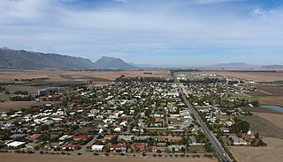
Carletonville is a town in Gauteng and the seat of the Merafong City Local Municipality in the West Rand District Municipality in Gauteng, South Africa, just north of the richest gold-mining area in the world. At 3,749 m, Western Deep Levels holds the record for the world's deepest gold mine.
Westonaria is a town in the west of Gauteng province of South Africa. It is situated in the Rand West City Local Municipality, part of the West Rand District Municipality. During the apartheid era, Africans lived outside town in Bekkersdal. The town is some 45 km west of Johannesburg and 18 km south of Randfontein.

Wolmaransstad is a maize-farming town situated on the N12 between Johannesburg and Kimberley in North West Province of South Africa. The town lies in an important alluvial diamond-mining area and it is the main town of the Maquassi Hills Local Municipality.
Koster is a small farming town situated on the watershed between the Orange and Limpopo Rivers in North West Province of South Africa.
Halfway House Estate is a suburb of Midrand, South Africa. It is located in Region A of the City of Johannesburg Metropolitan Municipality.

Rustenburg Municipality is a local municipality within the Bojanala Platinum District Municipality, in the North West province of South Africa. Rustenburg is situated at the foot of the Magalies mountain range. Rustenburg was proclaimed a township in 1851. The city of Rustenburg is situated some 112 km northwest from both Johannesburg and Pretoria. It is a malaria-free area. Rustenburg is the fastest growing municipality in South Africa, with the population rising from 387,096 in 2001 to 449,776 in 2007. It is the most populous municipality in the North West province.
Merafong City Municipality is a local municipality in the West Rand District Municipality, in the Gauteng province of South Africa. Its boundaries encloses some of the richest gold mines in the world. It is situated about 65 km from Johannesburg and is serviced by a number of major roads, including the N12 from Johannesburg to Kimberley and the N14.
Porterville is a town in the Western Cape province of South Africa.

Vosburg is a town 61 km west of Britstown, in the Northern Cape province of South Africa. The town has relatively low crime rate and features many 19th century buildings.

Hopefield is a settlement in West Coast District Municipality in the Western Cape province of South Africa on the R45 between Malmesbury and Vredenburg. The town lies east of Saldanha Bay and Langebaan, 40 km (25 mi) southeast of Vredenburg and 120 km (75 mi) north of Cape Town.

Willowmore is a town in Sarah Baartman District Municipality in the Eastern Cape province of South Africa.
Cala is a town in Sakhisizwe Local Municipality, part of the Chris Hani District Municipality in the Eastern Cape province of South Africa.

Middledrift, officially known as iXesi and also known as Middeldrift, is a small town located 90 kilometres (60 mi) north-west of East London in the Eastern Cape province of South Africa. It is situated in Raymond Mhlaba Municipality in Amathole District in an area that was formerly part of the Ciskei.
Oberholzer is a town in West Rand District Municipality in the Gauteng province of South Africa. The town is 85 km south-west of Johannesburg, just north-west of Carletonville.
Mpumalanga, also widely known as Hammarsdale, is a township located in the eThekwini Metropolitan Municipality in the KwaZulu-Natal province of South Africa. It is situated some 10 km south-south-east of Cato Ridge and some 50 km west of Durban. Derived from Zulu, the name means 'sunrise', 'the sun comes out'.
Cato Ridge is a town in the KwaZulu-Natal province of South Africa named after George Christopher Cato (1814–1893), the first mayor of Durban. Organisationally and administratively it is included in the Ethekwini Metropolitan Municipality as a suburb of the Outer West region.
Mhlangeni, also known as Hertzog, is a settlement in Amathole District Municipality in the Eastern Cape province of South Africa.
Spoegrivier is a town in Namakwa District Municipality in the Northern Cape province of South Africa.


