
Osmanabad District, officially known as Dharashiv District, is an administrative district in the Marathwada region in the Indian state of Maharashtra. The district headquarter is located at Osmanabad. The District of Osmanabad derives its name from the last ruler of Hyderabad, the 7th Nizam, Mir Osman Ali Khan, of which the region was a part till 1947. This region was earlier part of The Hyderabad State until Independence.This primarily rural district occupies an area of 7,569 km2 (2,922 sq mi) of which 241.4 km2 (93.2 sq mi) is urban and has a population of 1,657,576 of which 16.96% were urban.
Ashoknagar is a city and a Municipality Council in Ashoknagar District in Madhya Pradesh state of central India. It is the administrative headquarters of Ashoknagar District. Earlier it was part of Guna district. Ashoknagar is well known for its Grain Mandi and "Sharbati Gaihu", a type of wheat. The nearest city Guna 45 km from the city. Ashoknagar was formerly known as Pachar. The railway line passes from the middle of the city. Ashoknagar has a railway station and Two Bus stations. Ashoknagar is connected to the main cities of Madhya Pradesh by road and railway.
Beawar is a city in Beawar district of Indian state of Rajasthan. As of 2011, the population of Beawar is 342,935. It is located 60 kilometres south from Ajmer, the divisional headquarter and 184 kilometres (114 mi) southwest of the state capital Jaipur, amidst Aravali hills. The city used to be a major center for trade, especially in raw cotton, and used to have cotton presses and the Krishna cotton mills. Currently, major industries include mineral-based units, machine-based units, machine tools and accessories, pre-stressed concrete pipes, plastic products, textiles, wooden furniture and asbestos cement pipes. Beawar is the largest producer of cement in northern India and home to Shree Cement. It is situated in a mineral-rich region having reserves of feldspar, quartz, asbestos, soapstone, magnesite, calcite, limestone, mica, emerald, granite, and masonry stone. Reserves of barytes, fluorite, wollastonite and vermiculite have also been found. Nearest airports are Jodhpur (145 km), Kishangarh and Jaipur (190 km). It is also connected by RSRTC operated buses to all parts of Rajasthan, and neighboring Delhi NCR, Ahmedabad (Gujarat), Gwalior. It also has railway connectivity with Delhi, Mumbai, Ahmadabad, Bangalore (bi-weekly), Haridwar, Dehradun (weekly), Bareilly and Muzzafarpur.

Jhunjhunu district is a district of the Indian state of Rajasthan in northern India. The city of Jhunjhunu is the district headquarters.

Takhatgarh is a town in Pali District of Rajasthan state in India. The town is one of the nine municipalities in the district, located near the district border. It is only about 160 years old.
Aklera is a town and an Indian municipality in Jhalawar district in the state of Rajasthan. It is in the south-eastern region of Rajasthan at the edge of the Malwa plateau and has a rocky, scrub-covered terrain.
Deoli is a city situated at the point at which Tonk, Shahpura, Kekri and Bundi districts meet, though the bulk of the city is located in Shahpura and Tonk districts. It is officially a part of Tonk district. It is the tehsil headquarters of the Deoli tehsil.
Jintur city and a municipal council in Parbhani district in the Indian state of Maharashtra.
Malpura is a town with municipality in Tonk district in the Indian state of Rajasthan. Malpura is known for its Dadabadi, built by the Khartargach Sect of Shewtambar Jain in memory of 3rd Dada Gurudev Shri Jinkushalsurishwarji.Also known for its Forts,Malpura is popular visiting palace in Rajasthan.
Mundi is a city and Tehsil in the Khandwa district of Nimar region the Indian state of Madhya Pradesh. It is situated in North Side of East Nimar District.
Nainwan is a tehsil of Bundi district and a municipality in the Hadoti region of the state of Rajasthan in India.

Sardarshahar is a city located in the Churu district of Rajasthan, India. It is also the seat of the Rajasthan legislative assembly Sardarshahar Assembly constituency. Sardarshahar is the tehsil headquarter. and part of the Churu Lok Sabha constituency. Sardarshahar was established in 1838 at the place of "Alwana" village in Bikaner state. The city is named after Sardar Singh, The son of Bikaner Maharaja(Raja Ratan Singh). It is known for its grand Havelis (mansions) with frescoes, The only Clock Tower (GhantaGhar) in Asia which streets running under it in all four directions, Shri Ichha Puran Balaji Mandir, Acharya Shri Mahapragya Samadhi Sthal(ShantiPeeth), Gandhi Vidya Mandir and many more. It is famous for its Food, handicraft work, silver work, and woodwork. It is the birthplace of the Eleventh Acharya -Acharyashri Mahashramanji of the Shri Jain Terapanthi Sect.
Degana is a town municipality and headquarter to Sub-Division and Tehsil located in Nagaur district of Rajasthan, India.
Bijainagar is a city and headquarters of Bijainagar tehsil in the Beawar district of the Indian state of Rajasthan.It was founded by Shri Rao Saheb Vijay Singh ji Of Masuda in 1919 CE,This city is situated along the Khari River close to the southern border of Ajmer District.
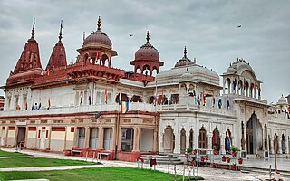
Shri Mahavir Ji is an important and prominent Jain pilgrimage site situated in Shri Mahaveerji town in Hindaun Block, Karauli district in Rajasthan. Given the importance of the religious place, the Indian Railways has specifically developed a railway station under West Central Railway zone by the name of Shri Mahaveerji railway station which is 10 minutes drive from the temple and temple authorities have arranged for regular buses from the station to the temple. The temple is visited by millions of Jain and Hindu devotees every year.
Peepal Khoont mainly known as Pipalkhunt is a village, Tehsil headquarter and Panchayat Samiti of the Pratapgarh district of Rajasthan state. It is a sub-division among the 5 sub-divisions of the Pratapgarh district. The main market is called Sadar Bajar. It is situated on National Highway 113. Pipalkhunt is a town located on the Banswara - Jaipur Expressway surrounded by the hills, plants and trees. The town is situated on the bank of the Mahi River.
Hindaun is a Block in Karauli district of the Indian state of Rajasthan in Northern India. It is a subdivisional headquarter. Its population is approximately 442,000. The block covers an area of 700 Square kilometres, which makes it the biggest block in Karauli. The subdistrict code of Hindaun Block is 00522. There are about 165 villages in Hindaun Block.
Para is a village in Kekri district, in Rajasthan state of India. As of 2011 census of India, its population is 3752.

Atishay Kshetra Lunwa is a famous Jain pilgrimage site situated 70 km from Jaipur. Lunwa is a small village in the Nagaur district of Rajasthan, India. The temple, one of two Jain temples in Lunwa, was established in 1672. लूणवा जैन मंदिर मेंथा पर अवस्थित है
Umarlai Khalsa is a village in Barmer District of Rajasthan state in India. It is about 100 km from Jodhpur. The town is famous for farming, Mata Nagnechiyaa Temple and Akhada, The town is well connected with Jodhpur by buses at frequent intervals. From Umarlai Khalsa towards Jalore there is India's Third Brahma Temple in the village of Asotra. From Umarlai Khalsa towards Barmer there is Ancient Temple of Lord Shri Vishnu named as Shri Ranchore Ray, Khed Mandir in the village of Khed The name Umarlai Khalsa derived from all the religious people of this village. About 13 km from Balotra is located the famous Jain Temple Nakoda. The place receives religious devotees from across India. The town is located near on the coast of the river Luni. The village of Umarlai Khalsa is mainly popular for housing the famous Ancient Temples of Lord Shiva. It is one of the most revered pilgrimage destinations for the Hindu community. The temple is an excellent example of fine architecture and many sculptures are carved inside the temple. Apart from this temple, a number of other temples are located in the town which include the Pabuji Rathord Mandir, Jog Maya Matha Mandir, Gogaji Mandir, Bhomiyaji Mandir, Hanuman Mandir and more.

