Jhunjhunu district

Last updated

Jhunjhunu district
'Shiv Kund' water reservoir at 'Dhosi Hill'.JPG
Shiv Kund at Dhosi Hill
Nawalgarh temple.jpg
Temple in Nawalgarh
Clock Tower - BITS - panoramio.jpg
Clock tower at BITS Pilani
Jhunjhunu in Rajasthan (India).svg
Location of Jhunjhunu district in Rajasthan
Coordinates(Jhunjhunu): 75°01′N76°04′E / 75.02°N 76.06°E / 75.02; 76.06 - 27°23′N28°19′E / 27.38°N 28.31°E / 27.38; 28.31
CountryIndia
State Rajasthan
DivisionSikar
Headquarters Jhunjhunu
Tehsils
Government
   Lok Sabha constituencies Jhunjhunu [1]
   Vidhan Sabha constituencies 1. Jhunjhunu, 2. Mandwa, 3. Pilani, 4. Nawalgarh, 5. Surajgarh [2]
Area
  Total5,928 km2 (2,289 sq mi)
Population
 (2011)
  Total2,137,045
  Density360/km2 (930/sq mi)
   Urban
22.89 percent
Demographics
   Literacy 74.72
  Sex ratio950
Time zone UTC+05:30 (IST)
Major Highways National Highway 11
State Highway 8
Website jhunjhunu.rajasthan.gov.in

Jhunjhunu district is a district of the Indian state of Rajasthan in northern India. The city of Jhunjhunu is the district headquarters. Jhunjhunu is an old and historical town having its own district headquarters. It is said that it was ruled over by Chouhan dynasty in the Vikram era 1045. The district is famous for the frescos on its grand Havelis. It is also famous for providing considerable representation to Indian defense forces. Jhunjhunu district was named in the memory of a Jat named “Jhunjha” or “Jujhar Singh Nehra”. The district has a population of 2,139,658 (2011 census), an area of 5926 km², and a population density of 361 persons per km. The district falls within Shekhawati region, and is bounded on the North-East and East by Haryana state, on the South-East, South & South-West by Sikar District & on the North-West and North by Churu District. [3]

Contents

Demographics

Historical population
YearPop.±% p.a.
1901341,572    
1911369,081+0.78%
1921353,140−0.44%
1931405,519+1.39%
1941491,003+1.93%
1951588,736+1.83%
1961719,650+2.03%
1971929,230+2.59%
19811,211,583+2.69%
19911,582,421+2.71%
20011,913,689+1.92%
20112,137,045+1.11%
source: [4]

According to the 2011 census Jhunjhunu district has a population of 2,139,658, [5] roughly equal to the nation of Namibia [6] or the US state of New Mexico. [7] This gives it a ranking of 214th in India (out of a total of 640). [5] The district has a population density of 361 inhabitants per square kilometre (930/sq mi). [5] Its population growth rate over the decade 2001-2011 was 11.81%. [5] Jhunjhunu has a sex ratio of 950 females for every 1000 males, [5] It also has a literacy rate of 74.72% which is considered excellent. 22.89% of the population live in urban areas. Scheduled Castes and Scheduled Tribes make up 16.88% and 1.95% of the population respectively. [5]


Religions in Jhunjhunu district (2011) [8]
ReligionPercent
Hindus
89.17%
Muslims
10.68%
Other or not stated
0.15%


Languages

Shekhawati a dialect of Rajasthani, and Hindi are mainly spoken languages. The language blends into Haryanvi along the Haryana border.

Places of interest

There are various places of interests in and around Jhunjhunu.

Museums

Fairs

Film location

The Mandawa area of Jhunjhunu district has been used as a film location for several Bollywood films, including the dance sequences of "Cutie Pie" in the movie Ae Dil Hai Mushkil , and the portrayal of Mandawa as Lucknow in the same film, and as Pakistan in Kabir Khan’s Bajrangi Bhaijaan .

Other notable films shot in the district include Half Girlfriend , Mirziya , PK , Jab We Met , Paheli , Shudh Desi Romance , Dolly Ki Doli , Manorama Six Feet Under and Kachche Dhaage . [9]

Education

Universities and colleges

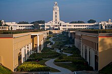
A Glimpse of BITS,Pilani Bits Clock tower.jpg
A Glimpse of BITS,Pilani

Universities in the district include Birla Institute of Technology & Science, Pilani (BITS Pilani) and Central Electronics Engineering Research Institute (CEERI), in Pilani, Jhunjhunu.

Plans are underway for the establishment of a new Sports University in the Jakhron Ka Bas, Deorasar, [10] supported by the Government of Rajasthan.

Schools

Notable people

See also

Related Research Articles

<span class="mw-page-title-main">Pilani</span> Town in Rajasthan, India

Pilani is a small town located, near the city of Jhunjhunu in the Jhunjhunu district of Rajasthan, India. Administratively, it forms a part of Jhunjhunu district. The town is best known as the location of BITS Pilani.
<span class="mw-page-title-main">Jhunjhunu</span> City in Rajasthan, India

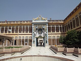
Jhunjhunu is a city in the state of Rajasthan in northern India and the administrative headquarters of Jhunjhunu District. Rajasthani and Hindi are widely spoken in Jhunjhunu. Jhunjhunu has given the highest number of soldiers to the Indian army and the paramilitary.

<span class="mw-page-title-main">Shekhawati</span> Region in Rajasthan, India

Shekhawati is a semi-arid historical region located in the northeast part of Rajasthan, India. The region was ruled by Shekhawat Rajputs. Shekhawati is located in North Rajasthan, comprising the districts of Neem Ka Thana, Jhunjhunu, Sikar that lies to the west of the Aravalis and Churu. It is bounded on the northwest by the Bagar region, on the northeast by Haryana, on the east by Mewat, on the southeast by Dhundhar, on the south by Ajmer, and on the southwest by the Marwar region. Its area is 13,784 square kilometers.

Nawalgarh is a heritage city in Jhunjhunu district of Indian state of Rajasthan. It is part of the Shekhawati region and is midway between Jhunjhunu and Sikar. It is 31.5 km from Sikar and 39.2 km from Jhunjhunu. Nawalgarh is famous for its fresco and havelis and considered as Golden City of Rajasthan. It is also the motherland of some great business families of India.

<span class="mw-page-title-main">Shekhawat</span> Rajput clan

Shekhawat is a clan of Rajputs found mainly in Shekhawati region of Rajasthan. Shekhawats are descendants of Maharao Shekha of Amarsar. Shekhawat is the most prominent sub-clan among Kachhwaha Rajputs. The Shekhawati region was ruled by them for more than 500 years and are honoured with the hereditary title of “Tazimi Sirdars”, whom HH the Maharaja of Jaipur receives by rising from his seat. Fought against mughals many time. Rao Sujjan Singh of Chhapoli fought mughal army with 300 men to save a temple. Col. J.C. Brooke in his book, Political History of India, wrote that “For the recruitment of Horse-army there is no region in India at par with Shekhawati.” Shekhawat is a very common surname in the Indian defence forces.
<span class="mw-page-title-main">Mandawa</span> Town in Rajasthan, India

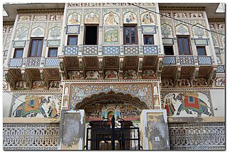
Mandawa is a town, just 29 km from Jhunjhunu city in Jhunjhunu district of Rajasthan, India. It is part of Shekhawati region. Mandawa is located at 28.05°N 75.15°E. It has an average elevation of 316 metres (1036 ft). The nearest railway station is Jhunjhunu railway station.
<span class="mw-page-title-main">Kuchaman City</span> City and District Headquarters in Rajasthan, India

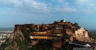
Kuchaman CityHindi pronunciation:[/ˌkuːtʃəˈmɑːnˈsɪti/] is a Municipal Council and District Headquarters of Didwana-Kuchaman District located in west-central Rajasthan, India. It is the largest city of newly Kuchaman district. The Didwana-Kuchaman district was carved out from the Nagaur District as the 38th District of the state of Rajasthan on 4 August 2023.

Sultana is a town in Jhunjhunu District of the Indian state of Rajasthan. It belongs to Jaipur Division. It is located 25 km to the east of District headquarters Jhunjhunu. 200 km from State capital Jaipur
<span class="mw-page-title-main">Bagar, Jhunjhunu</span> Village in Rajasthan, India

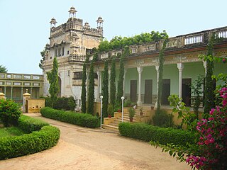
Bagar, or Baggar, is a town and municipal council in the Jhunjhunu district of Rajasthan, a northwestern state in India. Known for its heritage havelis, it is located 12 kilometres (7.5 mi) from Jhunjhunu city on NH 8 towards Chirawa-Loharu.

Jhajhar is a village, situated in the erstwhile province of Shekhawati of Rajasthan, India. It is located in the Jhunjhunu District, approximately 7 km from Nawalgarh. Formally it was the part of Pentalisa of Bhojyana.

Maharao Shardul Singh ji Shekhawat (1681-1742) was the Shekhawat ruler of Jhunjhunu. During his reign, the Shekhawats are considered to have reached the height of their powers. After his death the estate was divided equally among his surviving five sons, whose descendants continued to rule over it until India achieved independence.

Tain is a village in the Jhunjhunu district, India. It is part of the Shekhawati region of Rajasthan.

Kalipahari village is a big community of Shekhawat Rajputs in the Jhunjhunu District of Rajasthan. It is situated 5 km south of Bagar, Jhunjhunu. The village is famous for the frescos on its grand havelis.

Panchpana were the combined territories and thikanas ruled by the successors of Maharao Shardul Singh of Jhunjhunu, who belonged to the Bhojraj Ji Ka clan of Shekhawats. The Bhojraj Ji Ka Shekhawats ruled over two territories; Pentalisa and Panchpana. The Bhojraj Ji Ka clan of Shekhawats were the most prominent among the Shekhawat Rajputs. They built many magnificent forts in their thikanas. Panchpana thakurs ruled over highest number of thikanas in Shekhawati. Many thikanas had their own flags and emblems.

Balonda is a village in the Indian state of Rajasthan. Its mandal is Surajgarh and district is Jhunjhunu. It is located 17.7 kilometres (11.0 mi) from Surajgarh, 54.2 kilometres (33.7 mi) from Jhunjhunu, and 157 kilometres (98 mi) from Jaipur.

<span class="mw-page-title-main">Shekhawati painting</span>

The region of Shekhawati in Rajasthan is remarkable for its wealth of mural paintings which adorn the walls of many buildings, including havelis.

Pilani Assembly constituency is one of the constituencies of Rajasthan Legislative Assembly, and is a segment of Jhunjhunu.

Mandawa Assembly constituency is one of constituencies of Rajasthan Legislative Assembly in the Jhunjhunu.
<span class="mw-page-title-main">Bavaliya Baba</span> Hindu saint

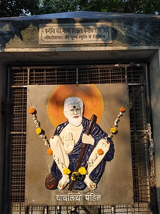
Bavaliya Baba, also known as Paramahansa Ganesh Narayan and Bavaliya Pandit (1847–1913), was an Indian Hindu saint associated with the Aghori sect.

References

  1. "Parliamentary Constituencies of Rajasthan" (PDF). 2012. Archived from the original (PDF) on 16 June 2013. Retrieved 23 February 2012.
  2. "Assembly Constituencies of Jhunjhunu district" (PDF). gisserver1.nic.in. 2012. Archived from the original (PDF) on 3 June 2013. Retrieved 23 February 2012.
  3. "History | District & Sessions Court Jhunjhunu | India" . Retrieved 3 May 2024.
  4. "Decadal Variation In Population Since 1901". Archived from the original on 8 August 2019. Retrieved 9 August 2019.
  5. 1 2 3 4 5 6 "District Census Handbook 2011: Jhunjhunu" (PDF). Census of India . Registrar General and Census Commissioner of India.
  6. US Directorate of Intelligence. "Country Comparison:Population". Archived from the original on 27 September 2011. Retrieved 1 October 2011. Namibia 2,147,585
  7. "2010 Resident Population Data". U. S. Census Bureau. Archived from the original on 19 October 2013. Retrieved 30 September 2011. New Mexico - 2,059,179
  8. "Table C-01 Population By Religion - Rajasthan". census.gov.in. Registrar General and Census Commissioner of India.
  9. TLJ, Team (24 January 2017). "Mandawa, Bollywood's Favourite Shooting Destination In Rajasthan". thelifestylejournalist.com. Retrieved 5 May 2024.
  10. "Vice Chancellors of State Universities". rajbhawan.rajasthan.gov.in. Retrieved 5 May 2024.
  11. "Param vir Chakra winners since 1950 | India News - Times of India". The Times of India .
  12. "Jhunjhunu army jawan, Chhatrapal Singh, martyred in Jammu and Kashmir". The PinkCity Post. 6 April 2020. Retrieved 17 October 2021.
  13. ANI (7 April 2020). "Mortal remains of paratrooper Chhtrapal Singh brought to Jhunjhunu". Business Standard India. Retrieved 17 October 2021.
  14. Saini, Vishwanath (6 April 2020). "छत्रपाल सिंह : 1997 में जन्म, 2015 में आर्मी ज्वाइन, 2018 में बने कमांडो, 2020 में LOC पर शहीद". hindi.oneindia.com (in Hindi). Retrieved 17 October 2021.