Rajsamand district

Last updated

Rajsamand district
Kumbhalgarh main gate.jpg
Dhuni in Anjana Fort - panoramio.jpg
Maharana pratap haldighatI.jpg
Third eye circle, Nathdwara.jpg
Rajsamand lake,.jpg
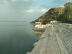
Clockwise from top-left: Kumbalgarh Fort, Anjana Fort, Third Eye Circle in Nathdwara, Rajsamand Lake, Statue of Maharana Pratap at Haldighati
Rajsamand in Rajasthan (India).svg
Coordinates: 25°04′N73°52′E / 25.067°N 73.867°E / 25.067; 73.867 Coordinates: 25°04′N73°52′E / 25.067°N 73.867°E / 25.067; 73.867
CountryFlag of India.svg  India
State Rajasthan
Division Udaipur
Headquarter Rajsamand
Established10 April 1991
Founded byRana Raj Singh
Named for Rajsamand lake
Area
  Total4,550.93 km2 (1,757.12 sq mi)
  Rank19
Population
 (2011) [1]
  Total1,156,597
  Density217/km2 (560/sq mi)
Languages
  Official Hindi, Rajasthani
  Regional Mewari
Time zone UTC+5:30 (IST)
PIN
313324/26
Telephone code02952
Vehicle registration RJ-30
Lok Sabha constituency Rajsamand (Lok Sabha constituency)
Nearest city Udaipur, Chittorgarh, Bhilwara, Ajmer
Avg. annual temperature22.5 °C (72.5 °F)
Avg. summer temperature45 °C (113 °F)
Avg. winter temperature00 °C (32 °F)
Website rajsamand.rajasthan.gov.in

Rajsamand District is a district of the state of Rajasthan in western India. The city of Rajsamand is the district headquarters. The district was constituted on 10 April 1991 from Udaipur district by carving out 7 tehsils - Bhim, Deogarh, Amet, Kumbhalgarh, Rajsamand, Nathdwara, and Railmagra. [2]

Contents

Geography

The district has an area of 4,768 km2. The Aravalli Range forms the northwestern boundary of the district, across which lies Pali District. Ajmer District lies to the north, Bhilwara District to the northeast and east, Chittorgarh District to the southeast, and Udaipur District to the south. The district lies in the watershed of the Banas River and its tributaries. Some other rivers are: Ari, Gomati, Chandra and Bhoga.

Demographics

Historical population
YearPop.±% p.a.
1901187,692    
1911232,110+2.15%
1921246,483+0.60%
1931282,066+1.36%
1941336,384+1.78%
1951395,465+1.63%
1961470,115+1.74%
1971553,189+1.64%
1981693,358+2.28%
1991819,014+1.68%
2001982,523+1.84%
20111,156,597+1.64%
source: [3]
Religions in Rajsamand district (2011) [4]
ReligionPercent
Hinduism
95.60%
Islam
2.91%
Jainism
1.29%
Other or not stated
0.20%

According to the 2011 census Rajsamand district has a population of 1,156,597, [1] roughly equal to the nation of Timor-Leste [5] or the US state of Rhode Island. [6] This gives it a ranking of 405th in India (out of a total of 640). [1] The district has a population density of 302 inhabitants per square kilometre (780/sq mi) . [1] Its population growth rate over the decade 2001-2011 was 17.35%. [1] Rajsamand has a sex ratio of 988 females for every 1000 males, [1] and a literacy rate of 63.93%. 15.89% of the population lives in urban areas. Scheduled Castes and Scheduled Tribes make up 12.81% and 13.90% of the population respectively. [1]

Languages of Rajsamand district (2011) [7]

   Mewari (75.36%)
   Rajasthani (17.19%)
   Hindi (5.30%)
   Marwari (0.97%)
  Others (1.18%)

At the time of the 2011 Census of India, 75.36% of the population in the district spoke Mewari, 17.19% Rajasthani, 5.30% Hindi and 0.97% Marwari as their first language. [7]

Places to interest

Rajsamand district had lot of natural and historical places to visit.

Related Research Articles

<span class="mw-page-title-main">Rajsamand</span> City in Rajasthan, India

Rajsamand is a city, located in Rajsamand district of Rajasthan, western India. The city is named for Rajsamand Lake, an artificial lake created in the 17th century by Rana Raj Singh of Mewar. It is the administrative headquarters of Rajsamand District.

<span class="mw-page-title-main">Kumbhalgarh Wildlife Sanctuary</span> Wildlife sanctuary in India

Kumbhalgarh Wildlife Sanctuary is located in the Rajsamand District of Rajasthan State in western India. It surrounds the Kumbhalgarh fortress and covers an area of 610.528 km2 (236 sq mi). The sanctuary extends across the Aravalli Range, covering parts of Rajsamand, Udaipur, and Pali districts, ranging from 500 to 1,300 metres in elevation. It is part of the Khathiar-Gir dry deciduous forests ecoregion.

<span class="mw-page-title-main">Sahebganj district</span> District of Jharkhand in India

Sahibganj district is one of the twenty-four districts of Jharkhand state, India, and Sahibganj is the administrative headquarters of this district.

<span class="mw-page-title-main">Washim district</span> District of Maharashtra in India

Washim district is a district in Maharashtra, India. The headquarters is at Washim. The area of the district is 5,150 km2 (1,990 sq mi).

<span class="mw-page-title-main">Sheopur district</span> District of Madhya Pradesh in India

Sheopur District is a district of Madhya Pradesh state in central India. The district is located in the north of the state and forms part of Chambal division. It is situated on the periphery of Rajasthan, which shows in the influence of Rajasthani culture in this district.

<span class="mw-page-title-main">Mandla district</span> District of Madhya Pradesh in India

Mandla District is a district of Madhya Pradesh in central India. The town of Mandla is the administrative headquarters of the district. It is part of Jabalpur Division.

<span class="mw-page-title-main">Jhabua district</span> District of Madhya Pradesh in India

Jhabua is a district of Madhya Pradesh state in central India. The town of Jhabua is the administrative headquarters of the district.

<span class="mw-page-title-main">Ratlam district</span> District of Madhya Pradesh in India

Ratlam District is a district of Madhya Pradesh state in central India. The town of Ratlam is administrative headquarters of the district.

<span class="mw-page-title-main">Chittorgarh district</span> District of Rajasthan in India

Chittorgarh district is one of the 33 districts of Rajasthan state in western India. The historic city of Chittaurgarh is the administrative headquarters of the district. The district was established on 1 August 1948 by integrating portions of various princely states: Mewar, Pratabgarh, Tonk, and Jhalawar. Chittaurgarh is famous for the Chittor fort, home to various famous Rajput dynasties.

<span class="mw-page-title-main">Udaipur district</span> District of Rajasthan in India

Udaipur district is one of the 33 districts of Rajasthan state in western India. The historic city of Udaipur is the administrative headquarters of the district. The district is part of the Mewar region of Rajasthan.

<span class="mw-page-title-main">Dungarpur district</span> District of Rajasthan in India

Dungarpur District is a district of the state of Rajasthan in western India. The town of Dungarpur is the district headquarters.

<span class="mw-page-title-main">Bhilwara district</span> District of Rajasthan in India

Bhilwara District is a district of the state of Rajasthan in western India. The city of Bhilwara is the district headquarters.

<span class="mw-page-title-main">Tonk district</span> District of Rajasthan in India

Tonk district is a district of the state of Rajasthan in western India. The city of Tonk is the administrative headquarters of the district. The district is bounded on the north by Jaipur district, on the east by Sawai Madhopur district, on the southeast by Kota district, on the south by Bundi district, on the southwest by Bhilwara district, and on the west by Ajmer district.

<span class="mw-page-title-main">Dholpur district</span> District of Rajasthan in India

Dholpur District is a district of Rajasthan state in Northern India. The town of Dholpur is the district headquarters. Dholpur District is a part of Bharatpur Divisional Commissionerate. It was carved out from the erstwhile Bharatpur District on 15 April 1982.

<span class="mw-page-title-main">Sirohi district</span> District of Rajasthan in India

Sirohi District is a district of Rajasthan state in western India. The city of Sirohi is the district headquarters.

<span class="mw-page-title-main">Churu district</span> District of Rajasthan in India

Churu district is a district of the Indian state of Rajasthan in northern India. It was founded by Banirot Rajputs. Some believe it was a village of jats known as kalera ka bas. Thakur Kushal Singh constructed the Churu fort in 1649 and during the battle of 1871 the area came under dominance of Bikaner State. The town of Churu is the administrative headquarters of the district.

<span class="mw-page-title-main">Baran district</span> District of Rajasthan in India

Baran district is a district in the Indian state of Rajasthan. The headquarters of the district are located at the city of Baran.

Deogarh, also known as Devgarh, is a town and a municipality, nearby Rajsamand city in Rajsamand District in the Indian state of Rajasthan. Formerly the town was an estate of the Chundawat Rajputs.

<span class="mw-page-title-main">Pratapgarh district, Rajasthan</span> District of Rajasthan in India

Pratapgarh district is the 33rd district of Rajasthan, created on 26 January 2008. It is a part of Udaipur Division and has been carved out from the erstwhile tehsils of Chittorgarh, Udaipur and Banswara districts. Pratapgarh town is the administrative headquarters of the district.

<span class="mw-page-title-main">Parshuram Mahadev Temple</span> Cave Temple of Shiva in Aravali hills

Parshuram Mahadev Temple is a cave Shiva temple located at border of Pali district and Rajsamand district of Rajasthan state in India. The main cave temple comes in Rajsamand district, whereas Kund Dham comes in Desuri Tehsil of Pali district. It is about 100 km away from Pali and only 10 km from famous Kumbhalgarh fort. The place is 14 km from Sadri town and 160km from Jodhpur. Access from lower altitude Sadri side is easier; however, access from Kumbhalgarh, Rajsamand, Nathdwara or Udaipur involves a little trekking downhill from a place designated as parking for the temple. There are 500 stairs to reach the ancient cave from Sadri side.

References

  1. 1 2 3 4 5 6 7 "District Census Handbook 2011 - Rajsamand" (PDF). Census of India . Registrar General and Census Commissioner of India.
  2. District Census Handbook Rajsamand PART XII-A (PDF). Directorate of Census Operations. 2011. Retrieved 30 March 2019.
  3. Decadal Variation In Population Since 1901
  4. "Table C-01 Population By Religion - Rajasthan". census.gov.in. Registrar General and Census Commissioner of India.
  5. US Directorate of Intelligence. "Country Comparison:Population". Archived from the original on 13 June 2007. Retrieved 1 October 2011. Timor-Leste 1,177,834, July 2011 est.
  6. "2010 Resident Population Data". U. S. Census Bureau. Retrieved 30 September 2011. Rhode Island 1,052,567
  7. 1 2 "Table C-16 Population by Mother Tongue: Rajasthan". censusindia.gov.in. Registrar General and Census Commissioner of India.