Antah is a city and a municipality in Baran district in the state of Rajasthan, India.
Chhipabarod is a census town in Baran district in the state of Rajasthan, India.

Gogapur is a census town in tehsil Mehidpur City and Ujjain district in the Indian state of Madhya Pradesh.This town is commonly known as Mehidpur Road and Mehidpur Mandi.

Kaithoon is a town and a municipality in Kota district in the Indian state of Rajasthan. The place is popular for its sarees known as Kota Doria.

Kiraoli is a town and a nagar panchayat in Agra district in the Indian state of Uttar Pradesh.

Kumbhkot is a census town in Kota district in the Indian state of Rajasthan.

Modak is a census town in Kota district in the Indian state of Rajasthan. Modak is in Ramganjmandi Tehsil. It is located 61 km south of Kota, the district headquarters.

Mungaoli is a town and a nagar panchayat in Ashoknagar district in the Indian state of Madhya Pradesh. It is situated on the Bina-Kota railway line.

Nainwan is a tehsil of Bundi district and a municipality in the Hadoti region of the state of Rajasthan in India.

Nalkheda is a town (Tehsil) and a nagar Parishad in Agar Malwa district in the Indian state of Madhya Pradesh. Nalkheda is situated on the bank of river Lakhunder.

Ramganj Mandi is a city and a municipality in Kota district in the Indian state of Rajasthan. It is known as stone city, coriander city. It has the largest grain market of coriander with around 6500 tons of coriander seeds arriving on a single day during season. Spices Giant MDH buys its coriander seeds from Ramganj Mandi. A new spice park is being constructed on Nimana road, the link road between SH 9B and NH 12. Annually billions of square feet of limestone is exported throughout the country, mainly in Punjab, Haryana, Chandigarh, Gujarat, Maharashtra and Madhya Pradesh. Around 1000 stone processing units are set up in the industrial area. More than 80 mines are present in area.Gandhi Kirana Store is the famous grocery store of the city. The quality of their grocery items are too good.

Sangod is a city and a municipality in Kota district in the Indian state of Rajasthan.Sangod is also a Legislative Assembly Bharat Singh Kundanpur is the Member of Legislative Assembly (MLA) from Sangod. Current SHO of sangod police station is Bharat Singh. Devki Nandan Rathore is Chairman of Municipal Corporation of Sangod.

Satalkheri is a census town in Kota District in the Indian state of Rajasthan.

Sogariya is a census town in Kota District in the Indian state of Rajasthan.

Suket is a census town in Kota district in the Indian state of Rajasthan. It is well known for mining of natural limestone named kota stone and some of the renowned firms like ASI & Gafoor & sons are recognized for both. Suket lies on the bank of the AHU river, a tributary of the river Chambal.

Udpura is a census town in Kota District in the Indian state of Rajasthan.

Uniara is a town and a municipality in Tonk district in the Indian state of Rajasthan. It is a tehsil of the Tonk district.

Srungavarapukota popularly known by its abbreviated form S.Kota is a neighbourhood in the district of Vizianagaram, India. S.Kota is located on Visakhapatnam – Araku road. The town was upgraded from gram panchayat to Nagar Panchayat in the year 2011.

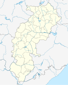
Kota is a town and a nagar panchayat in Bilaspur district in the Indian state of Chhattisgarh.

Narayangarh is a nagar panchayat city in district of Mandsaur, Madhya Pradesh. The Narayangarh city is divided into 15 wards for which elections are held every 5 years. The Narayangarh Nagar Panchayat has population of 10,191 of which 5,168 are males while 5,023 are females as per report released by Census India 2011.


