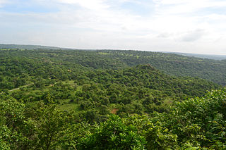
Sonbhadra or Sonebhadra is the second largest district by area of Uttar Pradesh after Lakhimpur Kheri. It is the only district in India which borders four states, namely Madhya Pradesh to the west, Chhattishgarh to the south, Jharkhand in the south-east and Bihar to the north-east. The district has an area of 6,788 km2 (2,621 sq mi) and a population of 1,862,559, with a population density of 270 inhabitants per square kilometre (700/sq mi). It lies in the extreme south-east of the state, and is bounded by Mirzapur District to the northwest, Chandauli District to the north, Kaimur and Rohtas districts of Bihar state to the north-east, Garhwa district of Jharkhand state to the east, Balrampur District of Chhattisgarh state to the south, and Singrauli district of Madhya Pradesh state to the west. The district headquarters is in the town of Robertsganj. Sonbhadra district is an industrial zone and it has much bauxite, limestone, coal, gold, etc. It is called the "Energy Capital of India" because there are multiple power plants.
Korba is a city and an industrial area in Korba District in the Indian state of Chhattisgarh. Korba was erstwhile part of Bilaspur District before 25 May 1998 later that Korba was made a separate District for ease of administration but it is still under Bilaspur Division. Korba is called power capital of Chhattisgarh due to its Coal reserves and Industrial base for multiple thermal based power plants from Public sector like NTPC Limited, CSEB from State of Chhattisgarh as well as from private sector apart from Power plants Korba has the Asia's second largest and India's largest open cast coal mine in Gevra area of Korba Coalfield. Korba produces 140 Million tons of coal every year which accounts for 17% of Country's total coal production and 85% of Chhattisgarh Coal production. BALCO Private owned Aluminium producer has its smelter Aluminium Plant in Korba. Here mainly the protected tribal tribe Korwa resides. Korba district is blessed by lush green forests from all around, a large population of tribals is found here. The tribals here prefer to live in harmony with the environment in the forest area due to which they have retained their distinctive cultural characteristics and traditional practices.

Raebarelipronunciation (help·info) is a city in Indian state of Uttar Pradesh. It is the administrative headquarters of Raebareli district and a part of Lucknow Division. The city is situated on the banks of the Sai river, 82 km (51 mi) southeast of Lucknow. It possesses many architectural features and sites, chief of which is a strong and spacious fort. As of 2011, Raebareli has a population of 191,316 people, in 35,197 households.

Robertsganj also known as Sonbhadra City is a city and a municipal board in Sonbhadra district in the Indian state of Uttar Pradesh.
Dibiyapur is a municipality-based city in Auraiya district in the most populous state of Uttar Pradesh in India. It is situated on State Highway 21. It is linked to Phaphund railway station on Kanpur–Delhi section of Howrah–Delhi main line and Howrah–Gaya–Delhi line which is operated by North Central Railway. The district administrative headquarter of the city is Auraiya. The city is situated between Agra and Kanpur and is famous for industries and education. Lower Ganga Canal passes through mid of the city.
Dudhi or Duddhi is a town and & Nagar panchayat in Sonbhadra district in the state of Uttar Pradesh, India. It belongs to Mirzapur Division. It is located 64 km south of the district capital, Robertsganj. Dudhi is a tehsil of sonebhadra district. Renukoot, Anpara, Obra, Robertsganj are the nearby Cities to Dudhi. Dudhinagar-Renukoot is demanded district by dudhinagar people. There are many places to visit and enjoy natural beauty and environment of this town. This has hidden tourism site as locals have named one site as "Mini Goa" people visit this place to celebrate New year. Locals are very friendly.
Karera is a municipality or Nagar Parishad in the Shivpuri district of the Indian state of Madhya Pradesh.
Patratu is a census town in the Patratu in the Ramgarh subdivision of the Ramgarh district in the Indian state of Jharkhand.

Singrauli district is one of the districts in the Indian state of Madhya Pradesh.

The 11447 / 11448 Shaktipunj Express is a daily express train which runs between Jabalpur Junction railway station of Jabalpur, a major city in Madhya Pradesh, and Howrah Junction railway station of Kolkata, the capital city of West Bengal state in India. It link in four states of India West Bengal, Jharkhand, Uttar Pradesh, Madhya Pradesh.
Rihand Nagar is a township, named after the Rihand River, a tributary of the Sone River. It is located near Bijpur and lies in the Sonebhadra district of Uttar Pradesh. This township is situated near the border of Uttar Pradesh and Madhya Pradesh in India. This township has been developed by National Thermal Power Corporation (NTPC) under its Power Project Scheme, wherein it established a coal-based power station of 3000 MW capacity.
Muirpur Airport also spelled as Myorpur Airport is an upcoming airport, situated at Muirpur approx 12 km from the Renukut in the Sonbhadra district in the Indian state of Uttar Pradesh. Airport is developing by upgrading the existing government airstrip. It will serves nearby towns, Northern Coalfields Limited (NCL) ,NTPC projects Renukut and Robertsganj, the Other towns of Sonbhadra and Singrauli district. The airport will serve the region which has many electrical power stations, known as "Energy Capital of India". It’s 26.5 km away from DUDHI TEHSIL.
Badarpur is a historic town in South East Delhi district in Delhi.

Madhupur is a census town in Sonbhadra district in the Indian state of Uttar Pradesh. It is located 17 km from Robertsganj which is the administrative headquarters of Sonbhadra District. The district Sonbhadra was created by carving off the southern part of the earlier Mirzapur district on 4 March 1989. Son, Karmnasha, Chandra Prabha, Rihand, Kanhar, Renu, Ghagar and Belan Rivers drain this area. in which Son River in main.

National Highway 39 is a National Highway in India. This highway passes through the Indian states of Madhya Pradesh, Uttar Pradesh and Jharkhand.
Sonbhadra railway station is a railway station in Sonbhadra district, Uttar Pradesh, India, serving the town of Robertsganj. The station is connected to major cities such as Jammu, Amritsar, Delhi, Kanpur,, Prayagraj, Varanasi and Lucknow.
Shaktinagar Terminal railway station is a small railway station in Sonbhadra, Uttar Pradesh. Its code is SKTN. It serves the town of Shaktinagar, but the station consists of only one platform and lacks facilities including running water, sanitation and shelter. The station is connected to major cities such as Chopan, Robertsganj, Mirzapur, Allahabad, Rae Bareli, Lucknow, Bareilly, Pilibhit, Tanakpur and Varanasi.

