Obra, Uttar Pradesh

Last updated

Obra
Town
India Uttar Pradesh location map.svg
Red pog.svg
Obra
Location in Uttar Pradesh, India
India location map 3.png
Red pog.svg
Obra
Obra (India)
Coordinates: 24°25′N82°59′E / 24.42°N 82.98°E / 24.42; 82.98
CountryFlag of India.svg  India
State Uttar Pradesh
District Sonebhadra
Population
 (2011) [1]
  Total46,574
Languages
  Official Hindi
Time zone UTC+5:30 (IST)
PIN
231219
Telephone code05445
Vehicle registration UP-64
Website sonbhadra.nic.in/default1.aspx

Obra is a town, Tehsil, and Assembly constituency of the Indian state of Uttar Pradesh. It is located in the Sonebhadra district. It has been upgraded from the stature of Nagar Panchayat, and was previously a part of the Mirzapur District. Obra is located 137 km from Varanasi at the Banks of Renu & Sone River with population of 46,574 as per the 2011 India Census. State-owned UPRVUNL and UPJVUNL have a coal-fired thermal power plant and a hydroelectric power plant in Obra, respectively. The thermal and hydroelectric power industries are the major source of employment, either directly or indirectly . Obra is not very well connected by rail. The nearest railway station is Chopan, which is about 10 kilometers from Obra, [2] and has connectivity to other major cities of India. Recreational places in Obra include Jawahar Bal Udayan (Children's Park), Ambedkar Stadium, Lord Shiva's temple, Sone river banks, and Parsoi and Kharatiya villages. Restructuring of government residential colony is ongoing (as of 2020) as new power plants are being constructed.

Contents

Geography

Obra is located at 24°25′N82°59′E / 24.42°N 82.98°E / 24.42; 82.98 . [3] It has an average elevation in the range of 315 and 485 metres. [4]

Demographics

As of 2011 India census, [5] Obra had a 406,574 of which 204,804 are males while 201,770 are females as per report released by Census India 2011. Obra has an average literacy rate of 87% , higher than the state average of 67.68%: male literacy is around 91.5%, and female literacy is 86.9%. In Obra, 12.36% of the population is under 6 years of age.

Power stations

Obra stands by the side of the Renu & Sone rivers, tributaries of the Ganga. The environment around nicely supports the Thermal and Hydroelectric (Hydel) Power Station. The thermal station has 13 units with the total capacity of 1550 MW and the Hydel has a maximum capacity of 99 MW. Thermal power station-B houses India's first 200 MW installed and commissioned units. Pushing aside heavy competition from home-bred companies like BHEL and L&T, South Korean's top power equipment manufacturer Doosan Heavy Industries & Construction Company's Indian arm, Doosan Power Systems India (DPSI), clinched two super-critical power projects of 1,320 MW each in Uttar Pradesh. the 2×660 MW Obra C project, in Sonebhadra district, would be a brownfield project and will cost R10,416 crore. The construction is now underway. Both the projects are expected to start generating 1320 MW of power each by 2021. [6]

Economy

Apart from the power plants, stone-crushing and transportation are major employment providers . Retail shops also form a chunk of the economy.

Media and communications

All India Radio has a local station in Obra which transmits various programs of mass interest. It was started on 28.08.1993. It operates on 102.7 MHz. It mainly originates programmes in Hindi as well as in Bhojpuri.

Schools and Colleges and coaching

  1. Rajkiya Snatakottar Mahavidyalaya (Obra Degree College)
  2. Vidya Niketan Junior High School Sector-10
  3. Sacred Heart Convent School
  4. Obra Inter College
  5. Kiddies Care English School
  6. Shishu Shiksha Niketan
  7. Saraswati Shishu Mandir
  8. Career Convent educational school
  9. Bal Vidya Mandir
  10. Shiksha Niketan Intermediate College
  11. Modern Convent School
  12. Swami Satyananda Saraswati Vidyalaya
  13. Girls Inter College
  14. Saraswati Vidya Mandir
  15. Islamia School
  16. Islamia Inter College
  17. Atmaram Pvt ITI Gajraj Nagar, Chopan Road, Obra
  18. DAV Public School
  19. Vijay ITI
  20. om coaching center sector 8 obra
  21. English medium School, Govt.School, Billi Gav
  22. Vikash coaching center khairatiya

Religious places

  1. Sharda Mandir Chopan Road
  2. Hanuman Mandir, at junction of Chopan Road and VIP Road
  3. Maa Sheetla Mandir, Chopan Road
  4. gaytri mandir sec-8
  5. Someswar Mahadev Mandir, Bhalua Tola
  6. Shiv Mandir, Sector 10
  7. Islamia Mosque, VIP Road
  8. Sacred Heart Church, VIP Road
  9. Sankat Mochan Mandir, Sector 2
  10. Baba Bhuteshwar Darbar Cave, Sector 3
  11. Buddha Vihar, Ambedkar Chauraha
  12. Chitra Gupta Mandir, Ram Mandir Colony
  13. Gurdwara Singh Sabha, Obra Sonebhadra
  14. Noori Maszid, Bhalua Tola
  15. Millat Nagar Mosque
  16. St.Luke's Church, sector-8
  17. Shiv Parvati Amar Gufa, Salaibanwa
  18. Geeta mandir , sector 8

Places to visit

Notable people


Related Research Articles

<span class="mw-page-title-main">Sonbhadra district</span> District in Uttar Pradesh, India

Sonbhadra or Sonanchal is the second largest district by area of Uttar Pradesh after Lakhimpur Kheri. The district headquarters is in the town of Robertsganj. Sonbhadra is also known as the "Energy Capital of India" because there are multiple power plants.

<span class="mw-page-title-main">Mirzapur division</span> Administrative division of Uttar Pradesh, India

Mirzapur division, also sometimes known as Vindhyachal division, is one of the 18 administrative geographical units of the northern Indian state of Uttar Pradesh. Mirzapur city is the administrative headquarters. Currently, the division consists of 3 districts:-

Barwadih is a town and Community Development Block in Latehar district of Jharkhand state in India.

Burhar is a town and nagar panchayat in Shahdol district in the state of Madhya Pradesh, India. Burhar was named after Budhi Mata, a local deity. It also has a temple belonging to her, in Purani Basti. Burhar is one of the fastest emerging commercial hubs of the division due to its geographical location.

Charthawal is a city and a nagar panchayat in Muzaffarnagar district in the state of Uttar Pradesh, India. It acts as the administrator of 59 surrounding villages.

Mundi is a city and Tehsil in the Khandwa district of Nimar region the Indian state of Madhya Pradesh. It is situated in North Side of East Nimar District.

Phusro is a nagar parishad in the Bermo subdivision of the Bokaro district in the Indian state of Jharkhand. It is situated about 35 kilometres (22 mi) from the district headquarters of Bokaro district. Damodar River passes through it.

<span class="mw-page-title-main">Renukoot</span> Village in Uttar Pradesh, India

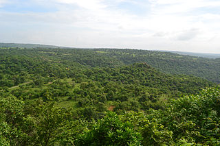
Renukoot is a town and a nagar panchayat in Sonbhadra district in the Indian state of Uttar Pradesh. It is 68 km south from the district headquarters Robertsganj.

Saurikh is a nagar panchayat in Kannauj district in the Indian state of Uttar Pradesh. Its old name was Sau-Rishi.It is located near main industrial and educational hub of Dibiyapur which is around at a distance of 55 km from the town.

Usawan is a town and a Nagar panchayat in Badaun District in the Indian state of Uttar Pradesh.

Faridpur is a town and a small Nagar Palika and tehsil in Bareilly district in the Indian state of Uttar Pradesh. Faridpur is known for zari work. It comes under 122 Legislative assembly. Current M.L.A. is Professor Shyam Bihari Lal and M.P. is Mr. Dharmendra Kashyap. Nagarpalika Chairman of Faridpur is Mr Sharaf Zari Wale

Tanda is a town in Ambedkar Nagar district in the Indian state of Uttar Pradesh situated on the banks of Ghaghara River. It is a nagar palika parishad and is part of Ayodhya division in Uttar Pradesh. The town is situated 20 kilometres (12 mi) north east from district headquarter Akbarpur. Tanda is also a tehsil in the district. It has one of the largest handloom weaving industries for manufacturing varieties like gamchha, lungi, polyester clothing, check-shirt clothes material in state of Uttar Pradesh.

Urjanagar is a residential colony for the employees of Chandrapur Super Thermal Power Station (CSTPS), operated by Maharashtra State Power Generation Company Limited (MSPGCL). It is approximately 6 km from Chandrapur.

<span class="mw-page-title-main">Singrauli district</span> City and district of Madhya Pradesh in India

Singrauli district is one of the districts in the Indian state of Madhya Pradesh.

Uttar Pradesh Rajya Vidyut Utpadan Nigam Limited (UPRVUNL) is wholly owned state thermal power utility with present generating capacity of 6134 MW, operating 4 Thermal Power Stations within Uttar Pradesh.

Rihand Nagar is a township, named after the Rihand River, a tributary of the Sone River. It is located near Bijpur and lies in the Sonebhadra district of Uttar Pradesh. This township is situated near the border of Uttar Pradesh and Madhya Pradesh in India. This township has been developed by National Thermal Power Corporation (NTPC) under its Power Project Scheme, wherein it established a coal-based power station of 3000 MW capacity.

Bagodar is a village in the Bagodar CD block in the Bagodar-Saria subdivision of the Giridih district in the Indian state of Jharkhand.

Belthara Road is a Nagar Panchayat city with a railway station in the north-western corner of Ballia district of Uttar Pradesh, India.

Narmada Nagar is a township in Punasa Tehsil in East Nimar district of Madhya Pradesh, India. It belongs to Indore division.

References

  1. "Census of India: Search Details". Archived from the original on 24 September 2015. Retrieved 27 May 2014.
  2. "Obra on the map". Google Maps.
  3. Falling Rain Genomics, Inc - Obra
  4. "Aerobiological investigation of atmosphere around thermal power plant, Obra, Sonebhadra, U P, India" (PDF). shodhganga.inflibnet.ac.in. Retrieved 19 May 2024.
  5. "Census of India 2011: Data from the 2011 Census, including cities, villages and towns (Provisional)". Census Commission of India. Archived from the original on 16 June 2004. Retrieved 1 November 2008.
  6. "Doosan Power clinches Rs 21,000 cr thermal power projects in UP". 5 October 2016.