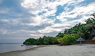
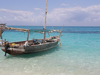
Mafia Island or Chole Shamba is an island of The Mafia Archipelago located in Mafia District in the southern Pwani Region of Tanzania across the Mafia Channel. The island is the third largest in Tanzanian ocean territory, but is not administratively included within the semi-autonomous region of Zanzibar, which has been politically separate since 1890. Mafia Island forms the largest part of Mafia District, one of the six administrative districts in the Pwani Region. As the Mafia Archipelago's main island, it's sometimes called Chole Shamba, meaning Chole farmlands in Swahili. This is in opposition to the historic settlement of Chole Mjini on Chole Island inside Mafia Bay. The island's population is over 65,000. The economy is based on fishing, subsistence agriculture and the market in Kilindoni. The island attracts some tourists, mainly scuba divers, birdwatchers, game fishermen, and people seeking relaxation.

The Rufiji River lies entirely within Tanzania. It is also the largest and longest river in the country. The river is formed by the confluence of the Kilombero and Luwegu rivers. It is approximately 600 kilometres (370 mi) long, with its source in southwestern Tanzania and its mouth on the Indian Ocean opposite Mafia Island across the Mafia Channel, in Pwani Region. Its principal tributary is the Great Ruaha River. It is navigable for approximately 100 kilometres (62 mi).
Rhapta was an emporion said to be on the coast of Southeast Africa, first described in the 1st century CE. Its location has not been firmly identified, although there are a number of plausible candidate sites. The ancient Periplus of the Erythraean Sea described Rhapta as "the last emporion of Azania", two days' travel south of the Menouthias islands. The Periplus also states that the city and port were ruled by South Arabian vassals of the Himyarite kingdom, particularly a certain “Mapharitic chieftain.”

Pwani Region is one of Tanzania's 31 administrative regions. The word "Pwani" in Swahili means the "coast". The regional capital is the town of Kibaha. The Region borders the Tanga Region to the north, Morogoro Region to the west, Lindi Region to the south, and surrounds Dar es Salaam Region to the east. The Indian Ocean also borders the region to its northeast and southeast. The region is home to Mafia Island, the Rufiji delta and Saadani National Park. The region is home to Bagamoyo town, a historical Swahili settlement, and the first colonial capital of German East Africa. According to the 2012 national census, the region had a population of 1,098,668, which was slightly lower than the pre-census projection of 1,110,917. From 2002 to 2012, the region's 2.2 percent average annual population growth rate was the seventeenth-highest in the country. It was also the 21st most densely populated region with 34 people per square kilometre., According to the 2022 census the population had nearly doubled to 2,024,947. the region is slightly larger than Belgium.
Mkuranga District Council is one of eight administrative districts of Pwani Region in Tanzania. The District covers an area of 2,827 km2 (1,092 sq mi). It is bordered to the north by Dar es Salaam's Kigamboni, Temeke and Ilala Districts. To the east by the Mafia Channel, to the south by Kibiti District, and to the west by Kisarawe District. The district is comparable in size to the land area of Samoa. The town of Mkuranga serves as its administrative capital. The district is home to the Vikindu Forest Reserve, one of last remaining East African coastal forests. In 2016 the Tanzania National Bureau of Statistics report the population of Mkuranga District were 243,062 people in the district, from 222,921 in 2012.

The Swahili coast is a coastal area of East Africa, bordered by the Indian Ocean and inhabited by the Swahili people. It includes Sofala ; Mombasa, Gede, Pate Island, Lamu, and Malindi ; and Dar es Salaam and Kilwa. In addition, several coastal islands are included in the Swahili coast, such as Zanzibar and Comoros.

Mafia District Council is one of eight administrative districts of Pwani Region in Tanzania. It administers not only the main Mafia Island but the entire Mafia Archipelago. The District covers an area of 642.6 km2 (248.1 sq mi). The Sea of Zanj completely encircles the District. Rufiji District is located on the other side of the Mafia Channel to the west. The district is comparable in size to the land area of Saint Lucia. The town of Kilindoni serves as its administrative capital. The District is home to the largest concentration of Whale Sharks in Africa, Mafia Island Marine Park, Historic Chole Island Ruins, Kisimani Mafia and Kua Ruins; and Mlola Forest Reserve. According to the 2012 Tanzania National Census, the population of the District was 46,438.
The East African coral coast is a marine ecoregion along the eastern coast of Africa. It extends along the coasts of Kenya, Tanzania, and northern Mozambique, from Lamu in Kenya to Angoche in Mozambique. It adjoins the Northern Monsoon Current Coast ecoregion to the north, and the Bight of Sofala/Swamp Coast ecoregion to the south.
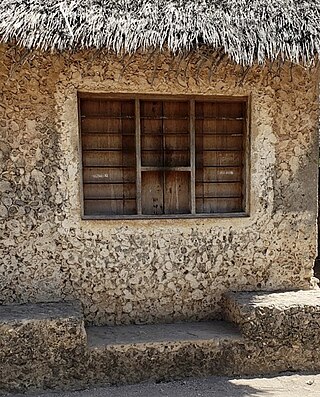
Kisimani Mafia is a national historic site located in Miburani ward in the Mafia Archipelago of Pwani Region's Mafia District. They are Mafia's oldest ruins, which are close to the district's capital of Kilindoni. The earliest strata of mosques, according to archaeologist Neville Chittick who performed excavations there in the 1950s, date from about the tenth and eleventh centuries. However, many of them have since been washed into the Mafia Channel.
Kwale Island is a protected, seasonally inhabited island in the Pemba Channel under the Tanga Marine Reserves (TMRS) with the IUCN category II located inside Kwale ward in Mkinga District of Tanga Region in Tanzania. The coral island, located approximately a kilometer offshore in Manza Bay, and the modern hamlet on the shoreline are both referred to as Kwale. 86.2% of Kwale Island, or 528.1 Ha, is covered with mangroves. Kwale Island and Ulenge Island are the only seasonally inhabited by islands in the marine reserve, thus the two have the most human impact. The Island has an average elevation of 7 m (23 ft).

The Mafia Archipelago or The Mafia Islands is an group of islands across the Mafia Channel in the Mafia District of Pwani Region's coast on the Sea of Zanj in Tanzania's Indian Ocean coast. The archipelago is composed of 9 islands and around 12 coral reefs. In total, the Mafia archipelago covers 972 km2 (375 sq mi) in total, of which 8.5 km2 (3.3 sq mi) 407 km2 are land and 565 km2 are water. and has an average elevation of 53 m (174 ft). Of the 12 reefs in the archipelago the most famous one is the Tutia Reef. The nine Islands in the archipelago are. The largest island in the archipelago is Mafia Island also known as Chole Shamba locally. The other eight islands inside Mafia District in addition to Mafia Island are; Juani Island, Chole Island, Jibondo Island (Kibondo), Bwejuu Island, Shungumbili Island (Thanda), Barakuni Island, Miewi Island, and Niororo Island (Nyororo).

Juani Island is an island of the Mafia Archipelago located in Jibondo ward of Mafia District in southern Pwani Region of Tanzania.
Jibondo Island is an island of the Mafia Archipelago located in Jibondo ward of Mafia District in southern Pwani Region of Tanzania. After Juani Island, which is to its east, the island is the third largest in the archipelago. Mafia Island is to the north, and the Mafia Channel is to the west and south. Jibondo ward is named after the island. The island is part of the Mafia Island Marine Park. A 15th-century Swahili mosque's ruins may be found on Jibondo Island, which is close to the coast.
Bwejuu Island is an island of the Mafia Archipelago located in Kilindoni ward of Mafia District in southern Pwani Region of Tanzania. After Jibondo Island, which is to its east, the island is the fourth largest in the archipelago. Mafia Island is to the east, and the Mafia Channel is to the west and south of the island.
Barakuni Island or in some maps as Mbarakuni Island is a protected island of the Mafia Archipelago located in Kirongwe ward of Mafia District in southern Pwani Region of Tanzania. The island is not part of the Mafia Island Marine Park.
Kirui Island officially, Kirui Island Marine Reserve is a protected, uninhabited island in the Pemba Channel under the Tanga Marine Reserves (TMRS) with the IUCN category II located within Mkinga District of Tanga Region in Tanzania. The Island is the largest in Tanga and one of the largest protected marine Islands in Tanzania Mangroves are thought to cover 680 ha (ha) of the island of Kirui, with the largest mangrove area being on the north and west sides, Kigomeni mangrove being on the east coast, and Kirui South Mangrove being on the south.
Ulenge Island officially, Ulenge Island Marine Reserve is a protected, seasonally habited island in the Tanga Bay of Pemba Channel under the Tanga Marine Reserves (TMRS) with the IUCN category II located within Tanga City Council of Tanga Region in Tanzania. Kwale Island and Ulenge Island are the only islands in the marine reserve that are seasonally inhabited. Of Tanga's whole marine reserves system, Ulenge Island is the most degraded. Ulenge's reefs had the lowest fish numbers and the lowest coral cover and species diversity. This is mostly because Tanga Bay and Tanga City Council are nearby, which has a greater negative human impact. Ulenge Island is nicknamed by English speakers as Bird Island due to its importance as a seabird sanctuary.
Koma Island also known as Charka Island is an island located in Kisiju ward of Mkuranga District in southern Pwani Region of Tanzania. The only historical source to mention this island is by Arab navigator Ibn Majid in 1470. In 1996, Felix Chami discovered a small Early Iron Age (EIA) or Early Iron Working (EIW) site on Koma island. The TIW pottery sherds, however, were absent in the island site, indicating that it was eventually abandoned. The Bantu settlement existed from the third to the sixth centuries.
Kwale Island is a protected island located in Fumba ward of Mjini District in Mjini Magharibi Region, Tanzania. The island is included in the marine conservation area of Menai Bay.