Pwani Region

Last updated
Pwani Region
Mkoa wa Pwani (Swahili)
Overhead view of the coastal area of Bagamoyo.jpg
Vikindu Coconuts.jpg
Architectural Detail - Bagamoyo - Tanzania - 01.jpg
From top to bottom:
Bird's eye view of Bagamoyo District, Coconut landscape of Mkuranga District and Bagamoyo
Etymology: The Coast
Nickname: 
Beautiful Pwani
Tanzania Pwani location map.svg
Location in Tanzania
Coordinates: 7°19′25.68″S38°49′13.8″E / 7.3238000°S 38.820500°E / -7.3238000; 38.820500
CountryFlag of Tanzania.svg  Tanzania
ZoneCoastal
Administrative Region1972
Capital Kibaha
Districts
Area
  Total32,547 km2 (12,566 sq mi)
  Rank 13th of 31
Highest elevation
(Pongwe)
874 m (2,867 ft)
Population
 (2022)
  Total2,024,947
  Rank 15th of 31
  Density62/km2 (160/sq mi)
Demonym Pwanian
Ethnic groups
  Settler Swahili
  Native Zaramo, Ndengereko, Rufiji, Kwere, Doe & Zigua
Time zone UTC+3 (EAT)
Postcode
61xxx
ISO 3166 code TZ-19
HDI (2021)0.525 [1]
low · 16th of 25
Website Official website
SymbolsofTanzania
Bird
Crowned Hawk-Eagle (Stephanoaetus coronatus) with prey ... (31850405640).jpg
African crowned eagle
Butterfly
Gold-banded Forester - Euphaedra neophron, Gorongosa National Park, Mozambique (30633313408).jpg
Gold banded forester
Fish
Whale shark Georgia aquarium.jpg
Whale shark
Mammal
Kobus ellipsiprymnus (Kruger, 2012).jpg
Waterbuck
Tree
Mangoes during the end of Autumn season in Hyderabad (2).jpg
Mango
Mineral
Kaolinite Ixtassou MNHN Geologie.jpg
Kaolin

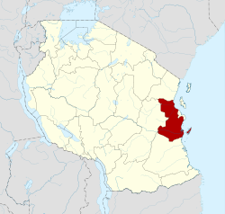
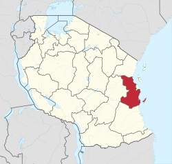
Pwani Region (Mkoa wa Pwani in Swahili) is one of Tanzania's 31 administrative regions. The word "Pwani" in Swahili means the "coast". The regional capital is the town of Kibaha. The Region borders the Tanga Region to the north, Morogoro Region to the west, Lindi Region to the south, and surrounds Dar es Salaam Region to the east. The Indian Ocean also borders the region to its northeast and southeast. The region is home to Mafia Island, the Rufiji delta and Saadani National Park. The region is home to Bagamoyo town, a historical Swahili settlement, and the first colonial capital of German East Africa. According to the 2012 national census, the region had a population of 1,098,668, which was slightly lower than the pre-census projection of 1,110,917. [2] :page 2 From 2002 to 2012, the region's 2.2 percent average annual population growth rate was the seventeenth-highest in the country. [2] :page 4 It was also the 21st most densely populated region with 34 people per square kilometre., [2] :page 6 [3] According to the 2022 census the population had nearly doubled to 2,024,947. [4] the region is slightly larger than Belgium (32,133 square kilometres (12,407 sq mi)).

Contents

Population

The native peoples of the Pwani Region are the Zaramo, Kwere, Doe, Ndengereko, Zigua, and Rufiji. The Zaramo are the dominant people group in Pwani Region and are native to central Pwani, specifically in Kisarawe, Kibaha, Mkuranga, and Bagamoyo districts. The second-largest group in terms of the territory is the Rufiji people who are native to Rufiji and Kibiti districts. The Kwere and Doe are native to Bagamoyo District and also southern Zigua people. In 2012, the region had 1,098,668 residents, up from 885,017 in the 2002 Population Census, indicating a considerable increase of 213,651 individuals (24.1%) during the intercensal period. The region has a population of 2.5 percent of Tanzania's overall population. When compared to other regions on the Mainland, the Coast Region ranks fifth least populated, followed by Iringa, Lindi, Njombe, and Katavi. Between 1988 and 2002, the population of the Pwani Region increased at a rate of 2.4 percent each year. Between 2002 and 2012, the annual growth rate fell to an average of 2.2 percent. [5]

CensusPopulation [4]
1978516,586
1988636,103
2002885,017
20121,098,668
20222,024,947
Zaramo Dance 1960s The National Archives UK - CO 1069-166-97.jpg
Zaramo Dance 1960s
Brooklyn Museum 1991.228.2 Zaramo Container Brooklyn Museum 1991.228.2 Container.jpg
Brooklyn Museum 1991.228.2 Zaramo Container

Economy

Agriculture remains the mainstay of the Pwani Region's economy. Commercial and peasant farming are practiced, with the latter taking precedence. Crop farming employed 82 percent of the economically active population in the 2007/08 Coast area agriculture sample census report, followed by livestock husbandry (2 percent), and fishing (2%). The remaining 12% worked in non-farming activities such as trade and repairs. Agriculture generates the majority of the region's monetary income, primarily through the sale of coconuts, oranges, mango, and cassava on a large scale. [6]

Administrative divisions

Districts

As of 2012, Pwani Region is divided into six districts, each administered by a council:

Districts of Pwani Region
Pwani in Tanzania.svg Bagamoyo District 311,740
Kibaha District 128,488
Kibaha Urban District 70,209
Kisarawe District 101,598
Mafia District 46,438
Mkuranga District 222,921
Rufiji District 217,274
Total1,098,668

However, additional districts have been added since 2012; Kibiti District and Chalinze District. [7] [8]

Education

Secondary (high) schools operated by the ministry of education in Pwani Region include:

  1. Kibaha Secondary School (Kibaha District)
  2. Kibiti Secondary School (Rufiji District)
  3. Minaki Secondary School (Kisarawe District) — this school was established in Kisarawe in 1925, as St. Andrews College. Prior to that, it traces its history back to a Universities' Mission to Central Africa mission school established in Kiungani, Zanzibar, in 1869. [9]

Notable people from Pwani Region

Related Research Articles

<span class="mw-page-title-main">Rufiji District, Pwani</span> District of Pwani Region, Tanzania

Rufiji is one of the six districts of the Pwani Region of Tanzania. It is bordered to the north by the Kisarawe and Mkuranga Districts, to the east by the Indian Ocean, to the south by the Kilwa District, Lindi Region and to the west by the Morogoro Region. The district capital is the town of Utete on the southern banks of the Rufiji River.

<span class="mw-page-title-main">Kilwa District, Lindi</span> District of Lindi Region, Tanzania

Kilwa District is one of six administrative districts of Lindi Region in Tanzania. The District covers an area of 15,000 km2 (5,800 sq mi). The district is comparable in size to the land area of the nation state of East Timor. Kilwa district is bordered to the north by Rufiji District in Pwani Region, to the east by the Indian Ocean, to the south by the Lindi District, Nachingwea District together with Ruangwa District, and to the west by the Liwale District. The district borders every other district in Lindi Region except Lindi Municipal District. The district seat (capital) is the town of Kilwa Masoko. The district is named after the medieval Swahili city state of Kilwa Kisiwani. According to the 2012 census, the district has a total population of 190,744.

<span class="mw-page-title-main">Lindi Region</span> Region of Tanzania

Lindi Region is one of Tanzania's 31 administrative regions. The region covers an area of 66,040 km2 (25,500 sq mi). The region is comparable in size to the combined land area of the nation state of Sri Lanka. The regional capital is the municipality of Lindi.

<span class="mw-page-title-main">Bagamoyo District, Pwani</span> District of Pwani Region, Tanzania

Bagamoyo District Council is one of eight administrative districts of Pwani Region in Tanzania. The District covers an area of 945 km2 (365 sq mi). The district is surrounded by the Chalinze District to the north and west, the Zanzibar Channel to the east, the Kibaha District to the south, and the Kinondoni District to the south-east in the Dar es Salaam Region. The district is comparable in size to the land area of Turks and Caicos Islands. The district capital is at Bagamoyo. 1n 2016 the Tanzania National Bureau of Statistics report there were 106,484 people in the district, from 311,740 in 2012, of which 97,660 where in current district wards. The decrease being from splitting of the district and creation of the Chalinze District in 2015.

<span class="mw-page-title-main">Kisarawe District, Pwani</span> District of Pwani Region, Tanzania

Kisarawe District Council is one of eight administrative districts of Pwani Region in Tanzania. The District covers an area of 5,031 km2 (1,942 sq mi). It is bordered to the east by Dar es Salaam Region's Ilala and Ubungo Municipal Councils. The Kibaha District and Kibaha Town Council border the district to the north, and the Mkuranga District and Kibiti District border it to the south-east. By the Rufiji District to the south, and the Morogoro District of the Morogoro Region to the west. The district is comparable in size to the land area of Trinidad and Tobago. The town of Kisarawe serves as its administrative capital. According to the 2012 Tanzania National Census, the population of the District was 101,598.

<span class="mw-page-title-main">Kwere people</span> Ethnic group from Pwani Region of Tanzania

The Kwere also known as Ngh'wele are a matrilineal ethnic and linguistic group native to Bagamoyo District and Chalinze District in Pwani Region of coastal Tanzania. The primary language spoken is Ngh'wele, called Kikwere in Swahili. The most famous person of Kwere descent is former President of Tanzania Jakaya Kikwete.

<span class="mw-page-title-main">Doe people</span> Ethnic group from Pwani Region, Tanzania

The Doe are an ethnic and linguistic group based in northern coastal Tanzania, in the Bagamoyo District and Chalinze District of Pwani Region. In 1987 the Doe population was estimated to number 24,000.

<span class="mw-page-title-main">Outline of Tanzania</span> Overview of and topical guide to Tanzania

The following outline is provided as an overview of and topical guide to Tanzania:

<span class="mw-page-title-main">Chanika, Ilala</span> Ward of Ilala District, Dar es Salaam Region

Chanika is an administrative ward of the Ilala Municipical Council of the Dar es Salaam Region in Tanzania. Majohe ward encircles the ward on its northern edge. Tambani Ward of the Mkuranga District in the Pwani Region lies to the south, while Msongola is to the east. The Msimbu and Kisarawe wards of the Kisarawe District in the Pwani Region are also to the west. According to the 2012 census, the ward has a total population of 43,912.

<span class="mw-page-title-main">Kisarawe II</span> Ward of the Kigamboni District in the Dar es Salaam Region of Tanzania

Kisarawe II or unofficially East Kisarawe is an administrative ward in the Kigamboni district of the Dar es Salaam Region of Tanzania. The Kibada and Mjimwema form the ward's northern border. East is Somangila. Pembamnazi borders it to the south. Toangoma in the Temeke District, as well as Vianzi and Vikindu in the Pwani Region's Mkuranga District, border the west. Since Kisarawe II is the district's top agricultural producer, it is known as Kigamboni's "ricebowl" and "food basket". In 2016 the Tanzania National Bureau of Statistics report there were 10,401 people in the ward, from 8,306 in 2012.

<span class="mw-page-title-main">Toangoma</span> Ward of Temeke District, Dar es Salaam Region

Toangoma is an administrative ward in the Temeke district of the Dar es Salaam Region of Tanzania. Kijichi and Kibada, the latter of which is a ward of Kigamboni MC, form the ward's northern and western boundaries. The west the ward is bordered by Mianzini and Mbagala Kuu. The ward is bordered to the east by Kisarawe II of Kigamboni MC. The ward is bordered to the south by the Pwani Region's Tambani and Vikindu. According to the 2012 census, the ward has a total population of 44,578.

Kisarawe is a Tanzanian district that is the larger settlement of the Pugu Hills, southwest of Dar es Salaam. In the Kisarawe district there is an 8200-hectares cultivation of Jatropha shrubs that are processed to produce biodiesel.

<span class="mw-page-title-main">Pugu, Ilala</span> Ward of Ilala District, Dar es Salaam Region

Pugu is an administrative ward of the Ilala Municipical Council of the Dar es Salaam Region in Tanzania. Kinyerezi and Kwembe ward of Kinondoni MC form the ward's northern boundary. The ward is bordered by Majohe to the south and Gongolamboto to the east. In the west the ward is bordered by Kisarawe ward of Kisarawe District in the Pwani Region. The ward is named after the Pugu Hills, which form its western border and are home to the Pugu Hills Forest Reserve and the Kazimzumbwi Forest Reserve, two of some of the world's oldest forests. According to the 2012 census, the ward has a total population of 49,422.

Zaramo is a Niger-Congo language, formerly primary language of the Zaramo people of eastern Tanzania. Zaramo is also known as Zalamo, Kizaramo, Dzalamo, Zaramu, Saramo and, Myagatwa. The language is critically endangered. The ethnic population of the Zaramo people reaches about 200,000, yet there are only a few elderly speakers remaining.

<span class="mw-page-title-main">Kibaha District, Pwani</span> District of Pwani Region, Tanzania

Kibaha is one of nine administrative districts of Pwani Region in Tanzania. The name means '"it is here" in Zaramo. The District covers an area of 1,502 km2 (580 sq mi). Kibaha District is bordered to the northeast by Kibaha Urban District and the north by Chalinze District. The district is bordered to the southeast by the Kisarawe District, On the western side the district is borderd by Morogoro District of Morogoro Region. The district seat (capital) is the town and ward of Mlandizi. According to the 2012 census, the district has a total population of 70,209.

<span class="mw-page-title-main">Majohe</span> Ward of Ilala District, Dar es Salaam Region

Majohe is an administrative ward of the Ilala Municipical Council of the Dar es Salaam Region in Tanzania. The communities of Ukonga, Gongolamboto, and Pugu border the ward on the north. By Kisarawe Ward in Kisarawe District in Pwani Region, to the west. Chanika and Msongola form the southern boundary of the ward. Kivule borders the ward on its eastern side. According to the 2012 census, the ward has a total population of 81,646.

<span class="mw-page-title-main">Chalinze District</span> District of Pwani Region, Tanzania

Chalinze District Council is one of nine administrative districts of Pwani Region in Tanzania. The district covers an area of 8,042 km2 (3,105 sq mi). The district is comparable in size to the land area of Puerto Rico. Chalinze District is bordered to the northeast by Pangani District, the north by Handeni District and in Kilindi District of Tanga Region. The district is bordered to the east by the Indian Ocean. Chalinze is also borders Bagamoyo District, Kibaha Urban District and to the South by Kibaha District. On the western part, the district is bordered by Mvomero District and Morogoro Rural District of Morogoro Region.

<span class="mw-page-title-main">Mkange</span> Ward in Chalinze District, Pwani Region

Mkange is an administrative ward in Chalinze District of Pwani Region in Tanzania. The ward covers an area of 939.5 km2 (362.7 sq mi), and has an average elevation of 250 m (820 ft). The ward is bordered by Pangani District to the north east and by Handeni District to the north west. Miono ward borders the ward directly to the west, and in the south the ward is bordered by Bagamoyo District. The eastern half of the ward is boarded by the Indian Ocean.

Mabwepande is an administrative ward in Kinondoni District of the Dar es Salaam Region in Tanzania. Bunju and Wazo wards form the ward's eastern boundary. The Mbezi ward of Ilala District borders the ward to the south. Pangani ward of Kibaha Town Council and Kerege ward of Bagamoyo District in Pwani Region border the wards to the west and north, respectively. According to the 2012 census, the ward has a total population of 25,460.

<span class="mw-page-title-main">Kibiti District</span> District of Pwani Region, Tanzania

Kibiti District Council is one of nine administrative districts of Pwani Region in Tanzania. The districts of Mkuranga District and Kisarawe District border the District to the northeast and northwest, respectively. The Mafia Channel forms the district's eastern boundary. The Rufiji District also forms a border to the south of Kibiti. The district covers an area of 2,805 km2 (1,083 sq mi). The district is comparable in size to the land area of Samoa. The district seat (capital) is the town of Kibiti. According to the 2012 census, the district has a total population of 117,752.

References

  1. "Sub-national HDI - Area Database - Global Data Lab". hdi.globaldatalab.org. Archived from the original on 2018-09-23. Retrieved 2020-02-26.
  2. 1 2 3 Population Distribution by Administrative Units, United Republic of Tanzania, 2013 Archived 2013-05-02 at the Wayback Machine
  3. Statistical Abstract 2011, Tanzania National Bureau of Statistics Archived 2013-11-05 at the Wayback Machine
  4. 1 2 "Tanzania: Regions and Cities - Population Statistics, Maps, Charts, Weather and Web Information". www.citypopulation.de. Retrieved 2024-02-09.
  5. "Pwani Population Profile". Archived from the original on 2022-06-15. Retrieved 2022-06-11.
  6. "Pwani Eocnomic Profile". Archived from the original on 2022-06-15. Retrieved 2022-06-11.
  7. "Kibiti District". Archived from the original on 2022-06-10. Retrieved 2022-06-11.
  8. "Chalinze District". Archived from the original on 2022-06-14. Retrieved 2022-06-11.
  9. Cooper-Poole, John; Doro, Marion, eds. (1 January 2006). "Reviews: The Story of Minaki. P M Libaba Second edition 2005, with additions by Peter White". Tanzanian Affairs. 83. Archived from the original on 7 July 2022. Retrieved 23 December 2010.