La Jara, New Mexico

Last updated
La Jara, New Mexico
CDP
Sandoval County New Mexico Incorporated and Unincorporated areas La Jara Highlighted.svg
Location of La Jara, New Mexico
Usa edcp location map.svg
Red pog.svg
La Jara, New Mexico
Location in the United States
Coordinates: 36°5′45″N106°57′23″W / 36.09583°N 106.95639°W / 36.09583; -106.95639 Coordinates: 36°5′45″N106°57′23″W / 36.09583°N 106.95639°W / 36.09583; -106.95639
Country United States
State New Mexico
County Sandoval
Area
[1]
  Total14.25 sq mi (36.91 km2)
  Land14.25 sq mi (36.91 km2)
  Water0.00 sq mi (0.00 km2)
Elevation
7,129 ft (2,173 m)
Population
 (2020) [2]
  Total177
  Density12.42/sq mi (4.79/km2)
Time zone UTC-7 (Mountain (MST))
  Summer (DST) UTC-6 (MDT)
ZIP code
87027
Area code 575
FIPS code 35-37490
GNIS feature ID0907648 [3]

La Jara is a census-designated place (CDP) in Sandoval County, New Mexico, United States. [3] The population was 209 at the 2000 census. It is part of the Albuquerque Metropolitan Statistical Area.

Contents

Geography

La Jara is located at 36°5′45″N106°57′23″W / 36.09583°N 106.95639°W / 36.09583; -106.95639 (36.095771, -106.956415). [4]

According to the United States Census Bureau, the CDP has a total area of 14.2 square miles (37 km2), all land.

Demographics

Historical population
CensusPop.
2020 177
U.S. Decennial Census [5] [2]

As of the census [6] of 2000, there were 209 people, 93 households, and 62 families residing in the CDP. The population density was 14.7 people per square mile (5.7/km2). There were 140 housing units at an average density of 9.9 per square mile (3.8/km2). The racial makeup of the CDP was 75.60% White, 1.44% Native American, 21.05% from other races, and 1.91% from two or more races. Hispanic or Latino of any race were 79.43% of the population.

There were 93 households, out of which 23.7% had children under the age of 18 living with them, 52.7% were married couples living together, 8.6% had a female householder with no husband present, and 33.3% were non-families. 26.9% of all households were made up of individuals, and 14.0% had someone living alone who was 65 years of age or older. The average household size was 2.25 and the average family size was 2.69.

In the CDP, the population was spread out, with 19.1% under the age of 18, 3.8% from 18 to 24, 20.6% from 25 to 44, 36.8% from 45 to 64, and 19.6% who were 65 years of age or older. The median age was 49 years. For every 100 females, there were 117.7 males. For every 100 females age 18 and over, there were 113.9 males.

The median income for a household in the CDP was $39,444, and the median income for a family was $46,406. Males had a median income of $28,542 versus $23,558 for females. The per capita income for the CDP was $19,691. About 10.8% of families and 6.6% of the population were below the poverty line, including none of those under the age of eighteen or sixty five or over.

Education

Its district is Cuba Independent Schools. [7]

See also

Related Research Articles

<span class="mw-page-title-main">Sandoval County, New Mexico</span> County in New Mexico, United States

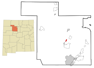
Sandoval County is located in the U.S. state of New Mexico. As of the 2010 census, the population was 131,561, making it the fourth-most populous county in New Mexico. The county seat is Bernalillo.

<span class="mw-page-title-main">Edgewater, Alabama</span> CDP in Alabama, United States

Edgewater is a census-designated place in Jefferson County, Alabama, United States. It is northeast from the Birmingham suburb of Pleasant Grove. Its population was 883 at the 2010 census. This area was damaged by tornadoes on April 15, 1956 and April 8, 1998. The 1998 tornado was rated F5 on the Fujita scale.

<span class="mw-page-title-main">Hamilton Branch, California</span> Census-designated place in California, United States

Hamilton Branch is a census-designated place (CDP) in Plumas County, California, United States. The population was 587 at the 2000 census.

<span class="mw-page-title-main">Interlaken, California</span> Census-designated place in California, United States

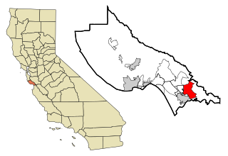
Interlaken is a census-designated place (CDP) in Santa Cruz County, California, United States. The population was 7,368 at the 2020 census.

<span class="mw-page-title-main">Cedar Crest, New Mexico</span> Census-designated place in New Mexico, United States

Cedar Crest is a census-designated place (CDP) in Bernalillo County, New Mexico, United States. The population was 958 at the 2010 census. It is part of the Albuquerque Metropolitan Statistical Area.

<span class="mw-page-title-main">Chilili, New Mexico</span> Census-designated place in New Mexico, United States

Chilili is a census-designated place in Bernalillo County, New Mexico, United States. The population was 137 at the 2010 census. It is part of the Albuquerque Metropolitan Statistical Area.

<span class="mw-page-title-main">San Juan, New Mexico</span> CDP in New Mexico, United States

San Juan is a census-designated place (CDP) in Rio Arriba County, New Mexico, United States. The population was 592 at the 2000 census.

<span class="mw-page-title-main">Algodones, New Mexico</span> CDP in New Mexico, United States

Algodones is a census-designated place (CDP) in Sandoval County, New Mexico, United States. The population was 814 at the 2010 census. It is part of the Albuquerque Metropolitan Statistical Area.

<span class="mw-page-title-main">Peña Blanca, New Mexico</span> CDP in New Mexico, United States

Peña Blanca is a census-designated place (CDP) in Sandoval County, New Mexico. As of the 2000 census, the CDP population was 661. It is part of the Albuquerque Metropolitan Statistical Area.

<span class="mw-page-title-main">Placitas, Sandoval County, New Mexico</span> CDP in New Mexico, United States

Placitas is a census-designated place (CDP) in Sandoval County, New Mexico, United States. As of the 2010 census, its population was 4,977. It is part of the Albuquerque Metropolitan Statistical Area.

<span class="mw-page-title-main">Ponderosa, New Mexico</span> CDP in New Mexico, United States

Ponderosa is a census-designated place (CDP) in Sandoval County, New Mexico, United States. The population was 383 as of New Mexico's 2015 Census. It is part of the Albuquerque Metropolitan Statistical Area.

<span class="mw-page-title-main">Pueblo of Sandia Village, New Mexico</span> Village in Sandoval County, New Mexico, US

Pueblo of Sandia Village is a census-designated place (CDP) in Sandoval County, New Mexico, United States.The population was 344 at the 2000 census. It is part of the Albuquerque Metropolitan Statistical Area.

<span class="mw-page-title-main">Regina, New Mexico</span> CDP in New Mexico, United States

Regina is a census-designated place (CDP)) in Sandoval County, New Mexico, United States. The population was 99 at the 2000 census. It is part of the Albuquerque Metropolitan Statistical Area. It was named for Regina, Saskatchewan.

<span class="mw-page-title-main">San Felipe Pueblo, New Mexico</span> CDP in New Mexico, United States

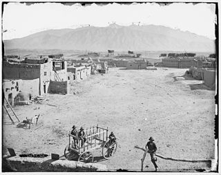
San Felipe Pueblo is a census-designated place (CDP) in Sandoval County, New Mexico, United States, and is located 10 miles (16 km) north of Bernalillo. As of the 2000 census, the CDP population was 2,080. It is part of the Albuquerque Metropolitan Statistical Area.

<span class="mw-page-title-main">Santa Ana Pueblo, New Mexico</span> CDP in New Mexico, United States

Santa Ana Pueblo is a census-designated place (CDP) in Sandoval County, New Mexico, United States. As of the 2000 census, the CDP had a total population of 479. It is part of the Albuquerque Metropolitan Statistical Area. The Pueblo, named Tamaya in Keres, administers a total reservation land of 73,000 acres (295 km2) in the Rio Grande valley and is composed of Native Americans who speak an eastern dialect of the Keresan languages.

<span class="mw-page-title-main">Torreon, Sandoval County, New Mexico</span> Census-designate place in Sandoval County, New Mexico, United States

Torreon is a census-designated place (CDP) in Sandoval County, New Mexico, United States. The population was 297 at the 2000 census. It is part of the Albuquerque Metropolitan Statistical Area.

<span class="mw-page-title-main">Zia Pueblo, New Mexico</span> CDP in New Mexico, United States

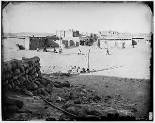
Zia Pueblo is a census-designated place (CDP) in Sandoval County, New Mexico, United States. The population was 646 at the 2000 census; Male: 310 Female: 336 The pueblo after which the CDP is named is included within the CDP; it is listed on the National Register of Historic Places.

<span class="mw-page-title-main">La Puebla, New Mexico</span> CDP in New Mexico, United States

La Puebla is a census-designated place (CDP) in Santa Fe County, New Mexico, United States. It is part of the Santa Fe, New Mexico Metropolitan Statistical Area. The population was 1,296 at the 2000 census.

<span class="mw-page-title-main">Meridian, Pennsylvania</span> Census-designated place in Pennsylvania, United States

Meridian is a census-designated place (CDP) in Butler County, Pennsylvania, United States. The population was 3,881 at the 2010 census.

<span class="mw-page-title-main">Jemez Pueblo, New Mexico</span> CDP in New Mexico, United States

Jemez Pueblo is a census-designated place (CDP) in Sandoval County, New Mexico, United States. The population was 1,788 at the 2010 census. It is part of the Albuquerque Metropolitan Statistical Area.

References

  1. "ArcGIS REST Services Directory". United States Census Bureau. Retrieved October 12, 2022.
  2. 1 2 "Census Population API". United States Census Bureau. Retrieved Oct 12, 2022.
  3. 1 2 U.S. Geological Survey Geographic Names Information System: La Jara
  4. "US Gazetteer files: 2010, 2000, and 1990". United States Census Bureau. 2011-02-12. Retrieved 2011-04-23.
  5. "Census of Population and Housing". Census.gov. Retrieved June 4, 2016.
  6. "U.S. Census website". United States Census Bureau . Retrieved 2008-01-31.
  7. "2020 CENSUS - SCHOOL DISTRICT REFERENCE MAP: Sandoval County, NM" (PDF). U.S. Census Bureau . Retrieved 2022-09-06.

Commons-logo.svg Media related to La Jara, New Mexico at Wikimedia Commons