San Ysidro, New Mexico

Last updated
San Ysidro, New Mexico
San Isidro church.jpg
Old church in San Ysidro
Sandoval County New Mexico Incorporated and Unincorporated areas San Ysidro Highlighted.svg
Location of San Ysidro, New Mexico
Usa edcp location map.svg
Red pog.svg
San Ysidro, New Mexico
Location in the United States
Coordinates: 35°33′12″N106°46′14″W / 35.55333°N 106.77056°W / 35.55333; -106.77056 Coordinates: 35°33′12″N106°46′14″W / 35.55333°N 106.77056°W / 35.55333; -106.77056
Country United States
State New Mexico
County Sandoval
Area
[1]
  Total2.34 sq mi (6.06 km2)
  Land2.34 sq mi (6.06 km2)
  Water0.00 sq mi (0.00 km2)
Elevation
5,466 ft (1,666 m)
Population
 (2020) [2]
  Total166
  Density71.00/sq mi (27.41/km2)
Time zone UTC-7 (Mountain (MST))
  Summer (DST) UTC-6 (MDT)
ZIP code
87053
Area code 575
FIPS code 35-71020
GNIS feature ID0928807

San Ysidro is a village in Sandoval County, New Mexico, United States. The population was 193 at the 2010 census. It is part of the Albuquerque Metropolitan Statistical Area.

Contents

Description

Church doors, San Ysidro San Isidro church doors.jpg
Church doors, San Ysidro

The village is near the junction of U.S. Highway 550 and NM Highway 4, at the south end of the Jemez Valley. The Jemez River runs through San Ysidro, just north of where the Rio Salado River joins the Jemez River.

The village has been a farming community since 1699 when Juan Trujillo established a settlement named for San Ysidro, or Saint Isidore the Farmer. The Village was incorporated in 1967. An annual San Ysidro Fiesta Day is held each year in mid-May.

In 2007, the exterior sets for the Taylor Hackford film Love Ranch were built just outside of San Ysidro on Highway 550.

Geography

San Ysidro is located at 35°33′12″N106°46′14″W / 35.55333°N 106.77056°W / 35.55333; -106.77056 (35.553457, -106.770566). [3]

According to the United States Census Bureau, the village has a total area of 2.3 square miles (6.0 km2), all land.

Demographics

Historical population
CensusPop.
1970 182
1980 1999.3%
1990 23317.1%
2000 2382.1%
2010 193−18.9%
2020 166−14.0%
U.S. Decennial Census [4] [2]

As of the census [5] of 2000, there were 238 people, 86 households, and 63 families residing in the village. The population density was 101.8 people per square mile (39.3/km2). There were 99 housing units at an average density of 42.3 per square mile (16.3/km2). The racial makeup of the village was 30.67% White, 0.84% African American, 7.56% Native American, 53.78% from other races, and 7.14% from two or more races. Hispanic or Latino of any race were 71.85% of the population.

There were 86 households, out of which 33.7% had children under the age of 18 living with them, 44.2% were married couples living together, 24.4% had a female householder with no husband present, and 25.6% were non-families. 22.1% of all households were made up of individuals, and 4.7% had someone living alone who was 65 years of age or older. The average household size was 2.77 and the average family size was 3.16.

In the village, the population was spread out, with 29.0% under the age of 18, 9.7% from 18 to 24, 24.4% from 25 to 44, 23.5% from 45 to 64, and 13.4% who were 65 years of age or older. The median age was 36 years. For every 100 females, there were 84.5 males. For every 100 females age 18 and over, there were 83.7 males.

The median income for a household in the village was $30,521, and the median income for a family was $32,188. Males had a median income of $26,429 versus $16,442 for females. The per capita income for the village was $14,787. About 10.6% of families and 15.1% of the population were below the poverty line, including 17.6% of those under the age of eighteen and 7.7% of those 65 or over.

Education

It is within the Jemez Valley Public Schools school district. [6]

See also

Related Research Articles

<span class="mw-page-title-main">Sandoval County, New Mexico</span> County in New Mexico, United States

Sandoval County is located in the U.S. state of New Mexico. As of the 2010 census, the population was 131,561, making it the fourth-most populous county in New Mexico. The county seat is Bernalillo.

<span class="mw-page-title-main">San Miguel County, New Mexico</span> County in New Mexico, United States

San Miguel County is a county in the U.S. state of New Mexico. As of the 2010 census, the population was 29,393. Its county seat is Las Vegas.

<span class="mw-page-title-main">Los Alamos County, New Mexico</span> County in New Mexico, United States

Los Alamos County is a county in the U.S. state of New Mexico. As of the 2010 census, the population was 17,950. The smallest county by area in the state, Los Alamos County was formerly administered exclusively by the U.S. federal government during the Manhattan Project, but it now has equal status to New Mexico's other counties. The county has two census-designated places: Los Alamos and White Rock.

<span class="mw-page-title-main">Tijeras, New Mexico</span> Village in New Mexico, United States

Tijeras is a village in Bernalillo County, New Mexico, United States. The population was 541 at the 2010 census. It is part of the Albuquerque metropolitan area.

<span class="mw-page-title-main">Bernalillo, New Mexico</span> Town in New Mexico, United States

Bernalillo is a town in Sandoval County, New Mexico, United States. As of the 2010 census, the town population was 8,320. It is the county seat of Sandoval County.

<span class="mw-page-title-main">Cuba, New Mexico</span> Village in Sandoval County, New Mexico, United States

Cuba is a village in Sandoval County, New Mexico, United States. As of the 2010 census, the village population was 735. It is part of the Albuquerque Metropolitan Statistical Area.

<span class="mw-page-title-main">Jemez Springs, New Mexico</span> Village in Sandoval County, New Mexico, United States

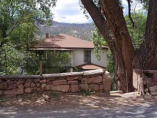
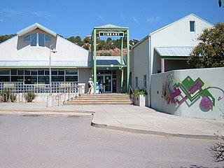
Jemez Springs is a village in Sandoval County, New Mexico, United States. The population was 250 at the 2010 census. Named for the nearby Pueblo of Jemez, the village is the site of Jemez State Monument and the headquarters of the Jemez Ranger District. The village and nearby locations in the Jemez Valley are the site of hot springs and several religious retreats.

<span class="mw-page-title-main">Peña Blanca, New Mexico</span> CDP in New Mexico, United States

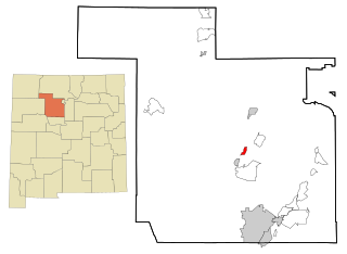
Peña Blanca is a census-designated place (CDP) in Sandoval County, New Mexico. As of the 2000 census, the CDP population was 661. It is part of the Albuquerque Metropolitan Statistical Area.

<span class="mw-page-title-main">Placitas, Sandoval County, New Mexico</span> CDP in New Mexico, United States

Placitas is a census-designated place (CDP) in Sandoval County, New Mexico, United States. As of the 2010 census, its population was 4,977. It is part of the Albuquerque Metropolitan Statistical Area.

<span class="mw-page-title-main">Ponderosa, New Mexico</span> CDP in New Mexico, United States

Ponderosa is a census-designated place (CDP) in Sandoval County, New Mexico, United States. The population was 383 as of New Mexico's 2015 Census. It is part of the Albuquerque Metropolitan Statistical Area.

<span class="mw-page-title-main">Pueblo of Sandia Village, New Mexico</span> Village in Sandoval County, New Mexico, US

Pueblo of Sandia Village is a census-designated place (CDP) in Sandoval County, New Mexico, United States.The population was 344 at the 2000 census. It is part of the Albuquerque Metropolitan Statistical Area.

<span class="mw-page-title-main">San Felipe Pueblo, New Mexico</span> CDP in New Mexico, United States

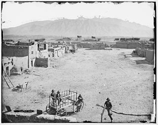
San Felipe Pueblo is a census-designated place (CDP) in Sandoval County, New Mexico, United States, and is located 10 miles (16 km) north of Bernalillo. As of the 2000 census, the CDP population was 2,080. It is part of the Albuquerque Metropolitan Statistical Area.

<span class="mw-page-title-main">Santa Ana Pueblo, New Mexico</span> CDP in New Mexico, United States

Santa Ana Pueblo is a census-designated place (CDP) in Sandoval County, New Mexico, United States. As of the 2000 census, the CDP had a total population of 479. It is part of the Albuquerque Metropolitan Statistical Area. The Pueblo, named Tamaya in Keres, administers a total reservation land of 73,000 acres (295 km2) in the Rio Grande valley and is composed of Native Americans who speak an eastern dialect of the Keresan languages.

<span class="mw-page-title-main">Torreon, Sandoval County, New Mexico</span> Census-designate place in Sandoval County, New Mexico, United States

Torreon is a census-designated place (CDP) in Sandoval County, New Mexico, United States. The population was 297 at the 2000 census. It is part of the Albuquerque Metropolitan Statistical Area.

<span class="mw-page-title-main">Zia Pueblo, New Mexico</span> CDP in New Mexico, United States

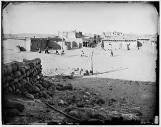
Zia Pueblo is a census-designated place (CDP) in Sandoval County, New Mexico, United States. The population was 646 at the 2000 census; Male: 310 Female: 336 The pueblo after which the CDP is named is included within the CDP; it is listed on the National Register of Historic Places.

<span class="mw-page-title-main">Agua Fria, New Mexico</span> CDP in New Mexico, United States

Agua Fria is a census-designated place (CDP) in Santa Fe County, New Mexico, United States. It is part of the Santa Fe, New Mexico Metropolitan Statistical Area. The population was 2,800 at the 2010 census. Agua Fria Village is a "Traditional Historic Community" (THC) as designated by the Santa Fe Board of County Commissioners in 1995 and subsequent Santa Fe County Ordinance #1996-16, as allowed by State Statute.

<span class="mw-page-title-main">Edgewood, New Mexico</span> Town in New Mexico, United States

Edgewood is a town in Santa Fe County, New Mexico, United States. Through annexations, its town boundaries now extend into Bernalillo and Sandoval counties. It is part of the Albuquerque–Santa Fe–Las Vegas combined statistical area.

<span class="mw-page-title-main">Corrales, New Mexico</span> Village in New Mexico, United States

Corrales is a village in Sandoval County, New Mexico, United States. First farmed by Tiquex Pueblo people, chosen due to its proximity to the Rio Grande, as documented by Hispano farmers of Nuevo México in the late 1500s. Despite being a part of the Albuquerque metropolitan area, the village maintains its rural character, while also being surrounded by the cities of Albuquerque and Rio Rancho. The population of Corrales was 8,329 at the 2010 Census.

<span class="mw-page-title-main">Albuquerque metropolitan area</span> Metropolitan area in central New Mexico

The Albuquerque Metropolitan Statistical Area, sometimes referred to as Tiguex, is a metropolitan area in central New Mexico centered on the city of Albuquerque. The metro comprises four counties: Bernalillo, Sandoval, Torrance, and Valencia. As of the 2010 United States Census, the MSA had a population of 887,077. The population is estimated to be 923,630 as of July 1, 2020, making Greater Albuquerque the 61st-largest MSA in the nation. The Albuquerque MSA forms a part of the larger Albuquerque–Santa Fe–Las Vegas combined statistical area with a 2020 estimated population of 1,165,181, ranked 49th-largest in the country.

<span class="mw-page-title-main">Jemez Pueblo, New Mexico</span> CDP in New Mexico, United States

Jemez Pueblo is a census-designated place (CDP) in Sandoval County, New Mexico, United States. The population was 1,788 at the 2010 census. It is part of the Albuquerque Metropolitan Statistical Area.

References

  1. "ArcGIS REST Services Directory". United States Census Bureau. Retrieved October 12, 2022.
  2. 1 2 "Census Population API". United States Census Bureau. Retrieved Oct 12, 2022.
  3. "US Gazetteer files: 2010, 2000, and 1990". United States Census Bureau. 2011-02-12. Retrieved 2011-04-23.
  4. "Census of Population and Housing". Census.gov. Retrieved June 4, 2015.
  5. "U.S. Census website". United States Census Bureau . Retrieved 2008-01-31.
  6. "2020 CENSUS - SCHOOL DISTRICT REFERENCE MAP: Sandoval County, NM" (PDF). U.S. Census Bureau . Retrieved 2022-07-12.