
The Common Agricultural Policy (CAP) is the agricultural policy of the European Union. It implements a system of agricultural subsidies and other programmes. It was introduced in 1962 and has since then undergone several changes to reduce the EEC budget cost and consider rural development in its aims. It has, however, been criticised on the grounds of its cost and its environmental and humanitarian effects.
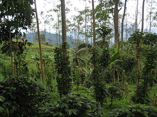
Sustainable agriculture is farming in sustainable ways meeting society's present food and textile needs, without compromising the ability for current or future generations to meet their needs. It can be based on an understanding of ecosystem services. There are many methods to increase the sustainability of agriculture. When developing agriculture within sustainable food systems, it is important to develop flexible business process and farming practices. Agriculture has an enormous environmental footprint, playing a significant role in causing climate change, water scarcity, water pollution, land degradation, deforestation and other processes; it is simultaneously causing environmental changes and being impacted by these changes. Sustainable agriculture consists of environment friendly methods of farming that allow the production of crops or livestock without damage to human or natural systems. It involves preventing adverse effects to soil, water, biodiversity, surrounding or downstream resources—as well as to those working or living on the farm or in neighboring areas. Elements of sustainable agriculture can include permaculture, agroforestry, mixed farming, multiple cropping, and crop rotation.

The National Estuarine Research Reserve System is a network of 29 protected areas established by partnerships between the National Oceanic and Atmospheric Administration (NOAA) and coastal states. The reserves represent different biogeographic regions of the United States. The National Estuarine Research Reserve System protects more than 1.3 million acres of coastal and estuarine habitats for long-term research, water-quality monitoring, education, and coastal stewardship.

A decision support system (DSS) is an information system that supports business or organizational decision-making activities. DSSs serve the management, operations and planning levels of an organization and help people make decisions about problems that may be rapidly changing and not easily specified in advance—i.e. unstructured and semi-structured decision problems. Decision support systems can be either fully computerized or human-powered, or a combination of both.

Crofting is a form of land tenure and small-scale food production particular to the Scottish Highlands, the islands of Scotland, and formerly on the Isle of Man. Within the 19th-century townships, individual crofts were established on the better land, and a large area of poorer-quality hill ground was shared by all the crofters of the township for grazing of their livestock.

The Macaulay Institute, formally the Macaulay Land Use Research Institute and sometimes referred to simply as The Macaulay, is a research institute based at Aberdeen in Scotland, which is now part of the James Hutton Institute. Its work covers aspects such as landscape, soil and water conservation and climate change.
CropSyst is a multi-year multi-crop daily time-step crop simulation model being developed by a team at Washington State University's Department of Biological Systems Engineering. The model is used to study the effect of cropping systems management on productivity (budgeting).
The Earth Institute is a research institute at Columbia University that was established in 1995. Its stated mission is to address complex issues facing the planet and its inhabitants, with a focus on sustainable development. With an interdisciplinary approach, this includes research in climate change, geology, global health, economics, management, agriculture, ecosystems, urbanization, energy, hazards, and water. The Earth Institute's activities are guided by the idea that science and technological tools that already exist could be applied to greatly improve conditions for the world's poor, while preserving the natural systems that support life on Earth.
The Climate Change Science Program (CCSP) was the program responsible for coordinating and integrating research on global warming by U.S. government agencies from February 2002 to June 2009. Toward the end of that period, CCSP issued 21 separate climate assessment reports that addressed climate observations, changes in the atmosphere, expected climate change, impacts and adaptation, and risk management issues. Shortly after President Obama took office, the program's name was changed to U.S. Global Change Research Program (USGCRP) which was also the program's name before 2002. Nevertheless, the Obama Administration generally embraced the CCSP products as sound science providing a basis for climate policy. Because those reports were mostly issued after the Fourth Assessment Report of the Intergovernmental Panel on Climate Change (IPCC), and in some cases focused specifically on the United States, they were generally viewed within the United States as having an importance and scientific credibility comparable to the IPCC assessments for the first few years of the Obama Administration.
TerrSet is an integrated geographic information system (GIS) and remote sensing software developed by Clark Labs at Clark University for the analysis and display of digital geospatial information. TerrSet is a PC grid-based system that offers tools for researchers and scientists engaged in analyzing earth system dynamics for effective and responsible decision making for environmental management, sustainable resource development and equitable resource allocation.
Irrigation in Brazil has been developed through the use of different models. Public involvement in irrigation is relatively new while private investment has traditionally been responsible for irrigation development. Private irrigation predominates in the populated South, Southeast, and Center-West regions with most of the country’s agricultural and industrial development. In the Northeast region, investments made by the public sector seek to stimulate regional development in an area prone to droughts and with serious social problems. These different approaches have resulted in diverse outcomes. Of the 120 million hectares (ha) that are potentially available for agriculture, only about 3.5 million ha are under irrigation, although estimates show that 29 million ha are suitable for this practice.

Agriculture in Scotland includes all land use for arable, horticultural or pastoral activity in Scotland, or around its coasts. The first permanent settlements and farming date from the Neolithic period, from around 6,000 years ago. From the beginning of the Bronze Age, about 2000 BCE, arable land spread at the expense of forest. From the Iron Age, beginning in the seventh century BCE, there was use of cultivation ridges and terraces. During the period of Roman occupation there was a reduction in agriculture and the early Middle Ages were a period of climate deterioration resulting in more unproductive land. Most farms had to produce a self-sufficient diet, supplemented by hunter-gathering. More oats and barley were grown, and cattle were the most important domesticated animal. From c. 1150 to 1300, the Medieval Warm Period allowed cultivation at greater heights and made land more productive. The system of infield and outfield agriculture may have been introduced with feudalism from the twelfth century. The rural economy boomed in the thirteenth century, but by the 1360s there was a severe falling off in incomes to be followed by a slow recovery in the fifteenth century.
WEAP is a model-building tool for water resource planning and policy analysis and is distributed at no charge to non-profit, academic and governmental organizations in developing countries.
Reducing emissions from deforestation and forest degradation and the role of conservation, sustainable management of forests and enhancement of forest carbon stocks in developing countries (REDD+) was first negotiated under the United Nations Framework Convention on Climate Change (UNFCCC) in 2005, with the objective of mitigating climate change through reducing net emissions of greenhouse gases through enhanced forest management in developing countries. Most of the key REDD+ decisions were completed by 2013, with the final pieces of the rulebook finished in 2015.

Holistic Management in agriculture is an approach to managing resources that was originally developed by Allan Savory. Holistic Management is a registered trademark of Holistic Management International.
Modelling frameworks are used in modelling and simulation and can consist of a software infrastructure to develop and run mathematical models. They have provided a substantial step forward in the area of biophysical modelling with respect to monolithic implementations. The separation of algorithms from data, the reusability of I/O procedures and integration services, and the isolation of modelling solutions in discrete units has brought a solid advantage in the development of simulation systems. Modelling frameworks for agriculture have evolved over time, with different approaches and targets
The Landscape Conservation Cooperatives (LCC) are a network of 22 regional conservation bodies covering the entire United States and adjacent areas, established in 2009. They are autonomous cooperatives sponsored by the U.S. Department of the Interior, and aim to develop coordinated conservation strategies applicable to large areas of landscape. Partnerships are formed with government and non-government conservation organizations. Similar initiatives have been started or advocated in other parts of the world.
Ecocrop was a database used to determine the suitability of a crop for a specified environment. Developed by the Food and Agriculture Organization of the United Nations (FAO) it provided information predicting crop viability in different locations and climatic conditions. It also served as a catalog of plants and plant growth characteristics.
Climate-smart agriculture (CSA) is an integrated approach to managing landscapes to help adapt agricultural methods, livestock and crops to the effects of climate change and, where possible, counteract it by reducing greenhouse gas emissions from agriculture, at the same time taking into account the growing world population to ensure food security. Thus, the emphasis is not simply on carbon farming or sustainable agriculture, but also on increasing agricultural productivity. "CSA ... is in line with FAO’s vision for Sustainable Food and Agriculture and supports FAO’s goal to make agriculture, forestry and fisheries more productive and more sustainable".
Agriculture contributes towards climate change through greenhouse gas emissions and by the conversion of non-agricultural land such as forests into agricultural land. In 2019 the IPCC reported that 13%-21% of anthropogenic greenhouse gasses came specifically from the Agriculture, Forestry, and Other Land Uses Sector (AFOLU). Emissions from agriculture of nitrous oxide, methane and carbon dioxide make up to half of the greenhouse-gases produced by the overall food industry, or 80% of agricultural emissions. Animal husbandry is a major source of greenhouse gas emissions.