Last Mountain Lake National Wildlife Area

Last updated

Last Mountain Lake National Wildlife Area
IUCN category IV (habitat/species management area) [1]
Canada Saskatchewan location map.svg
Red pog.svg
Location in Saskatchewan
Canada location map 2.svg
Red pog.svg
Last Mountain Lake National Wildlife Area (Canada)
Location RM of Wreford No. 280, Saskatchewan, Canada
Coordinates 51°22′00″N105°14′02″W / 51.3667°N 105.2339°W / 51.3667; -105.2339
Area15,602 ha (60.24 sq mi)
Designation National Wildlife Area
Established1987
Governing body Canadian Wildlife Service

Last Mountain Lake National Wildlife Area [2] is a National Wildlife Area (NWA) in the Canadian province of Saskatchewan. The protected area is in the Prairie Pothole Region of North America, which extends throughout three Canadian provinces and five U.S. states. It is also within Palliser's Triangle and the Great Plains ecoregion. The site is an Important Bird Area (IBA) of Canada, designated as Last Mountain Lake NWA (SK 001). [3]

Contents

Last Mountain Lake National Wildlife Area is located at the north end of Last Mountain Lake, 15 kilometres (9.3 mi) west of Govan. The majority of the park is in the RM of Wreford No. 280. Last Mountain National Wildlife Area resides in territories of the Cree, Anishinabewaki, Blackfoot, and Métis. [4] It also resides in the territory of the Assiniboine (Nakota) territory, and Saulteaux (Anishinabe) territory under Treaty 4. [5] The area has been designated as a National Wildlife Area which is protected under the Canada Wildlife Act.

History

Last Mountain Lake, also known as Long Lake, was named after a Cree oral history which recounts the Great Spirit digging out the soil and forming a valley (now known as Last Mountain Lake), and with that soil creating the hills found in the nearby area. [6] Historically, Indigenous peoples would visit the area during the fall months to fish for northern pike and whitefish in Long Lake and hunt bison, which was key to their livelihoods. [7]

In 1869, the Hudson's Bay Company built a trading post on the south end of the lake, known as Last Mountain House, with settlers following by 1885. [6] Known today for its rich biodiversity and ecological productivity, the Last Mountain Lake region was once home to great buffalo herds [6] and was located within the great bison belt.

Recognized for its importance as a remote breeding habitat for birds, Last Mountain Lake Wildlife Area became federally protected in 1887. The protected area originally consisted of just 1,025 hectares (2,530 acres) located on the northern end of Last Mountain Lake. It was designated Ramsar site No. 239 on May 24, 1982. [8] In 1987, 100 years after first being protected as a bird sanctuary, the Last Mountain Lake National Wildlife Area was officially established and encompassed 15,602 hectares (38,550 acres) of marsh, grasslands, and uplands. [9]

This area was North America's first federally protected bird sanctuary and today consists of 10,906 hectares (26,950 acres), remaining the oldest bird sanctuary in North America. [10] The area is a National Historic site and overlaps with Last Mountain Lake Migratory Bird Sanctuary, Last Mountain Lake NWA Western Hemisphere Shorebird Reserve Network (WHSRN), and Last Mountain Lake NWA – Important Bird Area (IBA).

Land composition

The protected area includes several small islands, including Bird, Royal, and Coney. The northernmost inlet for Last Mountain Lake, Lanigan Creek and its tributary Saline Creek, runs through the heart of the park. Several dykes were built to help control water flow and levels. Natural grasslands make up about 54% of the total protected area. The marshes and grasslands provide habitat and breeding grounds for about 280 species of migratory birds. 1,200 hectares (3,000 acres) of the park is dominated by native species. [11] Within the park, there are trails, a picnic area, a Nature Centre, and Last Mountain Bird Observatory, Saskatchewan's only bird monitoring station.

The area has a mix of different habitats which are separated into three designations. [11]

Upland ecosites

The upland ecosites are mainly composed of loamy to sandy grasslands and make up about 67% of the protected area. [11] These areas have a variety of different grasses that can grow, including wheatgrass and western porcupine grass. [11] While these areas mainly have grasses and non-native weeds growing in the present day, they were used as agricultural land in the past because of the soil composition. [11] Several different trees and shrubs including trembling aspen, willow, and thorny buffaloberry also find the soil composition easy to grow in and have been able to thrive in these areas.

Lowland ecosites

In the lowland ecosites, which make up 33% of the protected area, saline soils and clays can be found. [11] The composition of the soil is dependent on environmental factors such as wind, beaches, surrounding springs, and basins. [11] Lowland ecosites can have three different compositions, dry saline soils, saline wetlands, and freshwater wetlands. Each of these composition types will have different varieties of plants found within them. [11]

Aquatic habitats

Aquatic habitats (approximately 4,300 hectares (11,000 acres)) include streams, dugouts, deep marshes, and artificial reservoirs. [11] Snow runoff and evaporation rates will affect the flow rates of these areas. Sufficient water flow and quality can provide spawning areas for fish in creeks and streams. [11]

Land use

This Wildlife Area is now being protected but it used to be dominated by cultivated ground for crop production. [11] Migratory birds and wildlife use the lake's shallow bays for migration routes, nesting, and roosting cover. [11] The Canadian management plan in place has allowed the use of prescribed fire and water management programs to be tested and is now being used to benefit the area. The boundaries of the national wildlife area were originally put in place to protect wild fowl breeding grounds. [11]

Climate

Climate in this region of Saskatchewan involves long, warm summers and frigid, snowy, and dry winters. [12] Temperatures habitually vary between -19 °C to 26 °C and very rarely dip below -32 °C or above 32 °C. Low humidity levels are experienced throughout the entire year; its levels do not vary significantly. [12]

Rainfall and snowfall rates vary throughout the year; the rainy portion of the year lasts just over six months, from April to October, with June being the rainiest month at an average of 56 millimetres of rainfall. [12] The snowy portion of the year lasts for around six months as well, from April to October, with December being the snowiest month at an average of 60 millimetres of snowfall. [12]

Scenarios of how climate change will affect the Saskatchewan area were established following the most recent assessment on global climate change by the Intergovernmental Panel on Climate Change (IPCC), using the most recent global climate model results available. [13] This analysis includes the grassland regions of Saskatchewan and indicated decreases in annual mean precipitation within these regions going forward. [13] For the 2020s (2020-2039) and 2050s (2040-2069), changes in the range of annual mean precipitation are predicted to be between -10% and +25%, and between -5% and +35% for the 2080s (2070-2099) [13] Temperatures are predicted to rise between 0.5 and 3 °C for the 2020s, between 1 and 5 °C for the 2050s, and between 2 and 6.5 °C for the 2080s. [13] Winter and spring are predicted to see the largest range of temperature increase at between 1 and 6 °C, compared to summer and fall at 1 to 4 °C. [13] The province of Saskatchewan is expected to experience increased severity and frequency of extreme weather events such as droughts, flooding, and forest fires. [14]

Flora and fauna

Plant life

Last Mountain Lake National Wildlife Area contains approximately 318 plant species in 58 families. [15] Seven of these plant species are identified as rare for the Saskatchewan area. [15] Aspen trees and willow trees are the only endemic trees in the area and are quite scarce. [15] Shrubs are present in sufficiently moist hollows within the area. [15]

One native grassland complex that encompasses about a tenth of the area is mainly composed of northern rough fescue and spear grass, with herbaceous species also present including holden bean, northern bedstraw, crocus Anemone, low goldenrod, yellow toadflax, and western snowberry. [15] Degrees of alkalinity and slope determine what dominant plants are present. [15]

Moisture-tolerant species encompass a lowland complex that covers just over 12% of the area. [15] Mid-slope sites are composed of smooth blue beardtongue, bastard toadflax, early blue violet, and northern bedstraw as dominants. [15] Mid-lower slopes contain northern rough fescue, Kentucky blue grass, and green needle grass as dominants. [15] Lower slopes see Kentucky blue grass, northern reed grass, graceful sedge, and northern wheatgrass as dominants. [15] Soil salinity is associated with the following dominant grasses: Salt grass, wild barley, and slender wheatgrass. [15] Salt grass and Nuttals' salt-meadow grass are best supported by highly saline areas. [15]

A third complex that covers 2% of the area and that is found in wet meadows is composed of wild barley, beaked sedge, awned sedge, and spangletop. [15]

Alkaline wetlands make up a fourth complex that covers approximately 1% of the area. [15] When these areas dry out, which occurs frequently, a white alkali flat ringed with red samphire, wild barley, Nuttals' salt-meadow grass, salt grass, and sea-milkwort is left behind. [15] Sedges and reed grass make up the wetland edge vegetation, with the principal emergents being bulrush and cattail. [15]

The springs in the northern portion of the area are surrounded by raised bogs that best support cattails, sedges, and northern grass of Parnassus. [15] The blue-green algae species Anabaena , Anacystis, and Aphanizomenon are crucial to the area. [15]

Birds

Last Mountain Lake National Wildlife Area experiences a wealth of birdlife. The wide array of birdlife in the Last Mountain Lake National Wildlife Area can be attributed to it being one of the most productive lakes in southern Saskatchewan and to it being located in the heart of the Central Flyway of North America. [10] Large populations of birds use the region’s habitats as they cross the Great Plains. [10] During migration, more than 300 bird species have been documented in the Last Mountain Lake National Wildlife Area. [10] Throughout peak migration, up to 50,000 cranes, 450,000 geese, and several hundred thousand ducks can be visible. [10] It is a vital breeding ground for approximately 100 bird species that are unique to the prairie region, as well as a nesting ground for nine species of shorebirds, 43 species of songbirds, and 13 species of ducks. [10] Some of these include western grebe, American white pelican, American avocet, and Wilson's phalarope. [10]

At the north end of the lake, Ducks Unlimited Canada has constructed water control structures that provide supplementary marsh habitat for waterfowl and mud flats for shorebirds. [10]

When it comes to threatened, endangered, and vulnerable bird species, many of them rely on the National Wildlife Area’s legal protection. [10] These birds occupy several islands on the lake as well as floating platforms in the marsh. [10] Nine of Canada's 36 classified species by the Committee on the Status of Endangered Wildlife in Canada (COSEWIC) have satisfactory habitat within the Last Mountain Lake National Wildlife Area. [10] These species include peregrine falcon, piping plover, whooping crane, Sprague’s pipit, ferruginous hawk, loggerhead shrike, Baird’s sparrow, Caspian tern, and Cooper’s hawk. [10]

Other wildlife

In addition to migratory birds, the Last Mountain Lake National Wildlife Area is also utilized by other wildlife including sharp-tailed grouse, Hungarian partridge, red fox, badgers, coyotes, white-tailed jackrabbits, and white-tailed deer. [10] Important fish spawning areas are found within the marshes, streams, and shallow waters of the lake. [10] These aquatic areas support approximately 18 fish species including bigmouth buffalo, which is considered a vulnerable species. [15] Plankton are crucial in the area’s aquatic food chain. [15]

Threats

There are numerous invasive species present, which are considered one of the main threats to the area. [15] These species include smooth brome grass, Kentucky blue grass, quack grass, toadflax, nodding thistle, and sweet clover. [15] Other main threats to the area include gravel extraction, habitat fragmentation, and other human influences. [10]

Regulations

To protect the flora and fauna of the area, there are rules and regulations put in place restricting access to certain activities. Authorized activities include:

Activities that are prohibited include:

These regulations are put in place to protect the wildlife and plant species' habitats as well as the lives of the people who visit. Environment and Climate Change Canada's Wildlife Enforcement Directorate (ECCC-WED) officers are put in place to ensure the compliance with these regulations among all visitors to the park. [11]

The management plan not only restricts activities available to the public, it also implements restorative and conservative strategies that benefit the habitat and species of the area. [11] Beneficial activities in the management plan include:

See also

Related Research Articles

<span class="mw-page-title-main">Tantramar Marshes</span>

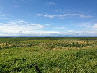
The Tantramar Marshes, also known as the Tintamarre National Wildlife Area, is a tidal saltmarsh around the Bay of Fundy on the Isthmus of Chignecto. The area borders between Route 940, Route 16 and Route 2 near Sackville, New Brunswick. The government of Canada proposed the boundaries of the Tantramar Marshes in 1966 and was declared a National Wildlife Area in 1978.

The Canadian Wildlife Service or CWS, is a Branch of the Department of Environment and Climate Change Canada, a department of the Government of Canada. November 1, 2012 marked the 65th anniversary of the founding of Service.

<span class="mw-page-title-main">Aspen parkland</span> Temperate grasslands, savannas, and shrublands ecoregion of Canada and the United States

Aspen parkland refers to a very large area of transitional biome between prairie and boreal forest in two sections, namely the Peace River Country of northwestern Alberta crossing the border into British Columbia, and a much larger area stretching from central Alberta, all across central Saskatchewan to south central Manitoba and continuing into small parts of the US states of Minnesota and North Dakota. Aspen parkland consists of groves of aspen, poplar and spruce, interspersed with areas of prairie grasslands, also intersected by large stream and river valleys lined with aspen-spruce forests and dense shrubbery. This is the largest boreal-grassland transition zone in the world and is a zone of constant competition and tension as prairie and woodlands struggle to overtake each other within the parkland.

<span class="mw-page-title-main">Dudhwa National Park</span> National park in Uttar Pradesh, India

The Dudhwa National Park is a national park in the Terai belt of marshy grasslands in northern Uttar Pradesh, India. It stretches over an area of 490.3 km2 (189.3 sq mi), with a buffer zone of 190 km2 (73 sq mi). It is part of the Dudhwa Tiger Reserve in the Kheri and Lakhimpur districts. The park is located on the Indo-Nepali border in the Lakhimpur Kheri District, and has buffers of reserved forest areas on the northern and southern sides. It represents one of the few remaining protected areas of the diverse and productive Terai ecosystem, supporting many endangered species, obligate species of tall wet grasslands and species of restricted distribution.

<span class="mw-page-title-main">Pacific Flyway</span> Major north-south flyway for migratory birds in the Americas

The Pacific Flyway is a major north-south flyway for migratory birds in the Americas, extending from Alaska to Patagonia. Every year, migratory birds travel some or all of this distance both in spring and in fall, following food sources, heading to breeding grounds, or travelling to overwintering sites.

<span class="mw-page-title-main">Alaksen National Wildlife Area</span> National Wildlife Area of Canada in Delta, British Columbia

The Alaksen National Wildlife Area is located on Westham Island in the city of Delta, British Columbia. It is an important stopover point for many species of birds migrating along the Pacific Flyway.

Grays Lake is a wetland in Idaho, United States. It lies in Bonneville County and Caribou County. Grays Lake National Wildlife Refuge was established in the area in 1965. Ranching is the predominant use of surrounding lands.

<span class="mw-page-title-main">Last Mountain Lake</span> Lake in Saskatchewan

Last Mountain Lake, also known as Long Lake, is a prairie lake formed from glaciation 11,000 years ago. It is located in south central Saskatchewan, Canada, about 40 kilometres (25 mi) north-west of the city of Regina. It flows into the Qu'Appelle River via Last Mountain Creek, which flows past Craven. It is approximately 93 km (58 mi) long, and 3 km (1.9 mi) wide at its widest point. It is the largest naturally occurring body of water in southern Saskatchewan. Only Lake Diefenbaker, which is man-made, is larger. The lake is a popular resort area for residents of south-eastern Saskatchewan.

<span class="mw-page-title-main">Wildlife of Libya</span> Natural fauna and flora of the country in north Africa

The wildlife of Libya is spread over the Mediterranean coastline and encompasses large areas of the Saharan desert. The protection of wildlife is provided through appropriate legislation in seven national parks, five reserves, 24 protected areas, two wetlands under Ramsar Convention, and also in other areas. Apart from these, there are also five UNESCO World Heritage Sites related to culture. The most important national parks are the El-Kouf National Park and Karabolli National Park. The well known nature reserves are the Benghazi Reserve and the Zellaf Reserve. The wildlife species recorded in the country are 87 mammals and 338 species of birds.

<span class="mw-page-title-main">Northern Basin and Range ecoregion</span>

The Northern Basin and Range ecoregion is a Level III ecoregion designated by the United States Environmental Protection Agency (EPA) in the U.S. states of Oregon, Idaho, Nevada, Utah, and California. It contains dissected lava plains, rolling hills, alluvial fans, valleys, and scattered mountain ranges in the northern part of the Great Basin. Although arid, the ecoregion is higher and cooler than the Snake River Plain to the north and has more available moisture and a cooler climate than the Central Basin and Range to the south. Its southern boundary is determined by the highest shoreline of Pleistocene Lake Bonneville, which once inundated the Central Basin and Range. The western part of the region is internally drained; its eastern stream network drains to the Snake River system.

<span class="mw-page-title-main">Wildlife of Canada</span> Overview of the wildlife of Canada

The wildlife of Canada or biodiversity of Canada consist of over 80,000 classified species, and an equal number thought yet to be recognized. Known fauna and flora have been identified from five kingdoms: protozoa ; chromist ; fungis ; plants ; and animals. Insects account for nearly 70 percent of recorded animal species in Canada. More than 300 species are found exclusively in Canada.

<span class="mw-page-title-main">Flora of Saskatchewan</span>

The native flora of Saskatchewan includes vascular plants, plus additional species of other plants and plant-like organisms such as algae, lichens and other fungi, and mosses. Non-native species of plants are recorded as established outside of cultivation in Saskatchewan, of these some non-native species remain beneficial for gardening, and agriculture, where others have become invasive, noxious weeds. Saskatchewan is committed to protecting species at risk in Canada. The growing season has been studied and classified into plant hardiness zones depending on length of growing season and climatic conditions. Biogeographic factors have also been divided into vegetative zones, floristic kingdoms, hardiness zones and ecoregions across Saskatchewan, and natural vegetation varies depending on elevation, moisture, soil type landforms, and weather. The study of ethnobotany uncovers the interrelation between humans and plants and the various ways people have used plants for economic reasons, food, medicine and technological developments. The Government of Saskatchewan has declared 3 indigenous plants as provincial symbols.

The San Luis National Wildlife Refuge Complex is located in the northern San Joaquin Valley, within Merced County and Stanislaus County of California. The complex, with four federal National Wildlife Refuges, is managed by the U.S Fish & Wildlife Service.

<span class="mw-page-title-main">Lenore Lake</span> Lake in Saskatchewan, Canada

Lenore Lake is a partly saline lake in the Canadian province of Saskatchewan. It is part of the Lenore Lake Basin, which includes several saline lakes as well as the freshwater St. Brieux and Burton Lakes. The basin has no natural outlet. The lake is within the aspen parkland ecozone of Saskatchewan. Lenore Lake was designated a migratory bird sanctuary in 1925. Raven Island, located at the southern end of Lenore Lake, is a National Wildlife Area of Canada.

<span class="mw-page-title-main">George C. Reifel Migratory Bird Sanctuary</span> Migratory bird sanctuary in Delta, British Columbia, Canada

George C. Reifel Migratory Bird Sanctuary is a protected area in Delta, British Columbia, Canada, and is part of the Fraser River estuary, designated a site of Hemispheric Importance by the Western Hemisphere Shorebird Reserve Network.

<span class="mw-page-title-main">Sonny Bono Salton Sea National Wildlife Refuge</span> Protected area in Imperial Valley, California

The Sonny Bono Salton Sea National Wildlife Refuge is located in the Imperial Valley of California, 40 miles (64 km) north of the Mexican border. Situated at the southern end of the Salton Sea, the refuge protects one of the most important nesting sites and stopovers along the Pacific Flyway. Despite its location in the Colorado Desert, a subdivision of the larger Sonoran Desert, the refuge contains marine, freshwater, wetland, and agricultural habitats which provide sanctuary for hundreds of birds and wetland species, including several that have been listed as endangered or sensitive by the U.S. Fish and Wildlife Service.

<span class="mw-page-title-main">Hagerman National Wildlife Refuge</span> Nature reserve in northwestern Grayson County, Texas, United States

Hagerman National Wildlife Refuge (HNWR), a haven for migratory birds and other wildlife, lies in northwestern Grayson County, Texas, on the Big Mineral Arm of Lake Texoma, on the Red River between Oklahoma and Texas. This National Wildlife Refuge is made up of water, marsh, and upland habitat. Visitors can hike, observe wildlife, hunt, and fish throughout the year.

Vaseux-Bighorn National Wildlife Area is a National Wildlife Area in British Columbia, Canada, primarily set aside to protect winter rangeland for California bighorn sheep. In 1979, the Vaseux-Bighorn Wildlife Area was established in response to substantial reduction in wild animal populations in the area. Identified factors contributing to species decline at the time were high predator population, overharvesting of species, and illegal hunting. Land development, cattle raising, and lumbering also might have altered species populations. Under these conditions, the area was able to be classified as a Category IV area by the IUCN and is now used for wildlife habitat and conservation. Even with minimal anthropogenic use of the area, threats persist through invasive species. Recreational use is limited spatially and is only open to the public during the day.

<span class="mw-page-title-main">Redberry Lake Biosphere Reserve</span> UNESCO Biosphere Reserve in Saskatchewan, Canada

The Redberry Lake Biosphere Region was established in 2000 as a UNESCO Biosphere Reserve covering 112,200 ha in the province of Saskatchewan, Canada. In 2019, the reserve expanded to become a region including the Redberry Lake watershed and surrounding land encompassing close to 700,000 ha of land. The regional landscape is composed of rolling prairie dotted with seasonal ponds and marshes along with aspen/shrub groves. The core area is Redberry Lake, a saline lake with several islands. There are small patches of natural mixed prairie which are very rare in this highly grazed and cultivated part of the prairies. The Redberry Lake Biosphere Region is committed to balancing conservation with sustainable development.

Last Mountain Lake Bird Sanctuary is a National Historic Site of Canada, located in the rural municipality of Last Mountain Valley No. 250 in Saskatchewan. The migratory bird sanctuary was the first established in North America. The 47.36 km2 (18.29 sq mi) area is within the Last Mountain Lake National Wildlife Area, an International Biological Program site, and includes adjacent uplands.

References

  1. "Last Mountain Lake National Wildlife Area". Protected Planet. Retrieved 8 November 2022.
  2. "Last Mountain Lake National Wildlife Area". Canadian Geographical Names Database. Government of Canada. Retrieved 8 November 2022.
  3. "Important Bird and Biodiversity Areas". Nature Saskatchewan. Nature Saskatchewan. Retrieved 1 December 2022.
  4. "Native Land". Native Land. Retrieved 6 November 2022.
  5. "Last Mountain Lake national wildlife area and migratory bird sanctuary: management plan (proposed)" . Retrieved 6 November 2022.
  6. 1 2 3 "Last Mountain Lake". Indigenous Saskatchewan Encyclopedia. Retrieved 25 October 2022.
  7. "History | Kannata Valley". kannatavalley.ca. Retrieved 5 November 2022.
  8. "Last Mountain Lake". Ramsar Sites Information Service. 1 January 2001. Retrieved 22 October 2022.
  9. "IBA Site Listing". www.ibacanada.org. Retrieved 7 November 2022.
  10. 1 2 3 4 5 6 7 8 9 10 11 12 13 14 15 "Last Mountain Lake National Wildlife Area". Government of Canada. 13 September 2022. Retrieved 25 October 2022.
  11. 1 2 3 4 5 6 7 8 9 10 11 12 13 14 15 16 17 "Last Mountain Lake national wildlife area and migratory bird sanctuary: management plan (proposed)". Government of Canada. Retrieved 12 October 2022.
  12. 1 2 3 4 "Climate and Average Weather Year Round in Regina". Weather Spark. Retrieved 12 October 2022.
  13. 1 2 3 4 5 Barrow, E. "Climate Scenarios for Saskatchewan". Prairie Adaptation Research Collaborative. Retrieved 5 November 2022.
  14. "Prairie Resilience: A Made-in-Saskatchewan Climate Change Strategy". Government of Saskatchewan.
  15. 1 2 3 4 5 6 7 8 9 10 11 12 13 14 15 16 17 18 19 20 21 22 "Information Sheet on Ramsar Wetlands" (PDF). Retrieved 5 November 2022.
  16. "Native Land". Native Land. Retrieved 6 November 2022.