Lauli'i is a village on the island of Upolu in Samoa. It is located on the central north coast of the island to the east of the capital Apia. Lauli'i is part of Vaimauga East Electoral Constituency which forms part of the larger political district of Tuamasaga.
Poutasi is a village on the south east coast of Upolu island in Samoa. The population was 379 in the 2006 Census. The village is part of Falealili Electoral Constituency in the larger political district of Atua. Poutasi was extensively damaged by the 2009 Samoa earthquake and tsunami.

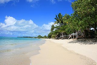
Vailele is a village situated on the central north coast of Upolu island in Samoa.
Lealatele is a village on the south east coast of Upolu island in Samoa. The village is part of Lepa Electoral Constituency which is within the larger political district of Atua.
Saleapaga is a village on the south east coast of Upolu island in Samoa. The village is part of Lepa Electoral Constituency which is within the larger political district of Atua.
Sapulu is a village at the east side of Savai'i island in Samoa. The village is part of the electoral constituency Fa'asaleleaga I which is within the larger political district (Itumalo) of Fa'asaleleaga.
Tino i Iva The Village of Uncle Bully, is a village at the east end of Savai'i island in Samoa. The village is part of the electoral constituency Fa'asaleleaga I which is within the larger political district (Itumalo) of Fa'asaleleaga.
Falefia is a village at the east end of Savai'i island in Samoa. The village is part of the electoral constituency Fa'asaleleaga I which is within the larger political district (Itumalo) of Fa'asaleleaga.
Vaiafai is a village at the east end of Savai'i island in Samoa. The village is part of the electoral constituency Fa'asaleleaga I which is within the larger political district (Itumalo) of Fa'asaleleaga.
Salelavalu Tai is a village at the east end of Savai'i island in Samoa. The village is part of the electoral constituency Fa'asaleleaga I which is within the larger political district (Itumalo) of Fa'asaleleaga.
Salelavalu Uta is a village at the east end of Savai'i island in Samoa. The village is part of the electoral constituency Fa'asaleleaga I which is within the larger political district (Itumalo) of Fa'asaleleaga.
Vaimaga is a village at the east end of Savai'i island in Samoa. The village is part of the electoral constituency Fa'asaleleaga II which is within the larger political district (Itumalo) of Fa'asaleleaga.
Sa'asa'ai is a village at the east end of Savai'i island in Samoa. The village is part of the electoral constituency Fa'asaleleaga III which is within the larger political district (Itumalo) of Fa'asaleleaga.
Saipipi is a village at the east end of Savai'i island in Samoa. The village is part of the electoral constituency Fa'asaleleaga III which is within the larger political district (Itumalo) of Fa'asaleleaga.
Lano is a village on the north east coast of Savai'i island in Samoa. The village is part of the electoral constituency Fa'asaleleaga IV which is within the larger political district (Itumalo) of Fa'asaleleaga.
Pu'apu'a is a village on the north east coast of Savai'i island in Samoa. The village is part of the electoral constituency Fa'asaleleaga IV which is within the larger political district (Itumalo) of Fa'asaleleaga.
Fogapoa is a village on the north east coast of Savai'i island in Samoa. The village is part of the electoral constituency Fa'asaleleaga II which is within the larger political district (Itumalo) of Fa'asaleleaga.

Lelepa is a village on the north central coast of Savai'i island in Samoa. The village is part of the electoral constituency Gaga'emauga III which forms part of the larger political district of Gaga'emauga.
Safa'i is a village on the north central coast of Savai'i island in Samoa. The village is part of the electoral constituency Gaga'emauga III which forms part of the larger political district Gaga'emauga.
Asaga is a village on the north east coast of Savai'i island in Samoa, situated between the villages of Lano to the south and Pu'apu'a to the north.


