Vaisigano River

Last updated
Vaisigano River
Location
CountrySamoa
Physical characteristics
Source 
 - locationSlopes of Mount Le Pu'e
 - coordinates 13°55′47″S171°45′05″W / 13.92972°S 171.75139°W / -13.92972; -171.75139
 - elevation860 metres (2,820 ft) [1]
Mouth  
 - coordinates
13°49′53″S171°45′37″W / 13.83139°S 171.76028°W / -13.83139; -171.76028 Coordinates: 13°49′53″S171°45′37″W / 13.83139°S 171.76028°W / -13.83139; -171.76028
 - elevation
0.0 metres (0 ft)
Length11.5 kilometres (7.1 mi)

The Vaisigano River is a river on Upolu, one of the two main islands of Samoa. It is one of several rivers and streams which flow through the nation's capital, Apia. The river has three main branches, all of which have their sources in the central volcanic ridge which runs the length of the island. The main (central) branch of the river rises on the northern slopes of Mount Le Pu'e, and joins with the eastern branch 4 km south of central Apia. The western branch joins one kilometre further north.

Upolu island in Samoa

Upolu is an island in Samoa, formed by a massive basaltic shield volcano which rises from the seafloor of the western Pacific Ocean. The island is 75 kilometres long and 1,125 square kilometres in area, making it the second largest of the Samoan Islands geographically. With approximately 145,000 people, it is by far the most populated of the Samoan Islands. Upolu is situated to the southeast of Savai'i, the "big island". Apia, the capital, is in the middle of the north coast, with Faleolo International Airport at the western end of the island. The island has not had any historically recorded eruptions, although three lava flows date back only a few hundred to a few thousand years.

Samoa country in Oceania

Samoa, officially the Independent State ofSamoa and, until 4 July 1997, known as Western Samoa, is a country consisting of two main islands, Savai'i and Upolu, and four smaller islands. The capital city is Apia. The Lapita people discovered and settled the Samoan Islands around 3,500 years ago. They developed a unique Samoan language and Samoan cultural identity.

Apia Place in Tuamasaga, Samoa

Apia is the capital and the largest city of Samoa. From 1900 to 1919, it was the capital of German Samoa. The city is located on the central north coast of Upolu, Samoa's second largest island. Apia is the only city in Samoa and falls within the political district (itūmālō) of Tuamasaga.

The main cross-island road, which runs from Apia to Si'umu, runs along a ridge overlooking the western branch's valley for part of its length; the settlements of Leaoa, Tiapapata, Letava, and Vaoala, which lie along the highway, are all therefore close to the river's course, as is Avele College, one of Samoa's main educational institutes. The waters of the river are used by the Alaoa Water Treatment Plant and power station, which supplies both water and electricity to Apia.
Related Research Articles

Rhine river in Western Europe

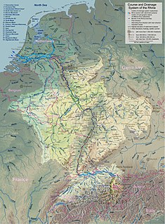
The Rhine is a European river that begins in the Swiss canton of Graubünden in the southeastern Swiss Alps, forms part of the Swiss-Liechtenstein, Swiss-Austrian, Swiss-German and then the Franco-German border, then flows through the German Rhineland and the Netherlands and eventually empties into the North Sea.

Savaii island

Savaiʻi is the largest and highest island in Samoa and the Samoan Islands chain. The island is the fifth largest in Polynesia, behind the two main islands of New Zealand and the Hawaiian Islands of Hawaii and Maui.

Salelologa Township & Ferry Terminal in Faasaleleaga, Samoa

Salelologa is a village district at the east end of Savai'i island in Samoa. It is the main entry point into the island with the only ferry terminal on Savai'i. It also serves as the main township for shopping and public amenities with a market selling fresh produce and arts and crafts.

Conococheague Creek tributary of the Potomac River in Pennsylvania and Maryland, United States

Conococheague Creek, a tributary of the Potomac River, is a free-flowing stream that originates in Pennsylvania and empties into the Potomac River near Williamsport, Maryland. It is 80 miles (129 km) in length, with 57 miles (92 km) in Pennsylvania and 23 miles (37 km) in Maryland. The watershed of Conococheague Creek has an area of approximately 566 square miles (1,470 km2), out of which only 65 square miles (170 km2) are in Maryland.

Tutuila largest island in American Samoa

Tutuila is the largest and the main island of American Samoa in the archipelago of Samoan Islands. It is the third largest island in the Samoan Islands chain of the Central Pacific located roughly 4,000 kilometers (2,500 mi) north-east of Brisbane, Australia and over 1,200 kilometers (750 mi) northeast of Fiji. It contains a large, natural harbor, Pago Pago Harbor, where Pago Pago, the capital of American Samoa is situated. Pago Pago International Airport is also located on Tutuila island. Its land expanse is about 68% of the total land area of American Samoa and with 56,000 people accounts for 95% of its population. The island has six terrestrial and three marine ecosystems.

Periyar (river) river in India

Periyar is the longest river and the river with the largest discharge potential in the Indian state of Kerala. It is one of the few perennial rivers in the region and provides drinking water for several major towns. The Periyar is of utmost significance to the economy of Kerala. It generates a significant proportion of Kerala's electrical power via the Idukki Dam and flows along a region of industrial and commercial activity. The river also provides water for irrigation and domestic use throughout its course besides supporting a rich fishery. Due to these reasons, the river has been named the "Lifeline of Kerala". Kochi city, in the vicinity of the river mouth draws its water supply from Aluva, an upstream site sufficiently free of seawater intrusion. Twenty five percent of Kerala's industries are along the banks of river Periyar. These are mostly crowded within a stretch of 5 kilometres (3 mi) in the Eloor-Edayar region (Udhyogamandal), about 10 kilometres (6 mi) north of Kochi harbor.

Tuamasaga District in Samoa

Tuamasaga is a district of Samoa, with a population of 83,191. The geographic area of Tuamasaga covers the central part of Upolu island.

Vaisigano District in Samoa

Vaisigano is a political district at the western tip of Savai'i island in Samoa. The capital of the district is Asau.

Rugby union in Samoa

Rugby union in Samoa is the country's most popular sport. The national teams in both the standard 15-man game and rugby sevens are consistently competitive against teams from vastly more populous nations.

Auala Village in Vaisigano, Samoa

Auala is a small village on the northwest coast of Savai'i island in Samoa. The village is in the electoral constituency of Vaisigano East which forms part of the larger political district of Vaisigano.

Matautu is the name of different villages in Samoa. Places named Matautu are found on the two largest islands, Upolu and Savai'i.

Tussey Mountain mountain in United States of America

Tussey Mountain is a stratigraphic ridge in central Pennsylvania, United States, trending east of the Bald Eagle, Brush, Dunning and Evitts Mountain ridges. Its southern foot just crosses the Mason–Dixon line near Flintstone, Maryland, running north 130 km (80 mi) to the Seven Mountains of central Pennsylvania, near Tusseyville, making it one of the longest named ridges in this section of the Ridge-and-valley Appalachians. The ridge line separates Morrison Cove from the Woodcock Valley and Friends Cove from the Black Valley. Tussey Mountain lies in, and the ridge line forms parts of the borders of, Centre, Blair, Bedford and Huntingdon counties.

Patamea Village in Gagaemauga, Samoa

Patamea is a village on the island of Savai'i in Samoa. While most villages on Savai'i are situated near the sea, Patamea is situated inland, away from the coast. The village is in the Gaga'emauga political district near the central north coast of the island.

Vaisala, Samoa Village in Vaisigano, Samoa

Vaisala is a small village on the northwest coast of Savai'i island in Samoa. The village lies within the political district of Vaisigano.

Falemauga Caves

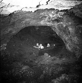
The Falemauga Caves are large natural caverns in a series of lava-tunnels situated in the Tuamasaga district along the central ridge of Upolu island in Samoa. The caves have been studied by archaeologists in Samoa with evidence of human occupation in pre-history. They were also used as a place of refuge by the people of Tuamasaga.

The Samoa Public Library, also known as the Nelson Memorial Public Library, is the main public library in Samoa.

References

  1. "Vaisigano River," Mapcarta. Retrieved 7 March 2019.