Lewisboro, New York

Last updated
Lewisboro, New York
LewisboroSeal.jpg
Westchester County New York incorporated and unincorporated areas Lewisboro highlighted.svg
Location in Westchester County and the state of New York.
Coordinates: 41°16′1″N73°35′19″W / 41.26694°N 73.58861°W / 41.26694; -73.58861
Country United States
State New York
County Westchester
Government
  TypeManager-Council
  Town SupervisorTony J. Gonçalves (D)
  Town Board
Members
Area
[1]
  Total29.16 sq mi (75.53 km2)
  Land27.75 sq mi (71.86 km2)
  Water1.42 sq mi (3.67 km2)
Elevation
440 ft (134 m)
Population
 (2010)
  Total12,411
  Estimate 
(2016) [2]
12,766
  Density460.10/sq mi (177.65/km2)
Time zone UTC-5 (Eastern (EST))
  Summer (DST) UTC-4 (EDT)
ZIP code
10590, 10536, 10526, 10597, 10518
Area code 914
FIPS code 36-42136
GNIS feature ID0979145
Website Town Website

Lewisboro is a town in Westchester County, New York, United States. The population was 12,411 at the 2010 census. [3] The town is named after John Lewis, an early settler. [4] Lewisboro is a suburb of New York City.

Contents

History

After purchasing land from the local natives, the first settlers established themselves around South Salem. The town was formed as "Salem" in 1747. By 1790 the town assumed its current dimensions as lands were removed for other towns. The name changed to South Salem in 1806. John Lewis, a financier, requested that the town be given his name and established a fund for the town, though he did not follow through on his promise of a railroad link. [5] An abundance of natural open space, Dry-stone walls and elegant Colonial mansions are dominant features.

Lewisboro has had two noteworthy historical characters. Sarah Bishop was the hermit of West Mountain. Apparently mistreated by British soldiers at the time of the Revolutionary War, she retreated to a solitary life in the Lewisboro area. A spot known as "Sarah Bishop's Cave" is on the hill on the north side of Lake Rippowam, near Mountain Lakes Camp. [6] The second historical character appeared around the time of the Civil War. The Leatherman was a wanderer who got his name from homemade leather garments. He is frequently mentioned as being in Lewisboro in the middle of the 19th century. He followed a route past homes that would offer him a meal and reappeared at the same doorsteps for 25 years. One of the hiking destinations in Ward Pound Ridge is to the Leatherman's cave, reportedly one of his more frequent homes. [7] In 1987, a 10k trail race called "The Leatherman's Loop" was started to honor his legacy and continues every spring at the Ward Pound Ridge Reservation. [8]

The Mead Memorial Chapel was listed on the National Register of Historic Places in 1999. [9]

Geography

Map of Westchester highlighting Lewisboro Lewisboro.PNG
Map of Westchester highlighting Lewisboro

The east town line is the border of Ridgefield, Connecticut and Wilton, Connecticut, while the southern border is the town of New Canaan, Connecticut. Interstate 684 passes near the west side of the town. The town's unusual chevron shape is partly the result of The Oblong, created during the resolution of the boundary dispute between Connecticut and New York. [10] [11]

Eastwoods Reservoir in Lewisboro Eastwoods Reservoir in Winter.jpg
Eastwoods Reservoir in Lewisboro

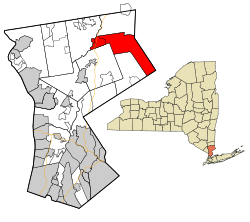
According to the United States Census Bureau, the town has a total area of 29.1 square miles (75 km2), of which 27.9 square miles (72 km2) is land and 1.3 square miles (3.4 km2), or 4.36%, is water.

Demographics

Historical population
CensusPop.Note
1790 1,453
1820 1,429
1830 1,5377.6%
1840 1,6195.3%
1850 1,608−0.7%
1860 1,88517.2%
1870 1,601−15.1%
1880 1,6120.7%
1890 1,417−12.1%
1900 1,311−7.5%
1910 1,127−14.0%
1920 1,069−5.1%
1930 1,42733.5%
1940 1,92935.2%
1950 2,35221.9%
1960 4,16577.1%
1970 6,61058.7%
1980 8,87134.2%
1990 11,31327.5%
2000 12,3248.9%
2010 12,4110.7%
2016 (est.)12,766 [2] 2.9%
U.S. Decennial Census [12]
Map of Westchester County showing population density Westchester Population.PNG
Map of Westchester County showing population density

The census [13] of 2000 counted 12,324 people living in the town, living in 4,218 households, of which 3,425 were families. The population density was 442.5 people per square mile (170.9/km2). There were 4,465 housing units at an average density of 160.3 per square mile (61.9/km2). The racial makeup of the town was 95.18% White, 1.19% African American, 0.06% Native American, 2.09% Asian, 0.49% from other races, and 0.99% from two or more races. Hispanic or Latino of any race were 2.48% of the population.

There were 4,218 households, of which 47.4% had children under the age of 18 living with them, 72.9% were married couples living together, 6.7% had a female householder with no husband present, and 18.8% were non-families. 15.2% of all households were made up of individuals, and 4.1% had someone living alone who was 65 years of age or older. The average household size was 2.91 and the average family size was 3.26.

In the town, the population was spread out, with 31.6% under the age of 18, 3.8% from 18 to 24, 28.5% from 25 to 44, 29.0% from 45 to 64, and 7.1% who were 65 years of age or older. The median age was 39 years. For every 100 females, there were 95.8 males. For every 100 females age 18 and over, there were 92.3 males.

The median income for a household in the town was $112,462, and the median income for a family was $157,412. Males had a median income of $84,616 versus $48,900 for females. The per capita income for the town was $54,795. About 1.4% of families and 1.9% of the population were below the poverty line, including 1.3% of those under age 18 and 2.7% of those age 65 or over.

Town life

Unlike the neighboring communities of Katonah and Ridgefield, Lewisboro does not have a downtown business district. Most residents in town do their shopping at plazas in Golden's Bridge, Cross River, Vista, or Ridgefield, CT.

Communities and locations in Lewisboro

Parks and preserves

Lewisboro is rich in natural areas and is a component of the biotic corridor. Two Westchester County Parks are on Lewisboro's borders, and there are six town parks and several community preserves.

Lakes and reservoirs

There are 7 lakes in the town of Lewisboro. Lake Waccabuc, Lake Oscaleta, and Lake Rippowam are interconnected and are collectively known as the Three Lakes, and are natural (not man-made) lakes. Lake Waccabuc is the largest and most well-known of these, and the area of town named after it has a separate post office. Lake Oscaleta and Lake Rippowam are also called the Twin Lakes, probably because of Twin Lakes Village, a development which runs between them. The other lakes in town are Lake Truesdale, Lake Katonah, Lake Kitchawan, and Timber Lake. Recognizing the importance of the lake communities in the town, in 2007 a Lakes Committee was formed by the Town of Lewisboro.

Additionally, there are a number of reservoirs in the town of Lewisboro, utilized by cities such as Norwalk, Connecticut. [15]

Browns Reservoir seen from Silver Spring Road in the hamlet of Vista Vista, NY March 2021.jpg
Browns Reservoir seen from Silver Spring Road in the hamlet of Vista

Schools in Lewisboro

The public schools in Lewisboro are part of the Katonah-Lewisboro School District. John Jay High School, located in Cross River, is the only high school in the Katonah-Lewisboro School District. It has been ranked as one of the top 200 high-schools in the nation by Newsweek magazine. [16] John Jay Middle School is also in Cross River on the same campus as John Jay High School. [17]

Transportation

Lewisboro is crossed by New York State Route 123,Which is a continuation of the Connecticut state route of the same name. The road runs through Lewisboro until intersecting with New York State Route 35. Housatonic Area Regional Transit (HART) operates a weekday commuter shuttle between Katonah station and the South Salem Municipal park and ride lot at 606 Old Post Rd. [18]

Notable people

A list of notable Waccabuc residents can be found on the hamlet's page.

Related Research Articles

<span class="mw-page-title-main">Westchester County, New York</span> County in New York, United States

Westchester County is located in the U.S. state of New York. It is the seventh most populous county in the State of New York and the most populous north of New York City. According to the 2020 United States Census, the county had a population of 1,004,456, its highest decennial count ever and an increase of 55,344 (5.8%) from the 949,113 counted in 2010. Located in the Hudson Valley, Westchester covers an area of 450 square miles (1,200 km2), consisting of six cities, 19 towns, and 23 villages. Established in 1683, Westchester was named after the city of Chester, England. The county seat is the city of White Plains, while the most populous municipality in the county is the city of Yonkers, with 211,569 residents per the 2020 U.S. Census.

<span class="mw-page-title-main">Fairfield County, Connecticut</span> County in Connecticut, United States

Fairfield County is a county in the southwestern corner of the U.S. state of Connecticut. It is the most populous county in the state and was also its fastest-growing from 2010 to 2020. As of the 2020 census, the county's population was 957,419, representing 26.6% of Connecticut's overall population. The closest to the center of the New York metropolitan area, the county contains four of the state's top 7 largest cities—Bridgeport (1st), Stamford (2nd), Norwalk (6th), and Danbury (7th)—whose combined population of 433,368 is nearly half the county's total population.

<span class="mw-page-title-main">New Fairfield, Connecticut</span> Town in Connecticut, United States

New Fairfield is a town in Fairfield County, Connecticut, United States. The population was 13,579 at the 2020 census. New Fairfield is one of five towns that surround Candlewood Lake, the largest lake in Connecticut. The town is located 55 miles (89 km) northeast of New York City, making it part of the New York metropolitan area. The town is part of the Western Connecticut Planning Region.

<span class="mw-page-title-main">Watertown, Connecticut</span> Town in Connecticut, United States

Watertown is a town in Litchfield County, Connecticut, United States. The town is part of the Naugatuck Valley Planning Region. The population was 22,105 at the 2020 census. The ZIP codes for Watertown are 06795 and 06779. It is a suburb of Waterbury. The urban center of the town is the Watertown census-designated place, with a population of 3,938 at the 2020 census.

<span class="mw-page-title-main">Middlefield, Connecticut</span> Town in Connecticut, United States

Middlefield is a town in Middlesex County, Connecticut, United States. The town is part of the Lower Connecticut River Valley Planning Region. The population was 4,217 at the 2020 census. The town includes the village of Rockfall in the northeast section.

<span class="mw-page-title-main">Goldens Bridge, New York</span> Census-designated place in New York, United States

Goldens Bridge is a hamlet and census-designated place (CDP) in the town of Lewisboro in Westchester County, New York, United States. The population was 1,630 at the 2010 census.

<span class="mw-page-title-main">Greenburgh, New York</span> Town in New York, United States

Greenburgh is a town in western Westchester County, New York. The population was 95,397 at the time of the 2020 census.

<span class="mw-page-title-main">North Salem, New York</span> Town in New York, United States

North Salem is a town in the northeastern section of Westchester County, New York, United States. The town, incorporated in 1788, is a suburb of New York City, located approximately 50 miles north of Midtown Manhattan. As of the 2020 census, North Salem was recorded as possessing a population of 5,243 people living on a land area of 21.37 square miles.

<span class="mw-page-title-main">Somers, New York</span> Town in New York, United States

Somers is a town located in northern Westchester County, New York, United States. As of the 2010 census, the town had a population of 20,434. The nearby Metro-North Commuter Railroad provides service to Grand Central Terminal in Manhattan with an average commute time of 65 to 75 minutes from stations at Purdys, Goldens Bridge, Croton Falls, and Katonah.

<span class="mw-page-title-main">Ridgefield (CDP), Connecticut</span> Census-designated place in Connecticut, United States

Ridgefield is a census-designated place (CDP) in Fairfield County, Connecticut, United States. It consists of the primary central village in the town of Ridgefield and surrounding residential areas. As of the 2010 census, the population of the CDP was 7,645, out of 24,638 in the entire town.

<span class="mw-page-title-main">Belchertown, Massachusetts</span> Town in Massachusetts, United States

Belchertown is a town in Hampshire County, Massachusetts, United States. It is part of the Springfield, Massachusetts Metropolitan Statistical Area. The population was 15,350 at the 2020 census. The town includes the census-designated place of Belchertown. Belchertown was formerly the home of the Belchertown State School. The land on which the school sat is, as of 2016, being redeveloped for mixed uses including residential, commercial and recreational. This includes the 385-acre (156 ha) Lampson Brook Farm, used for community and sustainable agriculture, outdoor recreation, and wildlife preservation.

<span class="mw-page-title-main">Bedford (town), New York</span> Town in New York, United States

Bedford is an incorporated town in Westchester County, New York. The population was 17,335 at the 2010 census.

<span class="mw-page-title-main">Ridgefield, Connecticut</span> Town in Connecticut, United States

Ridgefield is a town in Fairfield County, Connecticut, United States. Situated in the foothills of the Berkshire Mountains, the 300-year-old community had a population of 25,033 at the 2020 census. The town is part of the Western Connecticut Planning Region. The town center, which was formerly a borough, is defined by the U.S. Census Bureau as a census-designated place.

<span class="mw-page-title-main">Katonah, New York</span> CDP in the town of Bedford, Westchester County, in the U.S. state of New York

Katonah is a hamlet and census-designated place (CDP) within the town of Bedford, Westchester County, in the U.S. state of New York. The Katonah CDP had a population of 1,679 at the 2010 census.

Waccabuc is a hamlet and lake in the town of Lewisboro, Westchester County, New York, United States. Waccabuc is considered "New York's Secret Suburb" and is home to a "collection of privacy-loving C.E.O.s and bright stars in other firmaments," according to an Upstart Business Journal article about the tremendous number of notable residents in a hamlet of just a few hundred people. Waccabuc is known by many outside of the town for its Castle Rock.

<span class="mw-page-title-main">New York State Route 35</span> State highway in Westchester New York, US

New York State Route 35 (NY 35) is the principal east–west highway in the northern part of Westchester County, New York, carrying average daily volumes of around 16,500 vehicles. Its western terminus is at US 9 in Peekskill, while its eastern terminus is at the Connecticut state line in Lewisboro, where it becomes that state's Route 35.

<span class="mw-page-title-main">New York State Route 138</span> State highway in Westchester County, New York, US

New York State Route 138 (NY 138) is a 5.19-mile (8.35 km) long state highway in Westchester County, New York. It begins in the town of Somers at NY 100 and ends at NY 121 west of the hamlet of Waccabuc. The road passes by the shopping center at Golden's Bridge.

<span class="mw-page-title-main">Titicus Reservoir</span> Body of water

Titicus Reservoir is a reservoir located in the Town of North Salem in Westchester County, 30 miles (48 km) north of New York City. One of twelve in the NYC water supply's Croton Watershed, it has been supplying the system since 1893.

<span class="mw-page-title-main">Housatonic Area Regional Transit</span> Transportation provider in Danbury, Connecticut

Housatonic Area Regional Transit, known popularly as HARTransit, is the provider of public transportation for Danbury, Connecticut and surrounding communities. HARTransit was founded in 1972 as the Danbury-Bethel Transit District by the two municipalities. The name was changed to Housatonic Area Regional Transit in 1979 after the addition of other municipal members. The agency receives funding from municipal contracts, the Connecticut Department of Transportation, Federal Transit Administration and the New York State Department of Transportation. Prior to HARTransit's establishment, Danbury had gone without transit service since 1967 when the privately owned ABC Bus Company which had replaced the Candlewood Bus Company a few months before, ceased operations. The first local bus transit operator in the area, Danbury Power & Transportation Company, operated bus services in Danbury and Bethel from 1926 to 1965. HARTransit provides service to a greater number of towns than its predecessors.

West Mountain is a census-designated place (CDP) in the town of Ridgefield, Fairfield County, Connecticut, United States. It is on the west side of Ridgefield and is bordered to the west by the towns of North Salem and Lewisboro in Westchester County, New York. The West Mountain Historic District occupies 425 acres (172 ha) at the center of the CDP, and newer residences occupy portions of the remainder of the CDP.

References

  1. "New York: 2010, Population and Housing Unit Counts (CPH-2-34)" (PDF). 2010 Census of Population and Housing. United States Census Bureau. June 2012. Retrieved April 28, 2019.
  2. 1 2 "Population and Housing Unit Estimates". www.census.gov. Retrieved June 9, 2017.
  3. "Profile of General Population and Housing Characteristics: 2010 Demographic Profile Data (DP-1): Lewisboro town, Westchester County, New York". United States Census Bureau . Retrieved November 15, 2011.
  4. Gannett, Henry (1905). The Origin of Certain Place Names in the United States. U.S. Government Printing Office. p.  186.
  5. Lewisboro History Book Committee (1981), p. 70.
  6. Lewisboro History Book Committee (1981), pp. 305–309.
  7. Lewisboro History Book Committee (1981), p. 345.
  8. Leatherman’s Loop Founders Newsletter, Vol. 11: The status of the Loop in covid times 8 March 2021, www.leathermansloop.org, accessed 6 June 2021
  9. "National Register Information System". National Register of Historic Places . National Park Service. July 9, 2010.
  10. Lewisboro History Book Committee (1981), pp. 41–46.
  11. History of Putnam County www.rootsweb.ancestry.com, accessed 6 June 2021
  12. "Census of Population and Housing". Census.gov. Retrieved June 4, 2015.
  13. "U.S. Census website". United States Census Bureau . Retrieved 2008-01-31.
  14. "Lewisboro Tow". www.nelsap.org. Retrieved 2022-05-08.
  15. "Our Reservoirs and Watershed".
  16. Newsweek High School Rankings Archived 2007-04-23 at the Wayback Machine
  17. "Map of JJHS + JJMS". Google Maps. Retrieved 13 May 2014.
  18. https://www.hartransit.com/alert-route/ridgefield-katonah HARTransit South Salem - Katonah
  19. Van Meter, William. "'Maura is Real to Me': Jeffrey Tambor on His Role in Transparent". Vulture. Retrieved June 19, 2015.
Bibliography

Coordinates: 41°14′17″N73°31′21″W / 41.23806°N 73.52250°W / 41.23806; -73.52250