
The Royal National Park is a protected national park that is located in Sutherland Shire local government area in the southern portion of Sydney, New South Wales, Australia.
Berry is a small Australian village in the Shoalhaven region of the New South Wales South Coast, located 143 km (89 mi) south of the state capital, Sydney. It has many historical buildings which are listed on the New South Wales Heritage Register. Berry attracts many tourists who come to enjoy the diversity of landscapes, including coastal beaches, rich dairy farming, and forested mountains. The village hosts a local Produce Market which is held twice each month on the second Saturday and fourth Sunday. Together with Kiama 23 km (14 mi) to the north, Berry acts as a gateway through to other towns and villages along the South Coast of NSW via the Princes Highway and the South Coast railway line. Major highway building projects in and around Berry have now bypassed the village, creating uninterrupted motorway conditions for coastal travel south to Nowra and the South Coast and north to Wollongong and Sydney. This has resulted in the removal of all but local and visitor traffic within the village. Planning is underway to create a pedestrian-friendly precinct in and around Queens Street.

Richmond is a town in New South Wales, in the local government area of the City of Hawkesbury. It is located 19 metres above sea level on the alluvial Hawkesbury River flats, at the foot of the Blue Mountains on the Cumberland Plain. It is about 65 km by road from Sydney and about 78 km by road from Lithgow.

The Upper Hunter Shire is a local government area in the Upper Hunter Valley of New South Wales, Australia. The Shire was formed in May 2004 from the Scone Shire and parts of Murrurundi and Merriwa shires.

Glebe is an inner-western suburb of Sydney in New South Wales. Glebe is located 3 kilometres (1.9 mi) southwest of the Sydney central business district and is part of the local government area of the City of Sydney, in the Inner West region.

Lithgow is a town in the Central Tablelands of New South Wales, Australia and is the administrative centre of the City of Lithgow local government area. It is located in a mountain valley named Lithgow's Valley by John Oxley in honour of William Lithgow, the first Auditor-General of New South Wales.

Faulconbridge is a village located in the Blue Mountains 77 km west of the Sydney central business district, New South Wales and is 450 metres above sea level. At the 2016 census, Faulconbridge had a population of 4,025 people. At the 2021 cenus, the population had risen to 4,156.

Springwood is a town in the Blue Mountains, New South Wales, Australia. Springwood is located 72 kilometres west of the Sydney CBD in the local government area of the City of Blue Mountains. At the 2021 census, Springwood had a population 8,423 people.

The South Coast Railway is a commuter and goods railway line from Sydney to Wollongong and Bomaderry in New South Wales, Australia. Beginning at the Illawarra Junction, the line services the Illawarra and South Coast regions of New South Wales.

Otford is a village in the Otford Valley located 55 km south of the Sydney and 30 km north of the Wollongong CBD in New South Wales, Australia. Otford is within the local government area of the City of Wollongong.

The Hacking River is a watercourse that is located in the Southern Sydney region of New South Wales in Australia. For thousands of years traditional owners called the river Deeban, however the colonial settlers renamed the river after Henry Hacking, a British seaman who killed Pemulwuy and was a pilot at Port Jackson in colonial New South Wales.

Burning Palms is an unbounded neighbourhood within the locality of Lilyvale and a beach in the Royal National Park, Wollongong, south of Sydney, New South Wales, Australia. It has a surf club and a local cabin community, and is a popular day-walk destination, along with the 'figure-8' rock pools on the rock shelf to the beach's south.

Helensburgh railway station is a heritage-listed railway station located on the South Coast railway line in New South Wales, Australia. It serves the town of Helensburgh. It was added to the New South Wales State Heritage Register on 2 April 1999.

Picton is a small town in the Macarthur Region of New South Wales, Australia, in the Wollondilly Shire, in south-western Sydney. The town is located approximately 90 kilometres south-west of the Sydney CBD, close to Camden and Campbelltown. It is also the administrative centre of Wollondilly Shire.

Wingello is a village in the Southern Highlands of New South Wales, Australia. It has a station on NSW TrainLink's Southern Highlands Line. The surrounding area is part of the lands administrative unit of the Wingello Parish, a subdivision of Wingecarribee Shire.

Helensburgh is a small town, located 45 kilometres (28 mi) south of Sydney and 35 kilometres (22 mi) north of Wollongong and north and above the Illawarra escarpment and region. Helensburgh is in the Wollongong City Council local government area. It is surrounded by bushland reserves adjacent to the southern end of the Royal National Park and Garawarra State Conservation Area and the Woronora reservoir water catchment is to its west.
Lilyvale railway station is a former railway station on the Illawarra railway line in New South Wales, Australia.
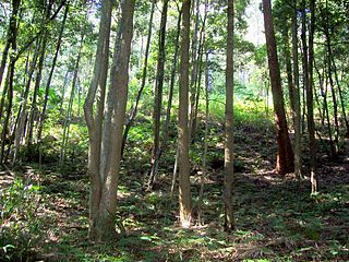
The Garawarra State Conservation Area is a protected conservation area that is located on the southern suburban fringe of Greater Sydney, in the state of New South Wales, in eastern Australia. The 949-hectare (2,350-acre) reserve abuts the Royal National Park and is situated 40 kilometres (25 mi) south of the Sydney central business district, near Helensburgh. Garawarra was gazetted as a park in 1987, and added, together with the Royal National Park, to the Australian National Heritage List on 15 September 2006.
Stanwell Tops is an exurban locality between the cities of Sydney and Wollongong on the New South Wales, Australia coastline. It lies northwest of Stanwell Park and southwest of Otford.
Lilyvale railway tunnels are heritage-listed railway tunnels on the Illawarra railway line at Lilyvale, City of Wollongong, New South Wales, Australia. It was designed and built by the then-New South Wales Government Railways. The property is owned by RailCorp, an agency of the Government of New South Wales. It was added to the New South Wales State Heritage Register on 2 April 1999.
