Lincoln Township, Marshall County, Minnesota

Last updated
Lincoln Township, Minnesota
Township
USA Minnesota location map.svg
Red pog.svg
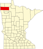
Lincoln Township, Minnesota
Location within the state of Minnesota
Coordinates: 48°29′39″N96°27′6″W / 48.49417°N 96.45167°W / 48.49417; -96.45167 Coordinates: 48°29′39″N96°27′6″W / 48.49417°N 96.45167°W / 48.49417; -96.45167
Country United States
State Minnesota
County Marshall
Area
  Total 35.6 sq mi (92.1 km2)
  Land 35.6 sq mi (92.1 km2)
  Water 0.0 sq mi (0.0 km2)
Elevation 1,060 ft (323 m)
Population (2000)
  Total 124
  Density 3.5/sq mi (1.3/km2)
Time zone Central (CST) (UTC-6)
  Summer (DST) CDT (UTC-5)
FIPS code 27-37142 [1]
GNIS feature ID 0664786 [2]

Lincoln Township is a township in Marshall County, Minnesota, United States. The population was 124 at the 2000 census.

Marshall County, Minnesota County in the United States

Marshall County is a county in the U.S. state of Minnesota. As of the 2010 census, the population was 9,439. Its county seat is Warren.

Minnesota State of the United States of America

Minnesota is a state in the Upper Midwest and northern regions of the United States. Minnesota was admitted as the 32nd U.S. state on May 11, 1858, created from the eastern half of the Minnesota Territory. The state has a large number of lakes, and is known by the slogan the "Land of 10,000 Lakes". Its official motto is L'Étoile du Nord.

Contents

Lincoln Township was organized in 1892, and named for Abraham Lincoln, 16th President of the United States. [3]

Abraham Lincoln 16th president of the United States

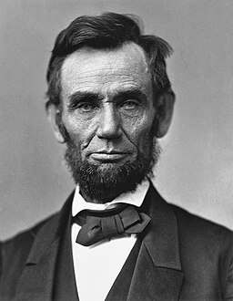
Abraham Lincoln was an American statesman, politician, and lawyer who served as the 16th president of the United States from 1861 until his assassination in April 1865. Lincoln led the nation through the American Civil War, its bloodiest war and its greatest moral, constitutional, and political crisis. He preserved the Union, abolished slavery, strengthened the federal government, and modernized the U.S. economy.

Geography

According to the United States Census Bureau, the township has a total area of 35.6 square miles (92 km2), all of it land.

United States Census Bureau Bureau of the United States responsible for the census and related statistics

The United States Census Bureau is a principal agency of the U.S. Federal Statistical System, responsible for producing data about the American people and economy. The Census Bureau is part of the U.S. Department of Commerce and its director is appointed by the President of the United States.

Demographics

As of the census [1] of 2000, there were 124 people, 48 households, and 33 families residing in the township. The population density was 3.5 people per square mile (1.3/km²). There were 62 housing units at an average density of 1.7/sq mi (0.7/km²). The racial makeup of the township was 99.19% White, and 0.81% from two or more races.

Census Acquiring and recording information about the members of a given population

A census is the procedure of systematically acquiring and recording information about the members of a given population. The term is used mostly in connection with national population and housing censuses; other common censuses include agriculture, business, and traffic censuses. The United Nations defines the essential features of population and housing censuses as "individual enumeration, universality within a defined territory, simultaneity and defined periodicity", and recommends that population censuses be taken at least every 10 years. United Nations recommendations also cover census topics to be collected, official definitions, classifications and other useful information to co-ordinate international practice.

Population density A measurement of population numbers per unit area or volume

Population density is a measurement of population per unit area or unit volume; it is a quantity of type number density. It is frequently applied to living organisms, and most of the time to humans. It is a key geographical term. In simple terms population density refers to the number of people living in an area per kilometer square.

There were 48 households out of which 33.3% had children under the age of 18 living with them, 62.5% were married couples living together, 4.2% had a female householder with no husband present, and 29.2% were non-families. 27.1% of all households were made up of individuals and 8.3% had someone living alone who was 65 years of age or older. The average household size was 2.58 and the average family size was 3.15.

Marriage social union or legal contract between people called spouses that creates kinship

Marriage, also called matrimony or wedlock, is a socially or ritually recognised union between spouses that establishes rights and obligations between those spouses, as well as between them and any resulting biological or adopted children and affinity. The definition of marriage varies around the world not only between cultures and between religions, but also throughout the history of any given culture and religion, evolving to both expand and constrict in who and what is encompassed, but typically it is principally an institution in which interpersonal relationships, usually sexual, are acknowledged or sanctioned. In some cultures, marriage is recommended or considered to be compulsory before pursuing any sexual activity. When defined broadly, marriage is considered a cultural universal. A marriage ceremony is known as a wedding.

In the township the population was spread out with 28.2% under the age of 18, 5.6% from 18 to 24, 29.8% from 25 to 44, 25.0% from 45 to 64, and 11.3% who were 65 years of age or older. The median age was 35 years. For every 100 females, there were 117.5 males. For every 100 females age 18 and over, there were 102.3 males.

The median income for a household in the township was $33,125, and the median income for a family was $34,688. Males had a median income of $32,500 versus $20,000 for females. The per capita income for the township was $12,943. There were 12.9% of families and 26.2% of the population living below the poverty line, including 51.5% of under eighteens and 9.5% of those over 64.

Per capita income mean income of the people in an economic unit such as a country or city

Per capita income (PCI) or average income measures the average income earned per person in a given area in a specified year. It is calculated by dividing the area's total income by its total population.

Related Research Articles

Mandt Township, Chippewa County, Minnesota Township in Minnesota, United States

Mandt Township is a township in Chippewa County, Minnesota, United States. The population was 175 at the 2000 census.

Moland Township, Clay County, Minnesota Township in Minnesota, United States

Moland Township is a township in Clay County, Minnesota, United States. The population was 340 at the 2000 census.

Pelican Township, Crow Wing County, Minnesota Township in Minnesota, United States

Pelican Township is a township in Crow Wing County, Minnesota, United States. The population was 400 at the 2000 census. This township was named from Pelican Lake.

Wolford Township, Crow Wing County, Minnesota Township in Minnesota, United States

Wolford Township is a township in Crow Wing County, Minnesota, United States. The population was 326 at the 2000 census. Wolford Township was named for Robert Wolford, an early settler.

Elk Lake Township, Grant County, Minnesota Township in Minnesota, United States

Elk Lake Township is a township in Grant County, Minnesota, United States. The population was 298 at the 2000 census.

Hansonville Township, Lincoln County, Minnesota Township in Minnesota, United States

Hansonville Township is a township in Lincoln County, Minnesota, United States. The population was 122 at the 2000 census.

Hendricks Township, Lincoln County, Minnesota Township in Minnesota, United States

Hendricks Township is a township in Lincoln County, Minnesota, United States. The population was 220 at the 2000 census.

Lake Benton Township, Lincoln County, Minnesota Township in Minnesota, United States

Lake Benton Township is a township in Lincoln County, Minnesota, United States. The population was 244 at the 2000 census.

Marble Township, Lincoln County, Minnesota Township in Minnesota, United States

Marble Township is a township in Lincoln County, Minnesota, United States. The population was 195 at the 2000 census.

Lyons Township, Lyon County, Minnesota Township in Minnesota, United States

Lyons Township is a township in Lyon County, Minnesota, United States, not to be confused with Lyons Township in Wadena County. The population was 208 at the 2000 census.

Veldt Township, Marshall County, Minnesota Township in Minnesota, United States

Veldt Township is a township in Marshall County, Minnesota, United States. The population was 56 at the 2000 census.

Buckman Township, Morrison County, Minnesota Township in Minnesota, United States

Buckman Township is a township in Morrison County, Minnesota, United States. The population was 717 at the 2000 census.

Norwegian Grove Township, Otter Tail County, Minnesota Township in Minnesota, United States

Norwegian Grove Township is a township in Otter Tail County, Minnesota, United States. The population was 349 at the 2000 census.

Sturgeon Lake Township, Pine County, Minnesota Township in Minnesota, United States

Sturgeon Lake Township is a township in Pine County, Minnesota, United States. The population was 409 at the 2000 census.

Garden Township, Polk County, Minnesota Township in Minnesota, United States

Garden Township is a township in Polk County, Minnesota, United States. It is part of the Grand Forks-ND-MN Metropolitan Statistical Area. The population was 227 at the 2000 census.

Godfrey Township, Polk County, Minnesota Township in Minnesota, United States

Godfrey Township is a township in Polk County, Minnesota, United States. It is part of the Grand Forks-ND-MN Metropolitan Statistical Area. The population was 327 at the 2000 census.

Mickinock Township, Roseau County, Minnesota Township in Minnesota, United States

Mickinock Township is a township in Roseau County, Minnesota, United States. The population was 302 at the 2000 census.

Hartford Township, Todd County, Minnesota Township in Minnesota, United States

Hartford Township is a township in Todd County, Minnesota, United States. The population was 677 at the 2000 census.

Iosco Township, Waseca County, Minnesota Township in Minnesota, United States

Iosco Township is a township in Waseca County, Minnesota, United States. The population was 598 at the 2000 census.

Ogema Township, Pine County, Minnesota Township in Minnesota, United States

Ogema Township is a township in Pine County, Minnesota, United States. The population was 298 at the 2000 census.

References

  1. 1 2 "American FactFinder". United States Census Bureau . Retrieved 2008-01-31.
  2. "US Board on Geographic Names". United States Geological Survey. 2007-10-25. Retrieved 2008-01-31.
  3. Upham, Warren (1920). Minnesota Geographic Names: Their Origin and Historic Significance. Minnesota Historical Society. p. 328.