Middle River, Minnesota

Last updated
Middle River
Marshall County Minnesota Incorporated and Unincorporated areas Middle River Highlighted.svg
Location of Middle River
within Marshall County and state of Minnesota
Coordinates: 48°26′6″N96°9′49″W / 48.43500°N 96.16361°W / 48.43500; -96.16361
CountryUnited States
State Minnesota
County Marshall
Area
[1]
  Total0.50 sq mi (1.29 km2)
  Land0.50 sq mi (1.29 km2)
  Water0.00 sq mi (0.00 km2)
Elevation
1,142 ft (348 m)
Population
 (2020) [2]
  Total304
  Estimate 
(2021) [3]
304
  Density611.67/sq mi (236.05/km2)
Time zone UTC-6 (CST)
  Summer (DST) UTC-5 (CDT)
ZIP code
56737
Area code 218
FIPS code 27-41912
GNIS feature ID0647816 [4]

Middle River is a city in Marshall County, Minnesota, United States, along the Middle River, from which the city took its name. [5] The population was 304 at the 2020 census. [2]

Contents

Geography

According to the United States Census Bureau, the city has a total area of 0.48 square miles (1.24 km2), all land. [6]

The community is along State Highway 32 (MN 32). It is 22 miles north of Thief River Falls.

Demographics

Historical population
CensusPop.Note
1910 149
1920 324117.4%
1930 275−15.1%
1940 32819.3%
1950 3568.5%
1960 41416.3%
1970 369−10.9%
1980 349−5.4%
1990 285−18.3%
2000 31911.9%
2010 303−5.0%
2020 3040.3%
2021 (est.)304 [3] 0.0%
U.S. Decennial Census [7]
2020 Census [2]

2010 census

As of the census of 2010, there were 303 people, 148 households, and 77 families living in the city. The population density was 631.3 inhabitants per square mile (243.7/km2). There were 161 housing units at an average density of 335.4 per square mile (129.5/km2). The racial makeup of the city was 96.7% White, 1.0% African American, 1.3% Native American, 0.3% Asian, and 0.7% from two or more races. Hispanic or Latino of any race were 1.0% of the population.

There were 148 households, of which 20.9% had children under the age of 18 living with them, 37.8% were married couples living together, 9.5% had a female householder with no husband present, 4.7% had a male householder with no wife present, and 48.0% were non-families. 41.2% of all households were made up of individuals, and 25% had someone living alone who was 65 years of age or older. The average household size was 2.05 and the average family size was 2.82.

The median age in the city was 44.9 years. 21.5% of residents were under the age of 18; 4.8% were between the ages of 18 and 24; 23.7% were from 25 to 44; 29.4% were from 45 to 64; and 20.5% were 65 years of age or older. The gender makeup of the city was 47.9% male and 52.1% female.

2000 census

As of the census of 2000, there were 319 people, 152 households, and 76 families living in the city. The population density was 639.9 inhabitants per square mile (247.1/km2). There were 161 housing units at an average density of 323.0 per square mile (124.7/km2). The racial makeup of the city was 98.75% White, and 1.25% from two or more races. 52.5% were of Norwegian, 8.6% Polish, 6.1% Finnish, 5.8% American, 5.0% Irish and 5.0% Swedish ancestry.

There were 152 households, out of which 23.0% had children under the age of 18 living with them, 36.8% were married couples living together, 9.2% had a female householder with no husband present, and 50.0% were non-families. 45.4% of all households were made up of individuals, and 22.4% had someone living alone who was 65 years of age or older. The average household size was 2.10 and the average family size was 2.88.

In the city, the population was spread out, with 23.5% under the age of 18, 7.5% from 18 to 24, 27.0% from 25 to 44, 23.5% from 45 to 64, and 18.5% who were 65 years of age or older. The median age was 38 years. For every 100 females, there were 88.8 males. For every 100 females age 18 and over, there were 89.1 males.

The median income for a household in the city was $23,929, and the median income for a family was $28,750. Males had a median income of $30,625 versus $20,179 for females. The per capita income for the city was $14,059. About 2.7% of families and 10.6% of the population were below the poverty line, including 5.0% of those under age 18 and 13.3% of those age 65 or over.

Related Research Articles

<span class="mw-page-title-main">Greers Ferry, Arkansas</span> City in Arkansas, United States

Greers Ferry is a city in Cleburne County, Arkansas, United States. The population was 891 at the 2010 census.

<span class="mw-page-title-main">Pendergrass, Georgia</span> City in Georgia, United States

Pendergrass is a city in Jackson County, Georgia, United States. The population was 1692 at the time of the 2020 census.

<span class="mw-page-title-main">Jasper, Georgia</span> City and county seat in Georgia, United States

Jasper is a city in Pickens County, Georgia, United States. The population was 3,684 at the 2010 census. The city is the county seat of Pickens County.

<span class="mw-page-title-main">Manassas, Georgia</span> City in Georgia, United States

Manassas is a city in Tattnall County, Georgia, United States. Per the 2020 census, the population was 59.

<span class="mw-page-title-main">Eagle, Idaho</span> City in Idaho, United States

Eagle is a city in the western United States in Ada County, Idaho, ten miles (16 km) northwest of downtown Boise. The population was 30,346 at the time of the 2020 census.

<span class="mw-page-title-main">Mapleton, Iowa</span> City in Iowa, United States

Mapleton is a city in Monona County, Iowa, United States. The population was 1,165 at the time of the 2020 census.

<span class="mw-page-title-main">Minden, Iowa</span> City in Iowa, United States

Minden is a city in Pottawattamie County, Iowa, United States. The population was 600 at the time of the 2020 census. It has possessed a post office since 1875.

<span class="mw-page-title-main">Woodland Hills, Kentucky</span> City in Kentucky, United States

Woodland Hills is a home rule-class city in Jefferson County, Kentucky, United States. The population was 696 at the 2010 census.

<span class="mw-page-title-main">Hersey, Maine</span> Town in the state of Maine, United States

Hersey is a town in Aroostook County, Maine, United States. The population was 73 at the 2020 census.

<span class="mw-page-title-main">St. Rosa, Minnesota</span> City in Minnesota, United States

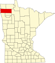
Saint Rosa is a city in Stearns County, Minnesota, United States. The population was 68 at the 2010 census. It is part of the St. Cloud Metropolitan Statistical Area.

<span class="mw-page-title-main">Georgetown, Mississippi</span> Town in Mississippi, United States

Georgetown is a town in Copiah County, Mississippi, United States. The population was 286 at the 2010 census. With its eastern border formed by the Pearl River, it is part of the Jackson Metropolitan Statistical Area.

<span class="mw-page-title-main">Westwood, Missouri</span> Village in Missouri, United States

Westwood is a village in west St. Louis County, Missouri, United States. The population was 278 at the 2010 census.

<span class="mw-page-title-main">Gardena, North Dakota</span> City in North Dakota, United States

Gardena is a city in Bottineau County, North Dakota, United States. The population was 24 at the 2020 census. Gardena was founded in 1905.

<span class="mw-page-title-main">West Unity, Ohio</span> Village in Ohio, United States

West Unity is a village in Williams County, Ohio, United States. The population was 1,763 at the 2020 census.

<span class="mw-page-title-main">Little Beaver Township, Lawrence County, Pennsylvania</span> Township in Pennsylvania, United States

Little Beaver Township is a township in Lawrence County, Pennsylvania, United States. The population was 1,227 at the time of the 2020 census, a decline from the figure of 1,411 tabulated in 2010.

<span class="mw-page-title-main">Warren South, Pennsylvania</span> Census-designated place in Pennsylvania, United States

Warren South is a former census-designated place (CDP) in Warren County, Pennsylvania, United States. The population was 1,651 at the 2000 census.

<span class="mw-page-title-main">Bailey, Texas</span> City in Texas, United States

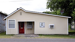
Bailey is a city in Fannin County, in the U.S. state of Texas. The population was 289 at the 2010 census, up from 213 at the 2000 census.

<span class="mw-page-title-main">Bellwood, Virginia</span> CDP in Virginia, United States

Bellwood is a census-designated place (CDP) in Chesterfield County, Virginia, United States. The population was 6,352 at the 2010 census. The community takes its name from Bellwood, one of the James River Plantations.

<span class="mw-page-title-main">Pennsboro, West Virginia</span> City in West Virginia, United States

Pennsboro is a city in Ritchie County, West Virginia, United States. The population was 1,050 at the 2020 census. The city is located at the junction of U.S. Route 50 and West Virginia Route 74; the North Bend Rail Trail also passes through the city.

<span class="mw-page-title-main">Hazel Green, Wisconsin</span> Village in Wisconsin, United States

Hazel Green is a village in Grant and Lafayette counties in the U.S. state of Wisconsin. The population was 1,256 at the 2010 census. Of this, 1,243 were in Grant County, and only 13 were in Lafayette County. The village is located mostly within the Town of Hazel Green in Grant County; only a small portion extends into the Town of Benton in Lafayette County.

References

  1. "2020 U.S. Gazetteer Files". United States Census Bureau. Retrieved July 24, 2022.
  2. 1 2 3 "Explore Census Data". United States Census Bureau . Retrieved May 19, 2022.
  3. 1 2 "City and Town Population Totals: 2020-2021". United States Census Bureau. June 25, 2022. Retrieved June 25, 2022.
  4. "US Board on Geographic Names". United States Geological Survey. October 25, 2007. Retrieved January 31, 2008.
  5. Upham, Warren (1920). Minnesota Geographic Names: Their Origin and Historic Significance. Minnesota Historical Society. p.  329.
  6. "US Gazetteer files 2010". United States Census Bureau. Archived from the original on January 25, 2012. Retrieved November 13, 2012.
  7. United States Census Bureau. "Census of Population and Housing" . Retrieved June 9, 2014.

Coordinates: 48°26′03″N96°09′51″W / 48.43417°N 96.16417°W / 48.43417; -96.16417