List of South American metropolitan areas by population

Last updated
Sao Paulo, the largest metropolitan area in South America. New Year S Eve Sao Paulo Bra (56608224).jpeg
São Paulo, the largest metropolitan area in South America.

This is a list of the fifty most populous metropolitan areas in South America as of 2015, the most recent year for which official census results, estimates or projections are available for every major metropolitan area in South America. All figures refer to mid-year populations.

Metropolitan areaPopulationYearCountry
1 São Paulo 21,090,792 [1] 2015Flag of Brazil.svg  Brazil
2 Buenos Aires 13,693,657 [lower-alpha 1] [3] [4] 2015Flag of Argentina.svg  Argentina
3 Rio de Janeiro 12,280,702 [1] 2015Flag of Brazil.svg  Brazil
4 Lima 9,904,727 [lower-alpha 2] [6] 2015Flag of Peru.svg  Peru
5 Bogotá 9,286,225 [lower-alpha 3] [8] 2015Flag of Colombia.svg  Colombia
6 Santiago 6,683,852 [lower-alpha 4] [10] 2015Flag of Chile.svg  Chile
7 Belo Horizonte 5,829,923 [1] 2015Flag of Brazil.svg  Brazil
8 Caracas 5,322,310 [lower-alpha 5] [13] 2015Flag of Venezuela.svg  Venezuela
9 Porto Alegre 4,258,926 [1] 2015Flag of Brazil.svg  Brazil
10 Brasília 4,201,737 [1] 2015Flag of Brazil.svg  Brazil
11 Fortaleza 3,985,297 [1] 2015Flag of Brazil.svg  Brazil
12 Salvador 3,953,290 [1] 2015Flag of Brazil.svg  Brazil
13 Recife 3,914,397 [1] 2015Flag of Brazil.svg  Brazil
14 Medellín 3,777,009 [lower-alpha 6] [8] 2015Flag of Colombia.svg  Colombia
15 Curitiba 3,502,804 [1] 2015Flag of Brazil.svg  Brazil
16 Campinas 3,094,181 [1] 2015Flag of Brazil.svg  Brazil
17 Guayaquil 2,952,159 [lower-alpha 7] [15] 2015Flag of Ecuador.svg  Ecuador
18 Cali 2,911,278 [lower-alpha 8] [8] 2015Flag of Colombia.svg  Colombia
19 Quito 2,653,330 [lower-alpha 9] [15] 2015Flag of Ecuador.svg  Ecuador
20 Maracaibo 2,576,836 [lower-alpha 10] [13] 2015Flag of Venezuela.svg  Venezuela
21 Manaus 2,523,819 [1] 2015Flag of Brazil.svg  Brazil
22 Asunción 2,482,760 [lower-alpha 11] [19] 2015Flag of Paraguay.svg  Paraguay
23 Paraíba Valley and North Coast 2,453,387 [1] 2015Flag of Brazil.svg  Brazil
24 Goiânia 2,421,833 [1] 2015Flag of Brazil.svg  Brazil
25 Belém 2,402,438 [1] 2015Flag of Brazil.svg  Brazil
26 Montevideo 2,059,988 [lower-alpha 12] [21] 2015Flag of Uruguay.svg  Uruguay
27 Barranquilla 2,025,071 [lower-alpha 13] [8] 2015Flag of Colombia.svg  Colombia
28 Santa Cruz de la Sierra 1,986,855 [lower-alpha 14] [24] 2015Bandera de Bolivia (Estado).svg  Bolivia
29 Vitória 1,910,101 [1] 2015Flag of Brazil.svg  Brazil
30 Sorocaba 1,888,073 [1] 2015Flag of Brazil.svg  Brazil
31 La Paz 1,849,504 [lower-alpha 15] [24] 2015Bandera de Bolivia (Estado).svg  Bolivia
32 Baixada Santista 1,797,500 [1] 2015Flag of Brazil.svg  Brazil
33 Valencia 1,544,004 [lower-alpha 16] [13] 2015Flag of Venezuela.svg  Venezuela
34 São Luís 1,538,131 [1] 2015Flag of Brazil.svg  Brazil
35 Córdoba 1,519,000 [lower-alpha 17] [28] 2015Flag of Argentina.svg  Argentina
36 Natal 1,504,819 [1] 2015Flag of Brazil.svg  Brazil
37 Rosario 1,429,000 [lower-alpha 18] [28] 2015Flag of Argentina.svg  Argentina
38 Piracicaba 1,412,721 [1] 2015Flag of Brazil.svg  Brazil
39 Norte Catarinense 1,344,089 [1] 2015Flag of Brazil.svg  Brazil
40 Barquisimeto 1,308,163 [lower-alpha 19] [13] 2015Flag of Venezuela.svg  Venezuela
41 Maceió 1,304,190 [1] 2015Flag of Brazil.svg  Brazil
42 João Pessoa 1,253,929 [1] 2015Flag of Brazil.svg  Brazil
43 Cochabamba 1,227,044 [lower-alpha 20] [24] 2015Bandera de Bolivia (Estado).svg  Bolivia
44 Teresina 1,194,911 [1] 2015Flag of Brazil.svg  Brazil
45 Maracay 1,189,314 [lower-alpha 21] [32] 2015Flag of Venezuela.svg  Venezuela
46 Cartagena 1,161,320 [lower-alpha 22] [8] 2015Flag of Colombia.svg  Colombia
47 Florianópolis 1,131,981 [1] 2015Flag of Brazil.svg  Brazil
48 Bucaramanga 1,122,945 [lower-alpha 23] [8] 2015Flag of Colombia.svg  Colombia
49 Mendoza 1,082,000 [lower-alpha 24] [28] 2015Flag of Argentina.svg  Argentina
50 Londrina 1,076,454 [1] 2015Flag of Brazil.svg  Brazil

Notes

  1. INDEC defines Greater Buenos Aires as comprising the Autonomous City of Buenos Aires plus twenty-four partidos of Buenos Aires Province, namely Almirante Brown, Avellaneda, Berazategui, Esteban Echeverría, Ezeiza, Florencio Varela, General San Martín, Hurlingham, Ituzaingó, José C. Paz, La Matanza, Lanús, Lomas de Zamora, Malvinas Argentinas, Merlo, Moreno, Morón, Quilmes, San Fernando, San Isidro, San Miguel, Tigre, Tres de Febrero and Vicente López. [2]
  2. INEI defines the Lima Metropolitan Area as comprising Lima Province and the Constitutional Province of Callao. [5]
  3. DANE defines the metropolitan area of Bogotá as comprising the Capital District and seventeen municipalities in Cundinamarca: Soacha, Facatativá, Zipaquirá, Chía, Mosquera, Madrid, Funza, Cajicá, Sibaté, Tocancipá, La Calera, Sopó, Tabio, Tenjo, Cota, Gachancipá and Bojacá. [7]
  4. The government of the Santiago Metropolitan Region defines the metropolitan area of Santiago as comprising Santiago Province, Cordillera Province and two communes (Calera de Tango and San Bernardo) in Maipo Province. [9]
  5. Population projection is that of the Sistema Metropolitano de Caracas, which comprises the five municipalities of the Metropolitan District of Caracas as well as the Altos Mirandinos Metropolitan Area, Guarenas-Guatire conurbation, Litoral Varguense conurbation and Valles del Tuy Metropolitan Area. [11] [12]
  6. Medellín's metropolitan area, officially known as the Metropolitan Area of the Aburrá Valley, comprises the municipalities of Barbosa, Bello, Caldas, Copacabana, Envigado, Girardota, Itagüí, La Estrella, Medellín and Sabaneta. [7]
  7. Population projection is that of the future Metropolitan District of Guayaquil, which will comprise the cantons of Guayaquil proper, Durán and Samborondón. [14]
  8. DANE defines the metropolitan area of Cali as comprising the municipalities of Cali, Jamundí, Palmira and Yumbo. [7]
  9. Population projection is that of Quito proper plus Rumiñahui Canton, which "is clearly within the suburban zone of the city of Quito." [16]
  10. The metropolitan area of Maracaibo comprises the municipalities of Jesús Enrique Lossada, La Cañada de Urdaneta, Mara, Maracaibo and San Francisco in the state of Zulia. [17]
  11. The Zona Metropolitana de Asunción (ZOMA) comprises twenty districts, including Asunción proper, fifteen districts in Central Department (all except Guarambaré, Nueva Italia, Villeta and Ypacaraí), and Benjamín Aceval, José Falcón, Nanawa and Villa Hayes districts in Presidente Hayes Department. [18]
  12. The metropolitan area of Montevideo comprises the departments of Montevideo proper, Canelones and San José. [20]
  13. The metropolitan area of Barranquilla comprises the municipalities of Barranquilla, Soledad, Galapa, Puerto Colombia and Malambo. [22]
  14. The government of Santa Cruz Department defines the metropolitan area of Santa Cruz as comprising Andrés Ibáñez Province and the municipality of Warnes in Ignacio Warnes Province. [23]
  15. A Metropolitan Development Agency for the La Paz area is currently being formed between the five municipalities of Pedro Domingo Murillo Province and the municipalities of Viacha in Ignacio Warnes Province and Laja in Los Andes Province. [25]
  16. The future Metropolitan District of Valencia will comprise the municipalities of Libertador, Los Guayos, Miguel Peña (currently still a parish within the municipality of Valencia), Naguanagua, San Diego and Valencia in the state of Carabobo. [26]
  17. INDEC defines Greater Córdoba as comprising the city of Córdoba proper plus nineteen localities in Colón Department, Córdoba Province. [27]
  18. INDEC defines Greater Rosario as comprising the city of Rosario proper plus the localities of Capitán Bermúdez, Fray Luis Beltrán, Funes, Granadero Baigorria, Puerto General San Martín, Pérez, Roldán, San Lorenzo, Soldini and Villa Gobernador Gálvez. [27]
  19. The metropolitan area of Barquisimeto comprises the municipalities of Iribarren and Palavecino in the state of Lara. [29]
  20. Cochabamba's metropolitan area, officially known as the Kanata Metropolitan Region, comprises the municipalities of Cochabamba proper, Quillacollo, Sipe Sipe, Tiquipaya, Vinto, Colcapirhua and Sacaba in Cochabamba Department. [30]
  21. The metropolitan area of Maracay comprises the city of Maracay proper plus the localities of Cagua, El Limón, Palo Negro, San Mateo, Santa Cruz, Santa Rita and Turmero in the state of Aragua. [31]
  22. The metropolitan area of Cartagena comprises the municipalities of Cartagena, Arjona, Turbaco and Turbana. [33]
  23. The metropolitan area of Bucaramanga comprises the municipalities of Bucaramanga, Floridablanca, Girón and Piedecuesta. [34]
  24. INDEC defines Greater Mendoza as comprising the city of Mendoza proper plus the localities of Capdeville, Godoy Cruz, Guaymallén, Las Heras, Luján de Cuyo, Maipú, and Papagayos. [27]

Related Research Articles

Misiones Department Department of Paraguay

Misiones is a department located in the southern region of Paraguay. Its capital is San Juan Bautista. The eighth of Paraguay's 17 departments, it was created in 1906, then known as the San Ignacio Department, and was not given its present name until 1945. Its current name reflects its status as home to several Jesuit Reductions, or missions.

San Vicente de Cañete Place in Lima, Peru

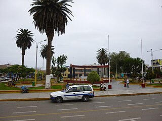
San Vicente de Cañete, commonly known as San Vicente or Cañete, is a city and capital of the Cañete Province, in southern Lima Region. With a population of 85,533.

Camaná Town in Arequipa, Peru

Camaná is the district capital of the homonymous province, located in the Department of Arequipa, Peru. In 2015, it had an estimate of 39,026 inhabitants.

Largest cities in the Americas Wikimedia list article

This is a list of the 50 largest cities in the Americas by population residing within city limits as of 2015, the most recent year for which official population census results, estimates or short-term projections are available for most of these cities. These figures do not reflect the population of the urban agglomeration or metropolitan area which typically do not coincide with the administrative boundaries of the city. For a list of the latter, see List of metropolitan areas in the Americas by population. These figures refer to mid-2015 populations with the following exceptions:

  1. Mexican cities, whose figures derive from the 2015 Intercensal Survey conducted by INEGI with a reference date of 15 March 2015;
  2. Calgary, whose 2015 municipal census had a reference date of April 1.
  3. Brazilian Cities, whose figures originate from the 2021 estimate given by the IBGE, with a reference date of July 1st, 2021.
Trujillo Province, Peru Province in La Libertad, Peru

Trujillo Province is one of twelve provinces in La Libertad Region in Peru.

Bagua Grande Village in Amazonas, Peru

Bagua Grande is a town in northern Peru, capital of Utcubamba Province, in the region Amazonas. It has an estimated 42,396 inhabitants, having changed from a rural to an urban area after experiencing much immigration in the 1960s. It is called by their inhabitants Corazón de Amazonas.

Chepén Place in La Libertad, Peru

Chepén is a city of La Libertad Region and capital of the Chepén Province, in Peru. The city is a rice production center with the valleys of Chepén and Jequetepeque, and has an active trading with neighboring Guadalupe, Pacasmayo and San Pedro de Lloc and other towns. It has factories in industrial dyes, food and primary production.

Moche, Trujillo Place in La Libertad Region, Peru

Moche is a Peruvian city, the capital of Moche District in Trujillo Province of La Libertad Region in northern Peru. It is located in the Moche Valley and was the center of development of the ancient Moche or Mochica culture. Now it is a major tourist destination of the Moche Route tourist circuit and It is part of the integrated area of Trujillo city.

Ilave Town in Puno, Peru

Ilave, also known as Illawi, is the capital city of the Ilave District in El Collao Province, in the Puno Region of Peru. According to the projection of the 2012 census, it has 57,366 inhabitants.

The Arequipa Metropolitan Area is the name used to refer to the metropolitan area whose principal city is Arequipa, according to Metropolitan Development Plan of Arequipa According to population statistics of INEI It is the second most populous metropolitan area of Peru in year 2017.

Iquitos metropolitan area Place in Peru

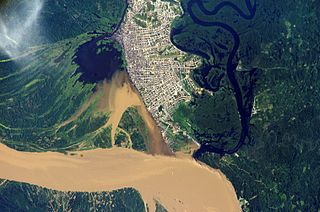
The Iquitos Metropolitan Area is the name used to refer to the Peruvian metropolitan area whose principal city is Iquitos, according to Municipality of Iquitos. According to population statistics of INEI It is the sixth most populous metropolitan area of Peru in year 2015.

References

  1. 1 2 3 4 5 6 7 8 9 10 11 12 13 14 15 16 17 18 19 20 21 22 23 24 25 26 "IBGE releases population estimates of the municipalities in 2015". IBGE. 2015-08-25. Retrieved 2016-04-25.
  2. ¿Qué es el Gran Buenos Aires? (PDF) (Report). INDEC. 2005. Archived from the original (PDF) on 2017-10-23. Retrieved 2016-04-25.
  3. "Población estimada al 1 de julio de cada año calendario por sexo, según comuna. Ciudad Autónoma de Buenos Aires. Años 2010-2025". INDEC. Archived from the original on 2015-06-12. Retrieved 2016-04-23.
  4. "Población estimada al 1 de julio de cada año calendario por sexo, según partido. Provincia de Buenos Aires. Años 2010-2025". INDEC. Archived from the original on 2015-09-24. Retrieved 2016-04-23.
  5. "PERÚ: LISTADO DE DISTRITOS QUE CONFORMAN LAS CIUDADES PRINCIPALES, SEGÚN DEPARTAMENTO". Perú: Estimaciones y Proyecciones de Población total y edades quinquenales, según Departamento, Provincia y Distrito, 2005-2015. INEI. November 2010. Retrieved 2016-04-23.
  6. "Cuadro Nº 11. Perú: Población total al 30 de junio, por grupos quinquenales de edad, según departamento y provincia, 2015". Perú: Estimaciones y Proyecciones de Población total y edades quinquenales, según Departamento, Provincia y Distrito, 2005-2015. INEI. November 2010. Retrieved 2016-04-23.
  7. 1 2 3 "Censo 2005" (PDF). DANE. Retrieved 2016-04-25.
  8. 1 2 3 4 5 6 "ESTIMACIONES DE POBLACIÓN 1985 - 2005 Y PROYECCIONES DE POBLACIÓN 2005 - 2020 TOTAL MUNICIPAL POR ÁREA". DANE. 2011-05-12. Retrieved 2016-04-25.
  9. Panorama de la población bajo la línea de pobreza en el Área Metropolitana de Santiago, periodo 1994 - 2009 (PDF) (Report). Ministry of Planning, Santiago Metropolitan Region. March 2011. p. 4. Retrieved 2016-04-25.
  10. "Comunas: Actualización Población 2002-2012 y Proyecciones 2013-2020". Instituto Nacional de Estadísticas . Retrieved 2016-04-25.
  11. "Caracas 2020. Diagnóstico". Mayor of the Metropolitan Area of Caracas. Archived from the original on 2016-03-05. Retrieved 2016-04-25.
  12. Alvarez, Rosangel. "Caracas: una ciudad de múltiples indefiniciones" (PDF). CONHISREMI. Revista Universitaria de Investigación y Diálogo Académico. p. 10. Archived from the original (PDF) on 2016-03-03. Retrieved 2016-04-25.
  13. 1 2 3 4 "Proyección de la población al 30 de junio con base al censo 2011, según entidad federal y municipios, 2000-2050". Instituto Nacional de Estadística. Retrieved 2016-04-23.
  14. "3. Niveles administrativos de planificación". National Secretary of Planning and Development. Retrieved 2016-04-26.
  15. 1 2 "Proyección de la Población Ecuatoriana, por años calenario, según cantones 2010-2020". Instituto Nacional de Estadística y Censos. Retrieved 2016-04-23.
  16. Murray, Sharon (1997). "2.3. General characteristics of the urban socio-ecosystem in Quito". Urban and Peri-Urban Forestry in Quito, Ecuador: a Case-Study. FAO . Retrieved 2016-04-26.
  17. Ordenanza de Contenido General Del Plan de Desarrollo Urbano Del Municipio Maracaibo (PDF) (Report). Maracaibo Municipal Council. 2005-01-18. p. 3. Archived from the original (PDF) on 2012-04-17. Retrieved 2016-04-25.
  18. Causarano, Mabel (2011). Paraguay: Regiones metropolitanas fronterizas. Una puesta al día (PDF) (Report). CEPAL. p. 7. Retrieved 2016-04-25.
  19. "Cuadro 1: Paraguay. Población nacional estimada y proyectada, según sexo, departamento, y distrito, 2000-2025". Paraguay. Proyección de la población por sexo y edad, según distrito, 2000-2025. Revisión 2015 (PDF) (Report). Dirección General de Estadística, Encuestas y Censos. October 2015. p. 32. Archived from the original (PDF) on 2015-10-16. Retrieved 2016-04-25.
  20. Informe Censos 2011: Montevideo y Área Metropolitana (PDF) (Report). Intendencia de Montevideo. p. 12. Retrieved 2016-04-26.
  21. "Poblaciones Estimadas y Proyectadas por Sexo y Edad según Departamentos: Período 1996-2025". Instituto Nacional de Estadística. Retrieved 2016-04-23.
  22. "Historia". Área metropolitana de Barranquilla. Retrieved 2016-04-25.
  23. Plan Departamental de Ordenamiento Territorial de Santa Cruz (PDF) (Report). Government of the Autonomous Department of Santa Cruz. Retrieved 2016-04-26.
  24. 1 2 3 "CUADRO Nº 3. BOLIVIA: PROYECCIONES DE POBLACIÓN, SEGÚN DEPARTAMENTO Y MUNICIPIO, 2012-2020". PROYECCIONES DE POBLACIÓN E INDICADORES DEMOGRÁFICOS, POR AÑOS CALENDARIO, 2012-2020. INE. 2014. Archived from the original on 2016-10-09. Retrieved 2016-04-25.
  25. "Crean la Agencia de Desarrollo Metropolitano". Servicio Departamental de Fortalecimiento Municipal y Comunitario. 2016-03-22. Retrieved 2016-05-05.
  26. LEY DE DIVISIÓN POLÍTICO-TERRITORIAL DEL ESTADO CARABOBO (PDF) (Report). Carabobo State Legislative Council. 2004-04-01. p. 20. Archived from the original (PDF) on 2016-03-03. Retrieved 2016-05-05.
  27. 1 2 3 Encuesta Permanente de Hogares: Mercado de trabajo, principales indicadores (Report). INDEC. 2015-02-18. pp. 28–29. Retrieved 2016-05-05.
  28. 1 2 3 Encuesta Permanente de Hogares: Mercado de trabajo, principales indicadores (Report). INDEC. 2015-11-16. p. 3. Retrieved 2016-05-05.
  29. "Amtt". Alcaldía de Iribarren. Retrieved 2016-05-05.
  30. "LEY N° 533". Plurinational Legislative Assembly. 2014-05-27. Retrieved 2016-05-05.
  31. Plan de Ordenación del Territorio del Estado Aragua (Report). Official Gazette of Aragua State. 1997-11-21. p. 4. Retrieved 2016-05-05.
  32. "Proyección de la población al 30 de junio, según entidad federal, municipios y parroquias, 2000-2050". Instituto Nacional de Estadística. Retrieved 2016-05-05.
  33. Ramírez, Juan Carlos; Parra-Peña S., Rafael Isidro (April 2013). Metrópolis de Colombia: aglomeraciones y desarrollo (PDF) (Report). CEPAL. p. 22. Retrieved 2016-05-06.
  34. "Nuestra Área". Área metropolitana de Bucaramanga. Retrieved 2018-04-21.