List of metropolitan areas in the Americas

Last updated

The New York metropolitan area, the most populous metropolitan area in the Americas with a population of 22,431,833 as of 2022 Past Vs. Present.png
The New York metropolitan area, the most populous metropolitan area in the Americas with a population of 22,431,833 as of 2022

The list of metropolitan areas in the Americas has the top 50 most populous as of the most recent census results or projections. It is impossible to definitively compare and rank areas because each country may set its own definition of metropolitan area. Where available, it uses official definitions of metropolitan areas based on one urban core and immediate surroundings, as opposed to polycentric conurbations. Population data are the most recent census results or projections from the authoritative national agency responsible for demographics.

Contents

List

Metropolitan areaCountryPopulationYearNotes
1 São Paulo Flag of Brazil.svg  Brazil 22,001,2812022 [1]
2 Mexico City Flag of Mexico.svg  Mexico 21,804,5152020 [2]
3 New York Flag of the United States (23px).png  United States 20,140,4702022 [3]
4 Buenos Aires Flag of Argentina.svg  Argentina 13,985,7942022 [lower-alpha 1] [5] [6]
5 Rio de Janeiro Flag of Brazil.svg  Brazil 13,191,0312022 [7]
6 Bogotá Flag of Colombia.svg  Colombia 12,772,8282022 [lower-alpha 2] [9]
7 Los Angeles Flag of the United States (23px).png  United States 12,872,3222022 [10]
8 Lima Flag of Peru.svg  Peru 11,283,7872022 [lower-alpha 3] [12]
9 Chicago Flag of the United States (23px).png  United States 9,876,3392022 [3]
10 Toronto Flag of Canada (Pantone).svg  Canada 9,765,1882022 [13]
11 San Francisco Flag of the United States (23px).png  United States 9,545,9212022 [3]
12 Miami Flag of the United States (23px).png  United States 9,484,4092022 [14]
13 Boston Flag of the United States (23px).png  United States 8,466,1862022 [3]
14 Dallas–Ft. Worth Flag of the United States (23px).png  United States 7,943,6852022 [14]
15 Houston Flag of the United States (23px).png  United States 7,368,4662022 [14]
16 Santiago Flag of Chile.svg  Chile 6,903,4792017 [15]
17 Washington Flag of the United States (23px).png  United States 6,304,9752023 [16]
18 Philadelphia Flag of the United States (23px).png  United States 6,241,1642022 [14]
19 Atlanta Flag of the United States (23px).png  United States 6,237,4352022 [14]
20 Belo Horizonte Flag of Brazil.svg  Brazil 6,194,0002022 [1]
22 Detroit–Windsor Flag of the United States (23px).png  United States
Flag of Canada (Pantone).svg  Canada
5,976,5952009 [17]
23 San Diego–Tijuana Flag of the United States (23px).png  United States
Flag of Mexico.svg  Mexico
5,434,0612020 [14] [2]
24 Monterrey Flag of Mexico.svg  Mexico 5,341,1712015 [2]
25 Guadalajara Flag of Mexico.svg  Mexico 5,286,6422015 [2]
26 Maracaibo Flag of Venezuela.svg  Venezuela 5,278,4482010 [18]
27 Caracas Flag of Venezuela.svg  Venezuela 5,243,3012011 [19]
28 Phoenix Flag of the United States (23px).png  United States 5,015,6782022 [14]
29 Porto Alegre Flag of Brazil.svg  Brazil 4,405,7692022 [1]
30 Montreal Flag of Canada (Pantone).svg  Canada 4,291,7322021 [13]
31 Santo Domingo Flag of the Dominican Republic.svg  Dominican Republic 4,274,6512022 [20]
32 Fortaleza Flag of Brazil.svg  Brazil 4,167,9962015 [1]
33 Medellín Flag of Colombia.svg  Colombia 4,068,0002022 [9]
34 Seattle Flag of the United States (23px).png  United States 4,034,2482022 [14]
35 Salvador Flag of Brazil.svg  Brazil 3,919,8642022 [1]
36 Recife Flag of Brazil.svg  Brazil 3,743,8542022 [1]
37 Curitiba Flag of Brazil.svg  Brazil 3,731,7692022 [1]
38 Minneapolis–St. Paul Flag of the United States (23px).png  United States 3,693,7292022 [14]
39 Campinas Flag of Brazil.svg  Brazil 3,656,3632022 [1]
40 Brasília Flag of Brazil.svg  Brazil 3,548,4382015 [1]
41 Tampa–St. Petersburg Flag of the United States (23px).png  United States 3,290,7302022 [14]
42 Puebla–Tlaxcala Flag of Mexico.svg  Mexico 3,199,5302020 [2]
43 San Jose Flag of Costa Rica.svg  Costa Rica 3,160,0002011 [21]
44 Guatemala City Flag of Guatemala.svg  Guatemala 3,160,0002024 [22]
45 Guayaquil Flag of Ecuador.svg  Ecuador 3,092,0002022 [23]
46 Denver Flag of the United States (23px).png  United States 2,985,8712022 [14]
47 Port-au-Prince Flag of Haiti.svg  Haiti 2,915,0002022 [24]
48 Quito Flag of Ecuador.svg  Ecuador 2,889,7032022 [25]
49 Cali Flag of Colombia.svg  Colombia 2,837,0002022 [9]
50 Baltimore Flag of the United States (23px).png  United States 2,835,6722022 [14]

Notes

  1. INDEC defines Greater Buenos Aires as comprising the Autonomous City of Buenos Aires plus 24 partidos of Buenos Aires Province, namely Almirante Brown, Avellaneda, Berazategui, Esteban Echeverría, Ezeiza, Florencio Varela, Hurlingham, Ituzaingó, José C. Paz, La Matanza, Lanús, Lomas de Zamora, Malvinas Argentinas, Merlo, Moreno, Morón, Quilmes, San Fernando, San Isidro, San Miguel, Tigre and Vicente López. [4]
  2. DANE defines the metropolitan area of Bogotá as comprising the Capital District and 17 municipalities in Cundinamarca: Soacha, Facatativá, Zipaquirá, Chía, Mosquera, Madrid, Funza, Cajicá, Sibaté, Tocancipá, La Calera, Sopó, Tabio, Tenjo, Cota, Gachancipá and Bojacá. [8]
  3. INEI defines the Lima Metropolitan Area as comprising Lima Province and the Constitutional Province of Callao. [11]

Related Research Articles

<span class="mw-page-title-main">Salta Province</span> Province of Argentina

Salta is a province of Argentina, located in the northwest of the country. Neighboring provinces are from the east clockwise Formosa, Chaco, Santiago del Estero, Tucumán and Catamarca. It also surrounds Jujuy. To the north it borders Bolivia and Paraguay and to the west lies Chile.

<span class="mw-page-title-main">Greater Buenos Aires</span> Urban agglomeration in Argentina

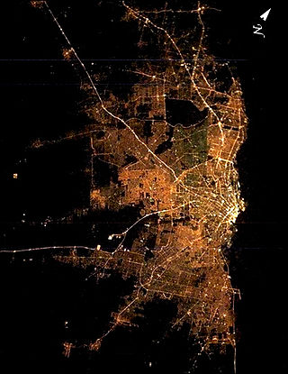
Greater Buenos Aires, also known as the Buenos Aires Metropolitan Area, refers to the urban agglomeration comprising the Autonomous City of Buenos Aires and the adjacent 24 partidos (districts) in the Province of Buenos Aires. Thus, it does not constitute a single administrative unit. The conurbation spreads south, west and north of Buenos Aires city. To the east, the River Plate serves as a natural boundary.

<span class="mw-page-title-main">Arequipa Province</span> Province in Arequipa, Peru

Arequipa is a province in the Arequipa Region, Peru. Its capital, Arequipa, is Peru's second most populous province of Peru. It borders the provinces of Islay, Camaná, Caylloma, and the Cusco and Puno regions. According to INEI in the year 2014 it has a population of 958.351 people.

<span class="mw-page-title-main">Largest cities in the Americas</span> List of largest cities located in The Americas

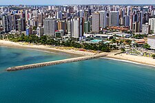
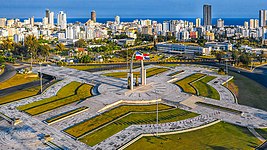
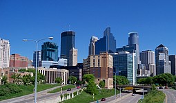
This is a list of the 50 largest cities in the Americas by population residing within city limits as of 2015, the most recent year for which official population census results, estimates, or short-term projections are available for most of these cities. These figures do not reflect the population of the urban agglomeration or metropolitan area which typically do not coincide with the administrative boundaries of the city. For a list of the latter, see List of metropolitan areas in the Americas by population. These figures refer to mid-2015 populations with the following exceptions:

  1. Mexican cities, whose figures derive from the 2015 Intercensal Survey conducted by INEGI with a reference date of 15 March 2015;
  2. Calgary, whose 2015 municipal census had a reference date of April 1.
  3. Brazilian cities, whose figures originate from the 2021 estimate given by the IBGE, with a reference date of July 1, 2021.
<span class="mw-page-title-main">Trujillo Province, Peru</span> Province in La Libertad, Peru

Trujillo Province is one of twelve provinces in La Libertad Region in Peru.

<span class="mw-page-title-main">Trancas Department</span> Department in Tucumán, Argentina

Trancas is a department located in the northern part of Tucumán Province, Argentina. It is bounded to the west and north by Salta Province, on the east by the Department of Burruyacú, to the south by the Department of Tafi Viejo and to the southwest by the Department of Tafí del Valle. The headquarters is the town of Trancas.

<span class="mw-page-title-main">Arequipa metropolitan area</span> Place in Peru

The Arequipa Metropolitan Area is the name used to refer to the metropolitan area whose principal city is Arequipa, according to Metropolitan Development Plan of Arequipa According to population statistics of INEI It is the second most populous metropolitan area of Peru in year 2017.

<span class="mw-page-title-main">Iquitos metropolitan area</span> Place in Peru

The Iquitos Metropolitan Area is the name used to refer to the Peruvian metropolitan area whose principal city is Iquitos, according to Municipality of Iquitos. According to population statistics of INEI It is the sixth most populous metropolitan area of Peru in year 2015.

<span class="mw-page-title-main">Comuna 1</span> Commune in Buenos Aires, Argentina

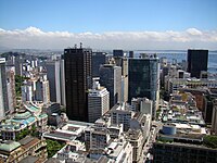
Comuna 1 is one of the 15 communes in which the Autonomous City of Buenos Aires is divided. It is made up of the neighborhoods of Retiro, San Nicolás, Puerto Madero, San Telmo, Monserrat and Constitución. It is located in the east of the city, has an area of 17.4 km2 and a total population of 205,886 according to the 2010 census of which 98,097 are men and 107,789 are women, which represent 47.6% and 52.4% of the commune respectively. The 2001 census registered 171,975 inhabitants, which represents an increase of 19.7%. With 50,948 inhabitants born outside the country, it is the commune that registers the highest proportion of foreigners (24.7%).

<span class="mw-page-title-main">Comuna 7</span> Commune in Buenos Aires, Argentina

Comuna 7 is one of the 15 communes in which the Autonomous City of Buenos Aires is divided. It is made up of the neighborhoods of Flores and Parque Chacabuco. It is located in the mid-southwest of the city, has an area of 12.4 km² and a total population of 220,591 according to the 2010 census of which 102,481 are men and 118,110 are women, which represent 46.5% and 53.5% of the commune respectively. The 2001 census registered 197,333 inhabitants, which represents an increase of 11.8%.

<span class="mw-page-title-main">Comuna 8</span> Commune in Buenos Aires, Argentina

Comuna 8 is one of the 15 communes in which the Autonomous City of Buenos Aires is divided. It is made up of the neighborhoods of Villa Soldati, Villa Lugano, and Villa Riachuelo. It is located in the southwest of the city, has an area of 21.9 km² and a total population of 187,237 according to the 2010 census of which 89,545 are men and 97,692 are women, which represent 47.8% and 52.2% of the commune respectively. The 2001 census registered 161,642 inhabitants, which represents an increase of 15.8%, being the commune that grew the second most in the last nine years. It is the commune with the second highest proportion of foreigners (23.4%), mostly from bordering countries, 2 of which 46.6% is of Bolivian origin, followed by those of Paraguayan origin (37.9%).

References

  1. 1 2 3 4 5 6 7 8 9 "Censo do IBGE : consulte a população atualizada por cidade". Exame (in Brazilian Portuguese). 2022.
  2. 1 2 3 4 5 "Censo de Población y Vivienda 2020 - SCITEL" (in Spanish). Retrieved 2021-01-26.
  3. 1 2 3 4 Bureau, U. S. Census. "U.S. Census website". United States Census Bureau . Retrieved 2023-03-02.
  4. ¿Qué es el Gran Buenos Aires? (PDF) (Report). INDEC. 2005. Archived from the original (PDF) on 2017-10-23. Retrieved 2016-04-25.
  5. "Población estimada al 1 de julio de cada año calendario por sexo, según comuna. Ciudad Autónoma de Buenos Aires. Años 2010-2025". INDEC. Archived from the original on 2015-06-12. Retrieved 2016-04-23.
  6. "Población estimada al 1 de julio de cada año calendario por sexo, según partido. Provincia de Buenos Aires. Años 2010-2025". INDEC. Archived from the original on 2015-09-24. Retrieved 2016-04-23.
  7. "IBGE releases population estimates of the municipalities in 2015". IBGE. 2015-08-25. Retrieved 2016-04-25.
  8. "Censo 2005" (PDF). DANE. Retrieved 2016-04-25.
  9. 1 2 3 "ESTIMACIONES DE POBLACIÓN 1985 - 2005 Y PROYECCIONES DE POBLACIÓN 2005 - 2020 TOTAL MUNICIPAL POR ÁREA". DANE. 2011-05-12. Retrieved 2016-04-25.
  10. "Revised Delineations of Metropolitan Statistical Areas, Micropolitan Statistical Areas, and Combined Statistical Areas, and Guidance on Uses of the Delineations of These Areas" (PDF). Office of Management and Budget. March 6, 2020. 0MB BULLETIN NO. 20-01. Retrieved December 6, 2021.
  11. "PERÚ: LISTADO DE DISTRITOS QUE CONFORMAN LAS CIUDADES PRINCIPALES, SEGÚN DEPARTAMENTO". Perú: Estimaciones y Proyecciones de Población total y edades quinquenales, según Departamento, Provincia y Distrito, 2005-2015. INEI. November 2010. Retrieved 2016-04-23.
  12. "Cuadro Nº 11. Perú: Población total al 30 de junio, por grupos quinquenales de edad, según departamento y provincia, 2015". Perú: Estimaciones y Proyecciones de Población total y edades quinquenales, según Departamento, Provincia y Distrito, 2005-2015. INEI. November 2010. Retrieved 2016-04-23.
  13. 1 2 "Annual demographic estimates by census metropolitan area, age and sex, based on the Standard Geographical Classification (SGC) 2011". Statistics Canada. 2018-02-13. Retrieved 2018-12-10.
  14. 1 2 3 4 5 6 7 8 9 10 11 12 Bureau, US Census. "Metropolitan and Micropolitan Statistical Areas Population Totals: 2020-2022". Census.gov. Retrieved 2023-11-27.
  15. "Censo de Población y Vivienda". Default. Retrieved 2023-11-27.
  16. Bureau, U. S. Census. "Metropolitan and Micropolitan Statistical Areas Population Totals: 2020-2023". United States Census Bureau . Retrieved 2024-04-30.
  17. World Agglomerations Retrieved on May 24, 2009.
  18. Archived November 14, 2009, at the Wayback Machine
  19. "Proyección de la población al 30 de junio con base al censo 2011, según entidad federal y municipios, 2000-2050". Instituto Nacional de Estadística. Retrieved 2016-04-23.
  20. "Informe básico XCPV" . Retrieved 1 February 2024.
  21. "X Censo Nacional de Población y VI de Vivienda 2011: Resultados Generales" [10th National Population Census and 6th Housing Census 2011: General Results](PDF). Archived from the original (PDF) on 2012-10-21. Retrieved 2012-09-27.
  22. Macrotrends Metro Area Estimate 2024
  23. "Proyección de la Población Ecuatoriana, por años calenario, según cantones 2010-2020". Instituto Nacional de Estadística y Censos. Retrieved 2016-04-23.
  24. POPULATION TOTALE, DE 18 ANS ET PLUS MENAGES ET DENSITES ESTIMES EN 2015 (PDF) (Report). Institut Haïtien de Statistique et d’Informatique (IHSI). March 2015. p. 23. Archived from the original (PDF) on 2015-11-06. Retrieved 2015-04-25.
  25. Citypopulation.de Population and area of Quito