List of metropolitan areas in Oceania by population

Last updated

This list ranks metropolitan areas in Oceania by their population; it includes metropolitan areas that have a population of over 100,000 people.

Contents

Sources and definitions

Metropolitan areas are listed as defined by their jurisdiction.

For Australia, metropolitan areas are defined as per the Greater Capital City Statistical Area (GCCSA) or Significant Urban Area (SUA) designations of the Australian Statistical Geography Standard (ASGS), as appropriate.

For New Zealand, metropolitan areas are defined as per the Functional Urban Area (FUA) classification [1] and population statistics are sourced from the Statistics New Zealand population estimates and projections.

For the United States, metropolitan areas are defined as per the Metropolitan Statistical Area (MSA) as defined by The United States Office of Management and Budget.

Metropolitan areas

RankMetropolitan area nameCountryPopulationUrban area (km2)Urban population density (people/km2)Territorial area (km2)Regions and municipalities encompassed
1Greater SydneyFlag of Australia (converted).svg  Australia 5,367,206 [2] 2,554.00 [3] 2,10116,367.70 Sydney, Parramatta, Penrith Greater Western Sydney, Central Coast (sometimes)
2Greater MelbourneFlag of Australia (converted).svg  Australia 5,159,211 [2] 2,453.00 [3] 2,1039,993.00 Melbourne, Bacchus Marsh, Gisborne-Macedon, Melton
3Greater BrisbaneFlag of Australia (converted).svg  Australia 2,560,720 [2] 1,342.701,02515,842.00 City of Brisbane, Ipswich, Logan City, Moreton Bay, Redland City
4 Greater Perth Flag of Australia (converted).svg  Australia 2,125,114 [2] 1,150.001,0896,417.90 Perth, Yanchep
5AucklandFlag of New Zealand.svg  New Zealand 1,661,114 [4] 747.50 [5] 2,4103,358,80 Auckland, Hibiscus Coast, Pukekohe, Helensville, Waimauku, Kumeu-Huapai, Riverhead, Beachlands-Pine Harbour, Maraetai, Waiuku, Tuakau, Pokeno [1]
6Greater AdelaideFlag of Australia (converted).svg  Australia 1,359,760 [2] 750.441,3933,259.80 Adelaide, Adelaide Hills
7Urban HonoluluFlag of the United States.svg  United States 953,207 [6] 440.70 [7] 2,2381,560.00 Honolulu, Honolulu County
8Gold Coast–Tweed HeadsFlag of Australia (converted).svg  Australia 709,495 [2] 648.00926 Gold Coast, Tweed Heads
9Christchurch [8] Flag of New Zealand.svg  New Zealand 510,661 [4] 387.20 [5] 1,2902,408.10 Christchurch, Rolleston, Lincoln, Prebbleton, Leeston, West Melton, Kaiapoi, Rangiora, Woodend, Pegasus [1]
10Newcastle–MaitlandFlag of Australia (converted).svg  Australia 498,095 [2] 441.20907 Newcastle, Maitland
11Canberra–QueanbeyanFlag of Australia (converted).svg  Australia 464,995 [2] 401.401,1582,342.00 Canberra, Queanbeyan
12WellingtonFlag of New Zealand.svg  New Zealand 441,230 [4] 379.72 [5] 1,3091,754.90 Wellington, Porirua, Lower Hutt, Upper Hutt, Featherston, Greytown [1]
13JayapuraFlag of Indonesia.svg  Indonesia 398,478 [9] 935.9274940.00 Jayapura
14Port MoresbyFlag of Papua New Guinea.svg  Papua New Guinea 364,145 [10] 266.501,366 Port Moresby
15Sunshine CoastFlag of Australia (converted).svg  Australia 348,343 [2] 321.00758 Sunshine Coast, Noosa
16Sorong metropolitan areaFlag of Indonesia.svg  Indonesia 345,342 [9] 656.60290 Sorong, Sorong Regency
17Central CoastFlag of Australia (converted).svg  Australia 337,284 [2] 1,681.00206 Gosford, Wyong, Terrigal
18WollongongFlag of Australia (converted).svg  Australia 309,345 [2] 684.00323 Wollongong
19GeelongFlag of Australia (converted).svg  Australia 282,412 [2] 168.60932 Geelong
20Greater Suva Urban AreaFlag of Fiji.svg  Fiji 221,150 [11] 50.00180521 Suva, Nasinu, Nausori, Lami
21HamiltonFlag of New Zealand.svg  New Zealand 219,455 [4] 119.80 [5] 1,6171,412.70 Hamilton, Ngaruawahia [1]
22HobartFlag of Australia (converted).svg  Australia 219,071 [2] 77.91696 Hobart
23TownsvilleFlag of Australia (converted).svg  Australia 183,322 [2] 261.30646 Townsville
24Greater Nouméa Urban AreaFlag of FLNKS.svg  New Caledonia 182,341 [12] 122.4514891,643.00 [13] Nouméa, Dumbéa, Le Mont-Dore, Païta
25TaurangaFlag of New Zealand.svg  New Zealand 178,463 [4] 139.20 [5] 1,132790.20 Tauranga, Omokoroa [1]
26CairnsFlag of Australia (converted).svg  Australia 155,340 [2] 198.60729 Cairns
27Dededo-Machanao-Apotgan Urban ClusterFlag of Guam.svg  Guam 139,825 [6] 93.6677 Dededo, Machanao, Apotgan
28ToowoombaFlag of Australia (converted).svg  Australia 139,526 [2] 114.1877 Toowoomba
29PapeeteFlag of French Polynesia.svg  French Polynesia 136,771 [12] 299.50 [13] 1,547457 Papeete, Pīra'e, Arue, Māhina, Fa'a'ā, Puna'auia, Pā'ea
30DarwinFlag of Australia (converted).svg  Australia 133,268 [2] 111.30727 Darwin
31Greater Honiara AreaFlag of the Solomon Islands.svg  Solomon Islands 130,176 [14] 133.00 [15] 9792,746 Honiara, Tandai, Malango
32DunedinFlag of New Zealand.svg  New Zealand 128,483 [4] 163.10 [5] 4101,033.8 Dunedin, Brighton, Mosgiel, Waikouaiti [1]
33BallaratFlag of Australia (converted).svg  Australia 109,533 [2] 739.00153 Ballarat
34ManokwariFlag of Indonesia.svg  Indonesia 107,325 [9] 392.082748,665 Manokwari
35BendigoFlag of Australia (converted).svg  Australia 102,499 [2] 164.90560 Bendigo
36LaeFlag of Papua New Guinea.svg  Papua New Guinea 100,677 [10] 130.891,138 Lae, Ahi Rural LLG

See also

Related Research Articles

<span class="mw-page-title-main">North Island</span> One of the two main New Zealand islands

The North Island, also officially named Te Ika-a-Māui, is one of the two main islands of New Zealand, separated from the larger but less populous South Island by Cook Strait. With an area of 113,729 km2 (43,911 sq mi), it is the world's 14th-largest island. It has a population of 3,922,000, which is 77% of New Zealand's residents, making it the most populous island in Polynesia and the 28th-most-populous island in the world.

<span class="mw-page-title-main">Wellington Region</span> Region of New Zealand

<span class="mw-page-title-main">South Wairarapa District</span> Territorial authority district in Wellington, New Zealand

The South Wairarapa District is a district at the south-east tip of the North Island of New Zealand, governed by the South Wairarapa District Council. The district comprises the southernmost part of the Wairarapa, and is part of the Wellington Region.

<span class="mw-page-title-main">Auckland Region</span> Region of New Zealand

Auckland is one of the sixteen regions of New Zealand, which takes its name from the eponymous urban area. The region encompasses the Auckland Metropolitan Area, smaller towns, rural areas, and the islands of the Hauraki Gulf. Containing 33 percent of the nation's residents, it has by far the largest population and economy of any region of New Zealand, but the second-smallest land area.

<span class="mw-page-title-main">Richmond, New Zealand</span> Town in Tasman District, New Zealand

Richmond is a town and the seat of the Tasman District Council in New Zealand. It lies 13 kilometres (8 mi) south of Nelson in the South Island, close to the southern extremity of Tasman Bay. The town, first settled by Europeans in 1842, was named in 1854 after the town of Richmond on Thames near London. The town has an estimated population of 18,450 as of June 2022.

<span class="mw-page-title-main">Ngatea</span> Place in Waikato region, New Zealand

Ngatea is a small town on the Hauraki Plains in the North Island of New Zealand. It is located 18 kilometres southwest of Thames and 70 kilometres southeast of Auckland. Ngatea lies on the Piako River, eight kilometres south of its outflow into the Firth of Thames.
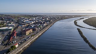
<span class="mw-page-title-main">Grey District</span> Territorial authority district in West Coast Regional Council, New Zealand

Grey District is a district in the West Coast Region of New Zealand that covers Greymouth, Runanga, Blackball, Cobden, and settlements along the Grey River. It has a land area of 3,474.44 square kilometres (1,341.49 sq mi). The seat of the Grey District Council, the local government authority that administers the district, is at Greymouth, where 58.6% of the district's population live.

<span class="mw-page-title-main">Ātiamuri</span> Hydro village in Waikato region, New Zealand

Ātiamuri is a former hydro village in the central North Island of New Zealand. It lies alongside State Highway 1 about 27 km south of Tokoroa and 38 km north of Taupō. It is bordered by the Waikato River and surrounded by pine plantations. Upper Ātiamuri, just north of the Waikato River, is a small community of lifestyle blocks, dairy farms and farm servicing businesses.

<span class="mw-page-title-main">Kimbolton, New Zealand</span> Settlement in Manawatū-Whanganui Region, New Zealand

Kimbolton is a rural village north of Feilding in the Manawatū District of the North Island of New Zealand. Kimbolton is named after Kimbolton, Cambridgeshire, a village in England which is the site of Kimbolton Castle, once the home of the Duke of Manchester. It was originally called Birmingham, after Birmingham, England.

<span class="mw-page-title-main">Tata Beach</span> Settlement in Tasman District, New Zealand

Tata Beach is a beach and small coastal settlement of predominantly holiday houses in the South Island, New Zealand. Found in the Golden Bay region, it is approximately 20 kilometres (12 mi) north-east of Tākaka.

Grovetown is a small town in Marlborough, New Zealand. State Highway 1 runs past the settlement to the west, and the Wairau River flows past to the northeast. Spring Creek is about 2.5 km to the north, and Blenheim is about 3.5 km to the south. To the east is Grovetown Lagoon, an oxbow loop of the Wairau River. The settlement had a usual resident population of 357 at the 2018 New Zealand census.

Egmont Village is a settlement in Taranaki, New Zealand. State Highway 3 runs through it. New Plymouth is 12 km to the north-west, and Inglewood is 6 km to the south-east. Waiwhakaiho River and Mangaoraka Stream flow past to the west and east, respectively.

<span class="mw-page-title-main">Taylorville, New Zealand</span> Town in New Zealand

Taylorville is a small town on the banks of the Grey River, It is roughly 10 kilometers from the mouth of the river in Greymouth.

<span class="mw-page-title-main">Rārangi</span> Town in Marlborough, New Zealand

Rārangi is a very small town in the South Island of New Zealand which is approximately 15 minutes drive to the north-east of Blenheim, on the coast of Cloudy Bay.

Kerepehi is a rural community in the Hauraki District and Waikato region of New Zealand's North Island. The alternative spelling Kerepeehi was in use until 1933.

<span class="mw-page-title-main">Whakatāne District</span> Territorial authority district in Bay of Plenty, New Zealand

Whakatāne District is a territorial authority district on the North Island of New Zealand. The Whakatāne District Council is headquartered in the largest town, Whakatāne. The district falls within the Bay of Plenty Region. Victor Luca has been the mayor of Whakatāne since the 2022 local elections.

<span class="mw-page-title-main">Haruru, New Zealand</span> Locality in New Zealand

Haruru is a residential and commercial locality in the Far North District of New Zealand. State Highway 11 runs through the locality. Puketona is 10 kilometres west, and Paihia is 4 kilometres east, The name means a continuous noise or roar in the Māori language, which refers to the sound of Haruru Falls, a five metre high broad waterfall about a kilometre away.

<span class="mw-page-title-main">Tanners Point</span> Rural settlement in the Bay of Plenty, New Zealand

Tanners Point is a rural settlement in the Western Bay of Plenty District and Bay of Plenty Region of New Zealand's North Island. It is on a headland on the eastern side of Tauranga Harbour, opposite Katikati Entrance.

References

  1. 1 2 3 4 5 6 7 "Functional urban areas – methodology and classification | Stats NZ". www.stats.govt.nz. Retrieved 2022-11-18.
  2. 1 2 3 4 5 6 7 8 9 10 11 12 13 14 15 16 17 18 19 "Australian Bureau of Statistics". abs.gov.au. Retrieved 12 March 2022.
  3. 1 2 "Australian cities among the largest and least densely settled in the world". architectureau.com. 20 April 2017. Retrieved 14 April 2020.
  4. 1 2 3 4 5 6 "Subnational population estimates (RC, SA2), by age and sex, at 30 June 1996-2022 (2022 boundaries)". Statistics New Zealand . Retrieved 25 October 2022. (regional councils); "Subnational population estimates (TA, SA2), by age and sex, at 30 June 1996-2022 (2022 boundaries)". Statistics New Zealand . Retrieved 25 October 2022. (territorial authorities); "Subnational population estimates (urban rural), by age and sex, at 30 June 1996-2022 (2022 boundaries)". Statistics New Zealand . Retrieved 25 October 2022. (urban areas)
  5. 1 2 3 4 5 6 "StatsNZ NZ Function Urban Areas". statsmaps.cloud.eaglegis.co.nz. Retrieved 24 March 2022.
  6. 1 2 "United States Census Bureau, Population Division Viewer". www.census.gov. Retrieved 12 March 2022.
  7. "United States Census Bureau, Population Division Viewer". www.census.gov. Retrieved 12 March 2022.
  8. "Our Population - Canterbury Wellbeing Index". www.canterburywellbeing.org.nz. Retrieved 2022-11-15.
  9. 1 2 3 "Hasil Sensus Penduduk 2020 di Provinsi Papua". papua.bps.go.id. Retrieved 12 March 2022.
  10. 1 2 "PAPUA NEW GUINEA 2011 NATIONAL REPORT - CENSUS 2011". www.spc.int/. Retrieved 12 March 2022.
  11. "Census 2017 of Population & Housing". www.statsfiji.gov.fj/. Retrieved 12 March 2022.
  12. 1 2 "Population, ménages et logement par commune, en 2019". ISEE. Retrieved 12 March 2022.
  13. 1 2 "Tableaux de l'économie calédonienne, Chapitre 1 : TERRITOIRE-ENVIRONNEMENT" (PDF). ISEE. Retrieved 12 March 2022.
  14. "2019 Census". ISEE. Retrieved 12 March 2022.
  15. "GREATER HONIARA URBAN DEVELOPMENT STRATEGY AND ACTION PLAN" (PDF). Asian Development Bank. Retrieved 12 March 2022.