This is a list of wildlife management areas in West Virginia.

Cumberland County is a county located in the U.S. state of Tennessee. As of the 2010 census, the population was 56,053. Its county seat is Crossville.

The Monongahela National Forest is a national forest located in the Allegheny Mountains of eastern West Virginia, USA. It protects over 921,000 acres of federally owned land within a 1,700,000 acres proclamation boundary that includes much of the Potomac Highlands Region and portions of 10 counties.

Nathaniel Mountain Wildlife Management Area is located on 10,675 acres (43.20 km2) south of Romney in Hampshire County, West Virginia. The wildlife management area's principle access road is off Grassy Lick Road. Nathaniel Mountain is owned by the West Virginia Division of Natural Resources (WVDNR), and is one of West Virginia's largest wildlife management areas. The WMA was expanded in November 2003 after the WVDNR purchased 1,800 acres (7.3 km2) from the MeadWestvaco Corporation.
Short Mountain Wildlife Management Area is located on 8,005 acres (32.40 km2) eight miles (13 km) south of Augusta off Augusta-Ford Hill Road in Hampshire County, West Virginia. Short Mountain WMA is owned by the West Virginia Division of Natural Resources.

National Conservation Lands, formally known as the National Landscape Conservation System, is a 35-million-acre (140,000 km2) collection of lands in 873 federally recognized areas considered to be the crown jewels of the American West. These lands represent 10% of the 258 million acres (1,040,000 km2) managed by the Bureau of Land Management (BLM). The BLM is the largest federal public land manager and is responsible for over 40% of all the federal public land in the nation. The other major federal public land managers include the US Forest Service (USFS), National Park Service (NPS), and the US Fish and Wildlife Service (USFWS).

The Minnesota Department of Natural Resources is the agency of the U.S. state of Minnesota charged with conserving and managing the state's natural resources. The agency maintains areas such as state parks, state forests, recreational trails, and recreation areas as well as managing minerals, wildlife, and forestry throughout the state. The agency is divided into six divisions - Ecological & Water Resources, Enforcement, Fish & Wildlife, Forestry, Lands & Minerals, and Parks & Trails.

Canaan Valley Resort State Park is a state park in the eastern United States, within Canaan Valley in Tucker County, West Virginia. Located in the highest valley east of the Mississippi River, the park contains the second-largest inland wetland area in the United States. The valley featured the first commercial ski development in West Virginia.
The Recreational Demonstration Area program was a National Park Service program during the 1930s and early 1940s that built forty-six public parks in twenty-four states on 397,000 acres (1,606.6 km2), chiefly near urban areas in the United States. The NPS used labor from a variety of Great Depression federal relief programs, chiefly the Civilian Conservation Corps and Works Progress Administration, to build recreational demonstration areas. By the end of World War II, the recreational demonstration areas had all either become National Park Service units or been given to their states for use as state parks.
The Iowa Department of Natural Resources is a department/agency of the U.S. state of Iowa formed in 1986, charged with maintaining state parks and forests, protecting the environment of Iowa, and managing energy, fish, wildlife, land resources, and water resources of Iowa.
A conservation officer is a law enforcement officer who protects wildlife and the environment. A conservation officer may also be referred to as an environmental technician or technologist, game warden, forest ranger, forest watcher, forest guard, forester, gamekeeper, investigator, wilderness officer, wildlife officer, or wildlife trooper. In Canada, all of these fall under the rubric of National Occupational Classification code 2224.
The West Virginia Division of Natural Resources (WVDNR) is an agency of the government of the U.S. state of West Virginia. While formerly known as the cabinet-level Department of Natural Resources, it is now part of the West Virginia Department of Commerce. The WVDNR is responsible for wildlife management, hunting and fishing regulations, and boater safety and also oversees state parks and resorts. It also operates the West Virginia State Wildlife Center, a zoo in French Creek that exhibits West Virginian wildlife.

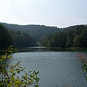
Berwind Lake Wildlife Management Area is located on 85 acres (340,000 m2) near War in McDowell County, West Virginia. The wildlife management area is centered on 20-acre (81,000 m2) Berwind Lake.

Beury Mountain Wildlife Management Area is located on 9,232 acres (3,736 ha) near Babcock State Park and New River Gorge National River in Fayette County, West Virginia. Beury Mountain's sloping terrain is covered with mixed hardwoods and oak-hickory second growth woodlands overlooking New River Gorge. Camping is not allowed at Beury Mountain WMA, but is available at nearby Babcock State Park.

Burches Run Wildlife Management Area, formerly Burches Run Lake WMA, is located on 55 acres (22 ha) near Wheeling in Marshall County, West Virginia. Until 2005 the wildlife management area contained a lake impounded by a dam at risk of failure. The name change occurred after the dam was removed. The terrain climbs gently above Burches Run and is covered by a mature oak-hickory second-growth forest.

New York State Wildlife Management Areas (WMAs) are conservation areas managed by the New York State Department of Environmental Conservation (NYSDEC) primarily for the benefit of wildlife, and used extensively by the public for hunting, fishing, and trapping. As of 2016, the NYSDEC owns and maintains 113 WMAs, with a total area of approximately 197,000 acres. The Wildlife Management Areas program is administered by the Division of Fish, Wildlife and Marine Resources of the NYSDEC.

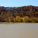
Bluestone Wildlife Management Area is a wildlife management area in southern West Virginia surrounding Bluestone Lake and the New River. The section of the lake from just upstream of the Bluestone River to Bluestone Dam is in Bluestone State Park; the rest of the lake in West Virginia basin comprises Bluestone WMA. All together, the WMA comprises 18,019 acres (72.92 km2) of land and water.
The former Fork Creek Wildlife Management Area was located on 7,000 acres (2,800 ha) in Boone County near Nellis, West Virginia. The steep terrain and narrow valleys are mostly covered with second-growth mixed hardwoods.

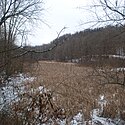
Laurel Lake Wildlife Management Area is located between Dingess and Lenore in Mingo County, West Virginia. Located on 12,856 acres (5,203 ha) of steep terrain with narrow valleys and ridgetops, the WMA contains second growth mixed hardwoods and hemlock with thick understory of mountain laurel and rhododendron.

Fairfax Pond-Rehe Wildlife Management Area is located on 638 acres (258 ha) south of Reedsville in Preston County, West Virginia. The wildlife management area is centered on a series of ponds and wetlands remaining from previous strip mining operations. The land was acquired in 2014.
| Wikimedia Commons has media related to Wildlife management areas of West Virginia . |