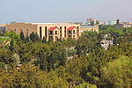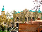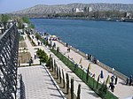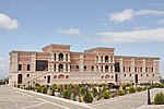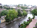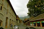
Azerbaijan is a country in the Caucasus region, situated at the juncture of Eastern Europe and West Asia. Three physical features dominate Azerbaijan: the Caspian Sea, whose shoreline forms a natural boundary to the east; the Greater Caucasus mountain range to the north; and the extensive flatlands at the country's center. About the size of Portugal or the US state of Maine, Azerbaijan has a total land area of approximately 86,600 km², less than 1% of the land area of the former Soviet Union. Of the three Transcaucasian states, Azerbaijan has the greatest land area. Special administrative subdivisions are the Nakhchivan Autonomous Republic, which is separated from the rest of Azerbaijan by a strip of Armenian territory, and the Nagorno-Karabakh Autonomous Region, entirely within Azerbaijan. The status of Nagorno-Karabakh is disputed by Armenia, but is internationally recognized as territory of Azerbaijan.

Baku is the capital and largest city of Azerbaijan, as well as the largest city on the Caspian Sea and in the Caucasus region. Baku is 28 metres (92 ft) below sea level, which makes it the lowest lying national capital in the world and also the largest city in the world below sea level. Baku lies on the southern shore of the Absheron Peninsula, on the Bay of Baku. Baku's urban population was estimated at two million people as of 2009. Baku is the primate city of Azerbaijan—it is the sole metropolis in the country, and about 25% of all inhabitants of the country live in Baku's metropolitan area.

Russia is the largest country in the world, covering over 17,125,192 km2 (6,612,074 sq mi), and encompassing more than one-eighth of Earth's inhabited land area. Russia extends across eleven time zones, and has the most borders of any country in the world, with sixteen sovereign nations.

West Asia, also called Western Asia or Southwest Asia, is the westernmost region of Asia. As defined by most academics, UN bodies and other institutions, the subregion consists of Anatolia, the Arabian Peninsula, Iran, Mesopotamia, the Armenian highlands, the Levant, the island of Cyprus, the Sinai Peninsula and the South Caucasus. The region is separated from Africa by the Isthmus of Suez in Egypt, and separated from Europe by the waterways of the Turkish Straits and the watershed of the Greater Caucasus. Central Asia lies to its northeast, while South Asia lies to its east. Twelve seas surround the region (clockwise): the Aegean Sea, the Sea of Marmara, the Black Sea, the Caspian Sea, the Persian Gulf, the Gulf of Oman, the Arabian Sea, the Gulf of Aden, the Red Sea, the Gulf of Aqaba, the Gulf of Suez, and the Mediterranean Sea. West Asia contains the majority of the similarly defined Middle East, but excludes most of Egypt and the northwestern part of Turkey, and includes the southern part of the Caucasus.

Ujar District is one of the 69 districts of Azerbaijan. It is located in the centre of the country and belongs to the Central Aran Economic Region. The district borders the districts of Agdash, Goychay, Kurdamir, and Zardab. Its capital and largest city is Ujar. As of 2020, the district had a population of 89,500.
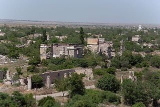
Aghdam District is one of the 69 administrative divisions of Azerbaijan. It is located in the west of the country and belongs to the Karabakh Economic Region. The district borders the districts of Khojaly, Kalbajar, Tartar, Khojavend, Aghjabadi, and Barda. Its capital is de jure Aghdam, though the current de facto capital is Quzanlı. As of 2020, the district had a nominal population of 204,000.
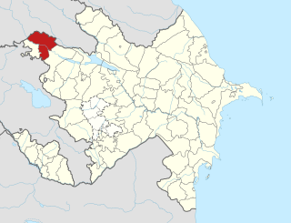
Aghstafa District is one of the 69 districts of Azerbaijan. Located in the northwest of the country, it belongs to the Gazakh-Tovuz Economic Region. The district borders the districts of Qazakh, Tovuz, as well as the Kakheti and Kvemo Kartli regions of Georgia. Its capital and largest city is Aghstafa. As of 2020, the district had a population of 88,500.

Balakan District is one of the 69 districts of Azerbaijan. It is located in the north of the country, in the Shaki-Zagatala Economic Region. The district borders the district of Zagatala, as well as the Kakheti region of Georgia and the Russian Republic of Dagestan. Its capital and largest city is Balakan. As of 2020, the district had a population of 99,100.

Hajigabul District is one of the 69 districts of Azerbaijan. It is located in the east of the country, in the Shirvan-Salyan Economic Region. The district borders the districts of Kurdamir, Agsu, Shamakhi, Gobustan, Absheron, Baku, Salyan, Sabirabad and the city of Shirvan. Its capital and largest city is Hajigabul. As of 2020, the district had a population of 76,600.

Shaki District is one of the 69 districts of Azerbaijan. Located in the north of the country, it belongs to the Shaki-Zagatala Economic Region. The district borders the districts of Qakh, Oghuz, Agdash, Yevlakh, and the Russian Republic of Dagestan. Its capital and largest city is Shaki. As of 2020, the district had a population of 188,100.

Salyan District is one of the 69 districts of Azerbaijan. Located in the east of the country, it belongs to the Shirvan-Salyan Economic Region. The district borders the districts of Bilasuvar, Sabirabad, Hajigabul, Baku, Neftchala, and the city of Shirvan. Its capital and largest city is Salyan. As of 2020, the district had a population of 139,900.

Shamakhi District is one of the 69 districts of Azerbaijan. It is located in the east of the country and belongs to the Mountainous Shirvan Economic Region. The district borders the districts of Quba, Khizi, Gobustan, Hajigabul, Agsu, and Ismayilli. Its capital and largest city is Shamakhi. As of 2020, the district had a population of 106,400.

Yardimli District is one of the 69 districts of Azerbaijan. It is located in the south-east of the country and belongs to the Lankaran-Astara Economic Region. The district borders the districts of Jalilabad, Masally, Lerik, and the Ardabil Province of Iran. Its capital and largest city is Yardimli. As of 2020, the district had a population of 68,000.

Sharur District is one of the 7 districts of the Nakhchivan Autonomous Republic of Azerbaijan. The district borders the districts of Kangarli, Sadarak, as well as the Vayots Dzor and Ararat provinces of Armenia and the West Azerbaijan Province of Iran. Its capital and largest city is Sharur. As of 2020, the district had a population of 117,600.
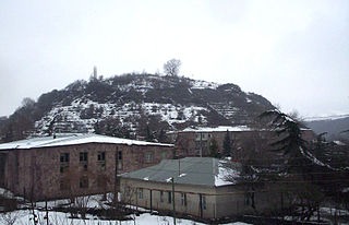
Ayrum is a town and urban community in the Noyemberyan Municipality of the Tavush Province of Armenia, located at a road distance of 206 km (128 mi) northeast of the capital Yerevan and 73 km (45 mi) north of the provincial capital Ijevan. It is situated on the shores of Debed river, only 2 km (1 mi) away from the Armenia–Georgia border. As of the 2011 census, Ayrum had a population of 2,126. As of the 2016 official estimate, the population of Ayrum is 2,000. The importance of the town is derived from its geographical location as the northeastern gate and railway hub for the entire republic.

The following outline is provided as an overview of and topical guide to Azerbaijan:

Russians in Azerbaijan are the second largest ethnic minority in Azerbaijan and is also the largest Russian community in the South Caucasus and one of the largest outside of Russia. Although in decline, the community still numbers 71,000 people as of 2019. Since their arrival at the beginning of the 19th century, the Russians have played an important role in all spheres of life, particularly during the Czarist and Soviet period, especially in the capital city of Baku.
This is a list of countries and territories in Europe by population density. Data are from the United Nations unless otherwise specified.


