External links
Poor Laws of the British Isles | ||
|---|---|---|
| Poor Laws by territory | 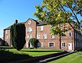 Nantwich workhouse | |
| Old Poor Law | ||
| Relief systems | ||
| New Poor Law | ||
| Changes after 1834 | ||
| Decline and abolition | ||
| Other | ||
The Poor Law Amendment Act 1834 and its administration entailed the creation of entirely new administrative areas throughout the United Kingdom: groups of parishes known as Poor Law Unions or simply Unions.
(Parish here = civil parish, defined as "area[s] for which a poor rate is or can be assessed" in mid-19th century legislation, as for example the Poor Law Amendment Act 1866; the thing is of course older than the term).
These groupings were based on geographical and demographic practicalities and took little account of most previous administrative arrangements, even cutting across county boundaries if necessary. By doing so there were created new Poor Law Counties, so called, in regard to the Poor Law itself, and other administrative functions, such as the decennial census, which used the Union boundaries. Note below, for example, Bourton and Silton, which although in Dorset, were for decades in the Wiltshire Union of Mere, and thus the Poor Law County of Wiltshire; the Somerset parishes in Sherborne Union, and thus in the Poor Law County of Dorset; and Lyme Regis, in Axminster Union and the Poor Law County of Devon.
In Dorset, however, the 1834 Unions were closely related to the pre-existing divisions (a unit developed principally for tax purposes), updated as recently as 1830 in a local Act of Parliament. See List of divisions in Dorset.
The Unions once established were used as the basis for subsequent administrative changes: they were taken from 1837 as the civil registration districts, and also as the basis for the sanitary districts introduced in the 1870s (see List of sanitary districts in Dorset).
Cranborne, see Wimborne
Purbeck, see Wareham
Separate Poor Law Unions for Wareham and for Purbeck were formed 25 March 1836, but were merged into a single Wareham & Purbeck Union in September 1836.
Separate Poor Law Unions for Wimborne and for Cranborne were formed on 28 September and 30 September 1835 respectively, but were merged into a single Wimborne & Cranborne Union in October 1836.
(in Devon)
(in Somerset)
(in Wiltshire)
(in Somerset)
Poor Laws of the British Isles | ||
|---|---|---|
| Poor Laws by territory | Nantwich workhouse | |
| Old Poor Law | ||
| Relief systems | ||
| New Poor Law | ||
| Changes after 1834 | ||
| Decline and abolition | ||
| Other | ||

West Dorset was a local government district in Dorset, England. Its council was based in Dorchester. The district was formed on 1 April 1974, under the Local Government Act 1972, and was a merger of the boroughs of Bridport, Dorchester and Lyme Regis, along with Sherborne urban district, and the rural districts of Beaminster, Bridport, Dorchester and Sherborne.

North Dorset was a local government district in Dorset, England. It was largely rural, but included the towns of Blandford Forum, Gillingham, Shaftesbury, Stalbridge and Sturminster Newton. Much of North Dorset was in the River Stour valley and is called the Blackmore Vale. The economy of North Dorset was largely dairy agriculture based.

Melbury Abbas is a village and civil parish in north Dorset, England, 3 km SSW of the town of Shaftesbury, east of the A350 Shaftesbury to Blandford Forum road.

Bere Regis is a village and civil parish in Dorset, England, situated 6 miles (9.7 km) north-west of Wareham. In the 2011 census the civil parish had a population of 1,745.
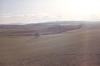
The Dorset Downs are an area of chalk downland in the centre of the county Dorset in south west England. The downs are the most western part of a larger chalk formation which also includes Cranborne Chase, Salisbury Plain, Hampshire Downs, Chiltern Hills, North Downs and South Downs.

Fontmell Magna is a village and civil parish in north Dorset, England. It is situated in the Blackmore Vale, close to the chalk hills of Cranborne Chase, on the A350 road five miles south of Shaftesbury and eight miles north of Blandford Forum. In the 2011 census the parish had a population of 734.

Dorset is a rural county in south west England. Its archaeology documents much of the history of southern England.
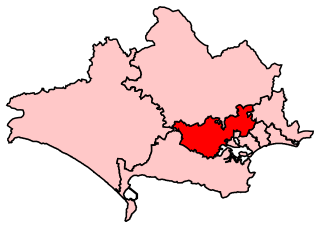
Mid Dorset and North Poole is a constituency represented in the House of Commons of the UK Parliament since 2015 by Michael Tomlinson, a Conservative.
The Stour Valley Way is a 64-mile (103 km) long-distance footpath in southern England. From Stourton, Wiltshire, the path travels southeast through Dorset to Hengistbury Head near Christchurch.
Sixpenny Handley Hundred was a hundred in the county of Dorset, England. It originally consisted of two distinct hundreds: Sexpena and Hanlega. Sometime around the 14th century, the two hundreds were united as the hundred of "Sexpenne et Henle". Sixpenny Handley Hundred contained the following parishes:
Cranborne Hundred was a hundred in the county of Dorset, England, containing the following parishes:
The High Sheriff of Dorset is an ancient High Sheriff title which has been in existence for over one thousand years. Until 1567 the Sheriff of Somerset was also the Sheriff of Dorset.

Dorset is a county located in the middle of the south coast of England. It lies between the latitudes 50.512°N and 51.081°N and the longitudes 1.682°W and 2.958°W, and occupies an area of 2,653 km2. It spans 90 kilometres (56 mi) from east to west and 63 kilometres (39 mi) from north to south.