
Sherborne is a market town and civil parish in north west Dorset, in South West England. It is sited on the River Yeo, on the edge of the Blackmore Vale, 6 miles east of Yeovil. The parish includes the hamlets of Nether Coombe and Lower Clatcombe. The A30 road, which connects London to Penzance, runs through the town. In the 2021 census the population of Sherborne was 10,361.
Sturminster Newton is a town and civil parish situated on the River Stour in the north of Dorset, England. The town is at the centre of the Blackmore Vale, a large dairy agriculture region around which the town's economy is built, and is known as 'the heart of the Blackmore vale'.
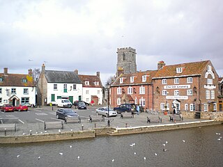
Wareham is a historic market town and, under the name Wareham Town, a civil parish, in the English county of Dorset. The town is situated on the River Frome eight miles (13 km) southwest of Poole.

Corscombe is a village and civil parish in the English county of Dorset, in the Dorset Council administrative area. The parish includes the small settlements of Benville and Toller Whelme to the south and in the 2011 census had a population of 445.

West Dorset was a local government district in Dorset, England. The district was formed on 1 April 1974 under the Local Government Act 1972, and was a merger of the boroughs of Bridport, Dorchester and Lyme Regis, along with Sherborne urban district and the rural districts of Beaminster, Bridport, Dorchester and Sherborne. Its council was based in Dorchester.

Hilton is a village and civil parish in the county of Dorset in southern England. It is sited at an elevation of 135 metres in a small valley which drains chalk hills in the eastern part of the Dorset Downs, approximately 8 miles west-southwest of the town of Blandford Forum. The summit of Bulbarrow Hill is 1+1⁄2 miles north of the village. In the 2011 census the parish—which includes the settlement of Ansty to the west—had 231 dwellings, 206 households and a population of 477.

Iwerne Minster is a village and civil parish in Dorset, England. It lies on the edge of the Blackmore Vale, approximately midway between the towns of Shaftesbury and Blandford Forum. The A350 main road between those towns passes through the edge of the village, just to the west. In the 2011 Census the civil parish had a population of 978.

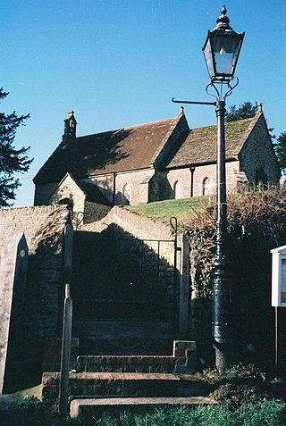
Stourton Caundle is a village and civil parish in the county of Dorset in southwest England. It lies within the Blackmore Vale, about five miles east of Sherborne. In the 2011 census the parish had 181 households and a population of 439.
Bradford Abbas is a village and civil parish in north-west Dorset, England, on the border with Somerset. The village is 3 miles (5 km) south-east of Yeovil and 5 miles (8 km) south-west of Sherborne. The parish includes the small settlement of Saxon Maybank to the north, and had a population of 975 at the 2011 Census.

Chetnole is a village and civil parish in the county of Dorset in southern England. It lies approximately 6 miles (9.7 km) south-southwest of Sherborne and 5.5 miles (8.9 km) southeast of Yeovil in Somerset. It is sited on Oxford clay by the small Wriggle River at the western end of the Blackmore Vale. There are around 128 houses in the village. It has a railway station on the Heart of Wessex Line that is served by Great Western Railway services. Dorset County Council estimate that in 2013 the population of the parish was 330. In the 2011 census the population of Chetnole parish combined with the small parish of Stockwood to the west was 344.

Chickerell is a town and parish in Dorset, England. In the 2011 census the parish and the electoral ward had a population of 5,515.
Fifehead Neville is a village and civil parish in the county of Dorset in southern England, situated in the Blackmore Vale about two miles southwest of the town of Sturminster Newton. In the 2011 census the population of the parish was 147.

Holwell is a village and civil parish in the county of Dorset in southern England, situated approximately 5 miles (8.0 km) south-east of Sherborne. It is sited on Oxford clay in the Blackmore Vale. Its name derives from the Old English hol and walu, meaning a bank or ridge in a hollow. The parish includes the hamlets of Sandhills, Westrow, Barnes Cross, The Borough, and Woodbridge. In the 2011 census the parish had a population of 369 and is part of the Cam Vale electoral ward. Until 1844 Holwell was an exclave of Somerset, being part of the parish of Milborne Port.

Mappowder is a village and civil parish in the county of Dorset in southern England. The parish lies approximately 9 miles southeast of the town of Sherborne and covers about 1,900 acres at an elevation of 75 to 160 metres. It is sited on Corallian limestone soil at the southern edge of the Blackmore Vale, close to the northern scarp face of the Dorset Downs. In the 2011 census the parish had 71 dwellings, 69 households and a population of 166.

Melcombe Horsey is a civil parish in the county of Dorset in South West England. It contains the small settlements of Melcombe Bingham, Bingham's Melcombe and Higher Melcombe, the last being the site of the deserted village of Melcombe Horsey. In the 2011 census the parish had a population of 141.

Oborne is a village and civil parish in north west Dorset, England, situated just north of the A30 road approximately 1 mile (1.6 km) northeast of Sherborne, and is close to the border with Somerset. In the 2011 census the parish had a population of 101. Oborne shares a grouped parish council, Yeohead & Castleton Parish Council, with the three village parishes of Poyntington, Goathill and Castleton.

Poyntington is a village and civil parish in the county of Dorset in South West England. It lies on the edge of the Blackmore Vale about 2 miles (3.2 km) north of Sherborne. In the 2011 census the parish had a population of 128.

South Perrott is a village and civil parish in northwest Dorset, England, 2 miles (3.2 km) southeast of Crewkerne. In 2012 the estimated population of the parish was 220. Figures from the 2011 census have been published for South Perrott parish combined with the neighbouring parish of Chedington; the population in these areas was 367.

Leigh is a village and civil parish in the county of Dorset in southern England, situated approximately 5 miles (8.0 km) south-southwest of Sherborne. It is known as the site of a former Miz Maze. In the 2011 census the parish had a population of 480.
Goathill is a village and civil parish in the county of Dorset in England, situated in northern Dorset, a couple of miles east of the town of Sherborne. It lies very close to the county boundary however, and for much of its history lay instead within the neighbouring county of Somerset, and has been described as being "just in Dorset by a nanny-goat's whisker". It remains part of the diocese of Bath and Wells.

