
Northampton is a town and civil parish in Northamptonshire, England. It is the county town of Northamptonshire and the administrative centre of the unitary authority of West Northamptonshire. The town is situated on the River Nene, 60 miles (97 km) north-west of London and 50 miles (80 km) south-east of Birmingham. Northampton is one of the largest towns in England; the population of its overall urban area was recorded as 249,093 in the 2021 census.

Corby is a town and civil parish in the North Northamptonshire unitary authority area of Northamptonshire, England. It is located 23 miles (37 km) north-east of Northampton. From 1974 to 2021, the town served as the administrative headquarters of the Borough of Corby. At the 2021 Census, the built-up area had a population of 68,164 while the borough, which was abolished in 2021, had a population of 75,571 in 2021.

Towcester is a market town and civil parish in the West Northamptonshire unitary authority area of Northamptonshire, England. From 1974 to 2021, it was the administrative centre of the South Northamptonshire district.
Biddlesden is a village and civil parish in Aylesbury Vale district in north-west Buckinghamshire, England on the boundary with Northamptonshire. It is about 5 miles (8 km) east-north-east of Brackley, Northamptonshire and 5 miles (8 km) north-west of Buckingham. The River Great Ouse forms part of the western boundary of the parish, separating the village from Northamptonshire. The ancient royal forest of Whittlewood extended to the northern edge of the village.

South Northamptonshire was a local government district in Northamptonshire, England, from 1974 to 2021. Its council was based in the town of Towcester, first established as a settlement in Roman Britain. The population of the Local Authority District Council in 2011 was 85,189.
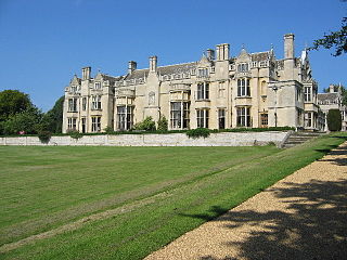
Thornby is a village and civil parish in West Northamptonshire in England. It has a Manor house. At the time of the 2001 census, the parish's population was 162 people, increasing to 189 at the 2011 Census. The village is bisected by the A5199 road between Northampton and Leicester and about 11 miles (17.7 km) north-west of Northampton town centre. It is about 1½ miles south of a junction with the A14 road which joins the M1 Motorway and M6 junction at Catthorpe with Felixstowe, Suffolk.

Sulby is a hamlet and civil parish in West Northamptonshire in England. The population of the hamlet at the 2011 Census is included in the civil parish of Sibbertoft.

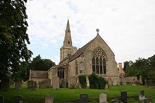
Spratton is a village and civil parish in the English county of Northamptonshire. The local government authority is West Northamptonshire. Before changes in 2021 it was governed by Daventry District Council. At the time of the 2001 census, the parish's population was 1,099 people, increasing to 1,150 at the 2011 Census. Spratton is 7.1 miles north of Northampton, 6.5 miles from Long Buckby and 11.4 miles from Daventry. The village is situated on the A5199 road.

Farthingstone is a village in West Northamptonshire in England. It is close to the major trunk routes of the M1 junction 16, M40 motorway, and A5 road, at the head of a valley and is 7 miles (11 km) south of Daventry and 3.5 miles (5.6 km) south west of Weedon Bec.
Aston le Walls is a village and civil parish in West Northamptonshire, England, close by the border with Oxfordshire. The village is about 9 miles (14.5 km) north of Banbury in Oxfordshire, and 10 miles (16.1 km) south of Daventry. Neighbouring villages are Chipping Warden, Lower Boddington Upper Boddington and Byfield. According to the 2001 census the village had a population of 334 falling to 293 at the 2011 census.

Dallington is an area and former civil parish about 1.5 miles (2.4 km) northwest of the centre of Northampton, now in the parish of Northampton, in the West Northamptonshire district, in the ceremonial county of Northamptonshire, England. Dallington was formerly a separate village. At the 2011 census the population was listed in the Spencer ward of Northampton Council.

Upton is a civil parish north-east of Kislingbury and south-west of Dallington, in Northamptonshire, England about 3.5 miles (6 km) west of Northampton town centre along the A4500 road. Formerly a scattered hamlet, it is now part of the town. The area west of Northampton is now a major area of expansion of the town and named Upton after the parish.

Hinton-in-the-Hedges is a small village and civil parish in West Northamptonshire, England, two miles due west of the town of Brackley. West of the village is Hinton-in-the-Hedges Airfield. At the time of the 2001 census, the parish's population was 179 people. It had decreased to 167 at the 2011 Census.

Great Harrowden is a village and civil parish in North Northamptonshire, with a population at the 2011 census of 161. The village is located near the A509 road running between Kettering and Wellingborough. The village formed part of the Orlingbury hundred and of Borough of Wellingborough.

West Northamptonshire is a unitary authority area covering part of the ceremonial county of Northamptonshire, England, created in 2021. By far the largest settlement in West Northamptonshire is the county town of Northampton. Its other significant towns are Daventry, Brackley and Towcester; the rest of the area is predominantly agricultural villages though it has many lakes and small woodlands and is passed through by the West Coast Main Line and the M1 and M40 motorways. The district includes the site of the Roman town of Bannaventa, and the grade I listed Althorp House and its estate.
Little Houghton is a village and civil parish in Northamptonshire, England, located about 2 miles (3.2 km) east of Northampton. At the time of the 2001 census, the parish's population was 367 people, increasing to 412 at the 2011 census.
Rushton is a village and civil parish in Northamptonshire. It is about 2 miles (3.2 km) north-east of Rothwell and 3 miles (4.8 km) north-west of Kettering. The parish covers 3,200 acres (1,300 ha) and is situated on both sides of the River Ise. It contains the sites of three deserted settlements, details of which are set out below.
Grafton Underwood is a village and civil parish in North Northamptonshire, England. At the time of the 2001 census, the parish's population was 134 people, increasing to 146 at the 2011 census. The village was used in Helen Fielding's Bridget Jones novels as her childhood home.
Lutton is a village and civil parish in North Northamptonshire, England. The 2011 Census recorded its parish population as 186.
