
The Bow River is a river in Alberta, Canada. It begins within the Canadian Rocky Mountains and winds through the Alberta foothills onto the prairies, where it meets the Oldman River, the two then forming the South Saskatchewan River. These waters ultimately flow through the Nelson River into Hudson Bay. The Bow River runs through the city of Calgary, taking in the Elbow River at the historic site of Fort Calgary near downtown. The Bow River pathway, developed along the river's banks, is considered a part of Calgary's self-image.
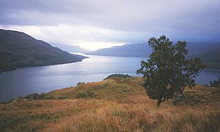
Loch Katrine is a freshwater loch in the Trossachs area of the Scottish Highlands, east of Loch Lomond, within the historic county and registration county of Perthshire and the contemporary district of Stirling. The loch is about 8 miles (13 km) long and 1 mile (1.6 km) wide at its widest point, and runs the length of Strath Gartney. It is within the drainage basins of the River Teith and River Forth.
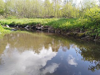
A body of water or waterbody is any significant accumulation of water on the surface of Earth or another planet. The term most often refers to oceans, seas, and lakes, but it includes smaller pools of water such as ponds, wetlands, or more rarely, puddles. A body of water does not have to be still or contained; rivers, streams, canals, and other geographical features where water moves from one place to another are also considered bodies of water.

Jurong Lake is a 70ha freshwater lake and reservoir located in the western region of Singapore formed with the damming of Sungei Jurong further downstream. The lake serves as a reservoir contributing to the water supply of the country. It lies next to the Lakeside MRT station, which derived its name from this geographical feature. The lake is surrounded by parkland, which serves as a recreational ground for nearby residents in Jurong East and Jurong West New Towns.
The Elbow River is a river in southern Alberta, Canada. It flows from the Canadian Rockies to the city of Calgary, where it merges into the Bow River.

Bow Valley Provincial Park is a provincial park in Alberta, Canada. Established in 1959 in the arch of the Bow River at its confluence with the Kananaskis River, the park is one park of many within the Kananaskis Country park system.
Little Bow Provincial Park is a provincial park located near the town of Vulcan and the village of Champion in Alberta, Canada.

A reservoir is an enlarged lake behind a dam. Such a dam may be either artificial, built to store fresh water or it may be a natural formation.

Lake Bronson State Park is a state park off of Kittson County Highway 28 East near Lake Bronson in the northwestern corner of Minnesota.

Barrier Lake is a man made reservoir at the north end of Kananaskis Country in Alberta, Canada.
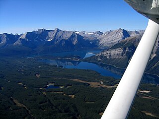
Lower Kananaskis Lake is a natural lake that was turned into a reservoir in Kananaskis Country in Alberta, Canada.

Spruce Run Recreation Area is a 1,290-acre (5.2 km2) New Jersey state recreation area located in Union Township and Clinton Township in Hunterdon County, New Jersey, United States. It encompasses the Spruce Run Reservoir that is used as a backup reservoir to protect the state from prolonged droughts. The reservoir is the third largest in the state, after Round Valley and Wanaque Reservoir. The reservoir is used for recreation purposes, including hunting, fishing, boating and swimming.
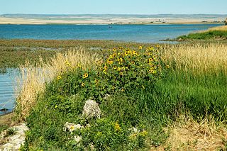
McGregor Lake is an elongated reservoir in Southern Alberta. McGregor Lake was created in 1920 by the completion of two dams bracketing water flowing through in Snake Valley. It is situated 100 km (62 mi) southeast of Calgary in the Vulcan County.

Lake McConaughy is a reservoir on the North Platte River. It is located 9 miles (14 km) north of Ogallala, Nebraska, United States, near U.S. Highway 26 and Nebraska Highway 61. The reservoir was named for Charles W. McConaughy, a grain merchant and mayor of Holdrege, Nebraska, one of the leading promoters of the project. Although he did not live to see the completion of the project, his leadership and perseverance eventually culminated in a public power and irrigation project that helped Nebraska become one of the nation's leading agricultural states.

Ghost Lake is a reservoir in Western Alberta, Canada, formed along the Bow River. It is located approximately 45 km (28 mi) west of the city of Calgary and immediately west of Cochrane. It has a water surface of 11.6 km2 (4.5 sq mi) and a drainage basin of 6,460 km2 (2,490 sq mi) The average depth of the lake is 14.5 m (48 ft), and it reaches a maximum of 34 m (112 ft)
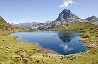
A lake is a naturally occurring, relatively large body of water localized in a basin surrounded by land, with much slower-moving flow than any inflow or outflow streams that serve to feed or drain the lake. Lakes lie completely on land and are separate from the ocean, although, but like the much larger oceans, they form part of the Earth's water cycle by serving as large standing water reservoirs. Most lakes are freshwater, but some are salt lakes with salinities even higher than that of seawater.
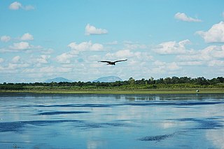
Hesaraghatta Lake is a manmade reservoir located 18 km to the north-west of Bengaluru in Karnataka state, India. It is a fresh water lake created in the year 1894 across the Arkavathy River to meet the drinking water needs of the city. Sir K. Seshadri Iyer, the then Dewan of erstwhile Mysore state and the then Chief Engineer of Mysuru, M. C. Hutchins, planned to build the scheme called the "Chamarajendra Water Works" to store a three-years' water supply to the city.
Crawling Valley Reservoir, or Barkenhouse Lake, is a reservoir in Alberta. The reservoir uses the existing Crawling Valley, which was depression created as a meltwater channel created during the letting of the Laurentide ice sheet at the end of the last ice age. Construction of dams and canals began in 1983, diverting some water from the Bow River via the North Branch Canal, starting just upstream of the Bassano Dam (southwest of the town of Bassano, to fill the reservoir. The main drainage flowing from the Crawling Valley Reservoir flows through a continuation of the North Branch Canal, serving irrigation needs, with other outflow into the Matzhiwin Creek.
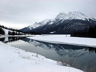
Spray Lakes Reservoir is a reservoir in Alberta, Canada. The Spray Lakes were a string of lakes formed along the Spray River, a tributary of the Bow River. With the damming of the river, the lakes were united in the Spray Lakes Reservoir.

Kesses Dam is a small man-made lake in Kenya. It is one of the sources of the Yala River. It is used as a source of water for irrigation and domestic use, and also for boating and other water activities.


