History
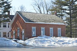
The land currently comprising Lyndhurst was part of the Connecticut Western Reserve, obtained via treaty with the Iroquois tribe in 1796 by the Connecticut Land Company. In 1797, Moses Cleaveland named the area east of the Cuyahoga River "Euclid," after the Greek Mathematician and Patron Saint of surveyors. Euclid Township was officially formed in 1809. Despite this, Lyndhurst's population consisted mostly of Native American Indians until after the War of 1812. [5]
In 1828 Euclid Township was divided into nine districts, with the present area of Lyndhurst becoming district four.
From 1877 the main traffic corridor has been Mayfield Road (U.S. Route 322). Initially a wood-planked toll road, it is now home to many retail establishments and restaurants.
The earliest industry was farming. As the area grew, it became known as Euclidville Village, the name changing to Lyndhurst Village in 1920 before Lyndhurst was formally incorporated as a city in 1921.
Population growth in Lyndhurst, which tapered during the Great Depression, skyrocketed during the postwar period, driven by both the baby boom and white flight from the urban center of Cleveland. Lyndhurst's population peaked in the 1970s. By 1980, lacking large tracts of available land for development, and with a population shift to exurban communities, the population of Lyndhurst began to shrink. The 2010, population of Lyndhurst was 29% less than its peak during the 1970s.
Eggshelland
Eggshelland is an annual lawn display of Easter egg mosaics, originally located at a resident's home between 1957 and 2013, [6] [7] during which time it became the subject of a documentary film. [8] [9] A different party took ownership of the maintenance of Eggshelland in 2014, relocating the display to various locations in and around Lyndhurst. [10] In 2022 the display moved to nearby Chester Township. [11] [12]
Demographics
Historical population| Census | Pop. | Note | %± |
|---|
| 1920 | 288 | | — |
|---|
| 1930 | 1,922 | | 567.4% |
|---|
| 1940 | 2,391 | | 24.4% |
|---|
| 1950 | 7,359 | | 207.8% |
|---|
| 1960 | 16,805 | | 128.4% |
|---|
| 1970 | 19,749 | | 17.5% |
|---|
| 1980 | 18,093 | | −8.4% |
|---|
| 1990 | 15,982 | | −11.7% |
|---|
| 2000 | 15,279 | | −4.4% |
|---|
| 2010 | 14,001 | | −8.4% |
|---|
| 2020 | 14,050 | | 0.3% |
|---|
| 2021 (est.) | 13,841 | | −1.5% |
|---|
|
The median income for a household in the city was $52,272, and the median income for a family was $64,961. Males had a median income of $45,172 versus $31,652 for females. The per capita income for the city was $28,206. About 1.3% of families and 2.5% of the population were below the poverty line, including 1.4% of those under age 18 and 3.3% of those age 65 or over.
Of the city's population over the age of 25, 43.2% held a bachelor's degree or higher. [17]
2020 census
Lyndhurst city, Ohio – Racial and ethnic composition
Note: the US Census treats Hispanic/Latino as an ethnic category. This table excludes Latinos from the racial categories and assigns them to a separate category. Hispanics/Latinos may be of any race.| Race / Ethnicity (NH = Non-Hispanic) | Pop 2000 [18] | Pop 2010 [19] | Pop 2020 [20] | % 2000 | % 2010 | % 2020 |
|---|
| White alone (NH) | 14,707 | 12,531 | 10,676 | 96.26% | 89.50% | 75.99% |
| Black or African American alone (NH) | 196 | 894 | 2,061 | 1.28% | 6.39% | 14.67% |
| Native American or Alaska Native alone (NH) | 1 | 5 | 8 | 0.01% | 0.04% | 0.06% |
| Asian alone (NH) | 181 | 223 | 430 | 1.18% | 1.59% | 3.06% |
| Native Hawaiian or Pacific Islander alone (NH) | 1 | 0 | 1 | 0.01% | 0.00% | 0.01% |
| Other race alone (NH) | 9 | 13 | 72 | 0.06% | 0.09% | 0.51% |
| Mixed race or Multiracial (NH) | 80 | 150 | 454 | 0.52% | 1.07% | 3.23% |
| Hispanic or Latino (any race) | 104 | 185 | 348 | 0.68% | 1.32% | 2.48% |
| Total | 15,279 | 14,001 | 14,050 | 100.00% | 100.00% | 100.00% |
2010 census
As of the census [21] of 2010, there were 14,001 people, 6,447 households, and 3,826 families residing in the city. The population density was 3,160.5 inhabitants per square mile (1,220.3/km2). There were 6,890 housing units at an average density of 1,555.3 per square mile (600.5/km2). The racial makeup of the city was 90.3% White, 6.4% African American, 1.6% Asian, 0.4% from other races, and 1.2% from two or more races. Hispanic or Latino of any race were 1.3% of the population.
There were 6,447 households, of which 21.4% had children under the age of 18 living with them, 48.2% were married couples living together, 8.4% had a female householder with no husband present, 2.8% had a male householder with no wife present, and 40.7% were non-families. 35.5% of all households were made up of individuals, and 17.3% had someone living alone who was 65 years of age or older. The average household size was 2.15 and the average family size was 2.80.
The median age in the city was 47 years. 17.4% of residents were under the age of 18; 5.2% were between the ages of 18 and 24; 25% were from 25 to 44; 28.1% were from 45 to 64; and 24.3% were 65 years of age or older. The gender makeup of the city was 46.0% male and 54.0% female.
This page is based on this
Wikipedia article Text is available under the
CC BY-SA 4.0 license; additional terms may apply.
Images, videos and audio are available under their respective licenses.