Walton Hills, Ohio

Last updated

Walton Hills, Ohio
Meadowpark Drive, WH.jpg
Houses on Meadowpark Drive
Cuyahoga County Ohio incorporated and unincorporated areas Walton Hills highlighted.svg
Location in Cuyahoga County and the state of Ohio
Coordinates: 41°21′51″N81°33′16″W / 41.36417°N 81.55444°W / 41.36417; -81.55444
Country United States
State Ohio
County Cuyahoga
Government
  Type Mayor-council
   Mayor Don Kolograf
Area
[1]
  Total6.80 sq mi (17.61 km2)
  Land6.75 sq mi (17.49 km2)
  Water0.05 sq mi (0.12 km2)
Elevation
0 ft (0 m)
Population
 (2020)
  Total2,033
  Density301.05/sq mi (116.24/km2)
 census
Time zone UTC-4 (EST)
  Summer (DST) UTC-4 (EDT)
Zip code
44146
Area code 440
FIPS code [2]
GNIS feature ID [3]
Website http://www.waltonhillsohio.gov/

Walton Hills is a village in Cuyahoga County, Ohio, United States. The population was 2,033 at the 2020 census. A suburb of Cleveland, it is a part of the Cleveland metropolitan area.

Contents

Geography

Walton Hills is located at 41°21′51″N81°33′16″W / 41.36417°N 81.55444°W / 41.36417; -81.55444 (41.364304, -81.554377). [4]

According to the United States Census Bureau, the village has a total area of 6.81 square miles (17.64 km2), of which 6.76 square miles (17.51 km2) is land and 0.05 square miles (0.13 km2) is water. [5]

Demographics

Historical population
CensusPop.Note
1960 1,776
1970 2,50841.2%
1980 2,199−12.3%
1990 2,3717.8%
2000 2,4001.2%
2010 2,281−5.0%
2020 2,033−10.9%
U.S. Decennial Census [6]

2010 census

As of the census [7] of 2010, there were 2,281 people, 937 households, and 681 families living in the village. The population density was 337.4 inhabitants per square mile (130.3/km2). There were 969 housing units at an average density of 143.3 per square mile (55.3/km2). The racial makeup of the village was 90.7% White, 8.1% African American, 0.2% Native American, 0.3% Asian, and 0.7% from two or more races. Hispanic or Latino of any race were 0.7% of the population.

There were 937 households, of which 16.3% had children under the age of 18 living with them, 63.1% were married couples living together, 6.6% had a female householder with no husband present, 3.0% had a male householder with no wife present, and 27.3% were non-families. 23.5% of all households were made up of individuals, and 13.6% had someone living alone who was 65 years of age or older. The average household size was 2.27 and the average family size was 2.65.

The median age in the village was 55.4 years. 11.2% of residents were under the age of 18; 4.8% were between the ages of 18 and 24; 13.2% were from 25 to 44; 40.1% were from 45 to 64; and 30.8% were 65 years of age or older. The gender makeup of the village was 47.8% male and 52.2% female.

2000 census

As of the census [2] of 2000, there were 2,400 people, 903 households, and 720 families living in the village. The population density was 349.0 inhabitants per square mile (134.7/km2). There were 919 housing units at an average density of 133.6 per square mile (51.6/km2). The racial makeup of the village was 96.46% White, 2.08% African American, 0.50% Asian, 0.08% from other races, and 0.88% from two or more races. Hispanic or Latino of any race were 0.92% of the population.

There were 903 households, out of which 21.5% had children under the age of 18 living with them, 69.9% were married couples living together, 7.0% had a female householder with no husband present, and 20.2% were non-families. 16.8% of all households were made up of individuals, and 10.0% had someone living alone who was 65 years of age or older. The average household size was 2.53 and the average family size was 2.85.

In the village, the population was spread out, with 17.0% under the age of 18, 5.8% from 18 to 24, 21.7% from 25 to 44, 29.0% from 45 to 64, and 26.5% who were 65 years of age or older. The median age was 48 years. For every 100 females there were 91.5 males. For every 100 females age 18 and over, there were 88.3 males.

The median income for a household in the village was $62,321, and the median income for a family was $67,537. Males had a median income of $41,900 versus $27,841 for females. The per capita income for the village was $26,405. About 1.1% of families and 2.1% of the population were below the poverty line, including 2.6% of those under age 18 and 3.4% of those age 65 or over.

Related Research Articles

<span class="mw-page-title-main">Highland Park, Florida</span> Village in Florida, United States

Highland Park is a village in Polk County, Florida, United States. Highland Park is part of the Lakeland–Winter Haven Metropolitan Statistical Area. Its population was 251 at the 2020 US census.

<span class="mw-page-title-main">Fenton, Louisiana</span> Village in Louisiana, United States

Fenton is a village in Jefferson Davis Parish, Louisiana, United States. The population was 226 at the 2020 census. It is notable for being a speed trap along U.S. Route 165.

Gun Plain Charter Township is a charter township of Allegan County in the U.S. state of Michigan. As of the 2020 census, the township population was 6,148.

<span class="mw-page-title-main">Wilbur Park, Missouri</span> Village in Missouri, United States

Wilbur Park is a village in St. Louis County, Missouri, United States. The population was 439 at the 2020 census.

<span class="mw-page-title-main">Milo, Missouri</span> Village in Missouri, United States

Milo is a village in Vernon County, Missouri, United States. The population was 90 at the 2010 census.

<span class="mw-page-title-main">Haywood City, Missouri</span> Village in Missouri, United States

Haywood City is a village in Scott County, Missouri, United States. The population was 206 at the 2010 census.

<span class="mw-page-title-main">Indian Point, Missouri</span> Village in Missouri, United States

Indian Point is a village in Stone County, Missouri, United States. The population was 550 at the 2020 census. It is part of the Branson, Missouri Micropolitan Statistical Area.
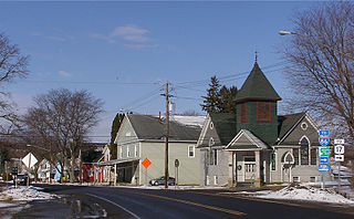
<span class="mw-page-title-main">Howard, New York</span> Town in New York, United States

Howard is a town in Steuben County, New York, United States. The population was 1,380 at the 2020 census.

<span class="mw-page-title-main">West Union, Ohio</span> Village in Ohio, United States

West Union is a village in Adams County, Ohio, United States, about 55 miles (89 km) southeast of Cincinnati. The population was 3,004 at the 2020 census. It is the county seat of Adams County. West Union is served by West Union High School, the Adams County/Ohio Valley School District, and the West Union Public Library, a branch of the Adams County Public Library.

<span class="mw-page-title-main">Bentleyville, Ohio</span> Village in Ohio, United States

Bentleyville is a village in Cuyahoga County, Ohio, United States. The population was 897 at the 2020 census. A suburb of Cleveland, it is a part of the Cleveland metropolitan area.

<span class="mw-page-title-main">Cuyahoga Heights, Ohio</span> Village in Ohio, United States

Cuyahoga Heights is a village in Cuyahoga County, Ohio, United States. The population was 573 at the 2020 census. A suburb of Cleveland, it is a part of the Cleveland metropolitan area.
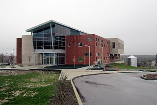
<span class="mw-page-title-main">Highland Hills, Ohio</span> Village in Ohio, United States

Highland Hills is a village in Cuyahoga County, Ohio, United States. The population was 662 at the 2020 census. A suburb of Cleveland, it was formally incorporated in 1990.

<span class="mw-page-title-main">Oakwood, Cuyahoga County, Ohio</span> Village in Ohio, United States

Oakwood is a village in Cuyahoga County, Ohio, United States. The population was 3,572 at the 2020 census. An eastern suburb of Cleveland, it is a part of the Cleveland metropolitan area.

<span class="mw-page-title-main">New Bavaria, Ohio</span> Village in Ohio, United States

New Bavaria is a village in Henry County, Ohio, United States. The population was 86 at the 2020 census.

<span class="mw-page-title-main">Ludlow Falls, Ohio</span> Village in Ohio, United States

Ludlow Falls is a village in Miami County, Ohio, United States. The population was 175 at the 2020 census. It is part of the Dayton Metropolitan Statistical Area. Ludlow Falls is named after surveyor Israel Ludlow.

<span class="mw-page-title-main">Burbank, Ohio</span> Village in Ohio, United States

Burbank is a village in Wayne County, Ohio, United States, along Killbuck Creek. The population was 296 at the 2020 census.

<span class="mw-page-title-main">Lucerne Mines, Pennsylvania</span> Census-designated place in Pennsylvania, United States

Lucernemines, usually written as Lucerne Mines, is a census-designated place (CDP) in Indiana County, Pennsylvania, United States. The population was 937 at the 2010 census.

<span class="mw-page-title-main">Wagener, South Carolina</span> Town in South Carolina

Wagener is a town in Aiken County, South Carolina, United States. The population was 797 at the 2010 census, making it the largest settlement in the county north of the South Fork Edisto River. It is part of the Augusta, Georgia metropolitan area.

<span class="mw-page-title-main">Beech Bottom, West Virginia</span> Village in West Virginia, United States

Beech Bottom is a village in Brooke County, West Virginia, United States, situated along the Ohio River. The population was 523 at the 2010 census. It is part of the Weirton–Steubenville metropolitan area.

<span class="mw-page-title-main">Oliver, Wisconsin</span> Village in Wisconsin, United States

Oliver is a village in Douglas County, Wisconsin, United States. The population was 423 at the 2020 census.

References

  1. "ArcGIS REST Services Directory". United States Census Bureau. Retrieved September 20, 2022.
  2. 1 2 "U.S. Census website". United States Census Bureau . Retrieved January 31, 2008.
  3. "US Board on Geographic Names". United States Geological Survey. October 25, 2007. Retrieved January 31, 2008.
  4. "US Gazetteer files: 2010, 2000, and 1990". United States Census Bureau. February 12, 2011. Retrieved April 23, 2011.
  5. "US Gazetteer files 2010". United States Census Bureau . Retrieved January 6, 2013.
  6. "Census of Population and Housing". Census.gov. Retrieved June 4, 2015.
  7. "U.S. Census website". United States Census Bureau . Retrieved January 6, 2013.