Bentlieyville, Ohio | |
---|---|
Motto(s): "Serve, Preserve, Conserve" | |
Coordinates: 41°24′49″N81°24′47″W / 41.41361°N 81.41306°W | |
Country | United States |
State | Ohio |
County | Cuyahoga |
Government | |
• Mayor | Kathleen M. Hale |
Area | |
• Total | 2.59 sq mi (6.70 km2) |
• Land | 2.54 sq mi (6.59 km2) |
• Water | 0.04 sq mi (0.11 km2) |
Elevation | 935 ft (285 m) |
Population (2020) | |
• Total | 897 |
• Density | 352.46/sq mi (136.10/km2) |
Time zone | UTC-5 (Eastern (EST)) |
• Summer (DST) | UTC-4 (EDT) |
ZIP code | 44022 |
Area code | 440 |
FIPS code | 39-05550 [3] |
GNIS feature ID | 1037862 [2] |
Website | villageofbentleyville.com |
Bentleyville is a village in Cuyahoga County, Ohio, United States. The population was 897 at the 2020 census. A suburb of Cleveland, it is a part of the Cleveland metropolitan area.
Bentleyville was laid out in 1831 by Adamson Bentley, and named for him. [4]
Bentleyville is located at 41°24′49″N81°24′47″W / 41.41361°N 81.41306°W (41.413520, -81.412996). [5]
According to the United States Census Bureau, the village has a total area of 2.60 square miles (6.73 km2), of which 2.56 square miles (6.63 km2) is land and 0.04 square miles (0.10 km2) is water. [6]
The current mayor of Bentleyville is Kathleen M. Hale. [7] She has been in office since January 2024. There are currently six members on village council. [8] The mayor and council members are elected every four years.
Census | Pop. | Note | %± |
---|---|---|---|
1930 | 83 | — | |
1940 | 117 | 41.0% | |
1950 | 152 | 29.9% | |
1960 | 301 | 98.0% | |
1970 | 338 | 12.3% | |
1980 | 381 | 12.7% | |
1990 | 674 | 76.9% | |
2000 | 947 | 40.5% | |
2010 | 864 | −8.8% | |
2020 | 897 | 3.8% | |
U.S. Decennial Census [9] |
As of the census [10] of 2020, there were 897 people, 245 households, and 316 families living in the village. The population density was 337.5 inhabitants per square mile (130.3/km2). There were 316 housing units at an average density of 124.2 per square mile (48.0/km2). The racial makeup of the village was 95.0% White, 0.7% African American, 2.8% Asian, and 1.5% from two or more races. Hispanic or Latino of any race were 0.6% of the population.
There were 245 households, of which 44.6% had children under the age of 18 living with them, 81.2% were married couples living together, 3.3% had a female householder with no husband present, 1.7% had a male householder with no wife present, and 13.9% were non-families. 13.2% of all households were made up of individuals, and 4.6% had someone living alone who was 65 years of age or older. The average household size was 2.85 and the average family size was 3.14.
The median age in the village was 46.2 years. 29.3% of residents were under the age of 18; 5.2% were between the ages of 18 and 24; 13.2% were from 25 to 44; 42.3% were from 45 to 64; and 10.1% were 65 years of age or older. The gender makeup of the village was 49.5% male and 50.5% female.
As of the census [3] of 2000, there were 947 people, 297 households, and 263 families living in the village. The population density was 363.3 inhabitants per square mile (140.3/km2). There were 306 housing units at an average density of 117.4 per square mile (45.3/km2). The racial makeup of the village was 97.15% White, 0.84% African American, 1.80% Asian, and 0.21% from two or more races. Hispanic or Latino of any race were 0.95% of the population.
There were 297 households, out of which 52.9% had children under the age of 18 living with them, 85.9% were married couples living together, 2.4% had a female householder with no husband present, and 11.4% were non-families. 8.8% of all households were made up of individuals, and 2.4% had someone living alone who was 65 years of age or older. The average household size was 3.19 and the average family size was 3.43.
In the village, the population was spread out, with 36.4% under the age of 18, 3.2% from 18 to 24, 21.5% from 25 to 44, 32.7% from 45 to 64, and 6.1% who were 65 years of age or older. The median age was 41 years. For every 100 females there were 103.7 males. For every 100 females age 18 and over, there were 99.3 males.
The median income for a household in the village was $160,902, and the median income for a family was $183,243. Males had a median income of $100,000 versus $55,313 for females. The per capita income for the village was $72,392. None of the families and 1.0% of the population were living below the poverty line, including no under eighteens and 1.7% of those over 64.
Bentleyville is served by the Chagrin Falls Exempted Village School District.
Oak Ridge is a census-designated place and unincorporated area in Orange County, Florida, United States. The population was 22,685 at the 2010 census. It is part of the Orlando–Kissimmee–Sanford, Florida Metropolitan Statistical Area.
Keomah Village is a city in Mahaska County, Iowa, United States. The population was 110 at the time of the 2020 census. Keomah Village is located adjacent to Lake Keomah State Park.
Sidney is a town in Kennebec County, Maine, United States. The population was 4,645 at the 2020 census. Sidney was incorporated as a town on January 30, 1792. The town was named for Sir Philip Sidney, an English author. Sidney is included in the Augusta, Maine micropolitan New England City and Town Area. Since 1937, the town has been the home of the New England Music Camp.
Applegate is a village in Sanilac County of the U.S. state of Michigan. The population was 241 at the 2020 census. Applegate is in the southeast corner of Washington Township on the boundary with Sanilac Township.
Minden City is a village in Sanilac County of the U.S. state of Michigan. The population was 197 at the 2010 census. The village is located within Minden Township. It has possessed a post office since 1862.
Roscoe is a village in St. Clair County, Missouri, United States. The population was 89 at the 2020 census.
Hillsdale is a village in St. Louis County, Missouri, United States. Greenwood Cemetery is located in Hillsdale. The population was 1,478 at the 2010 census.
Bristow is a village in Boyd County, Nebraska, United States. The population was 70 at the 2020 census, up from 65 in 2010.
Kennard is a village in Washington County, Nebraska, United States. The population was 361 at the 2010 census.
Powhatan Point is a village in southeastern Belmont County, Ohio, United States, along the Ohio River. The population was 1,461 at the 2020 census. It is part of the Wheeling metropolitan area.
Cuyahoga Heights is a village in Cuyahoga County, Ohio, United States. The population was 573 at the 2020 census. A suburb of Cleveland, it is a part of the Cleveland metropolitan area.
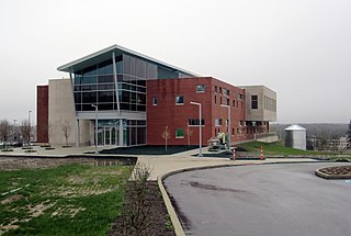
Highland Heights is a city in Cuyahoga County, Ohio, United States. The city's population was 8,719 as of the 2020 census. An eastern suburb of Cleveland, it is part of the Cleveland metropolitan area.
Highland Hills is a village in Cuyahoga County, Ohio, United States. The population was 662 at the 2020 census. A suburb of Cleveland, it was formally incorporated in 1990.
Walton Hills is a village in Cuyahoga County, Ohio, United States. The population was 2,033 at the 2020 census. A suburb of Cleveland, it is a part of the Cleveland metropolitan area.
Lakeline is a village in Lake County, Ohio, United States. The population was 216 at the 2020 census.
Pratt is a town in Kanawha County, West Virginia, United States, along the Kanawha River. The population was 482 at the 2020 census.
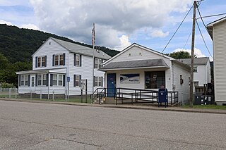
Reedy is a town in Roane County, West Virginia, United States. The population was 152 at the 2020 census.
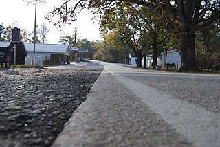
Smyrna is a small town in York and Cherokee counties in the U.S. state of South Carolina. The population was 45 at the 2010 United States Census,..
The village of Bourne is a census-designated place (CDP) in the town of Bourne in Barnstable County, Massachusetts, United States. The population was 1,418 at the 2010 census, out of 19,754 in the town of Bourne as a whole.
Mason is a village in Bayfield County, Wisconsin, United States. The population was 93 at the 2010 census. The village is located within the Town of Mason.