M16 (Johannesburg)

Last updated

Joburg road M16.svg
Metropolitan route M16
Route information
Maintained by Johannesburg Roads Agency and Gauteng Department of Roads and Transport
Length25.1 km (15.6 mi)
Major junctions
West endM71 ZAF jct.svg M71 Barry Hertzog Avenue, Greenside
Major intersectionsM27 ZAF jct.svg M27 Jan Smuts Ave, Westcliff
M9 ZAF jct.svg M9 Oxford Road, Saxonwold
M1 ZAF jct blue.svg M1 Riviera Road, Killarney
M31 ZAF jct.svg M31 West Street, Houghton Estate
M11 ZAF jct.svg M11 Louis Botha Avenue, Orange Grove
M40 ZAF jct.svg M40 Civin Drive, Senderwood
SA road N3 jct.svg N3 Linksfield Road Interchange, Dowerglen
M97 ZAF jct.svg M97 1st Avenue, Edenvale
M37 ZAF jct.svg M37 Van Riebeeck Avenue, Edenvale
M37 ZAF jct.svg M37 17th Avenue, Edenvale
M78 ZAF jct.svg M78 Harris Avenue, Edenglen
M59 ZAF jct.svg M59 Barbara Road, Croydon
M39 ZAF jct.svg M39 Isando Road, Croydon
East endM57 ZAF jct.svg M57 Pretoria Road, Kempton Park
Location
Country South Africa
Highway system
M14 ZAF jct.svg M14 M17 ZAF jct.svg M17

M16 is a metropolitan route in Johannesburg, South Africa. It begins in the north-western suburb of Greenside and heads eastwards through some of Johannesburg's northern suburbs and through Edenvale to end at the East Rand town of Kempton Park. [1] [2]

Route

Starting at an intersection with the M71 (Barry Hertzog Avenue) in Greenside, the route heads east as Greenhill Road to Parkview Golf Club. [3] :81 It then crosses the golf course and the Braamfontein Spruit as Wicklow Avenue. [3] :81 Crossing Emmarentia Avenue, it continues south-east until it reaches a t-junction with Westcliff Drive and continues eastwards as the latter, circling the Westcliff suburb and reaching the M27 road (Jan Smuts Avenue). [3] :81 The M16 route turns right onto Jan Smuts Avenue and is cosigned briefly before turning left into Upper Park Drive, Forest Town, where it follows the southern border of the Johannesburg Zoo and then becomes Erlsworld Way in Saxonwold. [3] :81 Outside the South African National Museum of Military History, it turns right into East World Way. [3] :82 It continues eastwards, crossing over Oxford Road and becomes Riviera Road in Killarney before reaching the M1 North motorway interchange. [3] :82

Crossing the M1 motorway, it reaches a t-junction with the M31 West Street in Houghton Estate, where it turns south and is cosigned briefly before turning left and heading east as 1st Avenue in Houghton, passing close to Houghton Golf Course before intersecting the M11 (Louis Botha Avenue). [3] :83 Turning left, now cosigned with the M11 Louis Botha Avenue it heads northwards into Orange Grove. [3] :83 Passing 8th Street (M16 one-way west), the route leaves Louis Botha Avenue, turning east into 10th Street (one-way east) before turning right onto 9th Avenue and left onto Club Street where it continues eastward close to Royal Johannesburg & Kensington Golf Club and then turns northwards past Huddle Park in Linksfield. [3] :83

There, it reaches the intersection with Civin Drive, crosses over it and turns eastwards as Linksfield Road to cross the N3 Eastern Bypass at the Linksfield Road Interchange. [3] :58 Continuing east through Dowerglen, it enters Edenvale, crossing the M97 1st Avenue and becomes 2nd Street (one-way east), passing through the CBD while Horwood Street to the south is the one-way M16 West. [3] :59 Leaving the CBD, it crosses 11th Avenue and becomes Homestead Road, crossing JP Bezuidenhout Park to the north and the cemetery to the south before crossing Paliser Road. It becomes Baker Road in Edenglen where it eventually reaches M78 Harris Avenue. [3] :60 Turn right onto Harris Avenue, it heads south, briefly cosigned with the M78 before Harris Avenue breaks off to the left continuing eastwards, passing Harmelia and reaches a t-junction with Sandvale Road, where the route turns left. [3] :60

Continuing northwards, it reaches the intersection of Driefontein and Barbara Road (M59) in Isandovale. [3] :60 The route crosses over and continues north-east through Croydon and reaches the intersection with Isando Road (M39). [3] :60 Crossing over it continues as a north-easterly route, following the R24 freeway to its right, through the industrial suburb of Spartan. [3] :61 The route then ends as a t-junction with the M57 road (Pretoria Road) in Kempton Park, just south of Rhodesfield. [3] :61

Related Research Articles

<span class="mw-page-title-main">R25 (South Africa)</span> Road in South Africa

The R25 is a provincial route in South Africa that connects Johannesburg with Groblersdal via Kempton Park, Bapsfontein and Bronkhorstspruit.

<span class="mw-page-title-main">R29 (South Africa)</span> Road in South Africa

The R29 is a provincial route in South Africa that connects Johannesburg with Leandra and Kinross via Germiston, Boksburg, Benoni and Springs. For much of its route it is named Main Reef Road. The R29 used to end near the Golela border post, however the section from Evander to Ermelo is now part of the N17 and the section from Ermelo to the Golela border post just after Pongola is now part of the N2.

<span class="mw-page-title-main">R33 (South Africa)</span> Road in South Africa

The R33 is a provincial route in South Africa that connects Pietermaritzburg with Lephalale via Greytown, Paulpietersburg, Carolina, Belfast and Vaalwater. It is a very long road, passing through 3 provinces.

<span class="mw-page-title-main">R34 (South Africa)</span> Road in South Africa

The R34 is a long provincial route in South Africa that connects Vryburg with Richards Bay via Kroonstad and Newcastle. It passes through three provinces, North West, the Free State and KwaZulu-Natal.

<span class="mw-page-title-main">R51 (South Africa)</span>

The R51 is a provincial route in South Africa that connects Bapsfontein with the N3 north of Villiers, via Springs, Nigel and Balfour.

<span class="mw-page-title-main">R82 (South Africa)</span> Road in South Africa

The R82 is a provincial route in South Africa that connects Johannesburg with Kroonstad via Vereeniging and Sasolburg. It starts just south of the M1 Johannesburg Municipal Highway's interchange with the N12 Southern Bypass, going south, meeting the R59, R54, R42 & R28 routes at Vereeniging before crossing the Vaal River into the Free State & proceeding to Kroonstad. It is an alternative, but longer route to the N1 National Route between Johannesburg & Kroonstad.

The R103 is a Regional Route in South Africa that is the designation for some of the old sections of roads that were previously the N3, prior to upgrading. It only has 3 sections, from Hillcrest to Ladysmith, from Warden to Villiers and from Heidelberg to Johannesburg.

<span class="mw-page-title-main">N12 (South Africa)</span> National road in South Africa

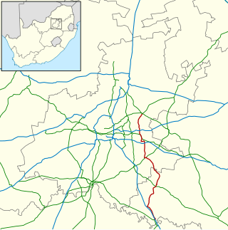
The N12 is a national route in South Africa which runs from George through Beaufort West, Kimberley, Klerksdorp and Johannesburg to eMalahleni.

<span class="mw-page-title-main">N14 (South Africa)</span> National road in South Africa

The N14 is a national route in South Africa which runs from Springbok in the Northern Cape to Pretoria in Gauteng. It passes through Upington, Kuruman, Vryburg, Krugersdorp and Centurion. The section between Pretoria and Krugersdorp is maintained by the Gauteng Provincial government and is also designated the P158.

The R101 is a Regional Route in South Africa that is the designation for some of the old sections of roads that were previously the N1, prior to upgrading. It only has 2 sections, from Bellville to Worcester and from Johannesburg to Polokwane.

The R555 is a Regional Route in South Africa that connects Springs with Ohrigstad via Delmas, Ogies, Witbank, Middelburg, Stoffberg and Burgersfort.

The M5 is a long metropolitan route in the Greater Johannesburg metropolitan area in South Africa. It starts in Ridgeway in the southern suburbs of Johannesburg. It passes through Mayfair and Brixton before travelling through Melville, Roosevelt Park, Northcliff, Blackheath and traversing the N1 Western Bypass at Randpark Ridge. It passes under the N14 freeway near Muldersdrift passing through the agricultural holding before ending at Kromdraai Road in the Lindley Agricultural Holdings. The main part of the route runs along Beyers Naudé Drive.

M7 is a metropolitan route in the Greater Johannesburg metropolitan area. The road connects Thokoza and the southern suburbs of Alberton with suburbs to the west of the Johannesburg CBD.

M11 is a major metropolitan route in Greater Johannesburg, South Africa. Historically it was part of the main road between Johannesburg and Pretoria; it now runs through the central and north-eastern parts of the city from Bassonia, passing through Johannesburg CBD and Hillbrow, passing through numerous older suburbs, including Houghton and Orange Grove and the Alexandra Township as Louis Botha Avenue, before it becomes the (R101) Old Pretoria Road and continues to Midrand and Pretoria.

The M33 is a metropolitan route in Johannesburg, South Africa. The southern half of the road connects the light industry areas of City Deep and Rosherville with the M2 motorway while the northern half connects the eastern suburbs of Johannesburg with the northern suburbs.

The M31 is a metropolitan route in Johannesburg, South Africa. The road connects the southern suburbs of Alberton with Johannesburg's northern suburbs. The routes eastern bypass in the Johnannesburg CBD connects the M2 motorway at the Heidelberg Interchange with M1 North motorway in Houghton and then the route follows the M1 motorway northwards until the M31 ends in Bramley.

M71 is a major metropolitan route in Johannesburg, South Africa. Starting in the northern CBD, it connects the centre of Johannesburg with the northern suburbs before ending in the outer northern city of Midrand.

The M18 is a long metropolitan route in Greater Johannesburg, South Africa. It connects Krugersdorp with Bruma via Constantia Kloof, Florida, Auckland Park, Braamfontein and Observatory.

The M20 is a short metropolitan route in Johannesburg, South Africa. It connects Randburg in the western part of Johannesburg with Edenvale in the east.

The M30 is a metropolitan route in Johannesburg, South Africa connecting Florida in the west with Lombardy East and Edenvale.

References

  1. "Johannesburg Roads Agency - Company documents". www.jra.org.za. Retrieved 23 March 2021.
  2. "Johannesburg Road Agency Q2 2021 Report" (PDF). Johannesburg Road Agency Website. Retrieved 23 March 2021.{{cite web}}: CS1 maint: url-status (link)
  3. 1 2 3 4 5 6 7 8 9 10 11 12 13 14 15 16 17 Street Guide Witwatersrand (11 ed.). MapStudio. 2001. ISBN   1-86809-537-1.