Wayanad is a district in the north-east of the Indian state of Kerala, with administrative headquarters at the municipality of Kalpetta. It is the only plateau in Kerala. The Wayanad Plateau forms a continuation of the Mysore Plateau, the southern portion of Deccan Plateau which links the Western Ghats with the Eastern Ghats. It is set high in the Western Ghats with altitudes ranging from 700 to 2,100 meters. Vellari Mala, a 2,240 m (7,349 ft) high peak situated on the trijunction of Wayanad, Malappuram, and Kozhikode districts, is the highest point in Wayanad district. The district was formed on 1 November 1980 as the 12th district in Kerala, by carving out areas from Kozhikode and Kannur districts. An area of 885.92 km2 in the district is forested. Wayanad has three municipal towns—Kalpetta, Mananthavady and Sulthan Bathery. There are many indigenous tribes in this area. The Kabini River, a tributary of Kaveri River, originates at Wayanad. Wayanad district, along with the Chaliyar valley in the neighbouring Nilambur in Malappuram district, is known for natural gold fields, which are also seen in other parts of the Nilgiri Biosphere Reserve. Chaliyar river, which is the fourth longest river of Kerala, originates on the Wayanad plateau. The historically important Edakkal Caves are located in Wayanad district.
Mahe also known as Mayyazhi, is a small town in the Mahe district of the Puducherry Union Territory. It is situated at the mouth of the Mahe River and is surrounded by the State of Kerala. The Kannur district surrounds Mahe on three sides and Kozhikode district from one side.
Nilambur is a major town, a municipality and a Taluk in the Malappuram district of the Indian state of Kerala. It is located close to the Nilgiris range of the Western Ghats on the banks of the Chaliyar River. This place is also known as 'Teak Town' because of the abundance of Nilambur teaks, which is a variety of a large, deciduous tree that occurs in mixed hardwood forests. Unlike many Municipalities of India; Nilambur is covered with large amounts of vegetation, making it very scenic.

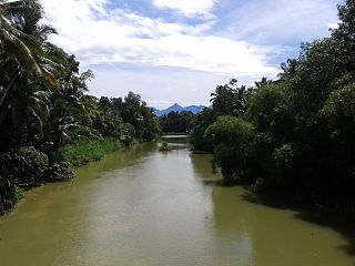
Chaliyar River is the fourth longest river in Kerala at 169 km in length. The Chaliyar is also known as Chulika River, Nilambur River or Beypore River as it is near the sea. Pothukal, Chungathara, Nilambur, Mampad, Edavanna, Kavanoor, Perakamanna, Areekode, Kizhuparamba, Elamaram, Cheekkode, Vazhakkad, Vazhayur, Cheruvadi, Edavannappara, Mavoor, Peruvayal, Feroke and Beypore are some of the towns/villages situated along the banks of the Chaliyar. It mainly flows through Malappuram district. Its tributaries flow through both the districts of Malappuram and Kozhikode. The bank of river Chaliyar in the Nilambur region is also known for its natural Gold fields. Explorations done at the valley of the river Chaliyar in Nilambur have shown reserves of the order of 2.5 million cubic meters of placers with 0.1 gram per cubic meter of gold. It originates at the Ilambaleri hills of Nilgiri Mountains in Nilgiris district, which is also near Wayanad-Malappuram district border. It flows mainly through the erstwhile region of Eranad, and finally empties into the Arabian Sea at Beypore port, opposite to Chaliyam harbour.

Brahmagiri, is a mountain range in the Western Ghats of south India. It is situated on the border between Kodagu district in Karnataka state in the north and Wayanad district of Kerala state on the south. Brahmagiri Hill, at 1608 m height, is a scenic tourist attraction. The top of Brahmagiri Hill is well forested and has much wildlife.

The Kerala backwaters are a network of brackish lagoons and canals lying parallel to the Arabian Sea of the Malabar coast of Kerala state in south-western India. It also includes interconnected lakes, rivers, and inlets, a labyrinthine system formed by more than 900 km (560 mi) of waterways, and sometimes compared to bayous. The network includes five large lakes linked by canals, both man made and natural, fed by 38 rivers, and extending virtually half the length of Kerala state. The backwaters were formed by the action of waves and shore currents creating low barrier islands across the mouths of the many rivers flowing down from the Western Ghats range. In the midst of this landscape there are a number of towns and cities, which serve as the starting and end points of backwater cruises. There are 34 backwaters in Kerala. Out of it, 27 are located either closer to Arabian Sea or parallel to the sea. The remaining 7 are inland navigation routes.

Periyar, IPA:[peɾijɐːr], is the longest river and the river with the largest discharge potential in the Indian state of Kerala. It is one of the few perennial rivers in the region and provides drinking water for several major towns. The Periyar is of utmost significance to the economy of Kerala. It generates a significant proportion of Kerala's electrical power via the Idukki Dam and flows along a region of industrial and commercial activity. The river also provides water for irrigation and domestic use throughout its course besides supporting a rich fishery. Due to these reasons, the river has been named the "Lifeline of Kerala". Kochi city, in the vicinity of the river mouth, draws its water supply from Aluva, an upstream site sufficiently free of seawater intrusion. Twenty five percent of Kerala's industries are along the banks of the Periyar. These are mostly crowded within a stretch of 5 kilometres (3 mi) in the Eloor-Edayar region (Udhyogamandal), about 10 kilometres (6 mi) north of Kochi harbor.
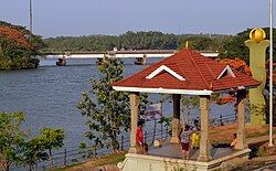
Beypore or Beypur is an ancient port town and a locality town in Kozhikode district in the state of Kerala, India. It is located opposite to Chaliyam, the estuary where the river Chaliyar empties into Arabian Sea. Beypore is part of Kozhikode Municipal Corporation. The place was formerly known as Vaypura / Vadaparappanad and also as Beydary. Tippu Sultan, ruler of Mysore, named the town "Sultan Pattanam". There is a marina and a beach while Beypore port is one of the oldest ports in Kerala, which historically traded with the Middle East. Beypore is noted for building wooden ships, known as dhows or urus in the Malayalam language. These ships were usually bought by Arab merchants for trading and fishing but are now used as tourist ships. According to Captain Iwata, founder member of the Association of Sumerian ships in Japan, Sumerian ships might have been built in Beypore. There is evidence to prove that Beypore had direct trade links with Mesopotamia and was a prominent link on the maritime silk route. The first railway line of Kerala was laid in 1861 from Tirur to Beypore (Chaliyam) passing through Tanur, Parappanangadi, Vallikkunnu, and Kadalundi.
Vatakara,, , French: Bargaret, is a Municipality, Taluk and a major town in the Kozhikode district of Kerala state, India. The municipality of Vatakara covers an area of 23.33 km2 (9.01 sq mi) and is bordered by Mahé to the north and Payyoli to the south. It is the headquarters of Vatakara taluk, which consists of 22 panchayats. During the reign of the Kolathiris and Zamorins, Vatakara was known as Kadathanadu. During the British Raj, it was part of the North Malabar region of Malabar District in the state of Madras. The historic Lokanarkavu temple, made famous by the Vadakkan Pattukal, is situated in Vatakara. A new tardigrade species collected from Vadakara coast has been named after Kerala State; Stygarctus keralensis.

Malabar District, also known as Malayalam District, was an administrative district on the southwestern Malabar Coast of Bombay Presidency (1792–1800), Madras Presidency (1800–1937), Madras Province (1937–1950) and finally, Madras State (1950–1956) in India. It was the most populous and the third-largest district in the erstwhile Madras State. The historic town of Calicut was the admisnitrative headquarters of this district.
Feroke is a Municipality and a part of Kozhikode metropolitan area under Kozhikode Development Authority (K.D.A) in the Kozhikode district of the Indian state of Kerala.

Kallayi is one of the rivers in Kerala, India. It originates in Cherikkulathur in the Western Ghats, at an elevation of 45 metres (148 ft) and is 22 km (13.7 mi) long. It is linked to the Chaliyar by a man-made canal on the south side of the small timber village of Kallayi lying on its banks. The Kallayi was known for its timber businesses, but now many of these have been closed down.

Mahé district is one of the four districts of the union territory of Puducherry, India. It consists of the whole of the Mahé region. Mahé is the smallest district of India in terms of land area. The total area of Mahé district is surrounded on three sides by Kannur District and one side by Kozhikode District. Geographically Mahé district is part of North Malabar region.

The Kallada River is the longest river in Kollam District, Kerala, India. The river originates in Kulathupuzha, in the Western Ghats, and flows west, reaching the Arabian Sea after traveling a distance of 120 km (75 mi).
The Neyyar River is 56 km long river which flows through the Thiruvananthapuram district of Kerala in India. It flows from the Agastya Mala (Agastyarkoodam) in the Western Ghats. The town Neyyattinkara in Thiruvananthapuram district, is situated on the banks of the river, is named after this river. The river flows through the Neyyar wildlife sanctuary and into the Neyyar resorvoir. It then flows towards the west through the towns of Kallikkad, Kattakkada, Ottashekharamangalam, Keezharoor, Anavoor, Aruvipuram, Neyyantinkara and Thirupuram. The river then empties into the Arabian Sea at the Poovar estuary. Tributaries include the Kallar, Mullayar, and the Karavaliyar. It has several small canals along the river and the Neyyar Irrigation Project, "Neyyar Dam", is situated in this river. A safari park is located near the river. Neyyar river has been severely affected by sand mining.

Panamaram is a town,village in Wayanad district in the state of Kerala, India.

The Perumba River is a 51 km long river which flows through the Kannur and Kasargod districts of the Malabar region in Kerala, India. The town of Payyannur is situated on the banks of this river subsequently the river is locally known as Payyannur River.

The Bharathappuzha, also known as the Nila or Ponnani River, is a river in the Indian states of Tamil Nadu and Kerala. With a length of 209 km, it is the second longest river that flows through Kerala after the Periyar. It flows through Palakkad Gap, which is also the largest opening in the Kerala portion of Western Ghats. The Nila has groomed the culture and life of South Malabar part of Kerala. It is also referred to as the "Peraar" in ancient scripts and documents. River Bharathapuzha is an interstate river and lifeline water source for a population residing in four administrative districts, namely Malappuram and Palakkad districts, and parts of Palakkad-Thrissur district border of Kerala and Coimbatore, and Tiruppur of Tamil Nadu. The fertile Thrissur-Ponnani Kole Wetlands lie on its bank.

The Anjarakandi River is one of two major rivers that flows through the Kannur District of Kerala in India. The river originates from the slopes of the Western Ghats bordering Wayanad and Kannur districts. The 48 km long river flows in the western direction emptying into the Arabian Sea at Dharmadom.