Mangas, New Mexico

Last updated

Mangas is an extinct town in Catron County, in the U.S. state of New Mexico. The GNIS classifies it as a populated place. [1]

Catron County, New Mexico County in the United States

Catron County is a county in the U.S. state of New Mexico. As of the 2010 census, the population was 3,725, making it New Mexico's third-least populous county. Its county seat is Reserve. Catron County is New Mexico's largest county by area.

U.S. state constituent political entity of the United States

In the United States, a state is a constituent political entity, of which there are currently 50. Bound together in a political union, each state holds governmental jurisdiction over a separate and defined geographic territory and shares its sovereignty with the federal government. Due to this shared sovereignty, Americans are citizens both of the federal republic and of the state in which they reside. State citizenship and residency are flexible, and no government approval is required to move between states, except for persons restricted by certain types of court orders. Four states use the term commonwealth rather than state in their full official names.

New Mexico State of the United States of America

New Mexico is a state in the Southwestern region of the United States of America; its capital and cultural center is Santa Fe, which was founded in 1610 as capital of Nuevo México, while its largest city is Albuquerque with its accompanying metropolitan area. It is one of the Mountain States and shares the Four Corners region with Utah, Colorado, and Arizona; its other neighboring states are Oklahoma to the northeast, Texas to the east-southeast, and the Mexican states of Chihuahua to the south and Sonora to the southwest. With a population around two million, New Mexico is the 36th state by population. With a total area of 121,592 sq mi (314,920 km2), it is the fifth-largest and sixth-least densely populated of the 50 states. Due to their geographic locations, northern and eastern New Mexico exhibit a colder, alpine climate, while western and southern New Mexico exhibit a warmer, arid climate.

Variant names were Mangus and Pinoville. [1] A post office called Pinoville was established in 1905, the name was changed to Mangus in 1909, and the post office closed in 1943. [2] The present name is after Mangas Coloradas, an Apache leader. [3]
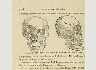
Mangas Coloradas Native American tribal chief

Mangas Coloradas or Mangus-Colorado, or Dasoda-hae was an Apache tribal chief and a member of the Mimbreño (Tchihende) division of the Central Apaches, whose homeland stretched west from the Rio Grande to include most of what is present-day southwestern New Mexico. He was the father-in-law of the Chiricahua (Tsokanende) Chief Cochise, the Mimbreño Chief Victorio and the Mescalero (Sehende) Chief Kutu-hala or Kutbhalla, and is regarded by many historians to be one of the most important Native American leaders of the 19th century due to his fighting achievements against the Mexicans and Americans.

Related Research Articles

Catron, Missouri City in Missouri, United States

Catron is a city in New Madrid County, Missouri, United States. The population was 67 at the 2010 census.

Fosters, Ohio human settlement in Ohio, United States of America

Fosters is an unincorporated community in southern Warren County, Ohio, United States. It straddles the Little Miami River in Deerfield and Hamilton Townships. It is located about two miles southwest of Hopkinsville, two miles west of Maineville, and two miles northeast of Twenty Mile Stand just off U.S. Route 22/State Route 3, the 3C Highway. The community is in the Kings Local School District and is served by the Maineville post office. The settlement was originally called Foster's Crossing. The community was named after the local Foster family.

Aragon, New Mexico Census-designated place in New Mexico, United States

Aragon is an unincorporated community and census-designated place on the Tularosa River in Catron County, New Mexico, United States. As of the 2010 census it had a population of 94. It is located at an altitude of 7,135 feet (2,175 m), 7 miles (11 km) northeast of Apache Creek.

Acadia Valley Hamlet in Alberta, Canada

Acadia Valley is a hamlet in southeast Alberta within the Municipal District (M.D.) of Acadia No. 34. The M.D. of Acadia No. 34's municipal office is located in Acadia Valley.

San Francisco Plaza, New Mexico Unincorporated community in New Mexico, United States

San Francisco Plaza was the name of three towns in Catron County, New Mexico, United States. Located in the San Francisco River Valley, the towns were settled by Spanish settlers in the 1860s. Today Middle San Francisco Plaza is called Middle Frisco, Lower San Francisco is called Lower Frisco, and Upper San Francisco was renamed Reserve when U.S. Forest Service headquarters were built there.

Millerstown, Champaign County, Ohio unincorporated community in Johnson Township, Champaign County, Ohio

Millerstown is an unincorporated community in eastern Johnson Township, Champaign County, Ohio, United States. It lies at the intersection of Heck Hill, Ward, and Zimmerman Roads, 2 12 miles (4.0 km) north of U.S. Route 36. Nettle Creek, a tributary of the Mad River, flows past Millerstown. It is located approximately 4 miles northeast of the village of St. Paris and 10 miles (16 km) west-northwest of the city of Urbana, the county seat of Champaign County.

Rock Haven, Fresno County, California Unincorporated community in California, United States

Rock Haven is an unincorporated community in Fresno County, California. It is located 1.5 miles (2.4 km) north of Shaver Lake Heights, at an elevation of 5774 feet.

East Palmyra is a hamlet in the Town of Palmyra, Wayne County, New York, United States near the Arcadia town line. It is located 5 miles (8 km) northeast of the Village of Palmyra and 5 miles (8 km) northwest of the Village of Newark, at an elevation of 443 feet. The primary cross roads where the hamlet is located are Tellier Road, South Creek Road and East Palmyra-Port Gibson Road.

Gerber is a ghost town in Walker County, in the U.S. state of Georgia.

Mitchell is a former town in Eagle County, in the U.S. state of Colorado. The GNIS classifies it as a populated place.

Rossville is an unincorporated community in Miami County, in the U.S. state of Ohio.

Mangas Springs is a populated place in Grant County, New Mexico named for the springs found at that location. It lies at an elevation of 4,734 feet / 1,443 meters on Mangus Creek a tributary of the Gila River.

Gettysburg was a town near the mouth of the Lyre River at the Strait of Juan de Fuca in Clallam County, in the U.S. state of Washington.

Patterson is an extinct town in Catron County, in the U.S. state of New Mexico. Located about 6 miles west of Horse Springs, the precise location of the town site is unknown to the GNIS.

Greens Gap is an extinct town in Catron County, in the U.S. state of New Mexico. The GNIS classifies it as a populated place.

Index is an extinct town in Cass County, in the U.S. state of Missouri.

Buckhart is an unincorporated community in Douglas County, Missouri. The townsite is at an elevation of 876 feet (267 m) located on Brush Creek east of Missouri Route 95 on State Route CC. It is south of Drury and northeast of Gentryville.

Washington Center is an unincorporated community in Harrison County, in the U.S. state of Missouri.

Pulltight is an unincorporated community in Mississippi County, in the U.S. state of Missouri.

References

  1. 1 2 U.S. Geological Survey Geographic Names Information System: Mangas
  2. "Post Offices". Jim Forte Postal History. Retrieved 8 September 2016.
  3. Boyle, Dixie (Feb 5, 2009). "A few ghost towns in Catron County". Mountain Mail. pp. B4. Retrieved 11 September 2016.

Coordinates: 34°09′25″N108°19′09″W / 34.15694°N 108.31917°W / 34.15694; -108.31917

Geographic coordinate system Coordinate system

A geographic coordinate system is a coordinate system that enables every location on Earth to be specified by a set of numbers, letters or symbols. The coordinates are often chosen such that one of the numbers represents a vertical position and two or three of the numbers represent a horizontal position; alternatively, a geographic position may be expressed in a combined three-dimensional Cartesian vector. A common choice of coordinates is latitude, longitude and elevation. To specify a location on a plane requires a map projection.