Greenlee County is a county in the southeastern part of the U.S. state of Arizona. As of the 2020 census, the population was 9,563, making it Arizona's least populous county. The county seat is Clifton.

Catron County is a county in the U.S. state of New Mexico. As of the 2010 census, the population was 3,725, making it New Mexico's third-least populous county. Its county seat is Reserve. Catron County is New Mexico's largest county by area.

Chilili is a census-designated place in Bernalillo County, New Mexico, United States. The population was 137 at the 2010 census. It is part of the Albuquerque Metropolitan Statistical Area.

Brimhall Nizhoni is a census-designated place (CDP) in McKinley County, New Mexico, United States. The population was 199 at the 2010 census. The Navajo Coyote Canyon Chapter House is located in Brimhall.

Beclabito is a census-designated place (CDP) in San Juan County, New Mexico, United States. The population was 317 at the 2010 census. It is part of the Farmington Metropolitan Statistical Area.

San Felipe Pueblo is a census-designated place (CDP) in Sandoval County, New Mexico, United States, and is located 10 miles (16 km) north of Bernalillo. As of the 2000 census, the CDP population was 2,080. It is part of the Albuquerque Metropolitan Statistical Area.

Tierra Bonita is a census-designated place (CDP) in Cameron County, Texas, United States. The population was 141 at the 2010 census. It is part of the Brownsville–Harlingen Metropolitan Statistical Area.
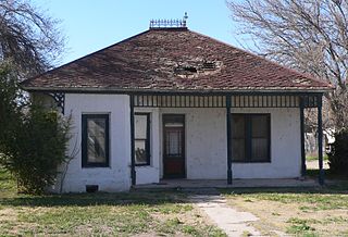
Luna is a census-designated place in northwestern Catron County, New Mexico, United States. As of the 2010 census it had a population of 158. It is situated on the San Francisco River and U.S. Route 180, 7 miles (11 km) east of the Arizona border and 20 miles (32 km) northwest of Reserve, the Catron county seat.
Homestead is a census-designated place in Catron County, New Mexico, United States. Its population was 47 as of the 2010 census.

Lower Frisco is a census-designated place in Catron County, New Mexico, United States. Its population was 31 as of the 2010 census. The community is part of San Francisco Plaza.
Middle Frisco is a census-designated place in Catron County, New Mexico, United States. Its population was 77 as of the 2010 census. The community is part of San Francisco Plaza.
Rancho Grande is a census-designated place in Catron County, New Mexico, United States. Its population was 142 as of the 2010 census. The community is located along U.S. Route 180.
Rivers is a census-designated place in Catron County, New Mexico, United States. Its population was 28 as of the 2010 census. The community is located at the confluence of the Tularosa River into the San Francisco River.
Highland Meadows is a census-designated place in Valencia County, New Mexico, United States. Its population was 624 as of the 2010 census.
Madrone is a census-designated place in Valencia County, New Mexico, United States. Its population was 707 as of the 2010 census. New Mexico State Road 304 passes through the community.
Pueblitos is a census-designated place in Valencia County, New Mexico, United States. Its population was 794 as of the 2010 census. New Mexico State Road 116 passes through the community.
Chamizal is an unincorporated community and census-designated place in Socorro County, New Mexico, United States. Its population was 101 as of the 2010 census. New Mexico State Road 408 passes through the community.
Las Nutrias is an unincorporated community and census-designated place in Socorro County, New Mexico, United States. Its population was 149 as of the 2010 census. New Mexico State Road 304 passes through the community.
Indian Hills is an unincorporated community and census-designated place in Torrance County, New Mexico, United States. Its population was 892 as of the 2010 census.
Chamita is a census-designated place in Rio Arriba County, New Mexico, United States. Its population was 870 as of the 2010 census. New Mexico State Road 74 passes through the community. During its earlier years, the community was known as San Pedro De Chamita and served as the first county seat for Rio Arriba county.

