Meadowood, Pennsylvania

Last updated
Meadowood, Pennsylvania
Map of Meadowood, Butler County, Pennsylvania Highlighted.png
Location within Butler County
USA Pennsylvania location map.svg
Red pog.svg
Meadowood
Location within the U.S. state of Pennsylvania
Coordinates: 40°50′49″N79°53′40″W / 40.84694°N 79.89444°W / 40.84694; -79.89444
Country United States
State Pennsylvania
County Butler
Township Butler
Area
[1]
  Total1.58 sq mi (4.09 km2)
  Land1.57 sq mi (4.06 km2)
  Water0.01 sq mi (0.03 km2)
Elevation
1,300 ft (400 m)
Population
 (2020) [2]
  Total2,729
  Density1,742.66/sq mi (672.69/km2)
Time zone UTC-5 (Eastern (EST))
  Summer (DST) UTC-4 (EDT)
FIPS code 42-48336

Meadowood is a census-designated place (CDP) in Butler County, Pennsylvania, United States. The population was 2,693 at the 2010 census. [3]

Contents

Geography

Meadowood is located on heights south of the city of Butler at 40°50′49″N79°53′40″W / 40.84694°N 79.89444°W / 40.84694; -79.89444 (40.846949, -79.894440), [4] within Butler Township. It is bordered to the southwest by the CDP of Oak Hills. The northwest edge of the CDP is formed by Connoquenessing Creek, flowing out of Butler on its way to the Beaver River.

Pennsylvania Route 356 passes through the CDP, leading north into downtown Butler and southeast 16 miles (26 km) to Freeport on the Allegheny River.

According to the United States Census Bureau, the CDP has a total area of 1.6 square miles (4.1 km2), of which 0.012 square miles (0.03 km2), or 0.82%, is water. [3]

Demographics

Historical population
CensusPop.Note
2020 2,729
U.S. Decennial Census [5]

As of the census [6] of 2000, there were 2,912 people, 1,100 households, and 799 families residing in the CDP. The population density was 1,881.2 inhabitants per square mile (726.3/km2). There were 1,130 housing units at an average density of 730.0 per square mile (281.9/km2). The racial makeup of the CDP was 98.73% White, 0.72% African American, 0.03% Native American, 0.21% Asian, and 0.31% from two or more races. Hispanic or Latino of any race were 0.14% of the population.

There were 1,100 households, out of which 28.5% had children under the age of 18 living with them, 63.2% were married couples living together, 6.1% had a female householder with no husband present, and 27.3% were non-families. 24.1% of all households were made up of individuals, and 12.3% had someone living alone who was 65 years of age or older. The average household size was 2.43 and the average family size was 2.89.

In the CDP, the population was spread out, with 20.4% under the age of 18, 4.7% from 18 to 24, 24.0% from 25 to 44, 27.1% from 45 to 64, and 23.8% who were 65 years of age or older. The median age was 46 years. For every 100 females, there were 90.0 males. For every 100 females age 18 and over, there were 86.3 males.

The median income for a household in the CDP was $48,004, and the median income for a family was $53,536. Males had a median income of $42,422 versus $23,387 for females. The per capita income for the CDP was $19,616. About 2.2% of families and 3.1% of the population were below the poverty line, including 3.5% of those under age 18 and 3.9% of those age 65 or over.

Related Research Articles

<span class="mw-page-title-main">Orchard Hills, Pennsylvania</span> Census-designated place in Pennsylvania, United States

Orchard Hills is a census-designated place (CDP) in Armstrong County, Pennsylvania, United States. The population was 1,952 at the 2010 census.

<span class="mw-page-title-main">West Hills, Pennsylvania</span> Census-designated place in Pennsylvania, United States

West Hills is a census-designated place (CDP) in Armstrong County, Pennsylvania, United States. The population was 1,263 at the 2010 census.

<span class="mw-page-title-main">Butler Township, Butler County, Pennsylvania</span> Township in Pennsylvania, United States

Butler Township is a township in Butler County, Pennsylvania, United States. The population was 17,248 at the 2010 census. The township was first settled by Europeans in 1795. It was established as a township in 1804 and as a first class township in 1922.

<span class="mw-page-title-main">Homeacre-Lyndora, Pennsylvania</span> Census-designated place in Pennsylvania, United States

Homeacre-Lyndora is a census-designated place (CDP) in Butler County, Pennsylvania, United States. The population was 6,906 at the 2010 census.

<span class="mw-page-title-main">Meridian, Pennsylvania</span> Census-designated place in Pennsylvania, United States

Meridian is a census-designated place (CDP) in Butler County, Pennsylvania, United States. The population was 3,881 at the 2010 census.

<span class="mw-page-title-main">Nixon, Pennsylvania</span> Census-designated place in Pennsylvania, United States

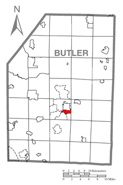
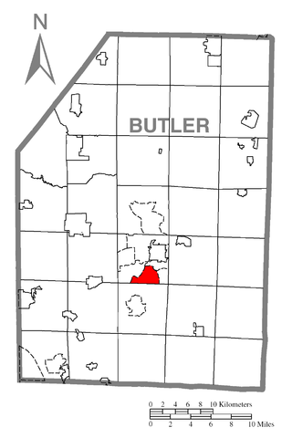
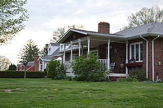
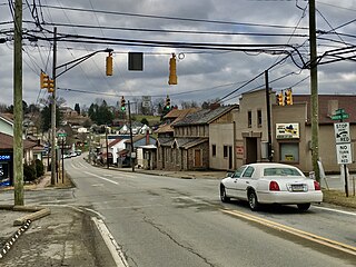
Nixon is a census-designated place (CDP) in Butler County, Pennsylvania, United States. The population was 1,373 at the 2010 census.

<span class="mw-page-title-main">Oak Hills, Pennsylvania</span> Census-designated place in Pennsylvania, United States

Oak Hills is a census-designated place (CDP) in Butler County, Pennsylvania, United States. The population was 2,333 at the 2010 census.

<span class="mw-page-title-main">Shanor-Northvue, Pennsylvania</span> Census-designated place in Pennsylvania, United States

Shanor-Northvue is a census-designated place (CDP) in Butler County, Pennsylvania, United States. The population was 5,051 at the 2010 census.

<span class="mw-page-title-main">Elim, Pennsylvania</span> Census-designated place in Pennsylvania, United States

Elim is an unincorporated community and census-designated place (CDP) in Upper Yoder Township, Cambria County, Pennsylvania, United States. The population was 3,727 at the 2010 census, down from 4,175 at the 2000 census.

<span class="mw-page-title-main">Guys Mills, Pennsylvania</span> Census-designated place in Pennsylvania, United States

Guys Mills is a census-designated place in Crawford County, Pennsylvania, United States. The population was 124 at the 2010 census.

<span class="mw-page-title-main">Lincolnville, Pennsylvania</span> Census-designated place in Pennsylvania, United States

Lincolnville is a census-designated place in Crawford County, Pennsylvania, United States. The population was 96, as per the 2010 census.

<span class="mw-page-title-main">Riceville, Pennsylvania</span> Census-designated place in Pennsylvania, United States

Riceville is a census-designated place in Crawford County, Pennsylvania, United States. The population was 68 at the 2010 census.

<span class="mw-page-title-main">Hiller, Pennsylvania</span> Census-designated place in Pennsylvania, United States

Hiller is an unincorporated community and census-designated place in Fayette County, Pennsylvania, United States. As of the 2010 census, it had a population of 1,155, down from 1,234 at the 2000 census.

<span class="mw-page-title-main">Leith-Hatfield, Pennsylvania</span> Census-designated place in Pennsylvania, United States

Leith-Hatfield is a census-designated place (CDP) in Fayette County, Pennsylvania, United States. The population was 2,546 at the 2010 census, down from 2,820 at the 2000 census. The twin villages of Leith and Hatfield are located in South Union Township.

Hasson Heights is a census-designated place (CDP) in Venango County, Pennsylvania, United States. The population was 1,351 at the 2010 census.

<span class="mw-page-title-main">Baidland, Pennsylvania</span> Census-designated place in Pennsylvania, United States

Baidland is a census-designated place (CDP) in Washington County, Pennsylvania, United States. The population was 1,563 at the 2010 census.

<span class="mw-page-title-main">Wickerham Manor-Fisher, Pennsylvania</span> Census-designated place in Pennsylvania, United States

Wickerham Manor-Fisher is a census-designated place (CDP) in Washington County, Pennsylvania, United States. The population was 1,728 at the 2010 census.

<span class="mw-page-title-main">Harrison City, Pennsylvania</span> Census-designated place in Pennsylvania, United States

Harrison City is a census-designated place (CDP) in Westmoreland County, Pennsylvania, United States. The population was 174 at the 2020 census.

<span class="mw-page-title-main">South Sumter, South Carolina</span> CDP in South Carolina, United States

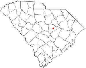
South Sumter is a census-designated place (CDP) in Sumter County, South Carolina, United States. The population was 3,365 at the 2000 census. It is included in the Sumter, South Carolina Metropolitan Statistical Area.

<span class="mw-page-title-main">Guerra, Texas</span> Census-designated place in Texas, United States

Guerra is a census-designated place (CDP) in Jim Hogg County, Texas, United States. The population was six at the 2010 census, giving it the distinction of smallest town by population in Texas.

References

  1. "ArcGIS REST Services Directory". United States Census Bureau. Retrieved October 12, 2022.
  2. "Census Population API". United States Census Bureau. Retrieved Oct 12, 2022.
  3. 1 2 "Geographic Identifiers: 2010 Demographic Profile Data (G001): Meadowood CDP, Pennsylvania". U.S. Census Bureau, American Factfinder. Archived from the original on February 12, 2020. Retrieved April 2, 2014.
  4. "US Gazetteer files: 2010, 2000, and 1990". United States Census Bureau. 2011-02-12. Retrieved 2011-04-23.
  5. "Census of Population and Housing". Census.gov. Retrieved June 4, 2016.
  6. "U.S. Census website". United States Census Bureau . Retrieved 2008-01-31.