Nixon, Pennsylvania

Last updated

Nixon, Pennsylvania
Map of Nixon, Butler County, Pennsylvania Highlighted.png
Location within Butler County
USA Pennsylvania location map.svg
Red pog.svg
Nixon
Location within the U.S. state of Pennsylvania
Coordinates: 40°47′8″N79°56′17″W / 40.78556°N 79.93806°W / 40.78556; -79.93806
Country United States
State Pennsylvania
County Butler
Township Penn
Area
[1]
  Total2.70 sq mi (6.99 km2)
  Land2.69 sq mi (6.97 km2)
  Water0.01 sq mi (0.03 km2)
Elevation
1,240 ft (380 m)
Population
 (2020) [2]
  Total1,393
  Density517.65/sq mi (199.89/km2)
Time zone UTC-5 (Eastern (EST))
  Summer (DST) UTC-4 (EDT)
FIPS code42-54552

Nixon is a census-designated place (CDP) in Penn Township, Butler County, Pennsylvania, United States. The population was 1,373 at the 2010 census. [3]

Contents

Geography

Nixon is located in Penn Township at 40°47′8″N79°56′17″W / 40.78556°N 79.93806°W / 40.78556; -79.93806 (40.785683, −79.937926). [4] Pennsylvania Route 8 passes through the CDP, leading north 6 miles (10 km) to Butler and south 26 miles (42 km) to downtown Pittsburgh.

According to the United States Census Bureau, the CDP has a total area of 2.7 square miles (7.0 km2), of which 0.012 square miles (0.03 km2), or 0.36%, is water. [3]

Demographics

Historical population
CensusPop.Note
2020 1,393
U.S. Decennial Census [5]

As of the 2000 census, [6] there were 1,404 people, 508 households, and 419 families residing in the CDP. The population density was 526.7 inhabitants per square mile (203.4/km2). There were 529 housing units at an average density of 198.4 per square mile (76.6/km2). The racial makeup of the CDP was 98.08% White, 0.28% African American, 1.35% Asian, 0.07% from other races, and 0.21% from two or more races. Hispanic or Latino of any race were 0.78% of the population.

There were 508 households, out of which 34.4% had children under the age of 18 living with them, 74.0% were married couples living together, 5.5% had a female householder with no husband present, and 17.5% were non-families. 15.4% of all households were made up of individuals, and 7.5% had someone living alone who was 65 years of age or older. The average household size was 2.67 and the average family size was 2.98.

In the CDP, the population was spread out, with 24.1% under the age of 18, 4.4% from 18 to 24, 26.0% from 25 to 44, 28.4% from 45 to 64, and 17.1% who were 65 years of age or older. The median age was 43 years. For every 100 females, there were 110.5 males. For every 100 females age 18 and over, there were 105.0 males.

The median income for a household in the CDP was $58,864, and the median income for a family was $65,759. Males had a median income of $48,550 versus $29,423 for females. The per capita income for the CDP was $27,269. About 3.3% of families and 3.4% of the population were below the poverty line, including none of those under age 18 and 14.6% of those age 65 or over.

Related Research Articles

<span class="mw-page-title-main">Curtisville, Pennsylvania</span> Census-designated place in Pennsylvania, United States

Curtisville is a census-designated place (CDP) in West Deer Township, Pennsylvania, United States. The population was 1,097 at the 2020 census.

<span class="mw-page-title-main">Lenape Heights, Pennsylvania</span> Census-designated place in Pennsylvania, United States

Lenape Heights is a census-designated place (CDP) in Armstrong County, Pennsylvania, United States. The population was 1,144 at the 2020 census.

<span class="mw-page-title-main">Orchard Hills, Pennsylvania</span> Census-designated place in Pennsylvania, United States

Orchard Hills is a census-designated place (CDP) in Armstrong County, Pennsylvania, United States. The population was 1,949 at the 2020 census.

<span class="mw-page-title-main">West Hills, Pennsylvania</span> Census-designated place in Pennsylvania, United States

West Hills is a census-designated place (CDP) in Armstrong County, Pennsylvania, United States. The population was 1,228 at the 2020 census.

<span class="mw-page-title-main">Meadowood, Pennsylvania</span> Census-designated place in Pennsylvania, United States

Meadowood is a census-designated place (CDP) in Butler County, Pennsylvania, United States. The population was 2,693 at the 2010 census.

<span class="mw-page-title-main">Meridian, Pennsylvania</span> Census-designated place in Pennsylvania, United States

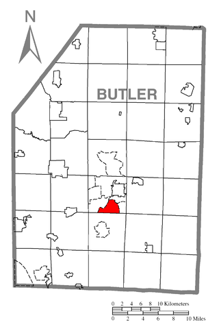
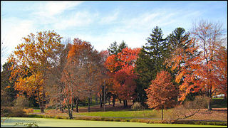
Meridian is a census-designated place (CDP) in Butler County, Pennsylvania, United States. The population was 3,881 at the 2010 census.

<span class="mw-page-title-main">Oak Hills, Pennsylvania</span> Census-designated place in Pennsylvania, United States

Oak Hills is a census-designated place (CDP) in Butler County, Pennsylvania, United States. The population was 2,333 at the 2010 census.

<span class="mw-page-title-main">Elim, Pennsylvania</span> Census-designated place in Pennsylvania, United States

Elim is an unincorporated community and census-designated place (CDP) in Upper Yoder Township, Cambria County, Pennsylvania, United States. The population was 3,727 at the 2010 census, down from 4,175 at the 2000 census.

<span class="mw-page-title-main">Kenilworth, Pennsylvania</span> Census-designated place in Pennsylvania, United States

Kenilworth is a census-designated place (CDP) in North Coventry Township, Chester County, Pennsylvania, United States. The population was 2,148 at the 2020 census.

<span class="mw-page-title-main">Guys Mills, Pennsylvania</span> Census-designated place in Pennsylvania, United States

Guys Mills is a census-designated place in Crawford County, Pennsylvania, United States. The population was 124 at the 2010 census.

<span class="mw-page-title-main">Hiller, Pennsylvania</span> Census-designated place in Pennsylvania, United States

Hiller is an unincorporated community and census-designated place in Fayette County, Pennsylvania, United States. As of the 2010 census, it had a population of 1,155, down from 1,234 at the 2000 census.

Black Lick is a census-designated place (CDP) in Burrell Township, Indiana County, Pennsylvania, United States. The population was 1,462 at the 2010 census.

Jacksonville is a census-designated place (CDP) in Indiana County, Pennsylvania, United States. The population was 637 at the 2010 census. It was formerly an independent borough, until January 1, 1993 when it was returned to Black Lick Township, Pennsylvania.

<span class="mw-page-title-main">Porter Township, Jefferson County, Pennsylvania</span> Township in Pennsylvania, United States

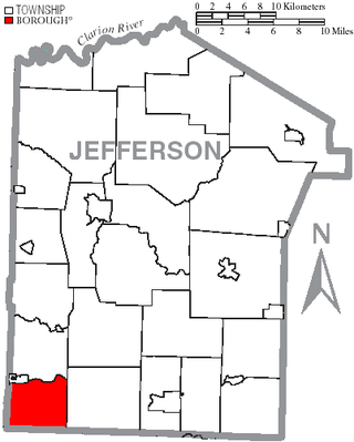
Porter Township is a township in Jefferson County, Pennsylvania, United States. The population was 294 at the 2020 census.

<span class="mw-page-title-main">Baidland, Pennsylvania</span> Census-designated place in Pennsylvania, United States

Baidland is a census-designated place (CDP) in Washington County, Pennsylvania, United States. The population was 1,563 at the 2010 census.

<span class="mw-page-title-main">Wickerham Manor-Fisher, Pennsylvania</span> Census-designated place in Pennsylvania, United States

Wickerham Manor-Fisher is a census-designated place (CDP) in Washington County, Pennsylvania, United States. The population was 1,728 at the 2010 census.

<span class="mw-page-title-main">Harrison City, Pennsylvania</span> Census-designated place in Pennsylvania, United States

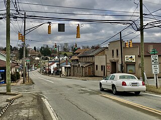
Harrison City is a census-designated place (CDP) in Westmoreland County, Pennsylvania, United States. The population was 174 at the 2020 census.

Lawson Heights is a census-designated place (CDP) in Unity Township, Westmoreland County, Pennsylvania, United States. The population was 2,339 at the 2000 census.

Loyalhanna is a census-designated place (CDP) in Westmoreland County, Pennsylvania, United States. The population was 3,415 at the 2000 census, at which time it was listed as McChesneytown-Loyalhanna, before just becoming the CDP of Loyalhanna for the 2010 census. As of the 2010 census the population was 3,428 residents.

Lynnwood-Pricedale is a census-designated place (CDP) in Fayette and Westmoreland counties in the Pennsylvania. The population was 2,031 at the 2010 census, down from 2,168 at the 2000 census. The community of Lynwood is located in Fayette County's Washington Township, while Pricedale is part of Westmoreland County's Rostraver Township.

References

  1. "ArcGIS REST Services Directory". United States Census Bureau. Retrieved October 12, 2022.
  2. "Census Population API". United States Census Bureau. Retrieved October 12, 2022.
  3. 1 2 "Geographic Identifiers: 2010 Demographic Profile Data (G001): Nixon CDP, Pennsylvania". U.S. Census Bureau, American Factfinder. Archived from the original on February 12, 2020. Retrieved April 2, 2014.
  4. "US Gazetteer files: 2010, 2000, and 1990". United States Census Bureau. February 12, 2011. Retrieved April 23, 2011.
  5. "Census of Population and Housing". Census.gov. Retrieved June 4, 2016.
  6. "U.S. Census website". United States Census Bureau . Retrieved January 31, 2008.