Shanor-Northvue, Pennsylvania

Last updated

Shanor-Northvue, Pennsylvania
Mayfield from Beechwood in Shanor.jpg
Houses on Mayfield Drive
Map of Shanor-Northvue, Butler County, Pennsylvania Highlighted.png
Location within Butler County
USA Pennsylvania location map.svg
Red pog.svg
Shanor-Northvue
Location within the U.S. state of Pennsylvania
Coordinates: 40°54′13″N79°54′30″W / 40.90361°N 79.90833°W / 40.90361; -79.90833
Country United States
State Pennsylvania
County Butler
Township Center
Area
  Total6.78 sq mi (17.55 km2)
  Land6.75 sq mi (17.49 km2)
  Water0.02 sq mi (0.06 km2)
Elevation
1,340 ft (410 m)
Population
 (2010)
  Total5,051
  Density288.8/sq mi (111.5/km2)
Time zone UTC-5 (Eastern (EST))
  Summer (DST) UTC-4 (EDT)
ZIP code
16001 [1]

Shanor-Northvue is a census-designated place (CDP) in Butler County, Pennsylvania, United States. The population was 5,051 at the 2010 census. [2]

Contents

Geography

Shanor-Northvue occupies the central and south-central portions of Center Township in Butler County and is located at 40°54′13″N79°54′30″W / 40.90361°N 79.90833°W / 40.90361; -79.90833 (40.903647, −79.908405). [3] It consists of residential areas outside the city of Butler that include Shanor Heights, Windward Heights, Timberly Heights, Northvue, and part of Fisher Heights. The Clearview Mall is located in Shanor Heights. Shanor-Northvue is bordered to the south by the Homeacre-Lyndora CDP in Butler Township.

Pennsylvania Route 8 is the main road through the CDP, leading south 3 miles (5 km) to downtown Butler and north 18 miles (29 km) to Harrisville.

According to the United States Census Bureau, Shanor-Northview has a total area of 6.8 square miles (17.5 km2), of which 0.023 square miles (0.06 km2), or 0.33%, is water. [2]

It is also home to Center Township School, which is part of the Butler Area school district system.

Demographics

As of the 2000 census, [4] there were 4,825 people, 1,997 households, and 1,373 families living in the CDP. The population density was 718.1 people per square mile (277.3 people/km2). There were 2,093 housing units at an average density of 311.5 per square mile (120.3/km2). The racial makeup of the CDP was 98.18% White, 0.39% African American, 0.02% Native American, 0.66% Asian, 0.02% Pacific Islander, 0.25% from other races, and 0.48% from two or more races. Hispanic or Latino of any race were 0.44% of the population.

There were 1,997 households, out of which 28.1% had children under the age of 18 living with them, 60.5% were married couples living together, 6.4% had a female householder with no husband present, and 31.2% were non-families. 28.3% of all households were made up of individuals, and 16.5% had someone living alone who was 65 years of age or older. The average household size was 2.36 and the average family size was 2.91.

In the CDP the population was spread out, with 21.7% under the age of 18, 5.8% from 18 to 24, 25.1% from 25 to 44, 26.0% from 45 to 64, and 21.4% who were 65 years of age or older. The median age was 43 years. For every 100 females there were 86.7 males. For every 100 females age 18 and over, there were 81.9 males.

The median income for a household in the CDP was $43,158, and the median income for a family was $53,426. Males had a median income of $45,000 versus $27,067 for females. The per capita income for the CDP was $23,852. About 2.0% of families and 5.1% of the population were below the poverty line, including 4.8% of those under age 18 and 5.8% of those age 65 or over.

Related Research Articles

<span class="mw-page-title-main">Beckett Ridge, Ohio</span> Census-designated place in Ohio, United States

Beckett Ridge is a census-designated place (CDP) in West Chester Township, Butler County, Ohio, United States. The population was 9,192 at the 2020 census.

<span class="mw-page-title-main">Day Heights, Ohio</span> Census-designated place in Ohio, United States

Day Heights is a census-designated place (CDP) in Clermont County, Ohio, United States. The population was 2,625 at the 2020 census.

<span class="mw-page-title-main">Harmar Township, Allegheny County, Pennsylvania</span> Township in Pennsylvania, United States

Harmar Township is a township in Allegheny County, Pennsylvania, United States. It contains the communities of Acmetonia, Harmarville, Harmar Heights, and Chapel Downs. The population was 3,136 at the 2020 census. The township was named after Harmar Denny, a U.S. congressman and son of Ebenezer Denny.

<span class="mw-page-title-main">Lenape Heights, Pennsylvania</span> Census-designated place in Pennsylvania, United States

Lenape Heights is a census-designated place (CDP) in Armstrong County, Pennsylvania, United States. The population was 1,144 at the 2020 census.

<span class="mw-page-title-main">West Hills, Pennsylvania</span> Census-designated place in Pennsylvania, United States

West Hills is a census-designated place (CDP) in Armstrong County, Pennsylvania, United States. The population was 1,228 at the 2020 census.

<span class="mw-page-title-main">Center Township, Butler County, Pennsylvania</span> Township in Pennsylvania, United States

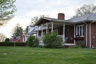
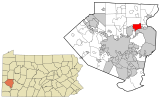
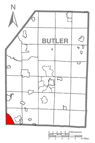
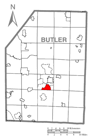
Center Township is a township in Butler County, Pennsylvania, United States. The population was 7,900 at the 2020 census.

<span class="mw-page-title-main">Cherry Township, Butler County, Pennsylvania</span> Township in Pennsylvania, United States

Cherry Township is a township in Butler County, Pennsylvania, United States. The population was 1,106 at the 2010 census.

<span class="mw-page-title-main">Fernway, Pennsylvania</span> Former census-designated place in Pennsylvania, United States

Fernway is a neighborhood in Cranberry Township, Butler County, Pennsylvania, United States. It includes 458 homes on 183 acres and was the first planned housing subdivision in the Township, dating back to the 1950s. Fernway was formerly used as the name of a census-designated place (CDP), but the designation was removed as of TIGER 2013 after Cranberry Township officials pointed out that users of Internet mapping websites frequently misinterpreted the CDP as the name of its parent municipality.

<span class="mw-page-title-main">Fox Run, Pennsylvania</span> Former census-designated place in Pennsylvania, United States

Fox Run is a neighborhood in Cranberry Township, Butler County, Pennsylvania, United States. It is among the Township's earliest housing developments, including 320 homes built on a 131-acre site in the late 1960s. It was formerly a census-designated place (CDP), but that designation was removed as of TIGER 2013 after Cranberry Township officials pointed out that users of Internet mapping websites had misinterpreted the CDP as the name of its parent municipality.

<span class="mw-page-title-main">Homeacre-Lyndora, Pennsylvania</span> Census-designated place in Pennsylvania, United States

Homeacre-Lyndora is a census-designated place (CDP) in Butler County, Pennsylvania, United States. The population was 6,906 at the 2010 census.

<span class="mw-page-title-main">Meadowood, Pennsylvania</span> Census-designated place in Pennsylvania, United States

Meadowood is a census-designated place (CDP) in Butler County, Pennsylvania, United States. The population was 2,693 at the 2010 census.

<span class="mw-page-title-main">Meridian, Pennsylvania</span> Census-designated place in Pennsylvania, United States

Meridian is a census-designated place (CDP) in Butler County, Pennsylvania, United States. The population was 3,881 at the 2010 census.

<span class="mw-page-title-main">Nixon, Pennsylvania</span> Census-designated place in Pennsylvania, United States

Nixon is a census-designated place (CDP) in Penn Township, Butler County, Pennsylvania, United States. The population was 1,373 at the 2010 census.

<span class="mw-page-title-main">Oak Hills, Pennsylvania</span> Census-designated place in Pennsylvania, United States

Oak Hills is a census-designated place (CDP) in Butler County, Pennsylvania, United States. The population was 2,333 at the 2010 census.

<span class="mw-page-title-main">Elim, Pennsylvania</span> Census-designated place in Pennsylvania, United States

Elim is an unincorporated community and census-designated place (CDP) in Upper Yoder Township, Cambria County, Pennsylvania, United States. The population was 3,727 at the 2010 census, down from 4,175 at the 2000 census.

<span class="mw-page-title-main">Rutherford, Pennsylvania</span> Census-designated place in Pennsylvania, United States

Rutherford is a census-designated place (CDP) in Swatara Township, Dauphin County, Pennsylvania, United States. The area is also known as Rutherford Heights. The population was 4,303 at the 2010 census, an increase over the figure of 3,859 tabulated in 2000. It is part of the Harrisburg–Carlisle Metropolitan Statistical Area.

Chevy Chase Heights is a census-designated place within White Township, Indiana County, Pennsylvania, United States. The population was 1,502 at the 2010 census.

Glenburn is a census-designated place (CDP) in Glenburn Township, Lackawanna County, Pennsylvania, United States. The population was 953 at the 2010 census. It is approximately 10 miles (16 km) north of downtown Scranton, in the growing suburban area known as the "Abingtons". Glenburn is located north of Clarks Summit and south of Dalton.

Woodland Heights is a census-designated place (CDP) in Venango County, Pennsylvania, United States. The population was 1,402 at the 2000 census.

Lawson Heights is a census-designated place (CDP) in Unity Township, Westmoreland County, Pennsylvania, United States. The population was 2,339 at the 2000 census.

References

  1. "Shanor-Northvue PA ZIP Code". zipdatamaps.com. 2023. Retrieved May 13, 2023.
  2. 1 2 "Geographic Identifiers: 2010 Demographic Profile Data (G001): Shanor-Northvue CDP, Pennsylvania". U.S. Census Bureau, American Factfinder. Archived from the original on February 12, 2020. Retrieved April 2, 2014.
  3. "US Gazetteer files: 2010, 2000, and 1990". United States Census Bureau. February 12, 2011. Retrieved April 23, 2011.
  4. "U.S. Census website". United States Census Bureau . Retrieved January 31, 2008.