Oak Hills, Pennsylvania

Last updated

Oak Hills, Pennsylvania
Map of Oak Hills, Butler County, Pennsylvania Highlighted.png
Location within Butler County
USA Pennsylvania location map.svg
Red pog.svg
Oak Hills
Location within the U.S. state of Pennsylvania
Coordinates: 40°49′30″N79°55′8″W / 40.82500°N 79.91889°W / 40.82500; -79.91889
Country United States
State Pennsylvania
County Butler
Township Butler
Area
[1]
  Total3.37 sq mi (8.72 km2)
  Land3.37 sq mi (8.72 km2)
  Water0.00 sq mi (0.00 km2)
Elevation
1,230 ft (370 m)
Population
 (2020) [2]
  Total2,382
  Density707.03/sq mi (273.02/km2)
Time zone UTC-5 (Eastern (EST))
  Summer (DST) UTC-4 (EDT)
FIPS code42-55969

Oak Hills is a census-designated place (CDP) in Butler County, Pennsylvania, United States. The population was 2,333 at the 2010 census. [3]

Contents

Geography

Oak Hills is located in the southern part of Butler Township at 40°49′30″N79°55′8″W / 40.82500°N 79.91889°W / 40.82500; -79.91889 (40.825041, −79.918853). [4] It is bordered to the northeast by Meadowood. The northwestern boundary of the CDP follows Connoquenessing Creek. Pennsylvania Route 8 passes through the CDP, leading north 4 miles (6 km) to downtown Butler and south 29 miles (47 km) to downtown Pittsburgh.

Butler County Community College is located in Oak Hills.

According to the United States Census Bureau, the CDP has a total area of 3.4 square miles (8.7 km2), all land. [3]

Demographics

Historical population
CensusPop.Note
2020 2,382
U.S. Decennial Census [5]

As of the 2000 census, [6] there were 2,335 people, 948 households, and 663 families living in the CDP. The population density was 723.4 inhabitants per square mile (279.3/km2). There were 973 housing units at an average density of 301.5 per square mile (116.4/km2). The racial makeup of the CDP was 98.46% White, 0.47% African American (roughly 11 individuals), 0.04% Native American (roughly 1 individual), 0.43% Asian, 0.09% Pacific Islander, 0.09% from other races, and 0.43% from two or more races. Hispanic or Latino of any race were 0.73% of the population.

There were 948 households, out of which 33.2% had children under the age of 18 living with them, 57.0% were married couples living together, 10.0% had a female householder with no husband present, and 30.0% were non-families. 26.2% of all households were made up of individuals, and 9.2% had someone living alone who was 65 years of age or older. The average household size was 2.46 individuals and the average family size was 2.98 individuals.

In the CDP, the population was spread out, with 25.0% under the age of 18, 7.2% from 18 to 24, 26.1% from 25 to 44, 27.2% from 45 to 64, and 14.6% who were 65 years of age or older. The median age was 40 years. For every 100 females, there were 90.6 males. For every 100 females age 18 and over, there were 88.0 males.

The median income for a household in the CDP was $46,078, and the median income for a family was $56,447. Males had a median income of $52,500 versus $32,083 for females. The per capita income for the CDP was $22,106. About 6.3% of families and 10.0% of the population were below the poverty line, including 14.3% of those under age 18 and 7.4% of those age 65 or over.

Related Research Articles

<span class="mw-page-title-main">Harbor Bluffs, Florida</span> Census-designated place in Florida, United States

Harbor Bluffs is a census-designated place (CDP) in Pinellas County, Florida, United States. The population was 2,860 at the 2010 census.

<span class="mw-page-title-main">Rio en Medio, New Mexico</span> CDP in New Mexico, United States

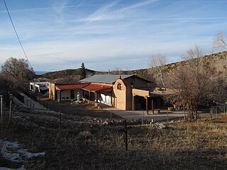
Rio en Medio is a census-designated place (CDP) in Santa Fe County, New Mexico, United States. It is part of the Santa Fe, New Mexico Metropolitan Statistical Area. The population was 131 at the 2000 census.

<span class="mw-page-title-main">Lenape Heights, Pennsylvania</span> Census-designated place in Pennsylvania, United States

Lenape Heights is a census-designated place (CDP) in Armstrong County, Pennsylvania, United States. The population was 1,144 at the 2020 census.

<span class="mw-page-title-main">Orchard Hills, Pennsylvania</span> Census-designated place in Pennsylvania, United States

Orchard Hills is a census-designated place (CDP) in Armstrong County, Pennsylvania, United States. The population was 1,949 at the 2020 census.

<span class="mw-page-title-main">West Hills, Pennsylvania</span> Census-designated place in Pennsylvania, United States

West Hills is a census-designated place (CDP) in Armstrong County, Pennsylvania, United States. The population was 1,228 at the 2020 census.

<span class="mw-page-title-main">Buffalo Township, Butler County, Pennsylvania</span> Township in Pennsylvania, United States

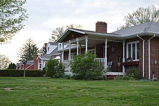
Buffalo Township is a township in Butler County, Pennsylvania, United States. The population was 7,896 at the 2020 census.

<span class="mw-page-title-main">Fox Run, Pennsylvania</span> Former census-designated place in Pennsylvania, United States

Fox Run is a neighborhood in Cranberry Township, Butler County, Pennsylvania, United States. It is among the Township's earliest housing developments, including 320 homes built on a 131-acre site in the late 1960s. It was formerly a census-designated place (CDP), but that designation was removed as of TIGER 2013 after Cranberry Township officials pointed out that users of Internet mapping websites had misinterpreted the CDP as the name of its parent municipality.

<span class="mw-page-title-main">Homeacre-Lyndora, Pennsylvania</span> Census-designated place in Pennsylvania, United States

Homeacre-Lyndora is a census-designated place (CDP) in Butler County, Pennsylvania, United States. The population was 6,906 at the 2010 census.

<span class="mw-page-title-main">Meadowood, Pennsylvania</span> Census-designated place in Pennsylvania, United States

Meadowood is a census-designated place (CDP) in Butler County, Pennsylvania, United States. The population was 2,693 at the 2010 census.

<span class="mw-page-title-main">Meridian, Pennsylvania</span> Census-designated place in Pennsylvania, United States

Meridian is a census-designated place (CDP) in Butler County, Pennsylvania, United States. The population was 3,881 at the 2010 census.

<span class="mw-page-title-main">Nixon, Pennsylvania</span> Census-designated place in Pennsylvania, United States

Nixon is a census-designated place (CDP) in Penn Township, Butler County, Pennsylvania, United States. The population was 1,373 at the 2010 census.

<span class="mw-page-title-main">Shanor-Northvue, Pennsylvania</span> Census-designated place in Pennsylvania, United States

Shanor-Northvue is a census-designated place (CDP) in Butler County, Pennsylvania, United States. The population was 5,051 at the 2010 census.

<span class="mw-page-title-main">Hiller, Pennsylvania</span> Census-designated place in Pennsylvania, United States

Hiller is an unincorporated community and census-designated place in Fayette County, Pennsylvania, United States. As of the 2010 census, it had a population of 1,155, down from 1,234 at the 2000 census.

<span class="mw-page-title-main">Leith-Hatfield, Pennsylvania</span> Census-designated place in Pennsylvania, United States

Leith-Hatfield is a census-designated place (CDP) in Fayette County, Pennsylvania, United States. The population was 2,546 at the 2010 census, down from 2,820 at the 2000 census. The twin villages of Leith and Hatfield are located in South Union Township.

<span class="mw-page-title-main">Harrison City, Pennsylvania</span> Census-designated place in Pennsylvania, United States

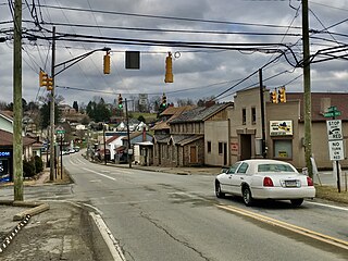
Harrison City is a census-designated place (CDP) in Westmoreland County, Pennsylvania, United States. The population was 174 at the 2020 census.

Loyalhanna is a census-designated place (CDP) in Westmoreland County, Pennsylvania, United States. The population was 3,415 at the 2000 census, at which time it was listed as McChesneytown-Loyalhanna, before just becoming the CDP of Loyalhanna for the 2010 census. As of the 2010 census the population was 3,428 residents.

<span class="mw-page-title-main">Bluetown-Iglesia Antigua, Texas</span> Former CDP in Texas, United States

Bluetown-Iglesia Antigua was a census-designated place (CDP) in Cameron County, Texas, United States. The population was 692 at the 2000 census. For the 2010 census the area was split into two CDPs, Bluetown and Iglesia Antigua. The communities are part of the Brownsville–Harlingen Metropolitan Statistical Area.

<span class="mw-page-title-main">Quail, Texas</span> Census-designated place in Texas, United States

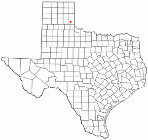
Quail is a rural small town and census-designated place in Collingsworth County, Texas, United States. The population was 19 at the 2010 census, down from 33 at the 2000 census. The town has a general store, a small hotel and an income tax service.

<span class="mw-page-title-main">Prairie Ridge, Washington</span> CDP in Washington, United States

Prairie Ridge is a census-designated place (CDP) in Pierce County, Washington, United States. The population was 12,288 at the 2020 census.

<span class="mw-page-title-main">Oak Hill, Maine</span> Census-designated place in Maine, United States

Oak Hill is a census-designated place (CDP) in the town of Scarborough in Cumberland County, Maine, United States. Prior to the 2020 census, the CDP was known as Scarborough. The population was 4,403 at the 2010 census. It is part of the Portland–South Portland–Biddeford, Maine Metropolitan Statistical Area.

References

  1. "ArcGIS REST Services Directory". United States Census Bureau. Retrieved October 12, 2022.
  2. "Census Population API". United States Census Bureau. Retrieved October 12, 2022.
  3. 1 2 "Geographic Identifiers: 2010 Demographic Profile Data (G001): Oak Hills CDP, Pennsylvania". U.S. Census Bureau, American Factfinder. Archived from the original on February 12, 2020. Retrieved April 2, 2014.
  4. "US Gazetteer files: 2010, 2000, and 1990". United States Census Bureau. February 12, 2011. Retrieved April 23, 2011.
  5. "Census of Population and Housing". Census.gov. Retrieved June 4, 2016.
  6. "U.S. Census website". United States Census Bureau . Retrieved January 31, 2008.