Portersville, Pennsylvania

Last updated

Portersville, Pennsylvania
Main Street commercial district in Portersville.jpg
Commercial district
Butler County Pennsylvania Incorporated and Unincorporated areas Portersville Highlighted.svg
Location of Portersville in Butler County, Pennsylvania.
USA Pennsylvania location map.svg
Red pog.svg
Portersville
Coordinates: 40°55′31″N80°08′39″W / 40.92528°N 80.14417°W / 40.92528; -80.14417
Country United States
State Pennsylvania
County Butler
Settled1826
Incorporated1844
Government
  TypeBorough Council
Area
[1]
  Total0.80 sq mi (2.06 km2)
  Land0.80 sq mi (2.06 km2)
  Water0.00 sq mi (0.00 km2)
Population
 (2020) [2]
  Total231
  Density290.57/sq mi (112.12/km2)
Time zone UTC-5 (Eastern (EST))
  Summer (DST) UTC-4 (EDT)
Zip code
16051
FIPS code42-62224

Portersville is a borough in Butler County, Pennsylvania, United States. The population was 235 at the 2010 census. [3]

Contents

Geography

Portersville is located near the western border of Butler County at 40°55′31″N80°8′39″W / 40.92528°N 80.14417°W / 40.92528; -80.14417 (40.925285, −80.144229). [4] It is surrounded by Muddy Creek Township, though the borough's western border comes within 660 feet (200 m) of the Lawrence County line.

U.S. Route 19, Perry Highway, passes through the center of the borough, leading north 22 miles (35 km) to Mercer and south 9.5 miles (15.3 km) to Zelienople. Interstate 79 passes just east of the borough, with access from Exit 96 (PA 488). I-79 leads south 38 miles (61 km) to Pittsburgh and north 90 miles (140 km) to Erie. Moraine State Park, situated around Lake Arthur, is a short distance east of I-79. Portersville lies between the cities of Butler 15 miles (24 km) east and New Castle 14 miles (23 km) to the west.

According to the United States Census Bureau, the borough has a total area of 0.81 square miles (2.1 km2), all land. [3]

Emergency services

Portersville has a no police force, an ambulance service, and a volunteer fire department. The Ambulance Service, Portersville EMS, and the Volunteer Fire Department, Portersville/Muddy Creek Township Volunteer Fire Department cover the Portersville area to include Muddy Creek Township, parts of Perry Township in Lawrence County, parts of Slippery Rock Township in Lawrence County, as well as Parts of Franklin Township in Butler County.

Events

Portersville has several events each year in the immediate and surrounding areas. The Portersville Steam Show occurs three times a year (May, August, and October). This event displays older steam engines and farm machinery to the public. The Moraine/Lake Arthur Regatta (in August each year) has water related activities for the entire family. The Pennsic War occurs each summer north of Portersville. McConnells Mill State Park, west of Portersville, holds its Heritage Days in September.

Demographics

Historical population
CensusPop.Note
1850 240
1870 198
1880 2169.1%
1890 190−12.0%
1900 1963.2%
1910 170−13.3%
1920 155−8.8%
1930 18519.4%
1940 27649.2%
1950 2946.5%
1960 34417.0%
1970 292−15.1%
1980 3209.6%
1990 307−4.1%
2000 268−12.7%
2010 235−12.3%
2020 231−1.7%
Sources: [5] [6] [7]

As of the 2000 census, [6] there were 268 people, 103 households, and 79 families residing in the borough. The population density was 328.4 people per square mile (126.8 people/km2). There were 109 housing units at an average density of 133.6 per square mile (51.6/km2). The racial makeup of the borough was 99.63% White, and 0.37% from two or more races.

There were 103 households, out of which 36.9% had children under the age of 18 living with them, 64.1% were married couples living together, 8.7% had a female householder with no husband present, and 23.3% were non-families. 20.4% of all households were made up of individuals, and 6.8% had someone living alone who was 65 years of age or older. The average household size was 2.60 and the average family size was 3.03.

In the borough the population was spread out, with 26.5% under the age of 18, 6.0% from 18 to 24, 34.3% from 25 to 44, 25.0% from 45 to 64, and 8.2% who were 65 years of age or older. The median age was 37 years. For every 100 females there were 98.5 males. For every 100 females age 18 and over, there were 93.1 males.

The median income for a household in the borough was $37,750, and the median income for a family was $40,536. Males had a median income of $35,625 versus $17,500 for females. The per capita income for the borough was $17,356. About 7.8% of families and 6.4% of the population were below the poverty line, including 9.7% of those under the age of eighteen and none of those sixty five or over.

Related Research Articles

<span class="mw-page-title-main">Butler County, Pennsylvania</span> County in Pennsylvania, United States

Butler County is a county in the Commonwealth of Pennsylvania. It is part of Western Pennsylvania. As of the 2020 census, the population was 193,763. Its county seat is Butler. Butler County was created on March 12, 1800, from part of Allegheny County and named in honor of General Richard Butler, a hero of the American Revolution.

<span class="mw-page-title-main">Callery, Pennsylvania</span> Borough in Pennsylvania, United States

Callery is a borough in Butler County, Pennsylvania, United States. The population was 394 at the 2010 census.

<span class="mw-page-title-main">Clay Township, Butler County, Pennsylvania</span> Township in Pennsylvania, United States

Clay Township is a township in Butler County, Pennsylvania, United States. The population was 2,547 at the 2020 census.

<span class="mw-page-title-main">Connoquenessing, Pennsylvania</span> Borough in Pennsylvania, United States

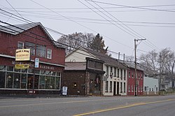
Connoquenessing is a borough in Butler County, Pennsylvania, United States. The population was 528 at the 2010 census.

<span class="mw-page-title-main">Connoquenessing Township, Butler County, Pennsylvania</span> Township in Pennsylvania, United States

Connoquenessing Township is a township in Butler County, Pennsylvania, United States. The population was 4,265 at the 2020 census.

<span class="mw-page-title-main">Franklin Township, Butler County, Pennsylvania</span> Township in Pennsylvania, United States

Franklin Township is a township in Butler County, Pennsylvania, United States. The population was 2,596 at the 2020 census.

<span class="mw-page-title-main">Jefferson Township, Butler County, Pennsylvania</span> Township in Pennsylvania, United States

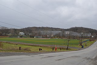
Jefferson Township is a township in Butler County, Pennsylvania, United States. The population was 5,209 at the 2020 census.

<span class="mw-page-title-main">Lancaster Township, Butler County, Pennsylvania</span> Township in Pennsylvania, United States

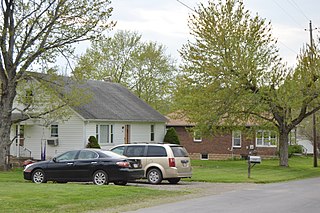
Lancaster Township is a township in Butler County, Pennsylvania, United States. As of the 2020 census, the township population was 2,747.

<span class="mw-page-title-main">Muddy Creek Township, Pennsylvania</span> Township in Pennsylvania, United States

Muddy Creek Township is a township in Butler County, Pennsylvania, United States. The population was 2,210 at the 2020 census.

<span class="mw-page-title-main">Prospect, Pennsylvania</span> Borough in Pennsylvania, United States

Prospect is a borough in Butler County, Pennsylvania, United States. As of the 2010 census, the borough had a population of 1,169.

<span class="mw-page-title-main">Seven Fields, Pennsylvania</span> Place in Pennsylvania, United States

Seven Fields is a borough in Butler County, Pennsylvania, United States. The population was 2,887 at the 2010 census, an increase from the figure of 1,986 tabulated in 2000.

<span class="mw-page-title-main">Slippery Rock, Pennsylvania</span> Borough in Pennsylvania, United States

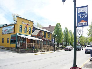
Slippery Rock is a borough in Butler County, Pennsylvania. The population was 3,081 at the 2020 census. Slippery Rock is included in the Greater Pittsburgh Region. It is home to Slippery Rock University of Pennsylvania, attended by nearly 9,000 students as a member of the Pennsylvania State System of Higher Education.

<span class="mw-page-title-main">Venango Township, Butler County, Pennsylvania</span> Township in Pennsylvania, United States

Venango Township is a township that is located in Butler County, Pennsylvania, United States. The population was 869 at the time of the 2020 census.

<span class="mw-page-title-main">West Liberty, Pennsylvania</span> Borough in Pennsylvania, United States

West Liberty is a borough in Butler County, Pennsylvania, United States. The population was 343 at the 2010 census.

<span class="mw-page-title-main">Worth Township, Butler County, Pennsylvania</span> Township in Pennsylvania, United States

Worth Township is a township that is located in Butler County, Pennsylvania, United States. The population was 1,398 at the time of the 2020 census.

<span class="mw-page-title-main">Richland Township, Clarion County, Pennsylvania</span> Township in Pennsylvania, United States

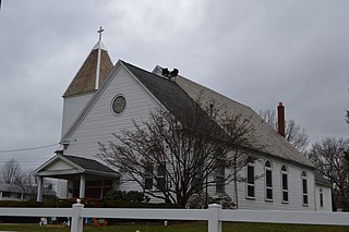
Richland Township is a township in Clarion County, Pennsylvania, United States. The population was 473 at the 2020 census, a decrease from the figure of 494 tabulated in 2010.

<span class="mw-page-title-main">Centerville, Crawford County, Pennsylvania</span> Borough in Pennsylvania, United States

Centerville is a borough in Crawford County, Pennsylvania, United States. The population was 176 at the 2020 census, down from 218 at the 2010 census. It was established in 1812.

<span class="mw-page-title-main">Cochranton, Pennsylvania</span> Borough in Pennsylvania, United States

Cochranton is a borough in Crawford County, Pennsylvania, United States. The population was 1,124 at the 2020 census, down from 1,136 as of the 2010 census.

<span class="mw-page-title-main">Hydetown, Pennsylvania</span> Borough in Pennsylvania, United States

Hydetown is a borough in Crawford County, Pennsylvania, United States. The population was 526 at the 2020 census, up from 526 at the 2010 census, down from 605 in 2000. It was established in 1862.

<span class="mw-page-title-main">Townville, Pennsylvania</span> Borough in Pennsylvania, United States

Townville is a borough in Crawford County, Pennsylvania, United States. The population was 326 at the 2020 census, up from 323 at the 2010 census.

References

  1. "ArcGIS REST Services Directory". United States Census Bureau. Retrieved October 16, 2022.
  2. "Census Population API". United States Census Bureau. Retrieved October 12, 2022.
  3. 1 2 "Geographic Identifiers: 2010 Demographic Profile Data (G001): Portersville borough, Pennsylvania". U.S. Census Bureau, American Factfinder. Archived from the original on February 12, 2020. Retrieved March 25, 2014.
  4. "US Gazetteer files: 2010, 2000, and 1990". United States Census Bureau. February 12, 2011. Retrieved April 23, 2011.
  5. "Census of Population and Housing". U.S. Census Bureau. Retrieved December 11, 2013.
  6. 1 2 "U.S. Census website". United States Census Bureau . Retrieved January 31, 2008.
  7. "Incorporated Places and Minor Civil Divisions Datasets: Subcounty Resident Population Estimates: April 1, 2010 to July 1, 2012". Population Estimates. U.S. Census Bureau. Archived from the original on June 11, 2013. Retrieved December 11, 2013.